RAILFAN GUIDES of the U.S.
Todd's Railfan Guide to
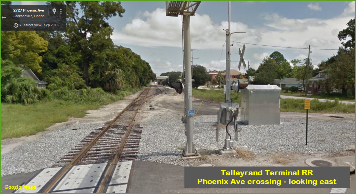
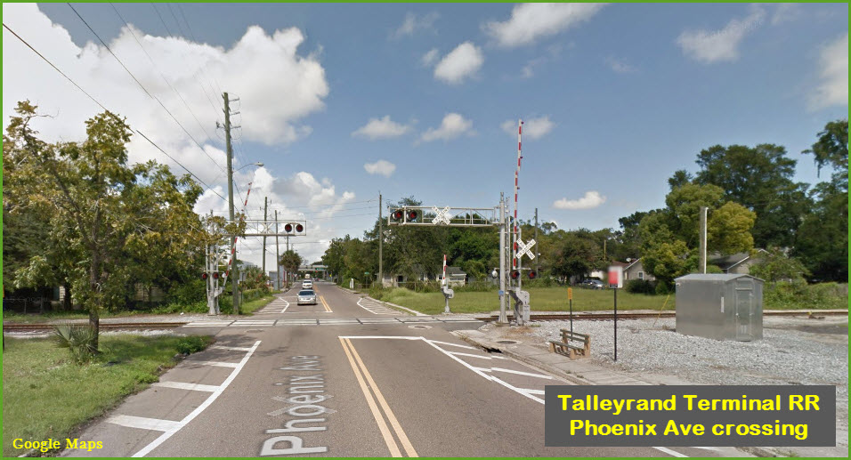
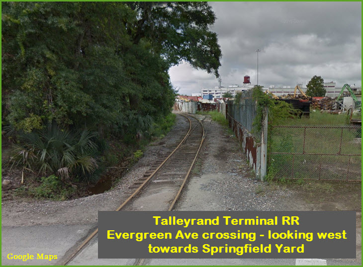
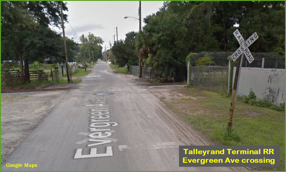
the TALLEYRAND TERMINAL RR
Jacksonville FL
In General
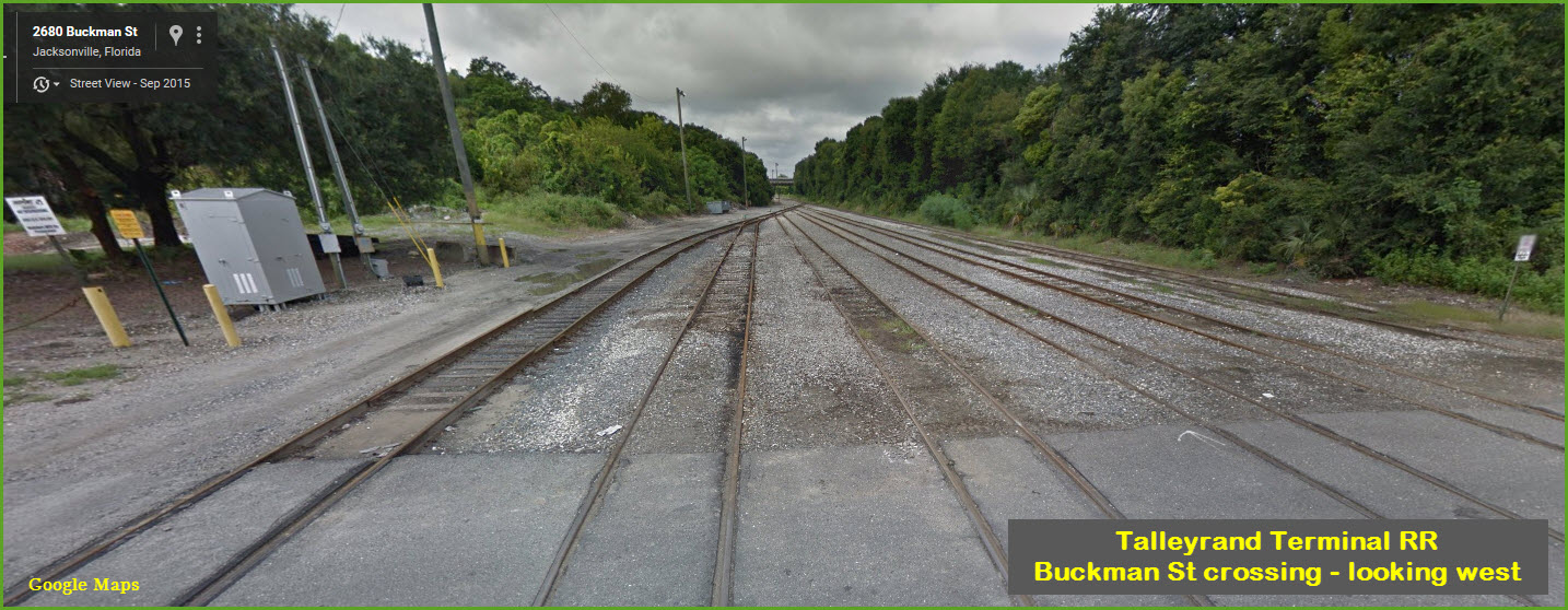
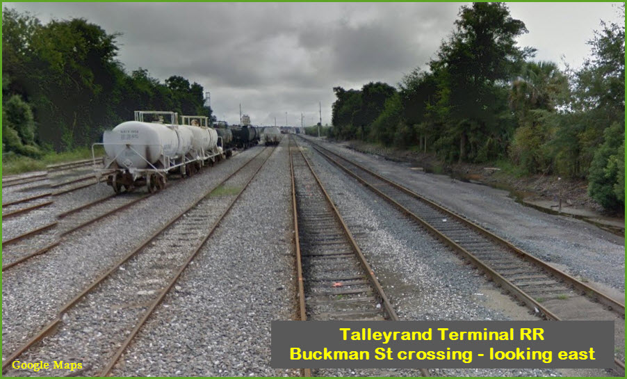
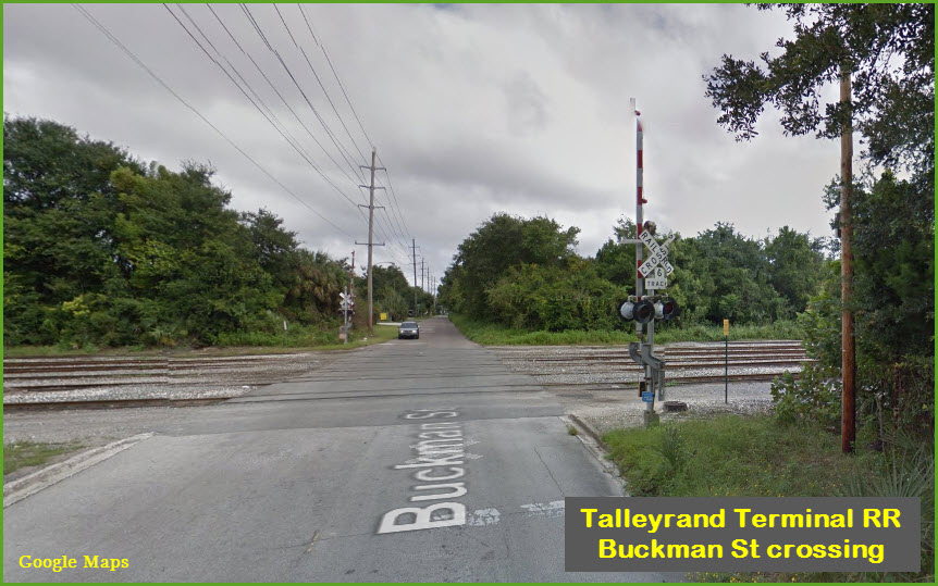
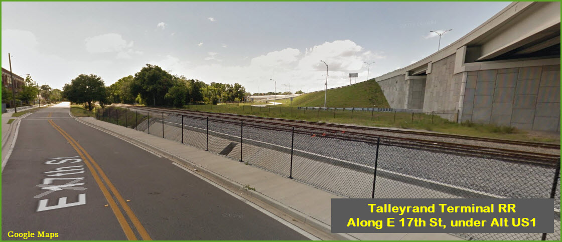
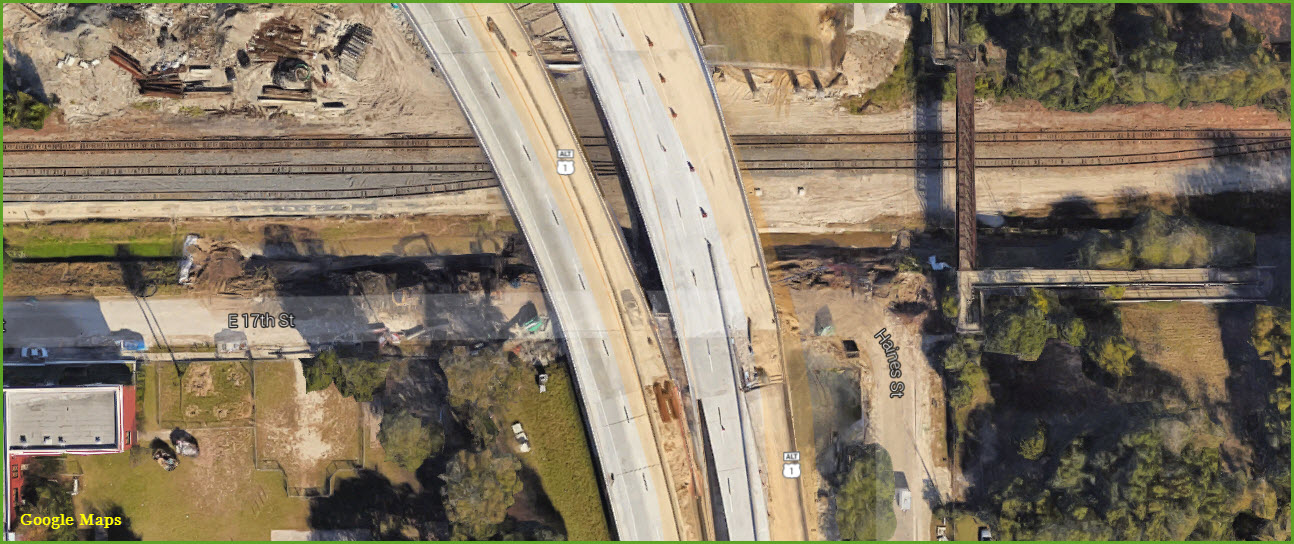
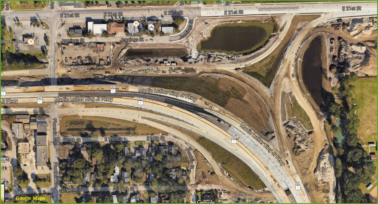
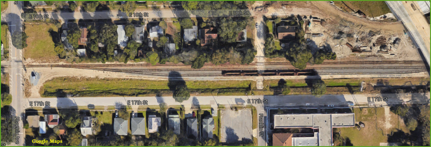
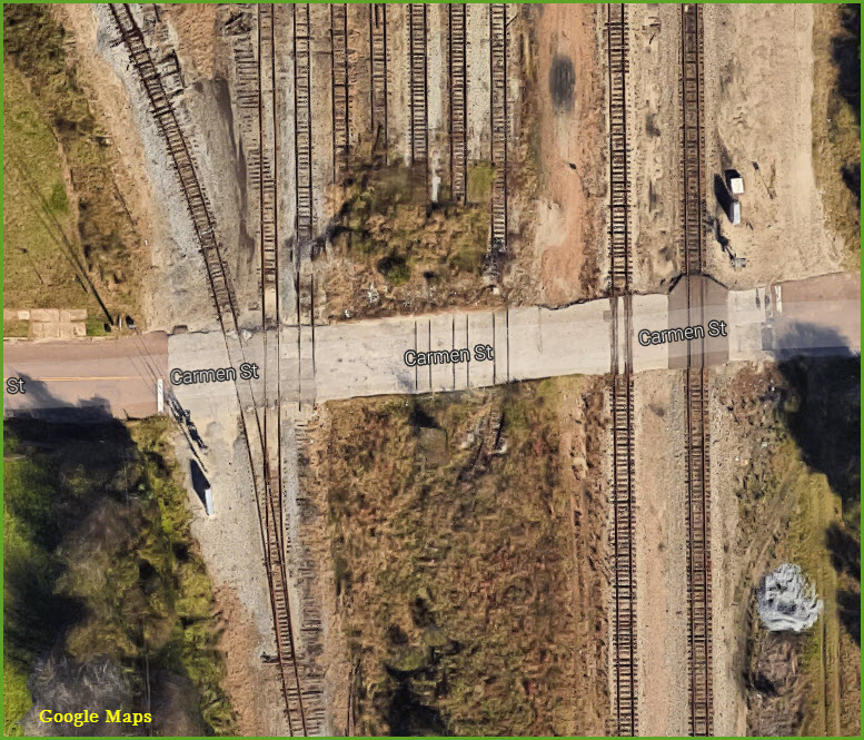
Getting Here
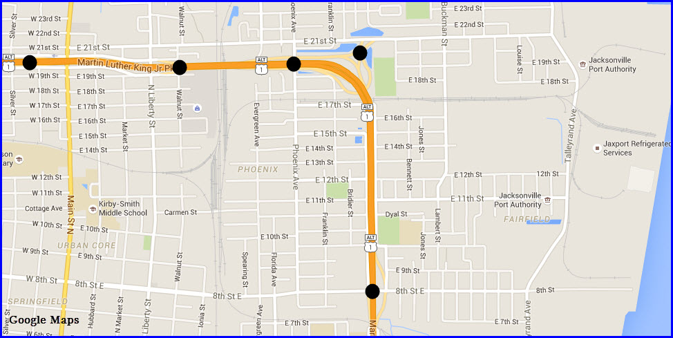
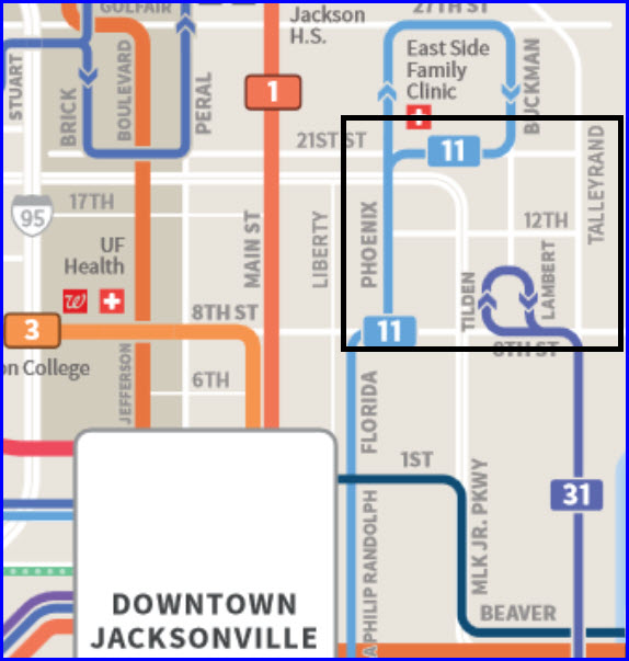
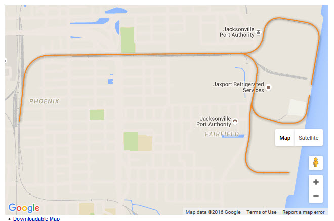
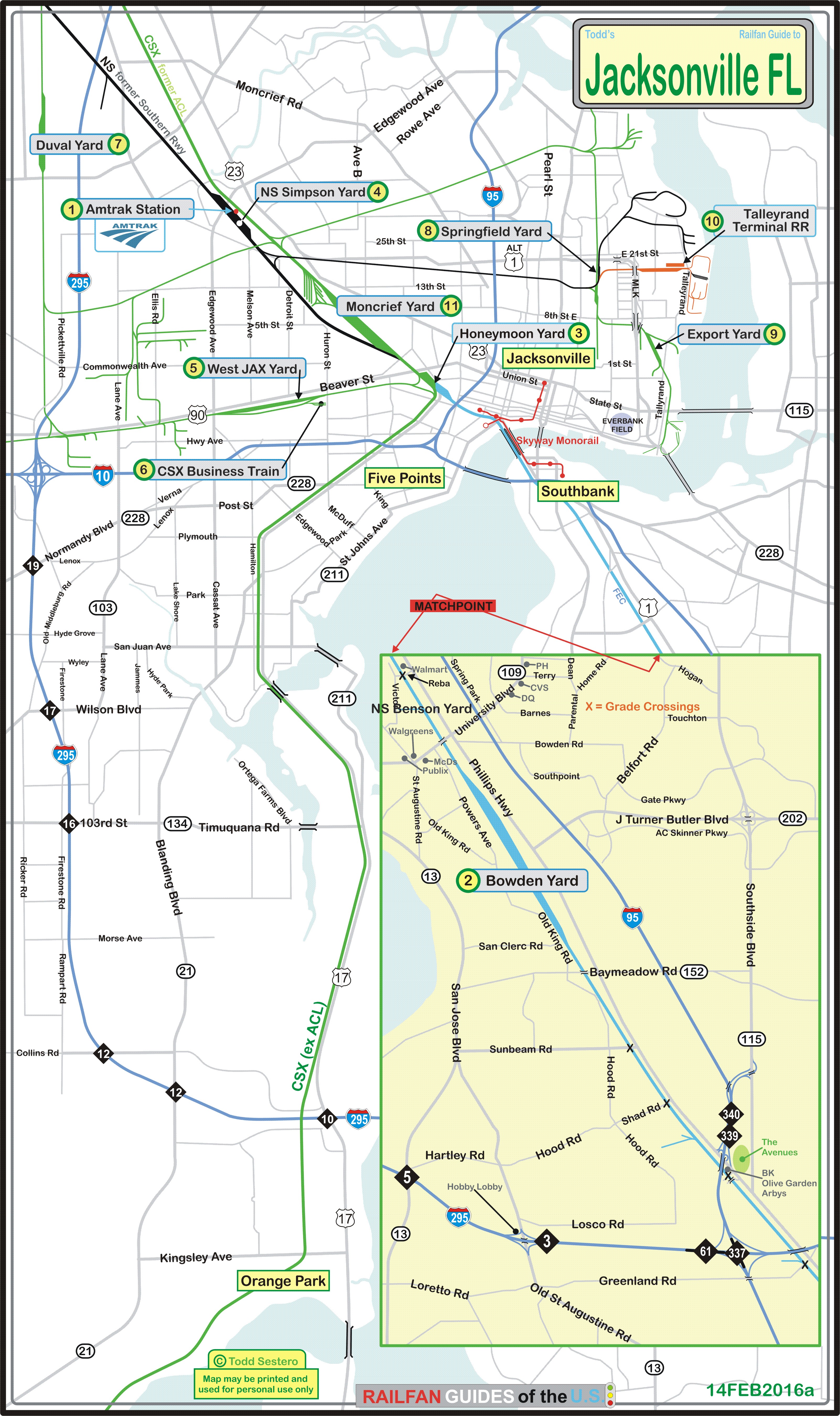
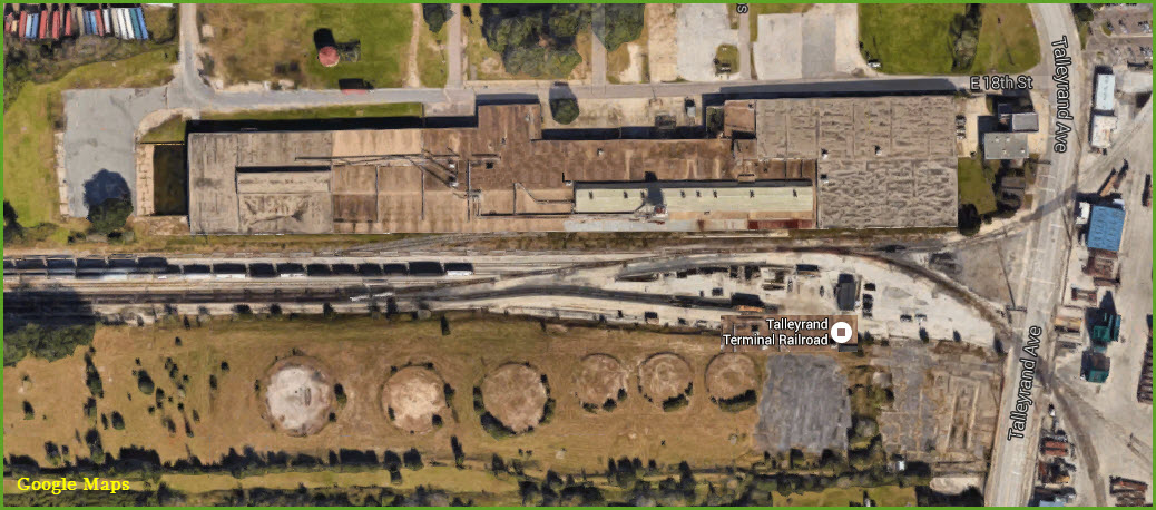
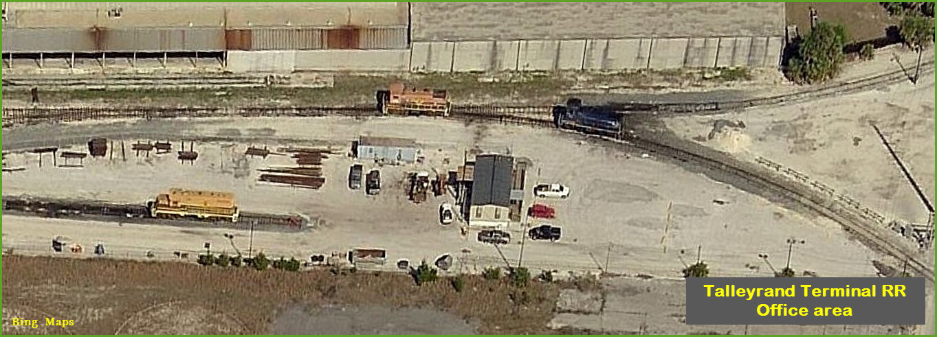
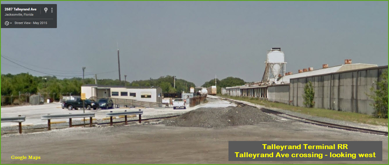
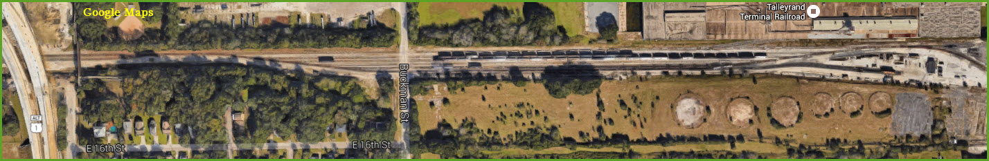
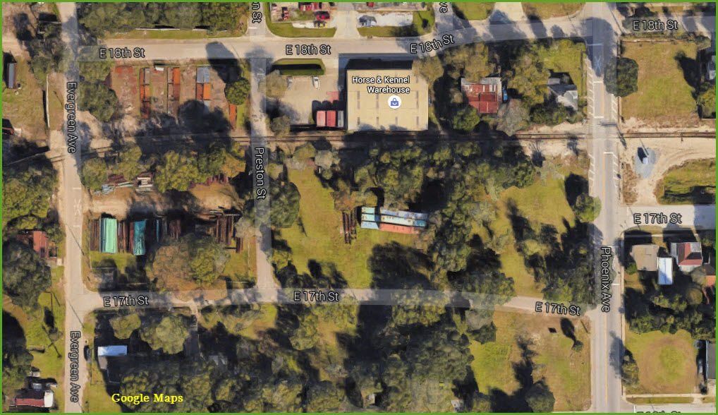
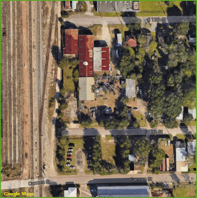
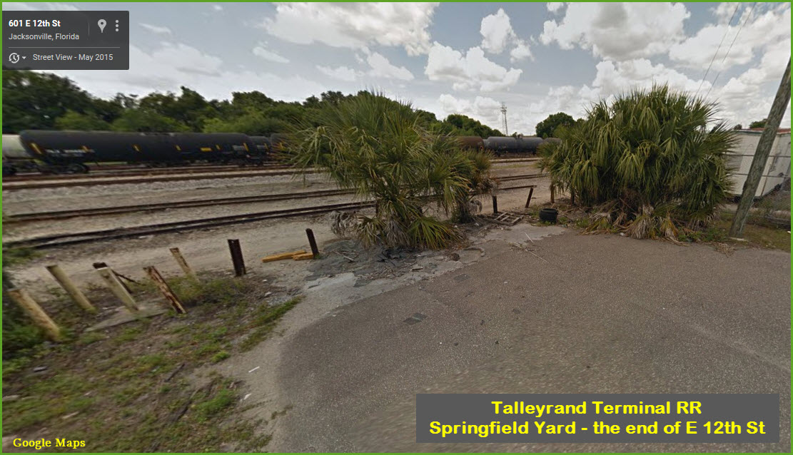
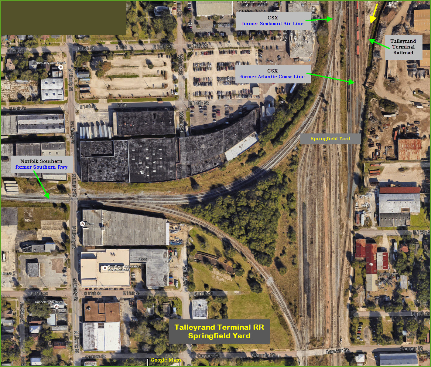
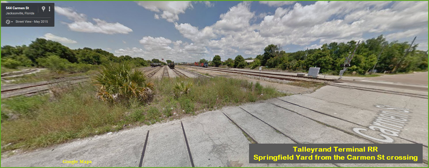
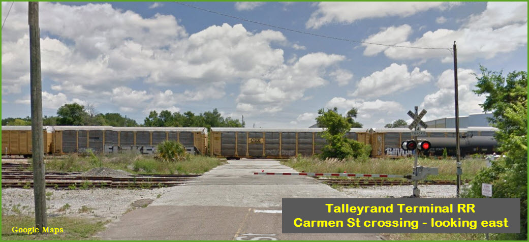
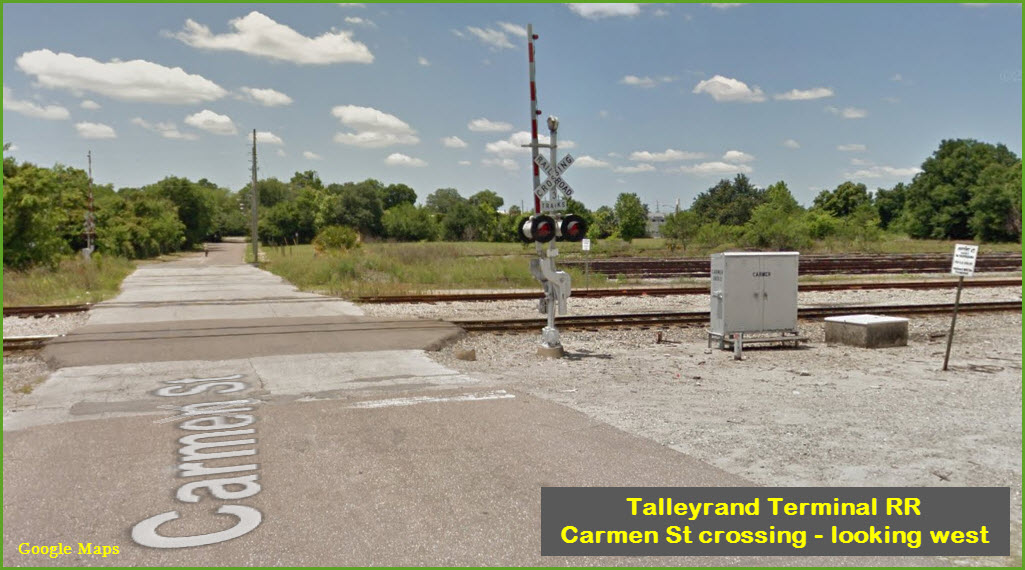
Maps
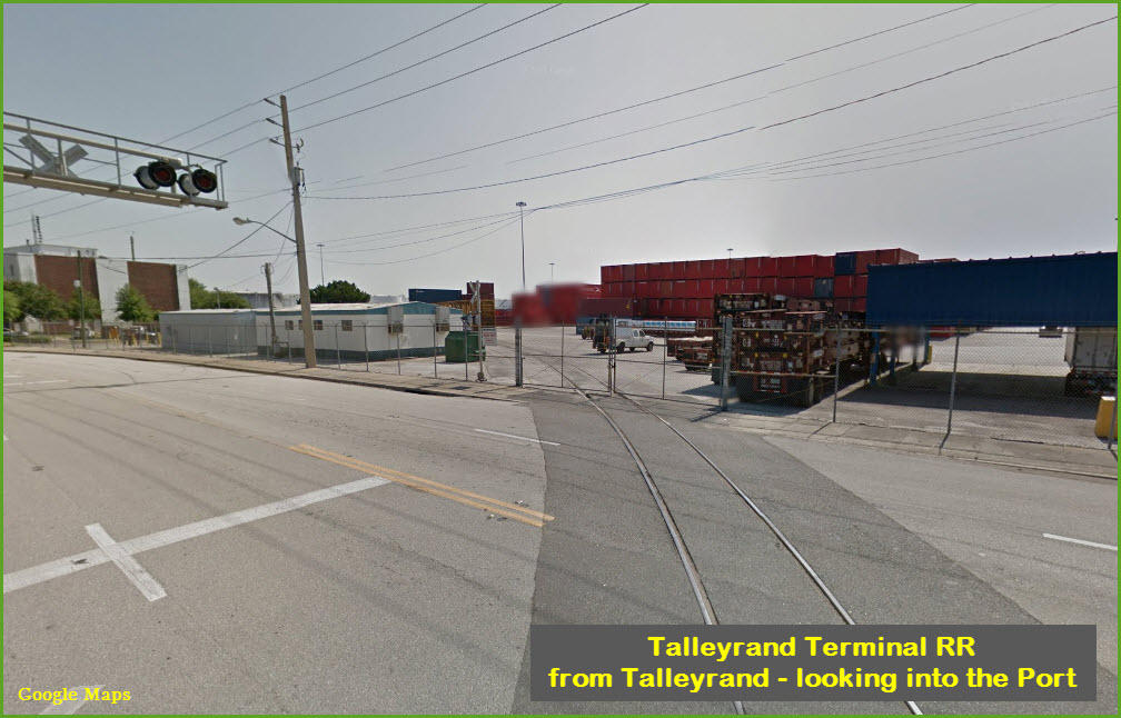
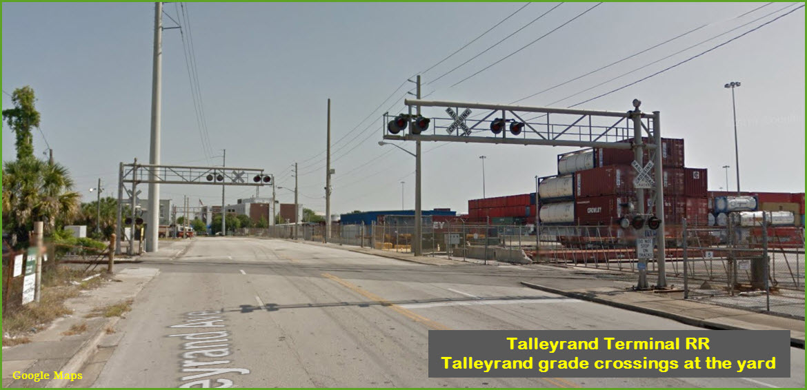
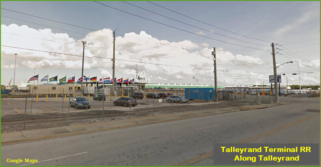
Details
Pictures
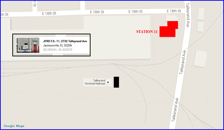
Fire & Police
Floobydust
USGS Maps
RAILFAN GUIDES HOME
RAILROAD SIGNALS HOME
Jacksonville FL
What's Here:
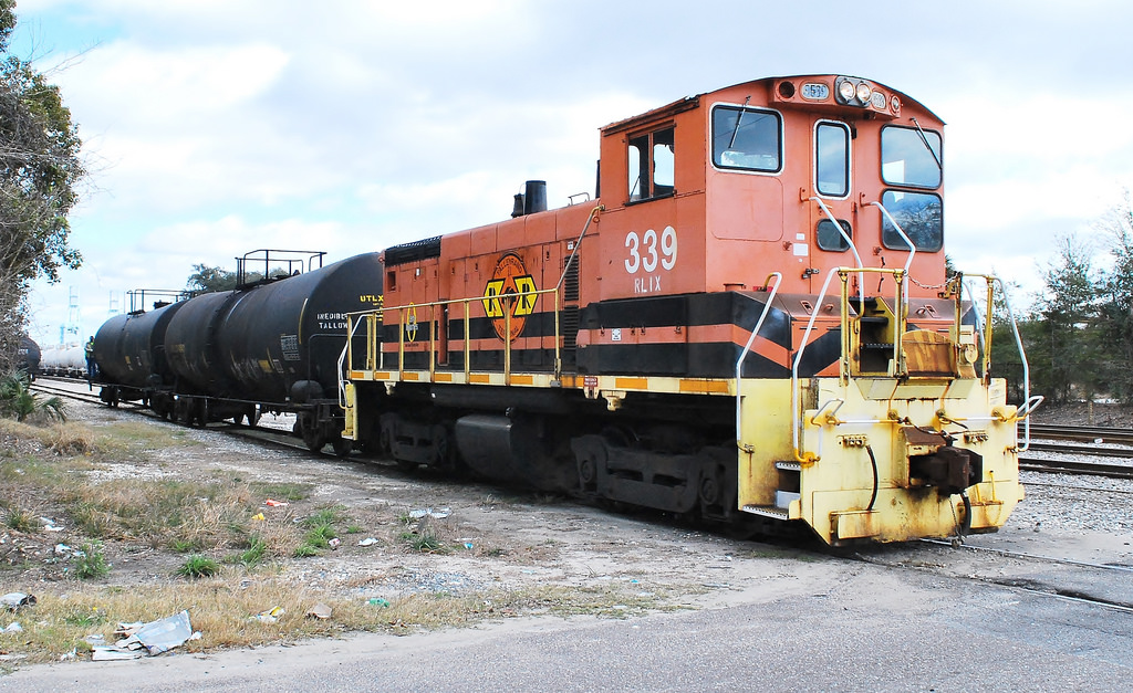
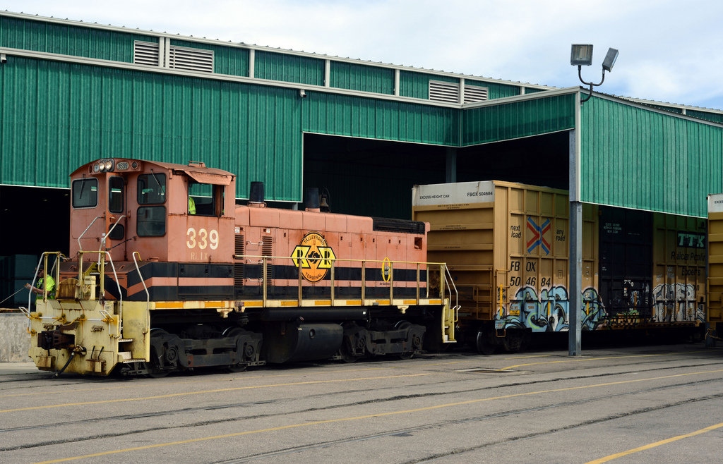
the Talleyrand Terminal Railroad, a member of the Genesee and Wyoming family.
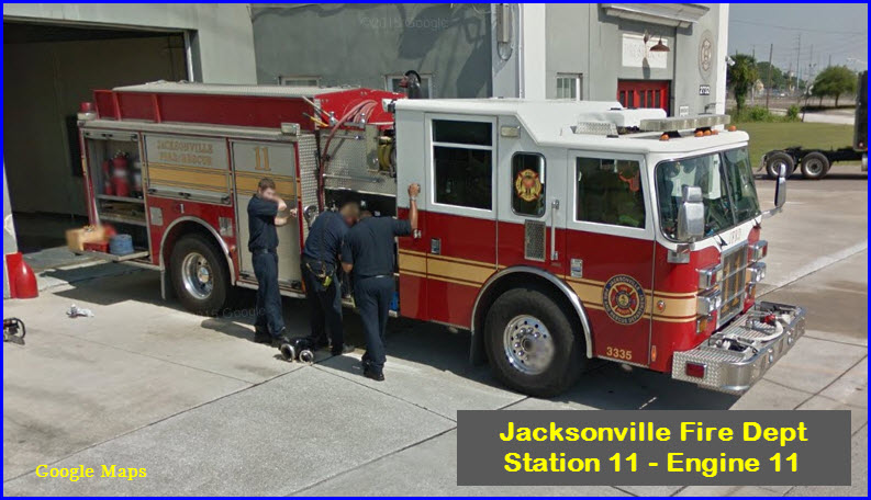
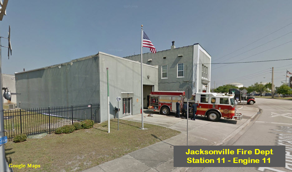
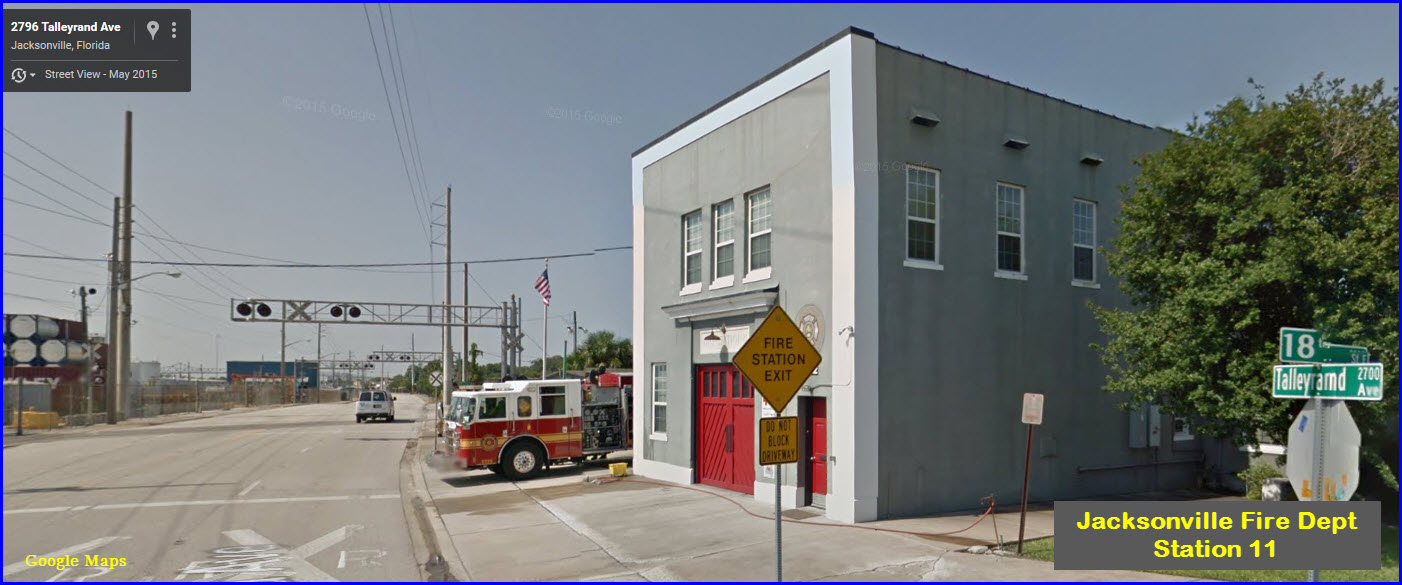
Jacksonville Fire Station 11.
Access by train/transit:
Amtrak to Union Station, then by rental car, taxi, or bus
The Scoop:
From the TTR website:
The Talleyrand Terminal Railroad (TTR) is a 2-mile short line freight railroad serving the Jacksonville Port Authority and interchanging with CSX Transportation and Norfolk Southern.
Commodities transported include automobiles, chemicals, farm and food products, intermodal containers, and pulp and paper.
The TTR was acquired by Genesee & Wyoming in 1996.
From Wikipedia:
The Talleyrand Terminal Railroad (reporting mark TTR) is a short line terminal railroad run by Rail Link, Inc., a subsidiary of Genesee & Wyoming Inc. It serves the Jacksonville Port Authority and tenants with over ten miles of track. It has only one main line, running west from the Tallyrand Marine Terminal on the St. Johns River to an interchange with CSX and Norfolk Southern northeast of downtown Jacksonville FL. Operations began on July 28, 1996.
Terminal Highlights (from http://www.jaxport.com/cargo/facilities/talleyrand-marine-terminal ):
Talleyrand Marine Terminal is located 21 nautical miles (38.9km) from the Atlantic Ocean on the St. Johns River with 4,780 linear feet (1,457m) of berthing space. The terminal handles containerized and breakbulk cargoes, automobiles and liquid bulk commodities such as molasses and vegetable oils. Breakbulk cargoes include steel, lumber and paper, and a variety of frozen and chilled goods. A 553,000-square foot warehouse stores a variety of cargoes, including rolls of fine and specialty papers, and 160,000 square feet of transit shed space capable of handling cargo in refrigerated, freezer or ambient conditions is available. Talleyrand's on-dock rail facilities are run by Talleyrand Terminal Railroad, Inc., which provides direct switching service for Norfolk Southern and CSX rail lines. The terminal is only 25 minutes from Florida East Coast Railroad's intermodal ramp, and is conveniently located within minutes of interstates I-95 and I-10.
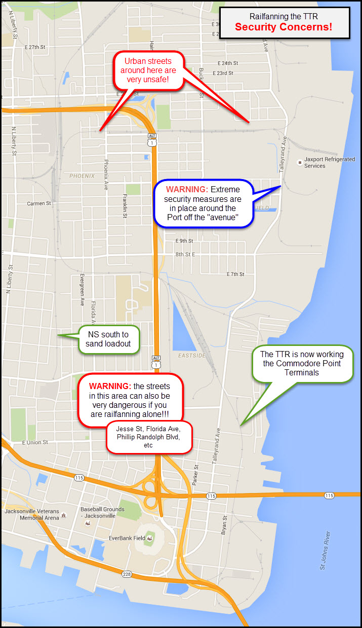
SAFETY and SECURITY:
Unfortunately for us railfans, almost the entire area that the TTR operates in is a bad area in one respect or the other.
Please pay particular attention to these warnings if you come here to railfan!
Robert Mann gives us the low-down so you may survive a trip to the TTR:
I worry about anyone not familiar with the area wandering off of the road and not coming back! EASY TO DO BOTH HERE AND NORTHWEST JAX. The flip side is, if you are seen to point a camera toward the port, you might expect homeland security to take it from you! The rules are different in the international port zone and you can’t play 'I’m a railfan, I have my rights,' card! The TT crew is friendly and will generally not object to someone parking at their offices for a couple of photos as long as you let them know what you are doing there and stay off the trains. They will also quickly warn you about trying to shoot in the direction of the port facilities as if by voice of experience! The Port Authority building is just up the road and while they can’t override the Homeland Security, US Customs, Coast Guard or other law enforcement they might allow a few photos if arrangements are made in advance with a clear purpose (IE: “I’m doing a story for Trains Magazine…”) in which case you will get a guided tour in a port vehicle. You will NOT be allowed to step out of the vehicle for any reason and you’ll have to shoot from inside. I wouldn’t suggest trying to get such permission to fill in a couple of photos for the train album.
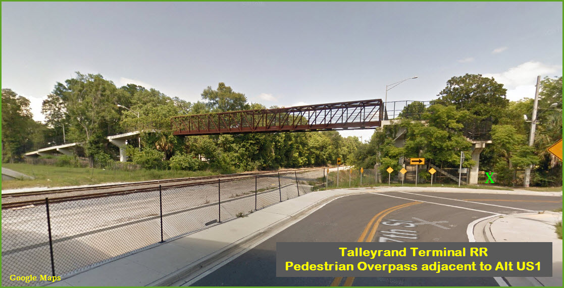
I would suggest all railfan activity be conducted from Talleyrand Avenue or from inside your personal vehicle at any of the good sites, making certain you are alone in the area. The foot bridges, while amazing photo opportunities, pose grave danger to the lone wolf photographer. These would be better used when the whole club is around for a shoot and even then, I would call the JSO (Sheriff is the Police in the Consolidated City) and let them know ‘the club is shooting photos and we just wanted to make everyone aware so we don’t unduly alarm anyone.’
Safety is somewhat improved in the Commodore Point Terminals area and you could get off the Avenue and back in the area of the old Ford Motor Plant, Silos etc for some cool shots, Export Yard in this area is impossible to get at safely or legally and CSX Security is on steroids in the area, full of intimidating bravado.
Yet being very careful, making a few calls or sending a note or two ahead of your trip can yield some of the most amazing big city, big industry, railroad scene photos you can imagine, the key is BE CAREFUL.
Acknowledgements:
Robert Mann; railroad consultant, transit specialist, and railfan in the Jacksonville area.
Thanks to Denver Todd for his help in suggesting changes to my railfan guides to help ya'll.
Websites and other additional information sources of interest for the area:
Aerial shots were taken from either Google Maps or www.bing.com/maps as noted. Screen captures are made with Snagit, a Techsmith product... a great tool if you have never used it!