In General
Getting Here
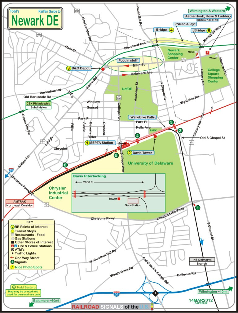
Map
Sites
Signals
Fire & Police
Floobydust
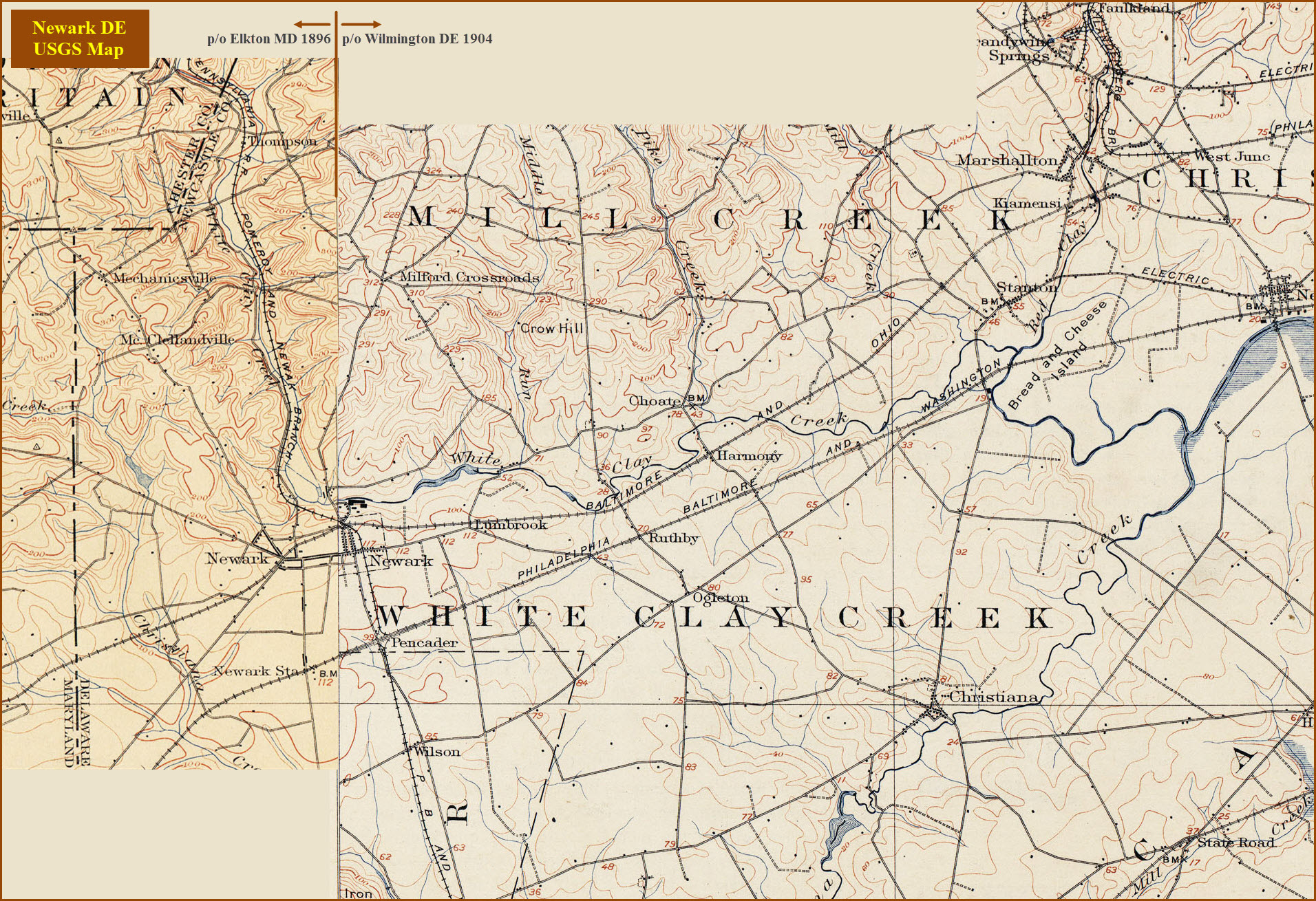
USGS Maps
RAILROAD SIGNALS HOME
Location / Name:
Newark DE, New Castle County
What's Here:
Newark SEPTA Station
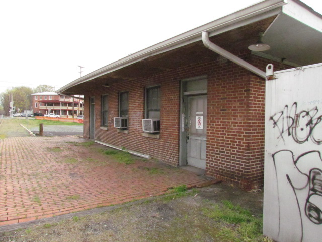
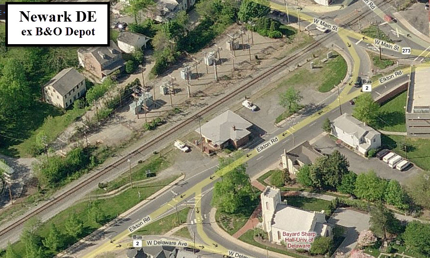
Former Newark B&O Depot (now MOW/systems shed for CSX)
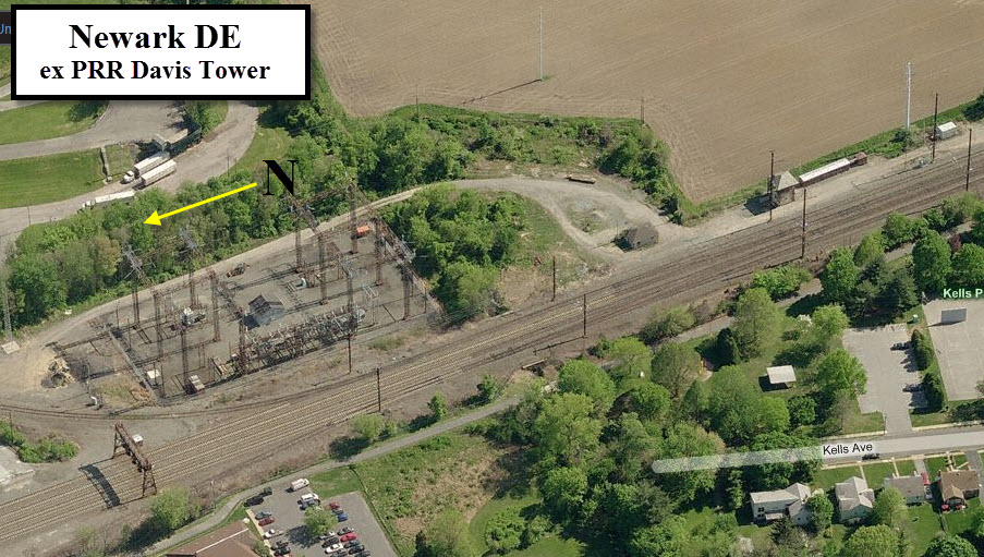
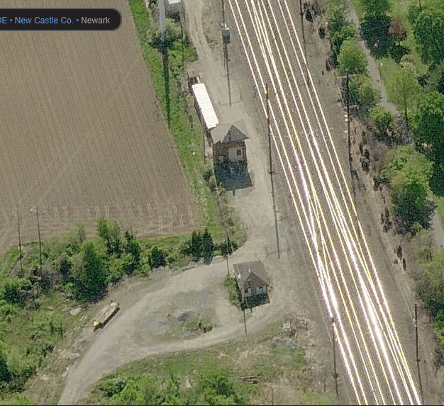
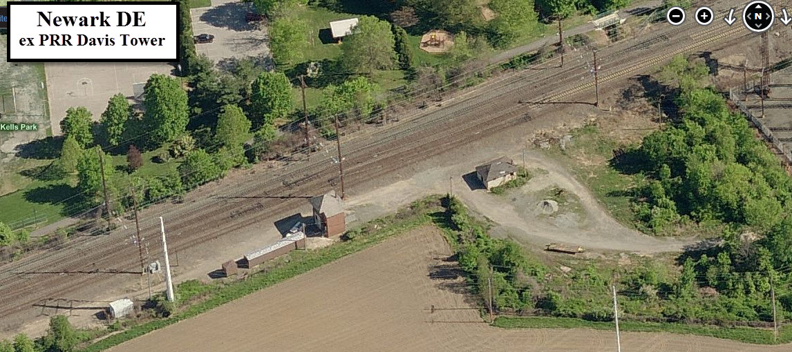
Former PRR Davis Tower
Interchange with the NS (PRR) Delmarva Secondary Line
Data:
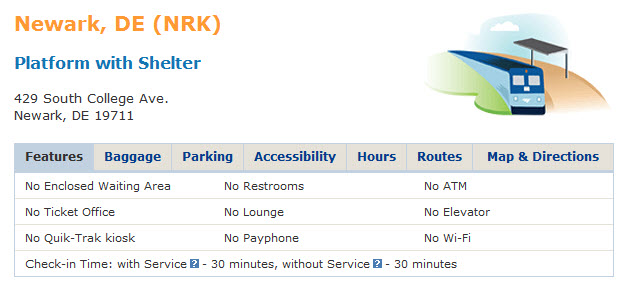
GPS Coordinates: 39.670353, -75.752754 (SEPTA Newark Station)
Phone A/C: 302
ZIP: 19711
Access by train/transit:
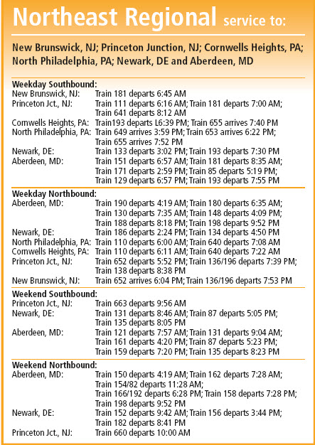
SEPTA, on the NEC, 1st station on the Newark/Wilmington Line (formerly the R2)
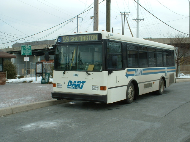
DART #59 Bus Line, connection with the SEPTA Newark Line
DART #33 & 34 Bus Lines, Newark to Christiana Mall
DART #16, Newark Express
Cecil Co Transit Route #4, Newark Connector into Maryland
The Scoop:
Admittedly, there is not a whole heck of a lot here in
Newark. You have the Amtrak/SEPTA station on the Northeast Corridor,
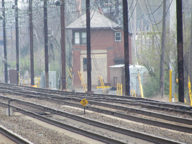
the ex-Pennsy Davis Tower which handled interlocking between the 4 tracks and
the interchange, an ex-B&O depot which is now used by the MOW guys, and a
CSX bridge over the old abandoned Pennsy right-of-way.
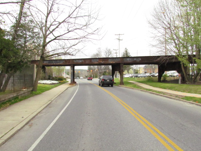
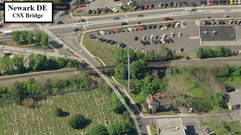
CSX passes through town on the north side, "north" of the NEC. Main Street crosses CSX at grade level, a couple of streets go under the tracks, and a couple others go over.
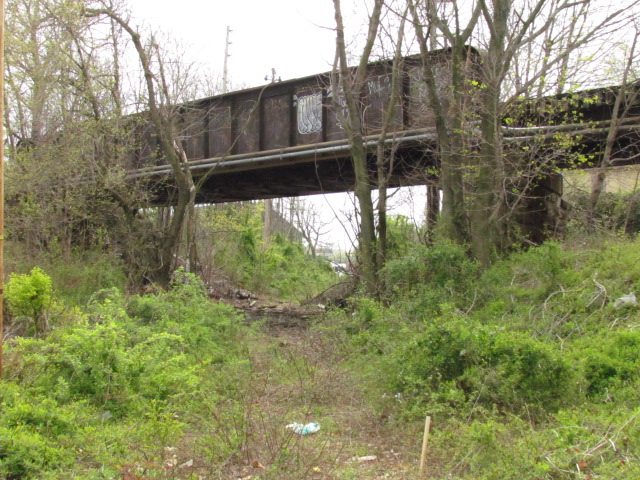
There was a Pennsy branch going into town, which has been long gone, but if you look at aerial views of the area, you can see where it went. The CSX bridge that goes over Chapel Street also went over the Pennsy tracks. The bridge offers interesting possibilities for through freights.
Septa has a commuter train that comes all the way "down" to Newark, probably to offer service to the University of Delaware. It used to known as the R2 line, but is now called the Wilmington/Newark line.
Davis Tower is easy to get pictures of from the bike path that parallels the tracks on the north side. Looks like you can gain access to it through the baseball fields off of Kells Ave.
The Chrysler plant shut down at the end of 2008, and
the University of Delaware subsequently bought the property for around $24M.
As of 6/2012, there is talk of moving the Newark SEPTA station from the
current location on my map, to a new location where the plant was with some
money coming from the feds. The plant opened in 1951 (a good year) as
a tank plant, and then converted to making cars in 1957. In 1997,
Chrysler spent $623M to upgrade the plant to make Durango's.
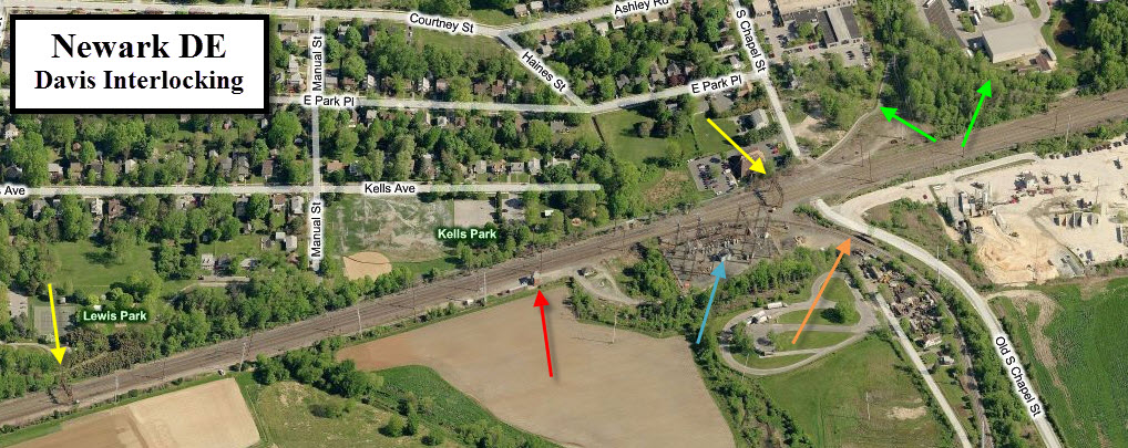
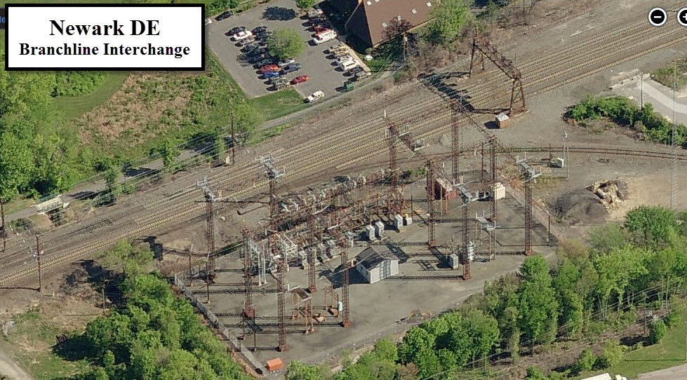
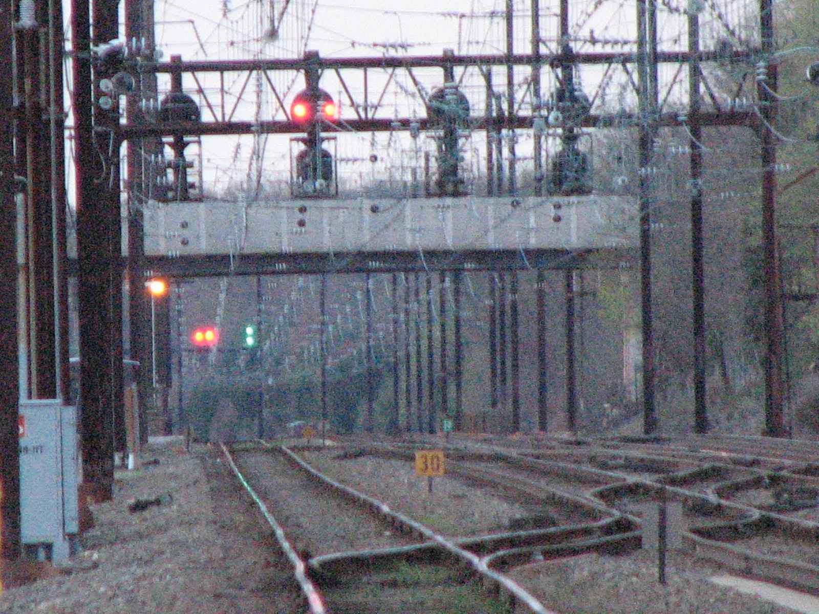
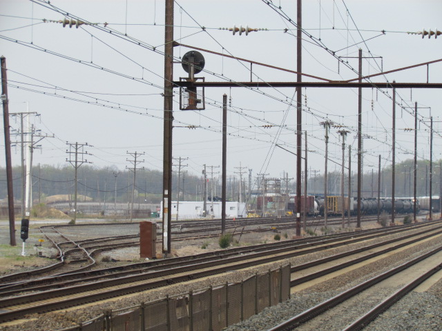
The top photo shows the tower with the
northern signal bridge for the interlocking, the SB interchange, and the
substation. In all three shots, you can clearly see the bike path on
the north side of the tracks, making it easy to get directly across from the
tower for pictures. In the screen capture below, the two signal bridges got yellow
arrows pointing at them, the tower a red arrow, the sub-station is in blue,
the Delmarva branch heads south with an orange arrow, and the north branch
leads are in pointed at by green arrows.
Disclaimers:
I love trains and I love signals. I am not an expert.
Please Note:
Since the main focus of my two websites is railroad signals,
the railfan guides are oriented towards the signal fan being able to locate
them. For those of you into the modeling aspect of our hobby, my
indexa page has a
list of almost everything railroad oriented I can think of to provide you
with at least a few pictures to help you detail your pike. If this is a railfan page, every effort has been made to
make sure that the information contained on this map and in this railfan
guide is correct. Once in a while, an error may creep in..... :-) My philosophy: Pictures and maps are worth a thousand
words, especially for railfanning. Text descriptions only get you so far,
especially if you get lost or disoriented. Take along good maps.... a GPS
is OK to get somewhere, but maps are still better if you get lost! I belong
to AAA, which allows you to get local maps for free when you visit the local
branches. ADC puts out a nice series of county maps for the Washington DC
area, but their state maps do not have the railroads on them. If you can
find em, I like the National Geographic map book of the U.S..... good,
clear, and concise graphics, and they do a really good job of showing you
where tourist type attractions are, although they too lack the railroads.
Other notes about specific areas will show up on that page if known. Beware: If used as a source, ANYTHING from Wikipedia
must be treated as being possibly being inaccurate, wrong, or not true.
RAILFAN GUIDES HOME
2008-0413b, 2005-0203, 2012_0401wilmb
NEW 03/14/2012,
11/02/2016
Scanners Frequencies:
CSX
160.230 - Road
160.785 - Maintenance of Way
161.100 - Dispatcher
160.530 - Yard-Wilsmere
NORFOLK SOUTHERN
160.410 - Yard
160.980 - Yard
160.800 - Dispatch
AMTRAK
160.920 - All freight and passenger operations in Northern DE
Acknowledgements:
Denver Todd
Websites and other additional information sources of interest for the area:
None Yet
Find your way to I-95, and head to exit 1. This is College Ave... take it north till you go over the NEC and then take a right onto Kells
Ave, then a right on Wolloston Ave, and finally a right onto Waterworks Lane to the Septa/Amtrak station.
ou can also come into town from Wilmington via Kirkwood Hwy, but it is a slow and painful process due to suburban sprawl and traffic lights. The only bonus is
that you would pass within a quarter of a mile of the Wilmington & Western RR.
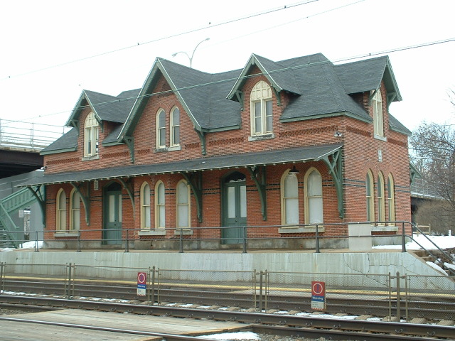
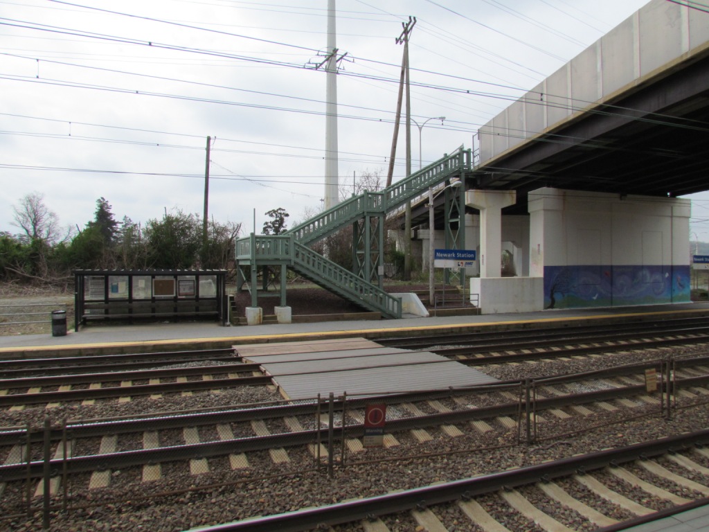
![]() the Amtrak / Septa Station
the Amtrak / Septa Station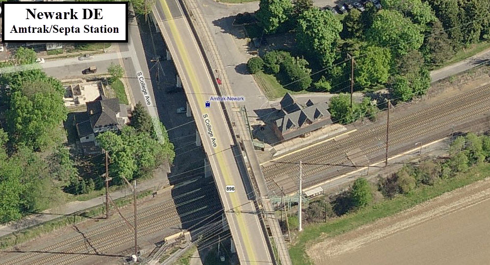


![]() Davis Tower & Interlocking
Davis Tower & Interlocking
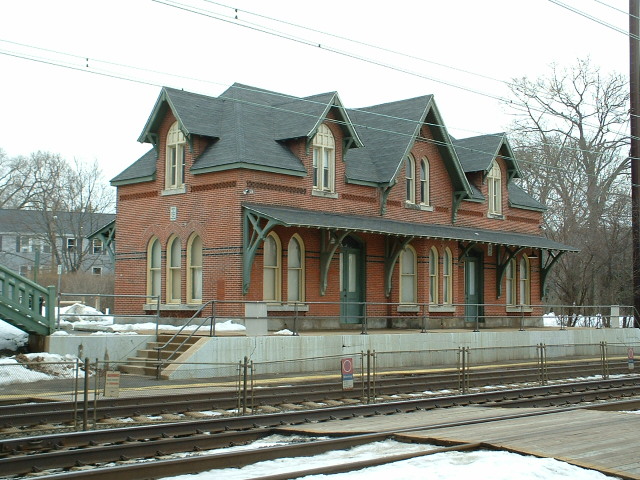
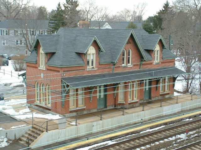
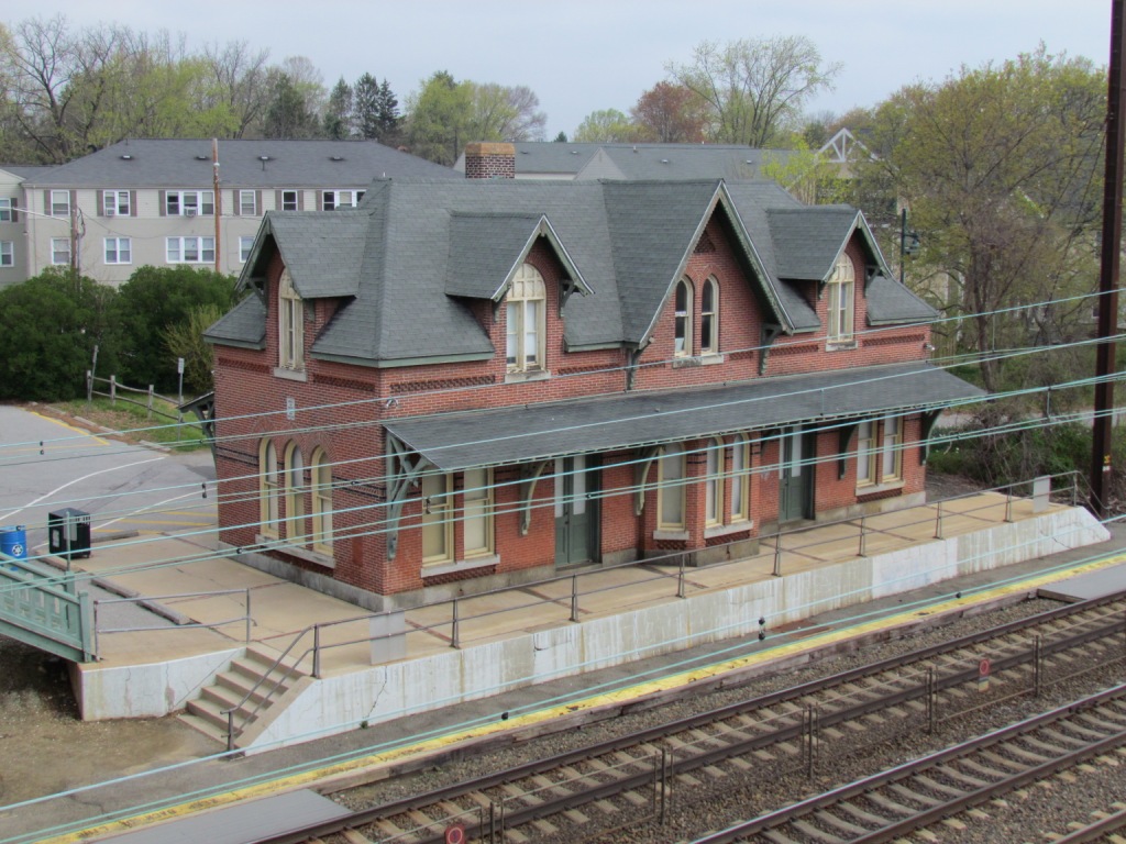
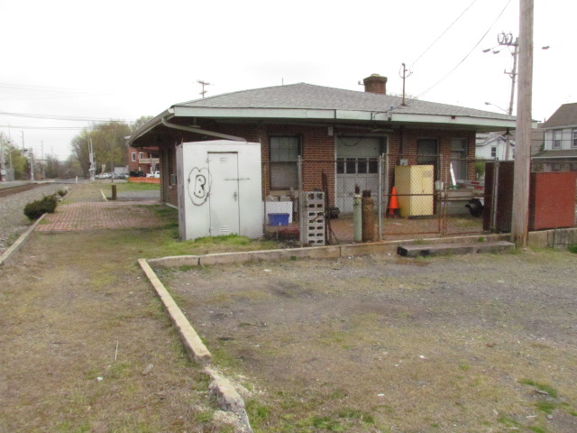
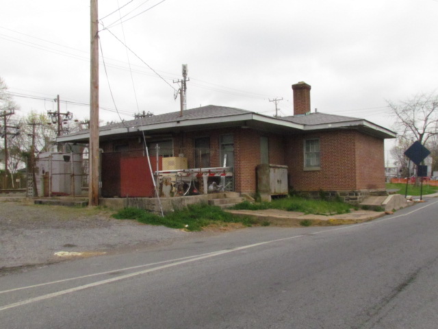
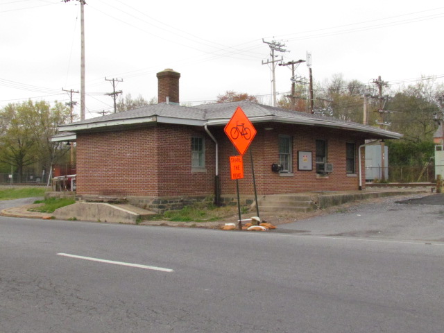
![]() ex B&O Depot
ex B&O Depot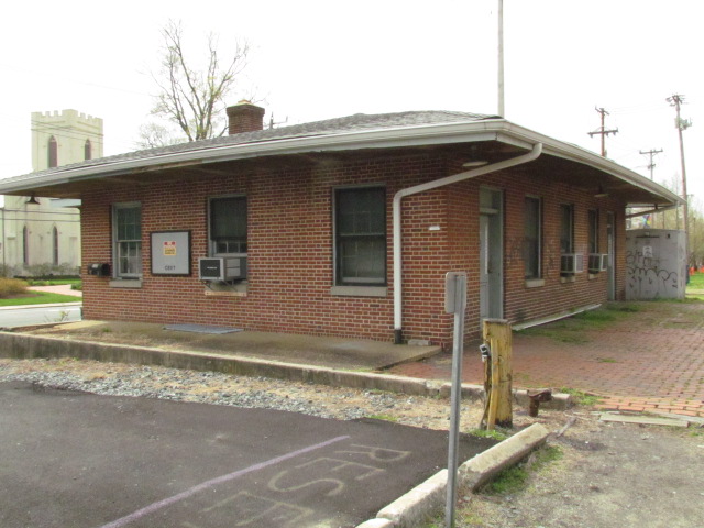
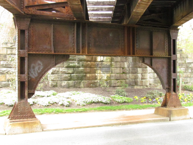
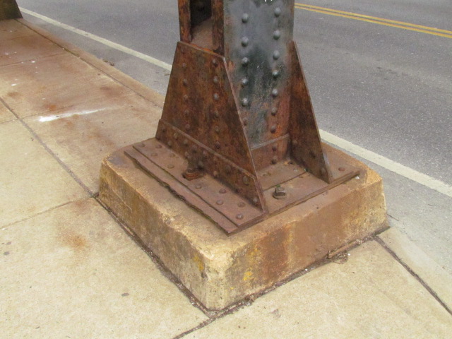
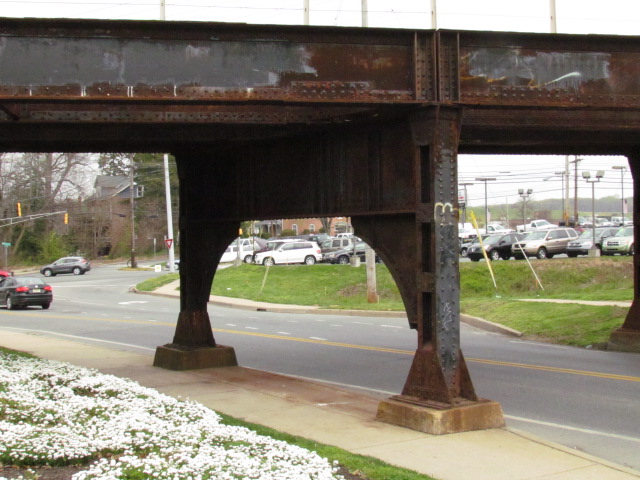
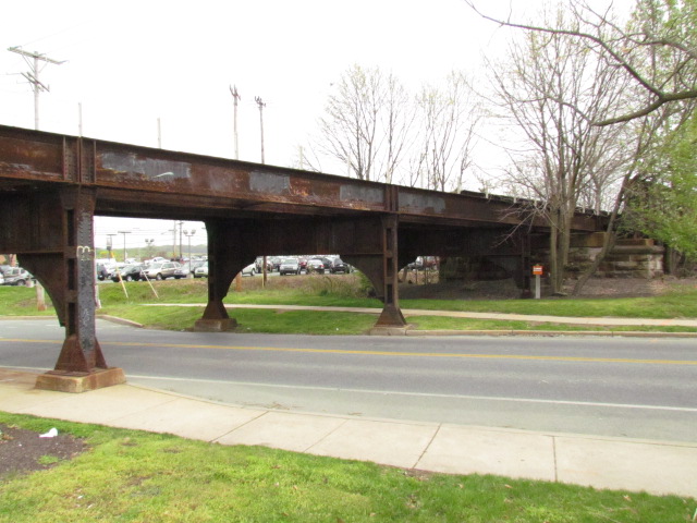
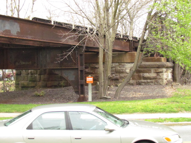
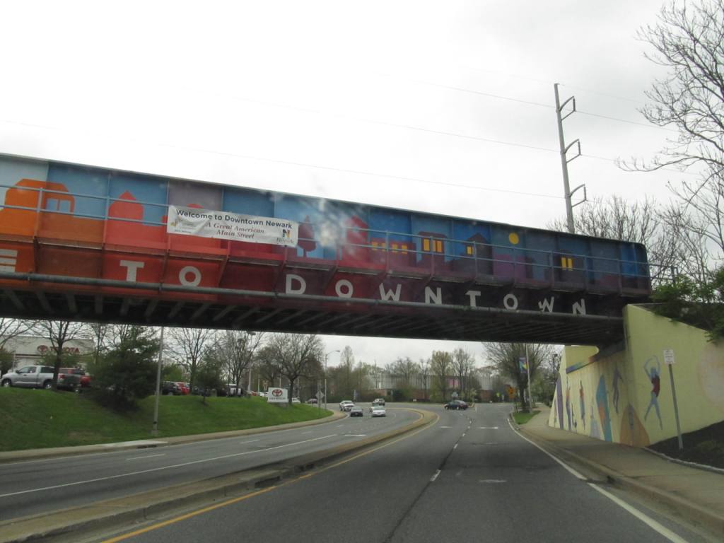
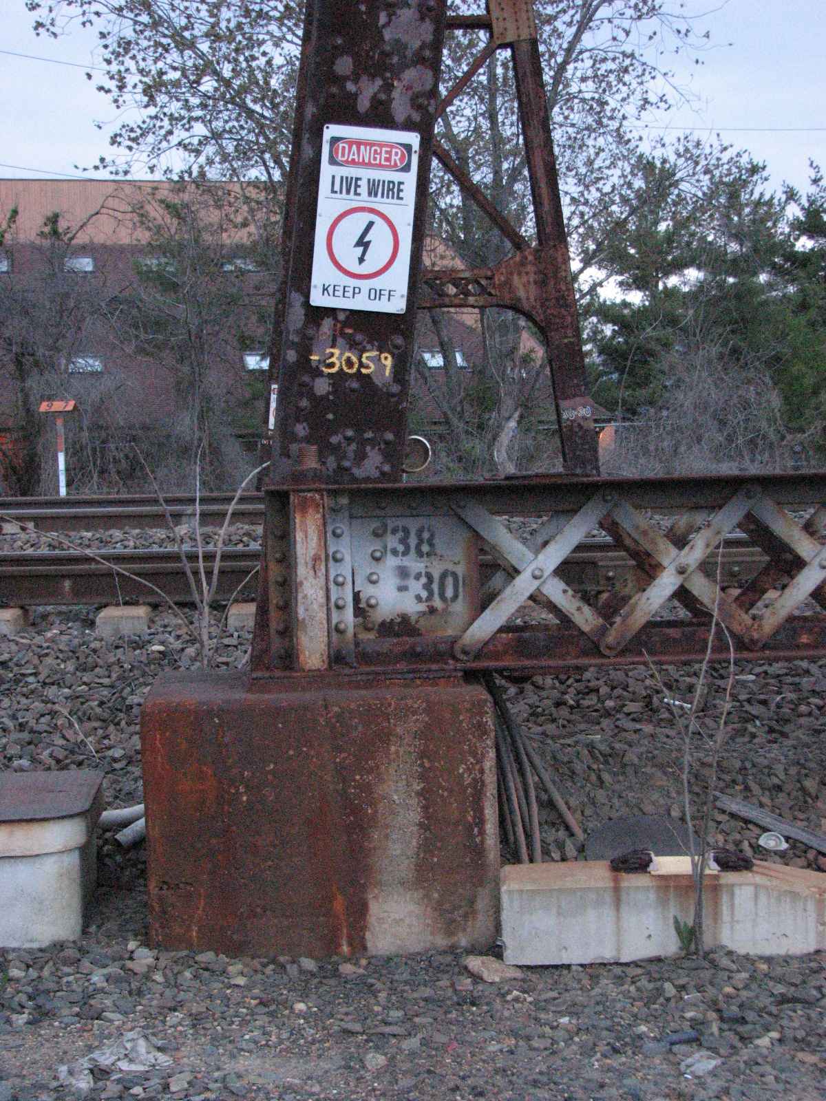
![]() CSX Bridge - ex B&O over Chapel St
CSX Bridge - ex B&O over Chapel St
A most interesting bridge, with many unusual features, that's why I took the time to take detail shots :-) Modelers should have fun with this one!
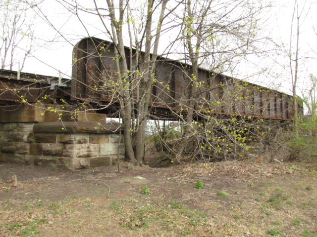
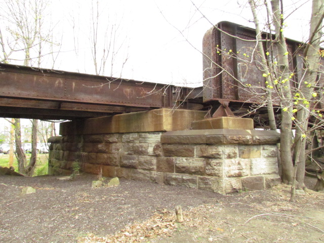
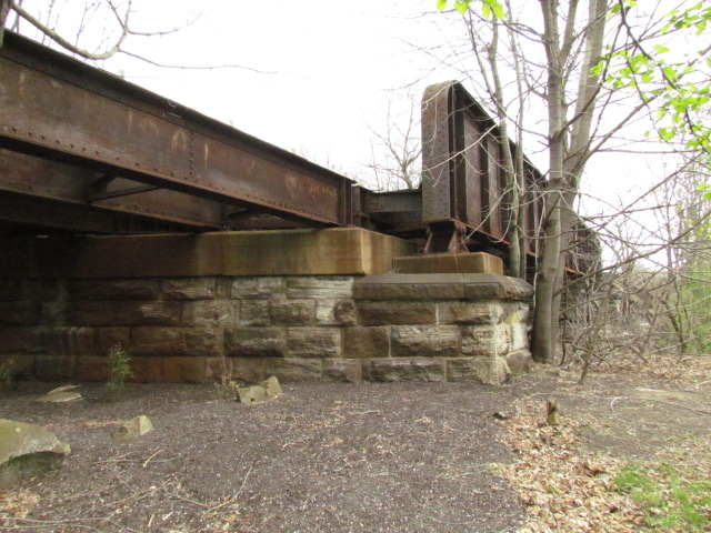
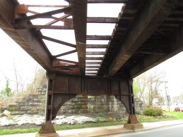


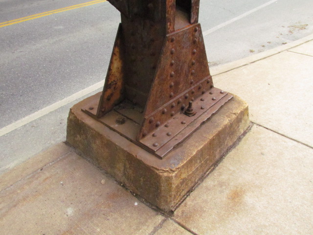
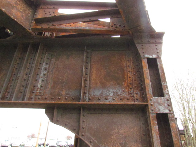

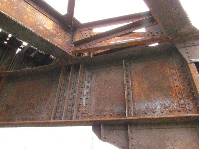
 I also like taking pictures of unusual or interesting things, I think this qualifies...
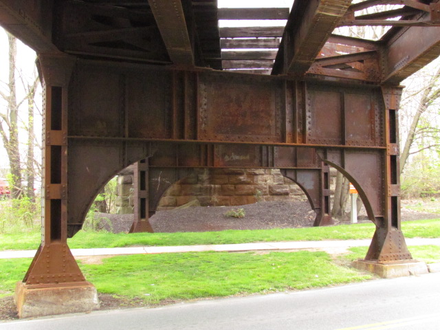
![]() CSX Bridge - ex B&O over Kirkwood Highway
CSX Bridge - ex B&O over Kirkwood Highway

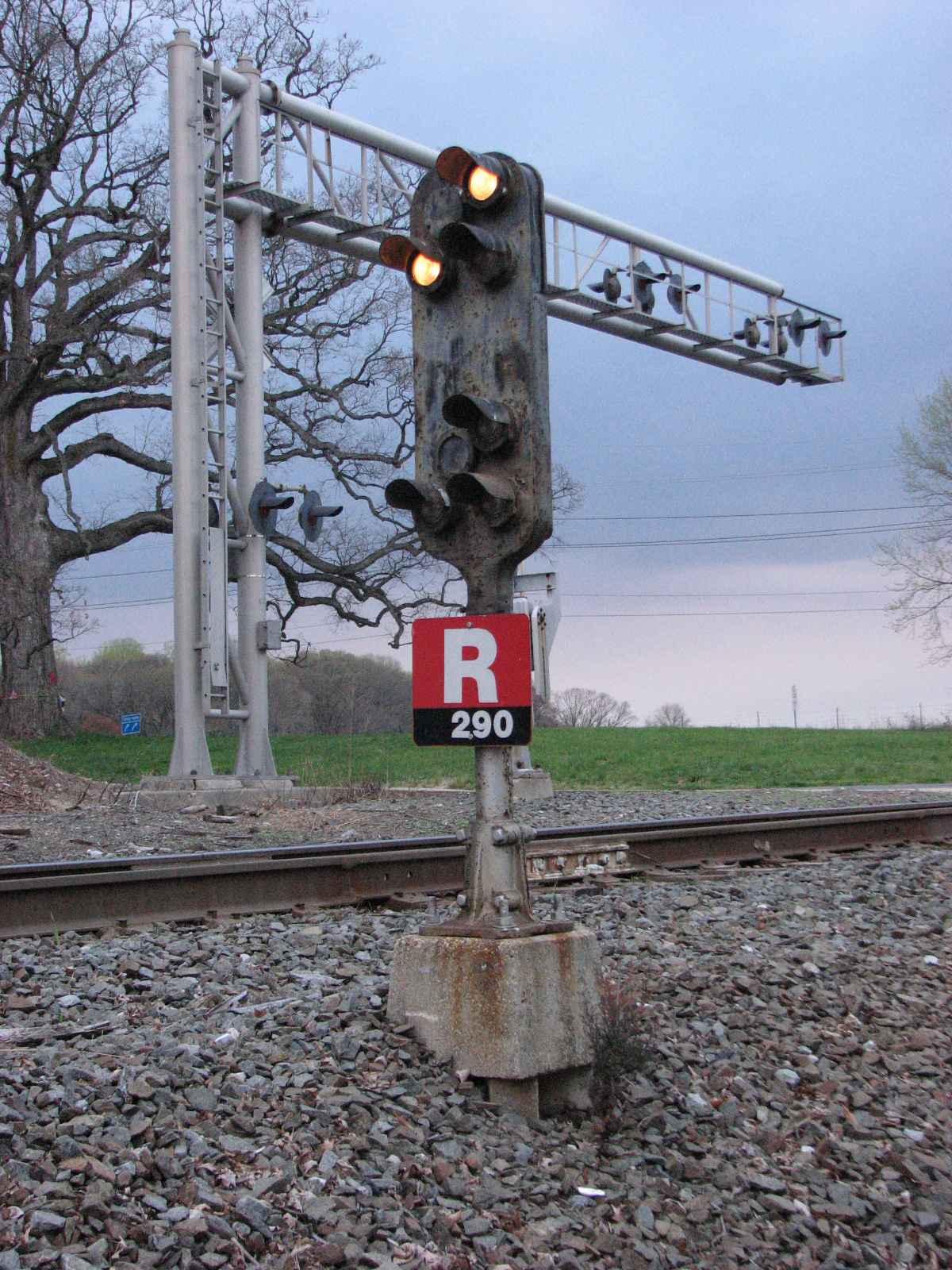
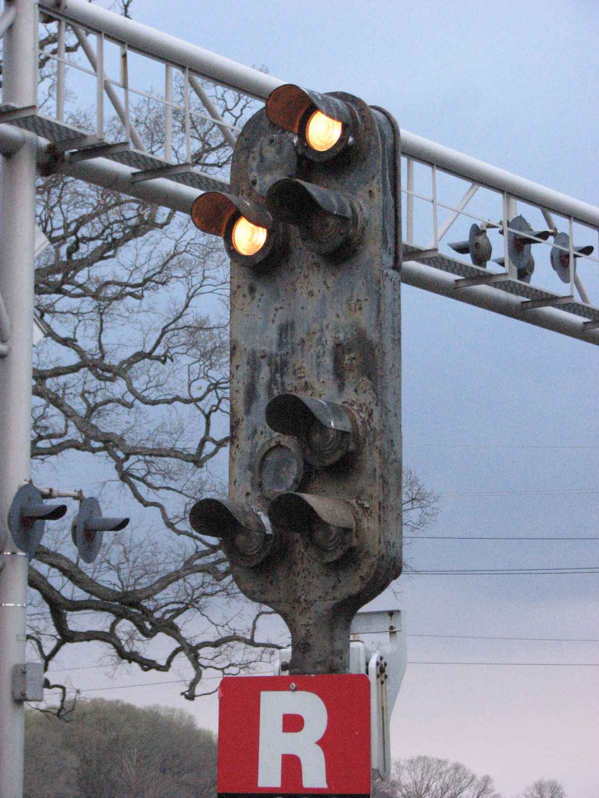
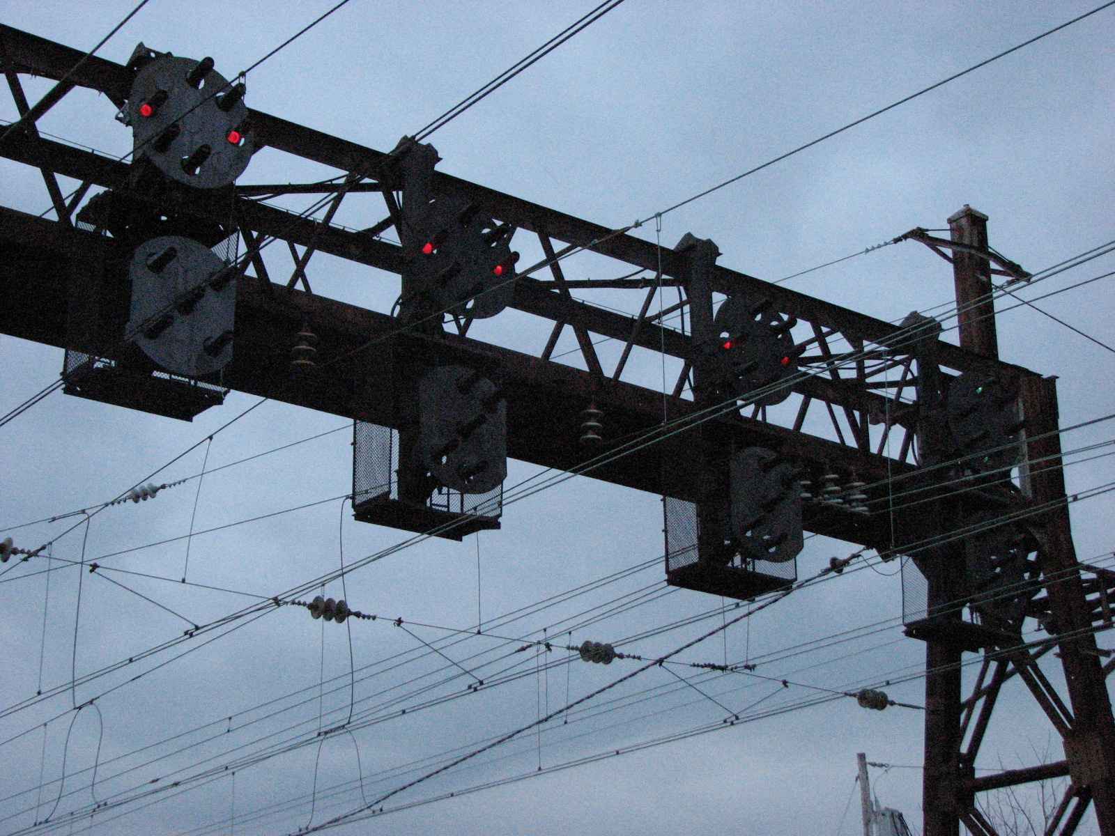
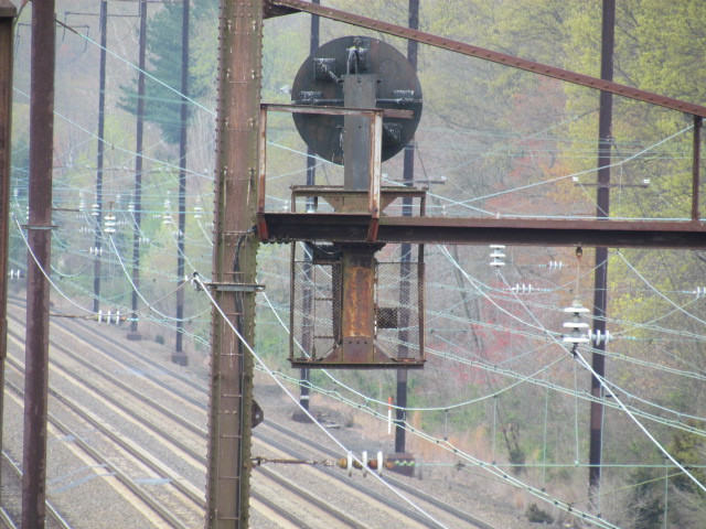
This area, being on the Baltimore & Ohio RR AND Pennsylvania RR mainlines,
HAD a nice selection of PL (Position Light) and CPL (Color Position Light) signals.
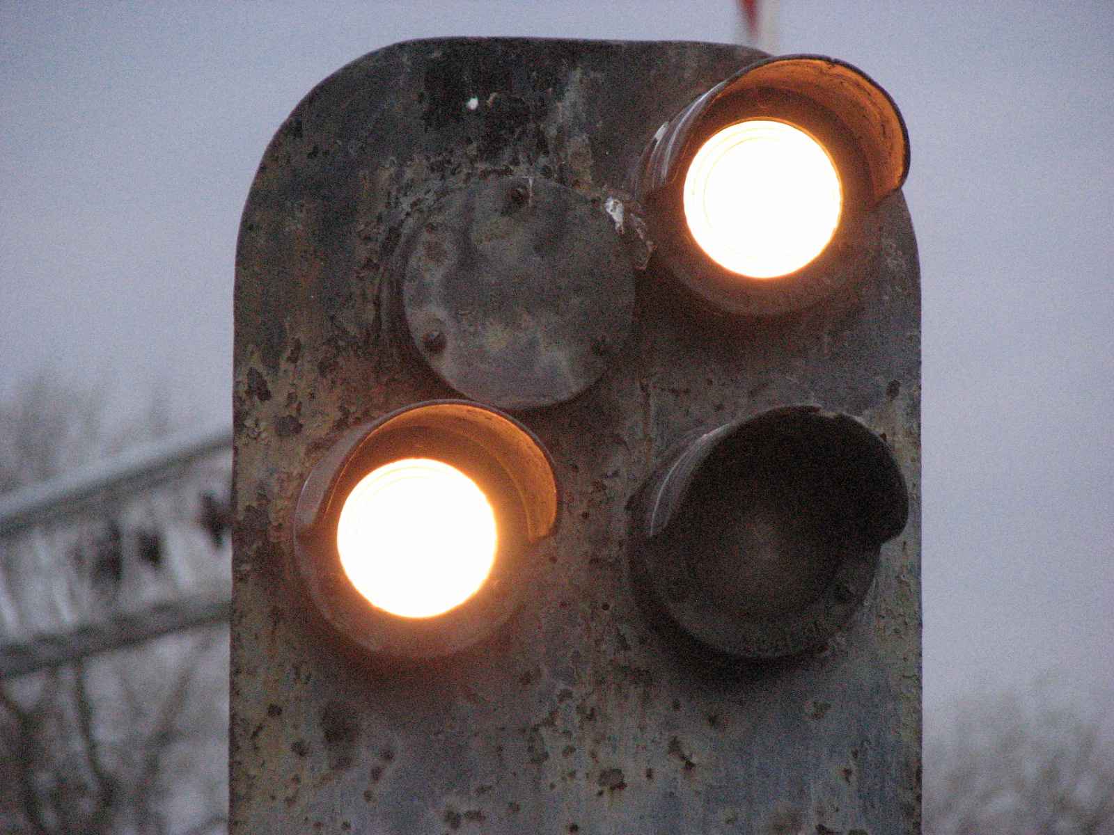
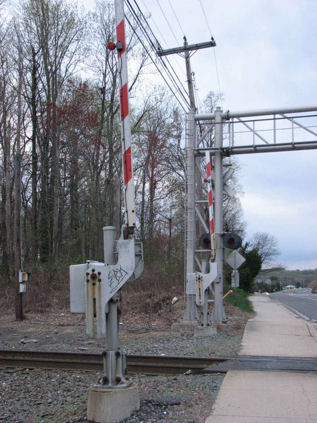
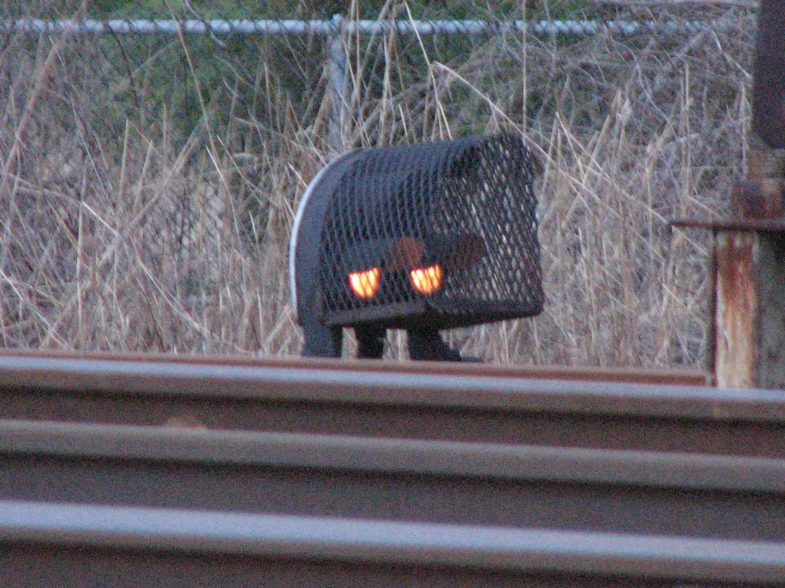
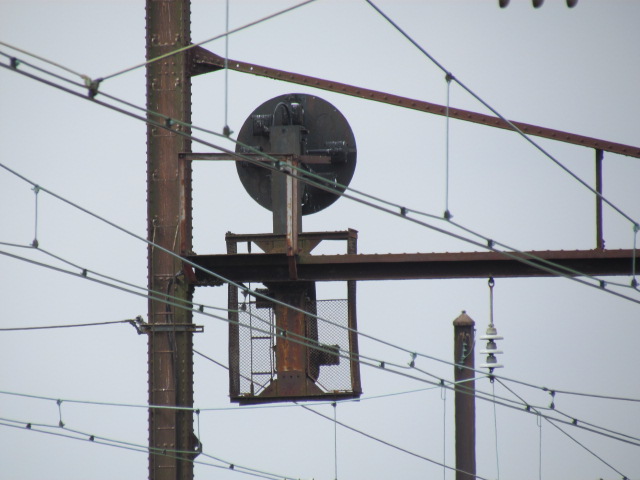
If you're into signals, the area still has a number of Pennsy PL types around, including a pedestal signal used on the approach to the mainline, a mast mounted dwarf PL
for the interchange, a low mounted dwarf in between a couple of the mainline tracks, and three signal bridges in the immediate area.
The Pennsy PL signals on the NEC were converted a long time ago to what we call PCL's, or Position Color Light signals, to avoid confusion with the B&O's version (it is
a non-official term, so not everyone uses the term, some do call them CPL's).
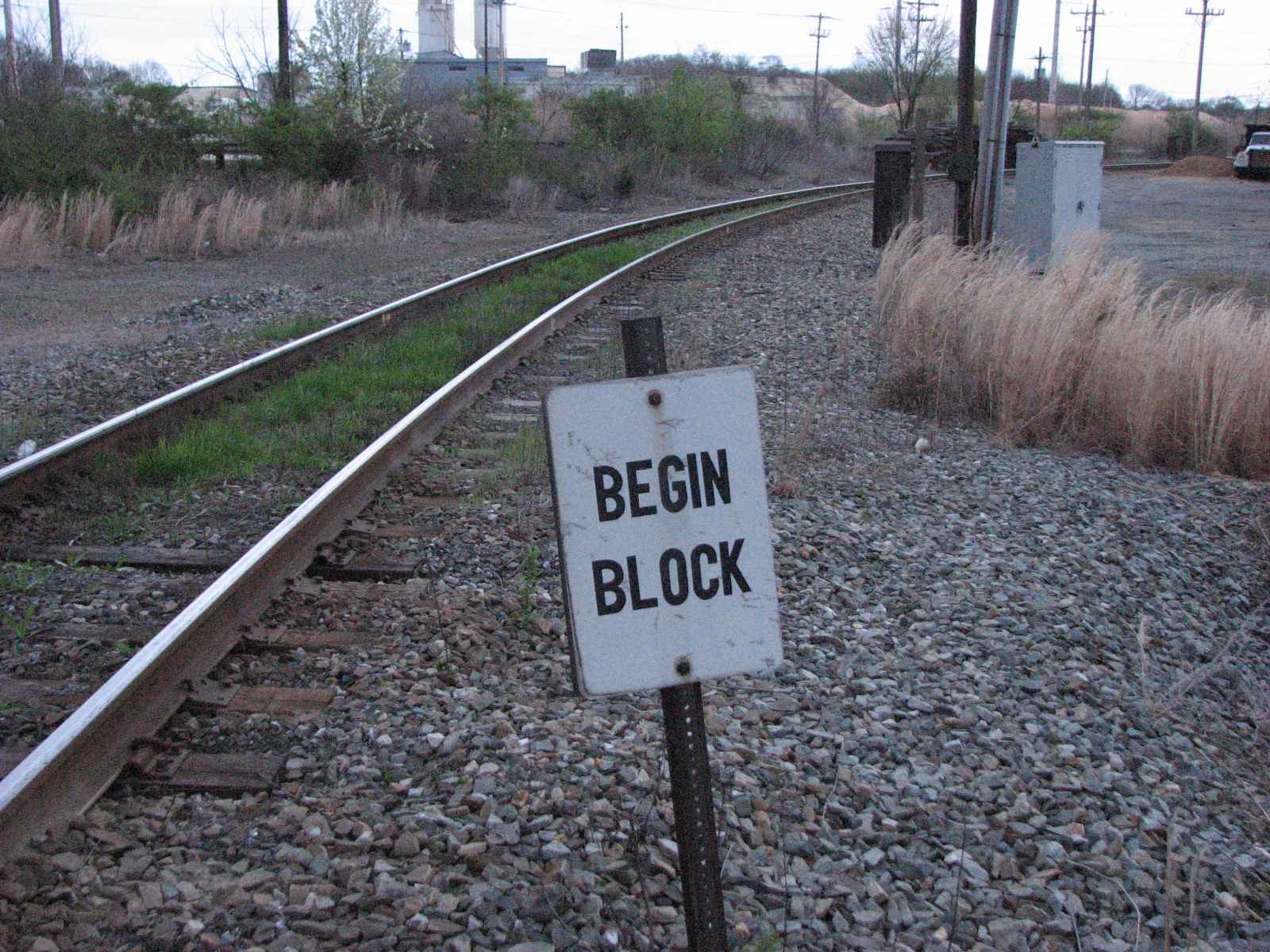
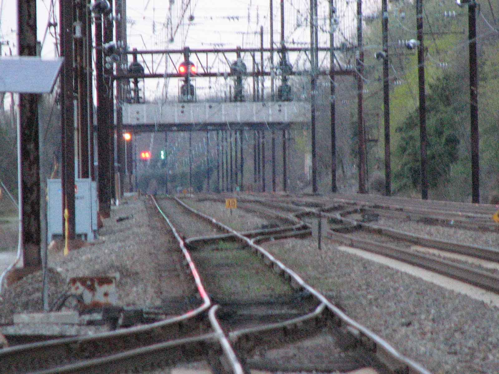
The signal sets at 3 and 4 are for a number of crossovers between those two sets of signals. The right-of-way also goes from 4 tracks north of the station to 3 tracks
heading south.
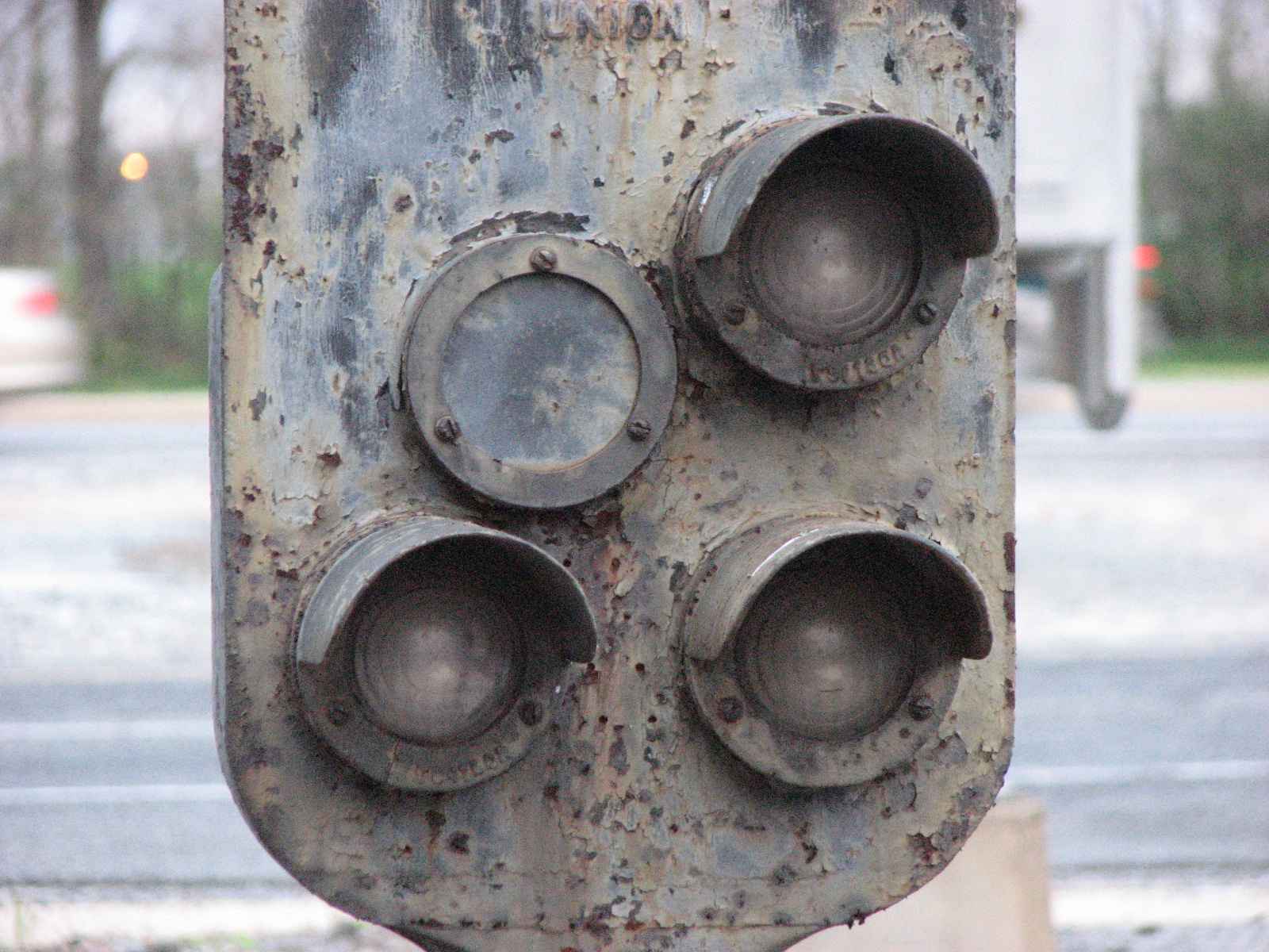
Most, if not all of the B&O CPL's have been replaced by the standard 3 or 4 aspect Darth Vader style color light signals, starting maybe around 2005 in a replacement
program by CSX, starting with the signals at Route 40 west in eastern Baltimore, and slowly working their way east towards Philly.
![]() Pedestal Signal - GONE
Pedestal Signal - GONE
This is an approach signal WAS for the interchange with the Amtrak mainline. The grade crossing also has pedestrian crossing gates. Most pedestal signals are
not this easy to up close to (one of the few other places is Perryville MD). I came thru here in the summer of 2016 and noticed that the pedestal signal was gone,
probably as part of a small scale signal upgrade. I noticed that all of the PL signals around here have had lunar colored (cool white in layman's terminology)
LED's placed in them.
The grade crossing is also unusual for Delaware because there are pedestrian crossing gates on both sides of the road and tracks.


 The grade crossing at this location.
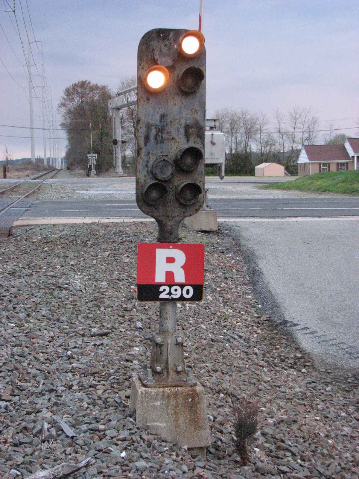
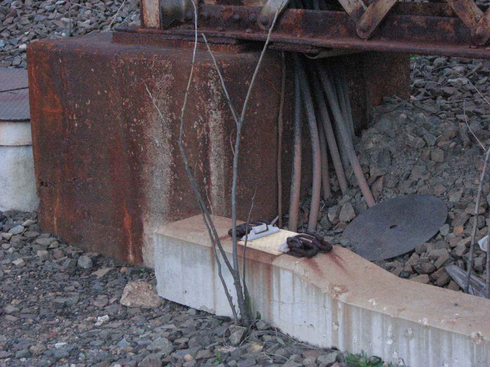
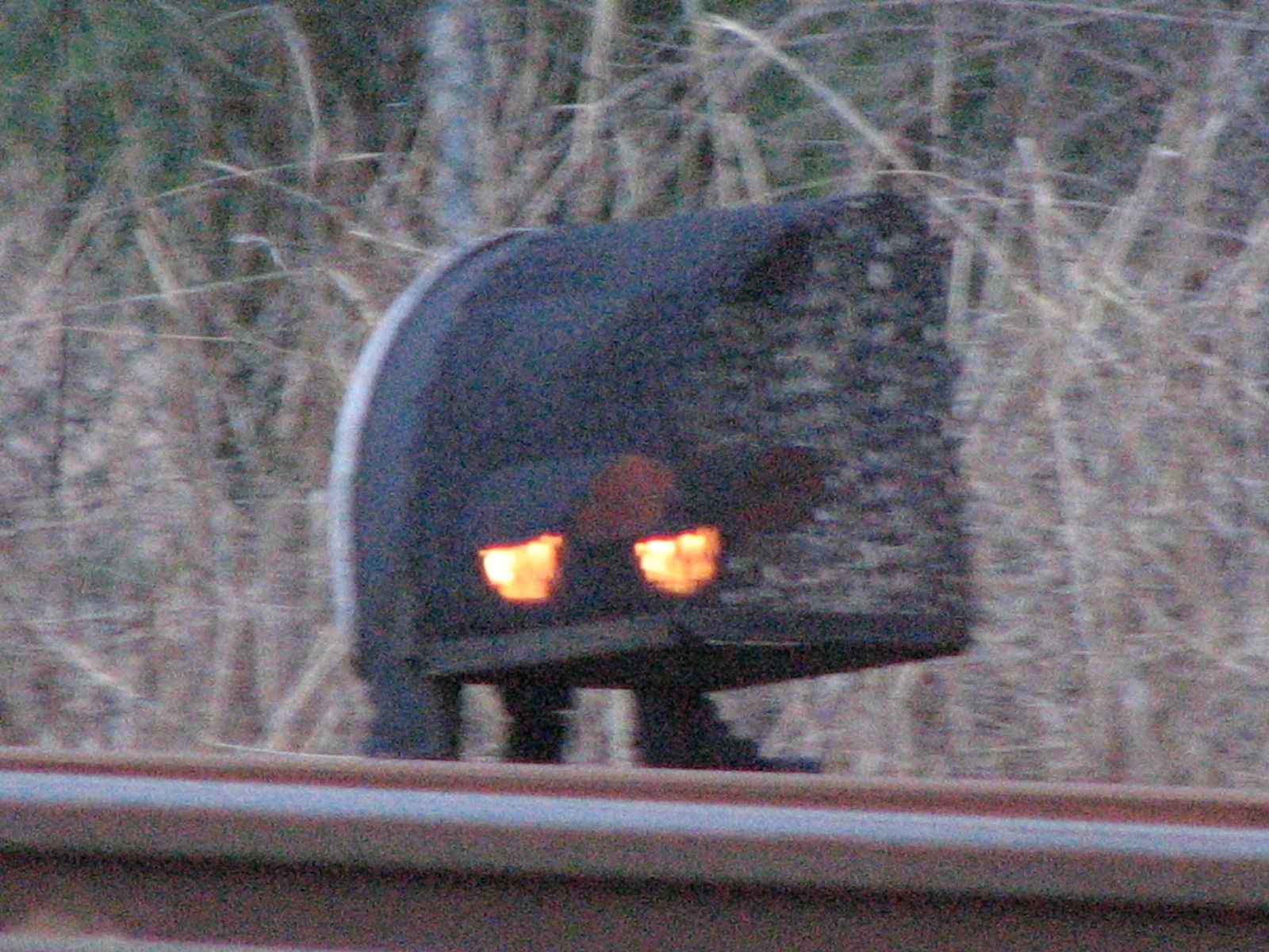
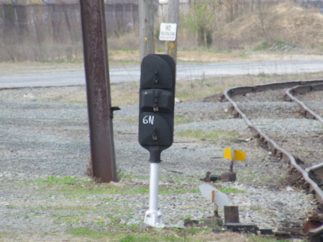
![]() Mast Mounted Dwarf Signal
Mast Mounted Dwarf Signal

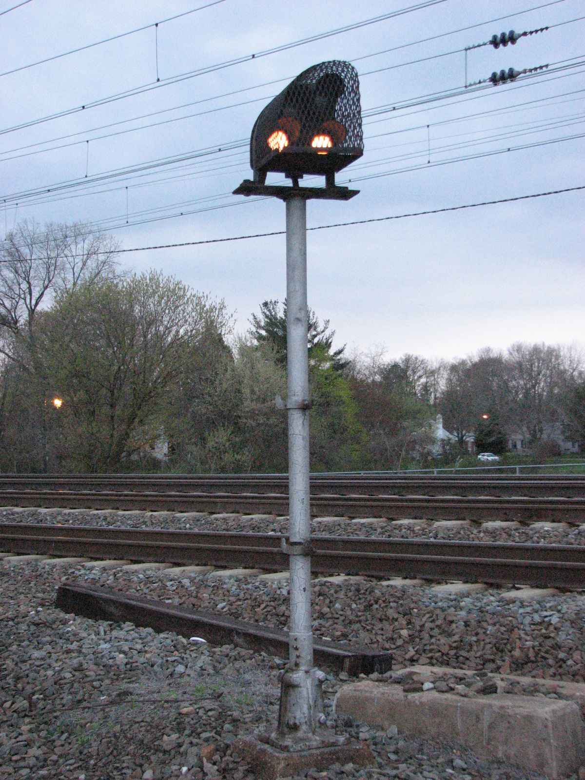

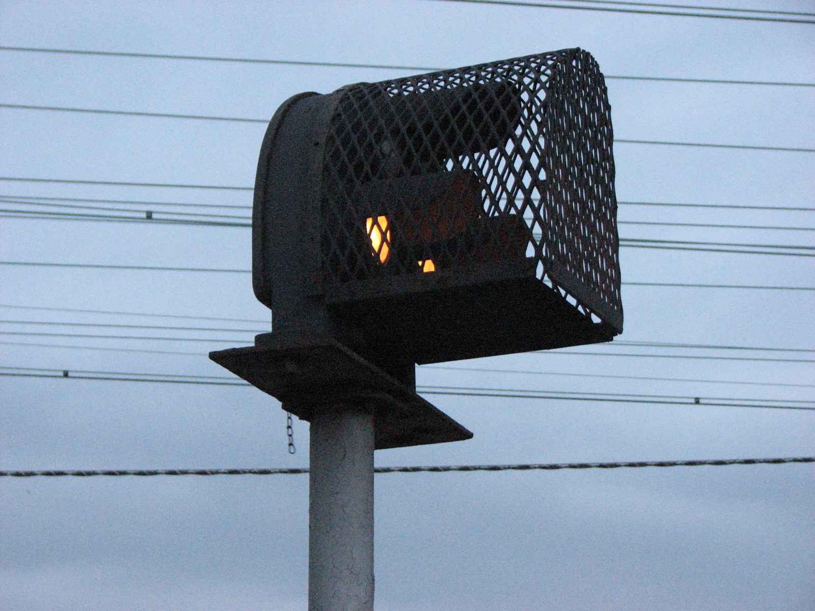
 Looking south (L), then looking towards the mainline (R).
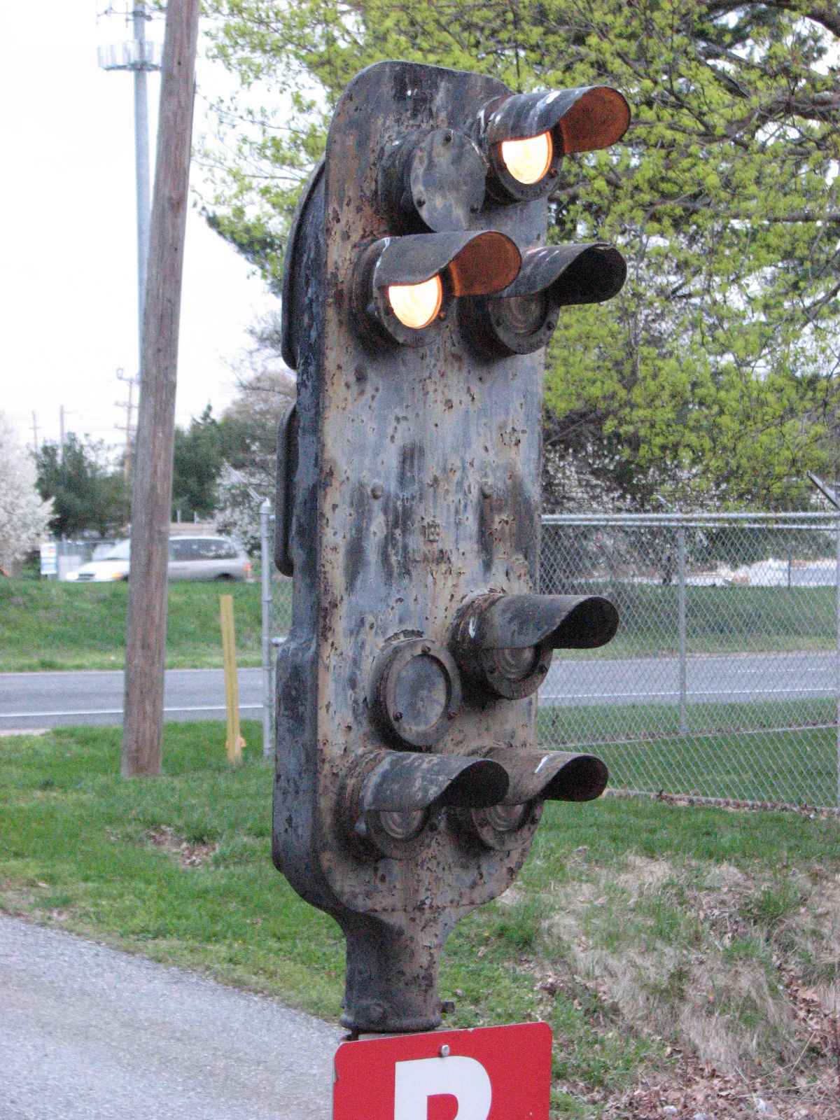
![]() SB Mainline Signals and a Dwarf
SB Mainline Signals and a Dwarf

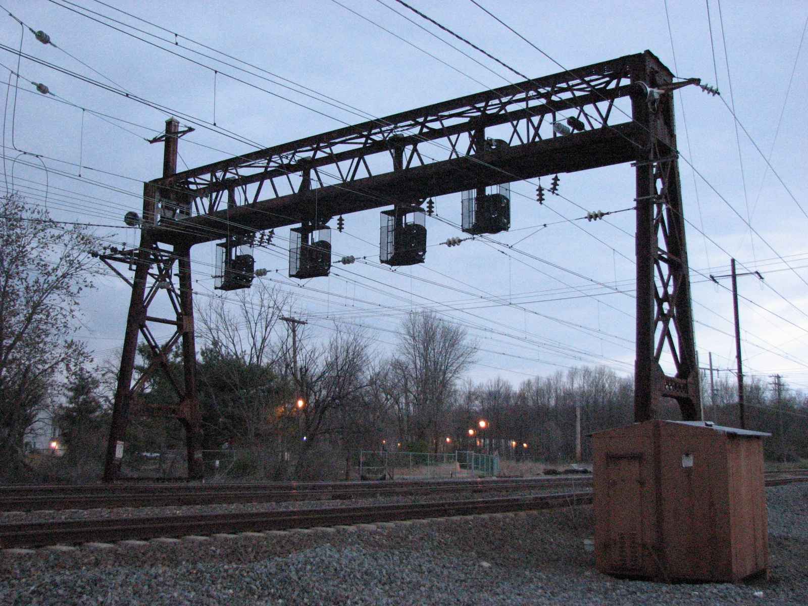

Looking south on the Northeast Corridor:
Adjacent to where the branch line comes into the mainline is one of Amtrak's substations:
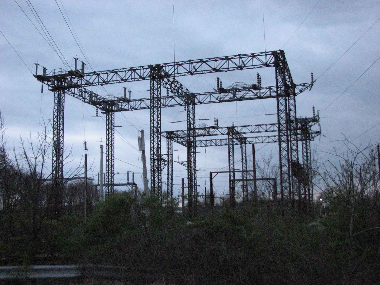
![]() NB Mainline Signals
NB Mainline Signals
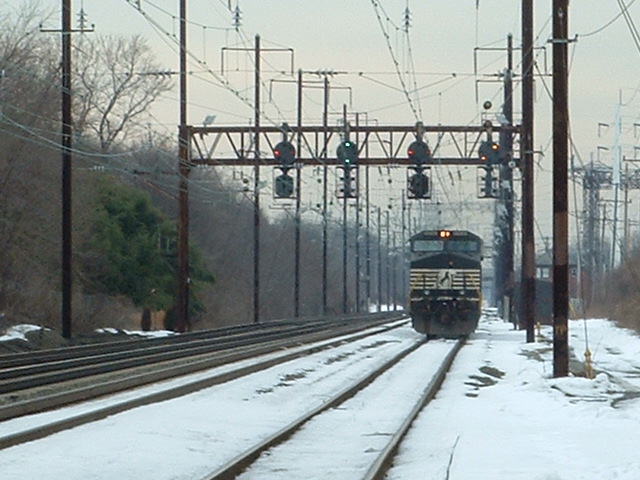
A pair of NS GE's heading into the Chrysler plant yard with the signals in the background, 2005:

![]() Chrysler Yard Signals
Chrysler Yard Signals

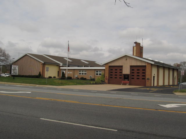
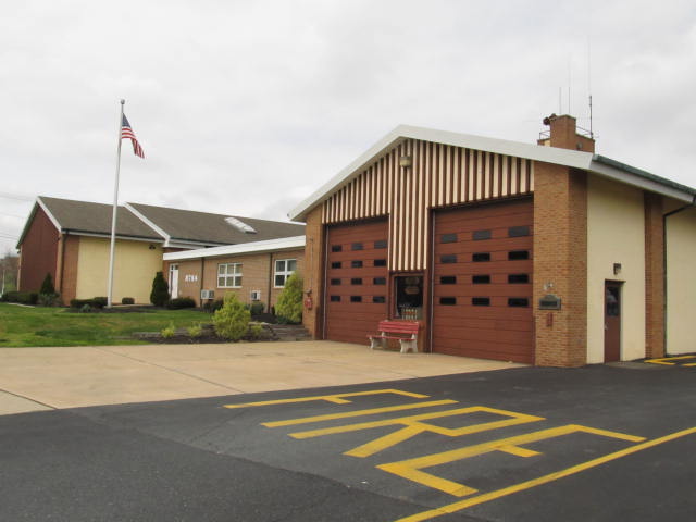
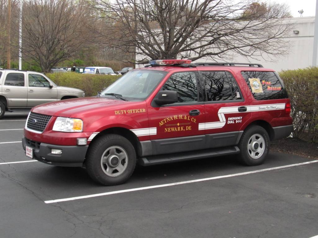
Aetna Hook, Hose & Ladder Company

1ofWhatOtherNudder
The
Courtesy of the University of Texas Library, click here for their index page.
Pictures and additional information is always needed if anyone feels
inclined to take 'em, send 'em, and share 'em, or if you have something to
add or correct.... credit is always given! BE NICE!!! Contact info is
here
RAILROAD SIGNALS HOME
Last Modified
25-May-2018