RAILFAN GUIDES of the U.S.
Todd's Railfan Guide to
the VIRGINIA AVENUE TOWER and TUNNEL
Washington DC
In General
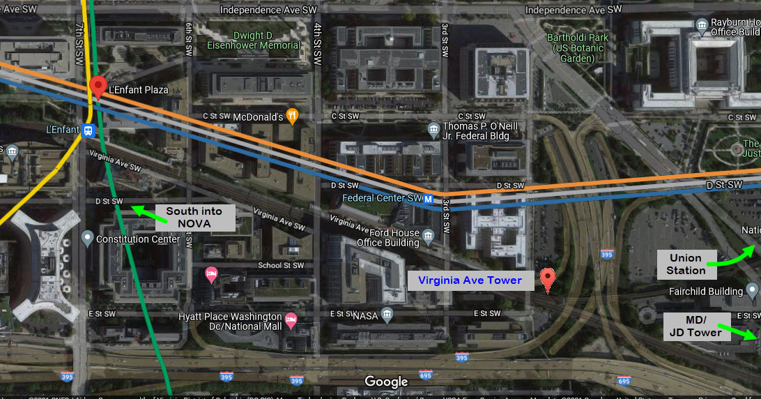
Getting Here
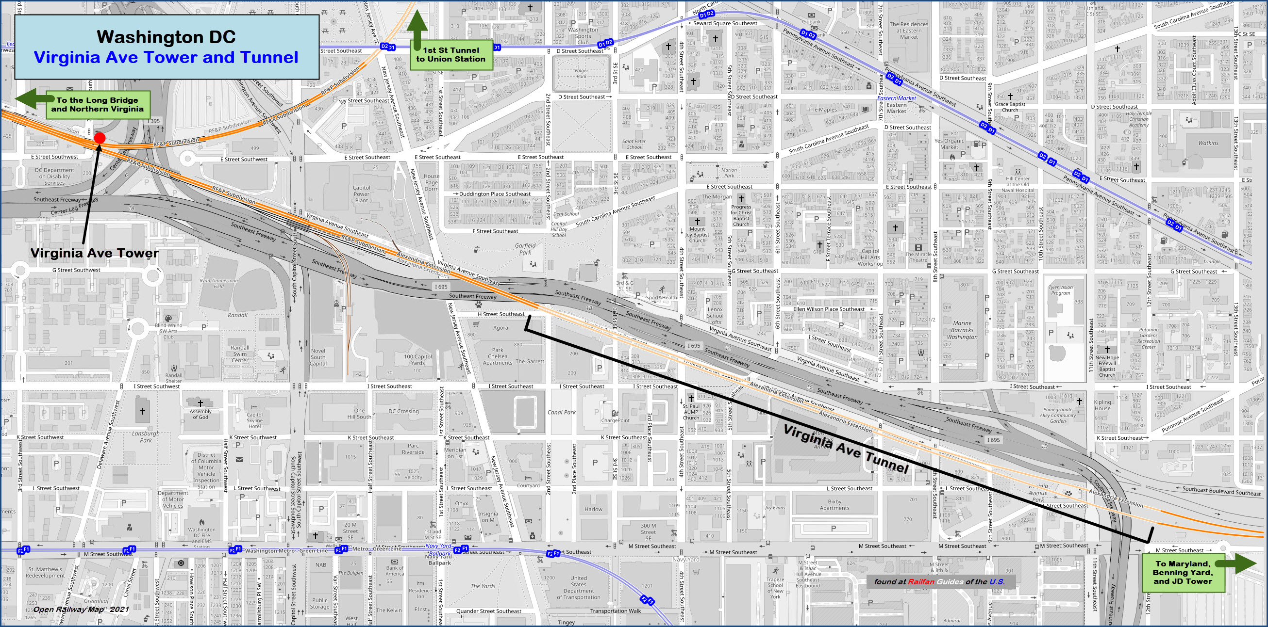
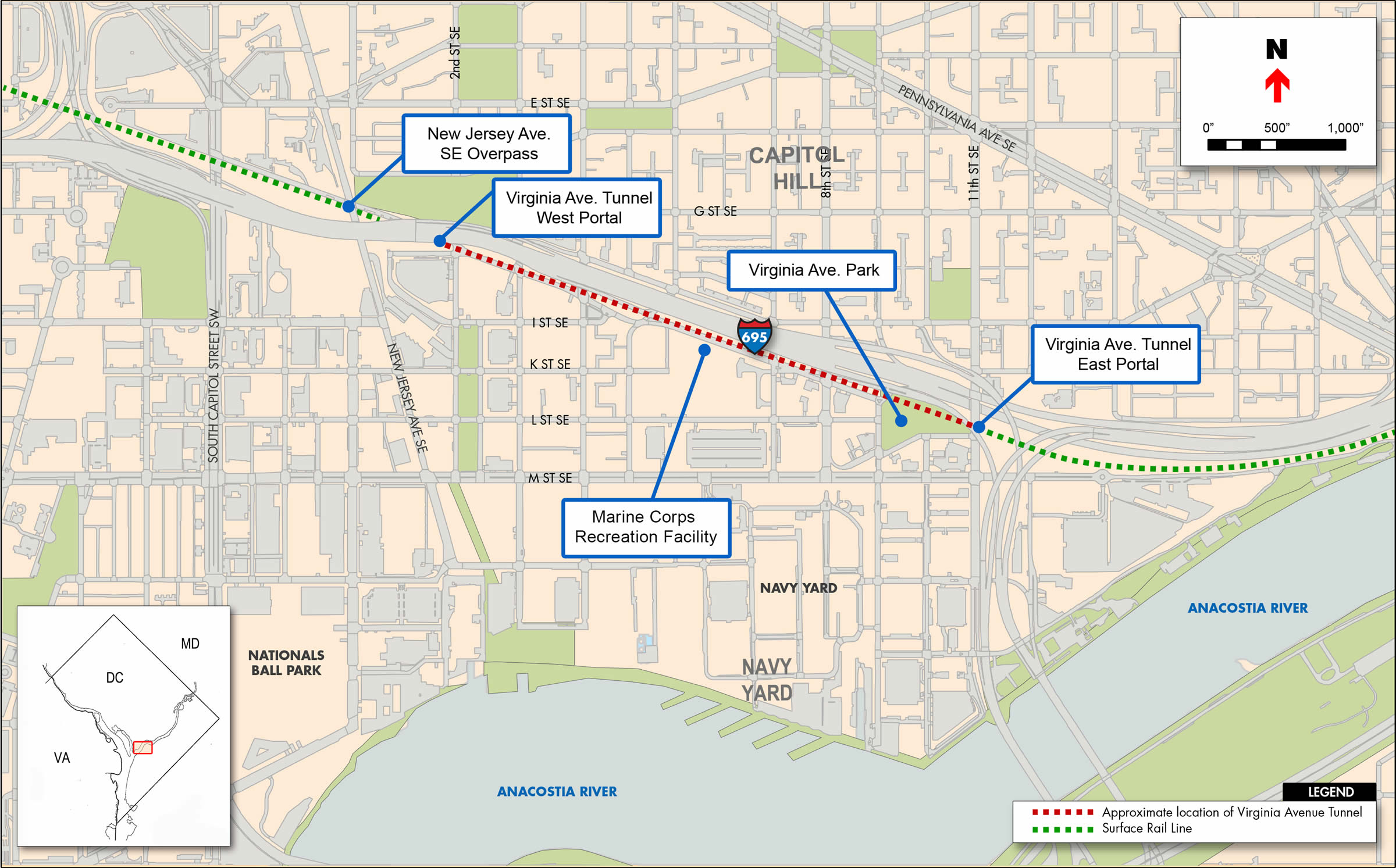
Map
The Tower
The Tunnel
Pictures
Bridges
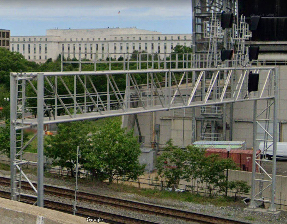
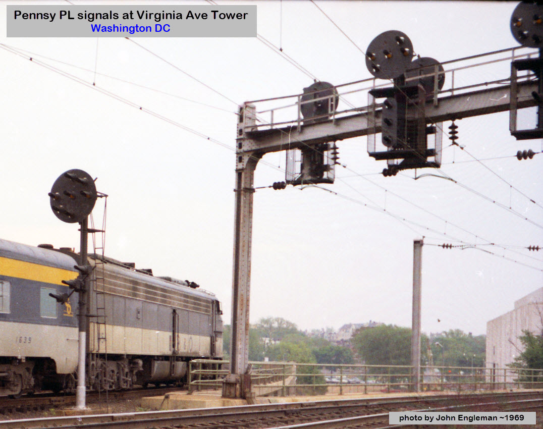
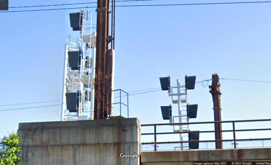
Signals
Floobydust
RAILROAD SIGNALS HOME
Location / Name:
Washington DC
What's Here:
Virginia Avenue Tower
Virginia Avenue Tunnel
Data:
GPS Coordinates:
Tower: 38.88355, -77.01341
Tunnel West Portal: 38.88068, -77.00375
Tunnel East Portal: 38.87728, -76.99067
Phone A/C: 202
ZIP: 20515
Access by train/transit:
DC Metro L'Enfant Plaza station is 4 blocks away: orange, silver, blue, green, yellow lines
VRE/Amtrak L'Enfant station is also 4 blocks away
DC Metro Federal Center SW station is 2 blocks away: orange, silver, blue lines
The Scoop on the Tower:
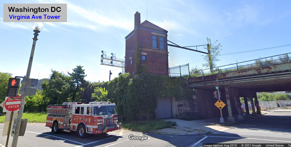
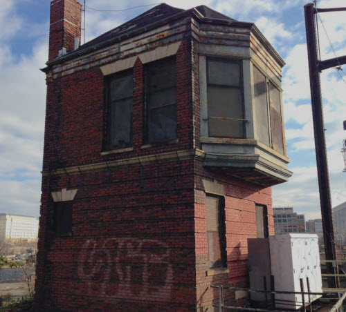
The Virginia Avenue Tower is a two-story, late Victorian railroad interlocking control tower. It was erected circa 1905 as a railroad interlocking station, responsible for mechanically switching trains between the First Street tunnel connection to Union Station and the main Pennsylvania Railroad freight line along Virginia Avenue.
It is one of seven towers that Washington DC used to have, and one of the only two left standing - the other being the K Street tower in the Union Station yard complex. CSX stopped using the tower in 1989, according to one source.
One of the other seven towers, Anacostia, was torn down in 2008.
The Scoop on the Tunnel:
From Wikipedia The Virginia Avenue Tunnel is a railroad tunnel in Washington DC owned by CSX Transportation. It is part of the CSX RF&P Subdivision and serves freight trains along the eastern seaboard routes, providing a bypass around Union Station.
The double-tracked tunnel is located under Virginia Avenue SE, from 15th and M Streets SE to 2nd Street and Virginia Avenue SE. The eastern portal connects to the Anacostia Railroad Bridge and the CSX Capital Subdivision. At the western end the RF&P Sub runs to the Long Bridge into Northern Virginia (NOVA).
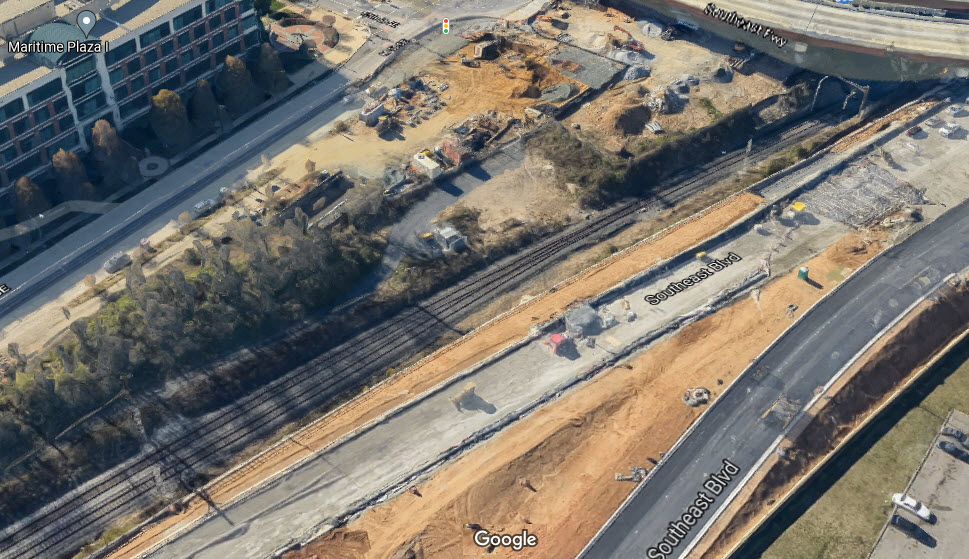
CSX rebuilt the tunnel to replace its deteriorated structure and increase capacity to allow double-stacked containers to pass through. Construction began in 2015 and the project was completed in 2018. (end wiki)
From CSX: The Virginia Avenue Tunnel in southeast Washington, D.C., is a crucial part of the United States’ East Coast railroad network. The tunnel lets trains move freight between key ports, manufacturing centers, and consumer markets. As of 2015, parts of the tunnel were constructed in 1872 and needed to be replaced to meet the growing demands of increased freight traffic.
Beginning in May of 2015, CSX started construction to replace the old tunnel with two new tunnels, which allow for two freight containers stacked on each car to travel through. These double-stacked intermodal freight trains carry essential items like consumer goods and can carry twice as much freight as a single-stack train. The project allows CSX to better serve customers, bring jobs to the local community, and position the Greater Washington (and Baltimore, for that matter - Todd) region for economic growth.
Construction of the project, including the restoration of streetscapes and landscapes, was completed in 42 months. Thanks to CSX’s design-build partners, Clark/Parsons JV, the project was successfully completed in the Fall of 2018. (end csx)
From Alchetron: The tunnel was constructed in 1872 by the Baltimore and Potomac Railroad (B&P), later controlled by the Pennsylvania Railroad. It originally served the B&P station on the present-day site of the National Gallery of Art, on the National Mall at 6th & B Street NW (today's Constitution Avenue). The tunnel was built using the cut and cover method. It was constructed of ashlar stone for the sidewalls, and brick and stone for the arches. In 1904 the tunnel was extended to its present length due to a track relocation. Initially the tunnel served both freight and passenger service until Union Station's opening in 1908, and since that time it has been freight-only. The tunnel's second track was removed in 1936 to accommodate electrification and increasingly large railroad equipment. (end Alchetron)
If you take the time to read the Alchetron page, you will understand why projects in this country take forever to get started, and then forever to get completed.
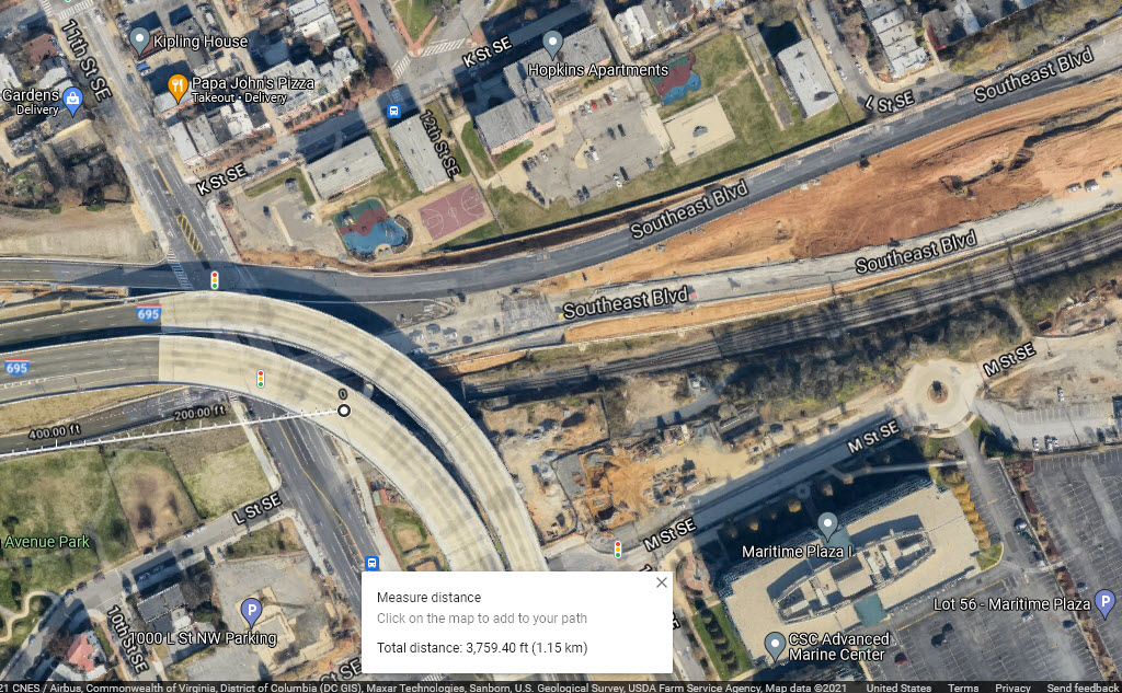
Using Google Maps to measure the tunnel length, I'm coming up with about 3,750 feet... The Alchetron website lists the tunnel length as being 1,155 meters, or 3,789 feet.
Bing does not have their Birds Eye View available for DC, and the USGS maps are not that revealing, so neither will be shown here.
Acknowledgements:
John Engleman
rockcreek
Alchetron
Denver Todd
Wikipedia
CSX
Websites and other additional information sources of interest for the area:
https://historicsites.dcpreservation.org/items/show/885
https://ggwash.org/view/38200/this-vacant-tower-could-become-your-favorite-new-bar interesting article from 2006
https://en.wikipedia.org/wiki/Virginia_Avenue_Tunnel just down the street from the Tower
https://www.clarkconstruction.com/our-work/projects/csx-virginia-avenue-tunnel-reconstruction
https://www.csx.com/index.cfm/about-us/projects-and-partnerships/virginia-avenue-tunnel/
https://www.jdland.com/dc/va-ave-tunnel.cfm
https://alchetron.com/Virginia-Avenue-Tunnel
Getting to G
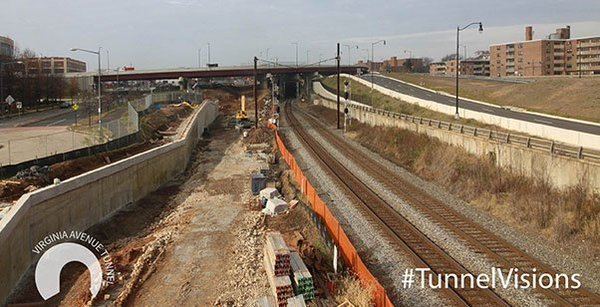
 from ggwash.org
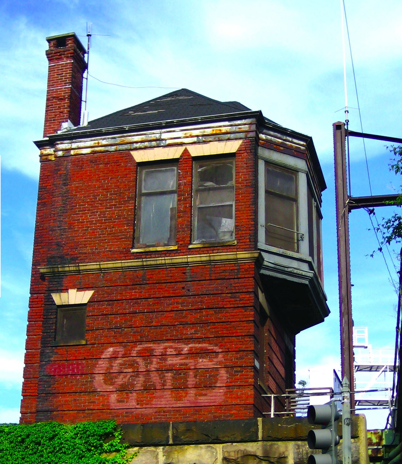 photo by rockcreek, via flickr, 2009
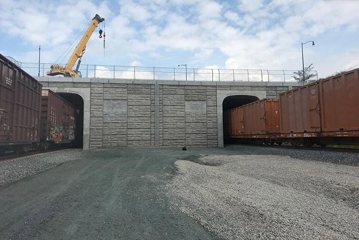
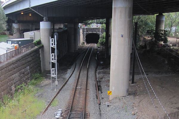
 east portal
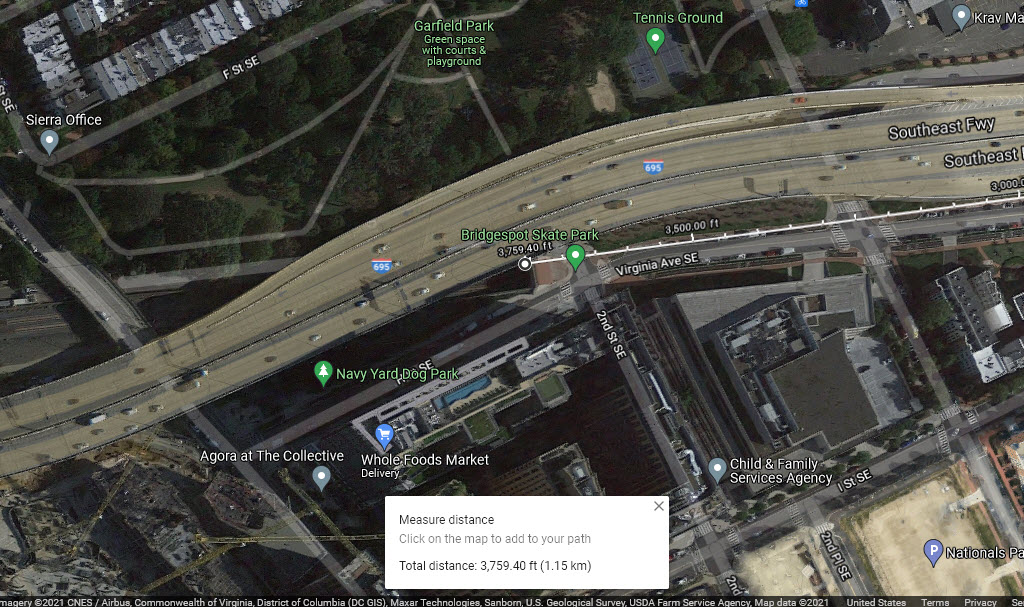 west portal
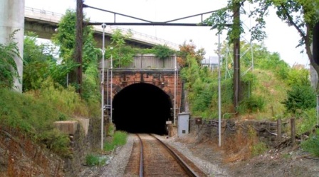 before
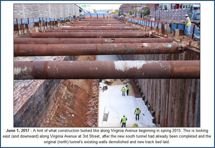 from the JDLand page
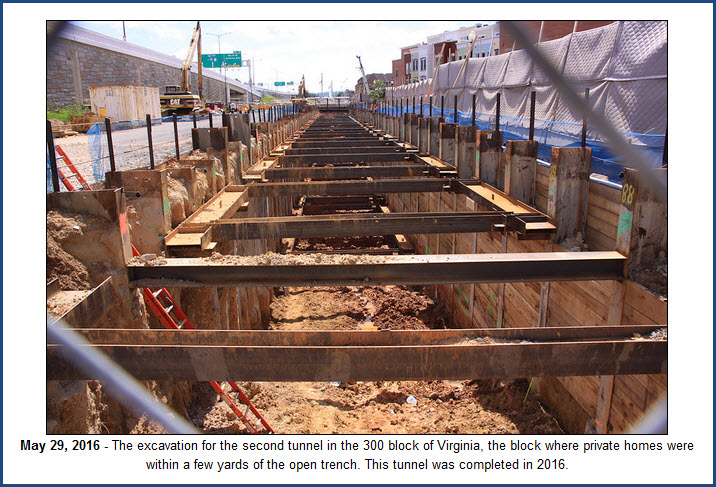 from the JDLand page
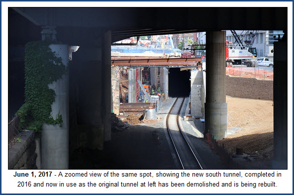 from the JDLand page
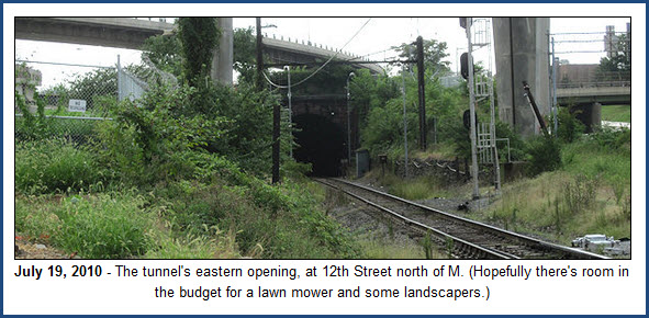 from the JDLand page
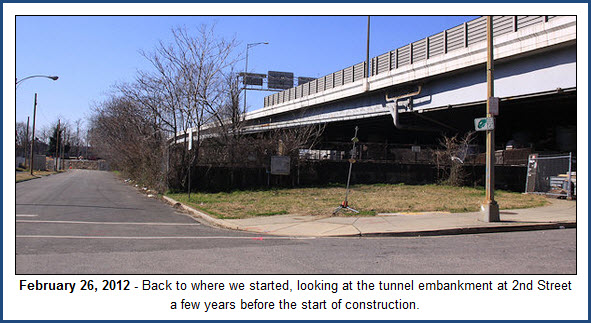 from the JDLand page
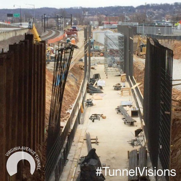
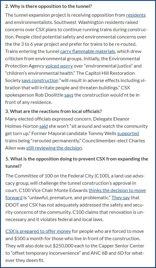
Here are a couple of concerns and objections raised during the planning stage of the tunnel. Anyone suggesting that the trains carrying hazardous materials be rerouted has NO idea what it would take to get trains into Virginia if they didn't come thru DC.
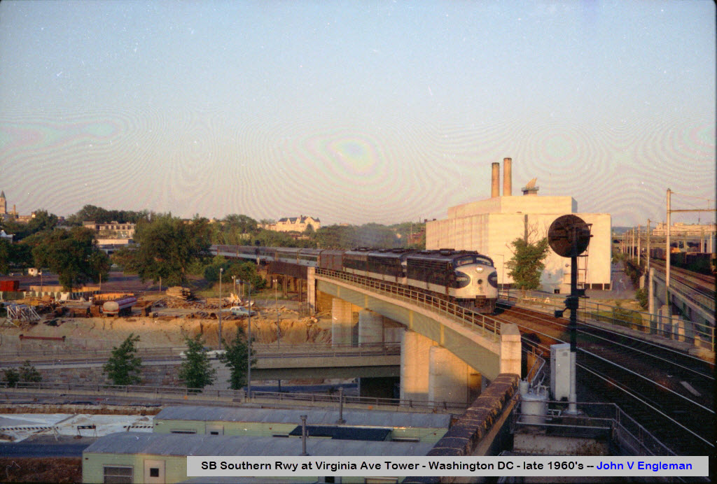
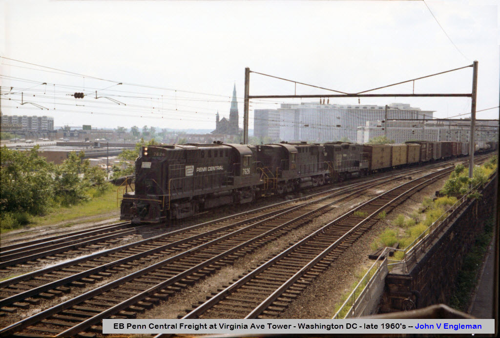
Although the engines say SCL, the train at this point is an RF&P train, coming off the Washington Terminal tracks and heading south on the (then) Penn Central tracks, heading towards the Long Bridge and then into NOVA (Northern Virginia).
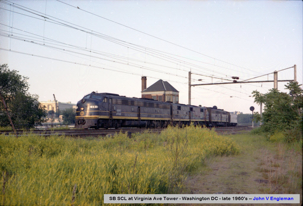
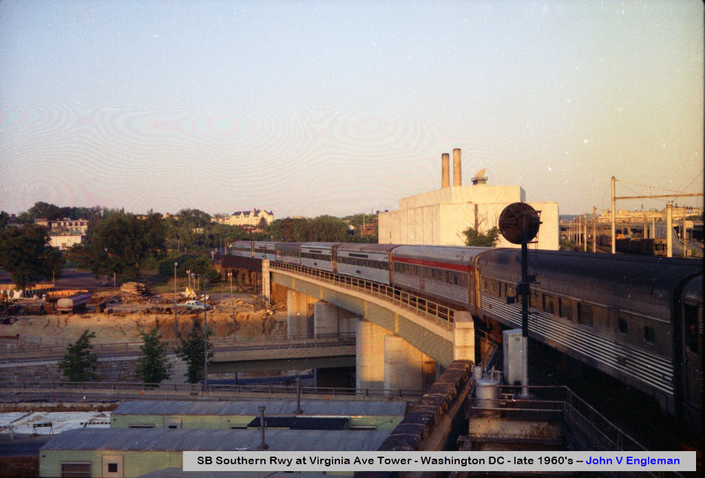
Same thing for this train, it may be in Southern colors, but it is still an RF&P train until it gets on Southern Rwy tracks. Five months before Amtrak took over in May of 1971, I came home from L.A. on one of the Southern trains which originated in New Orleans. One of the best meals I have ever had, bar none, was on that SR train coming up thru Georgia and the Carolina's! (it was lamb chops, BTW)
The
The
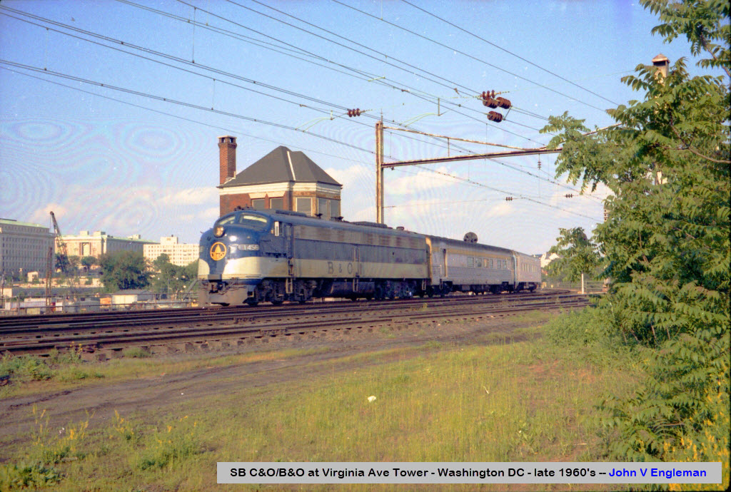
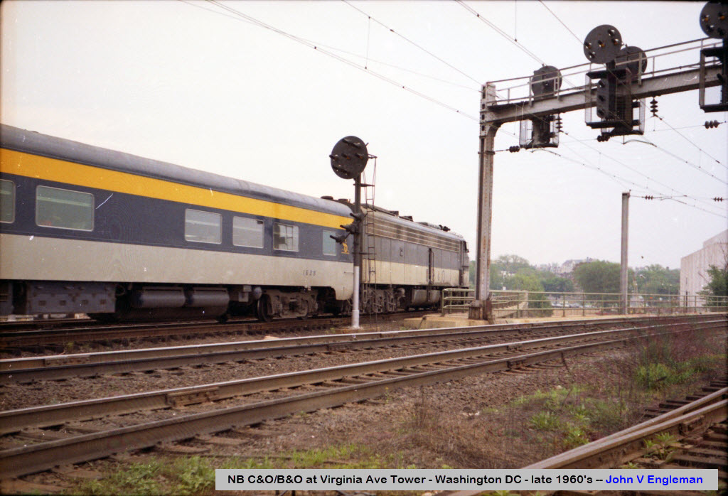
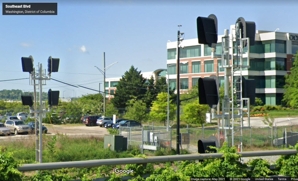
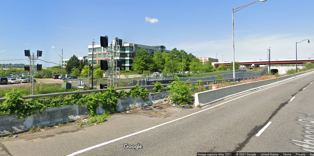
The signals adjacent to and near the tower are now all standard colorlight signals. Prior to this, they were Pennsy PL signals since this was a PRR line. When the pictures above by John were taken, the freight line was also electrified into RF&P's Pot Yard.
 before
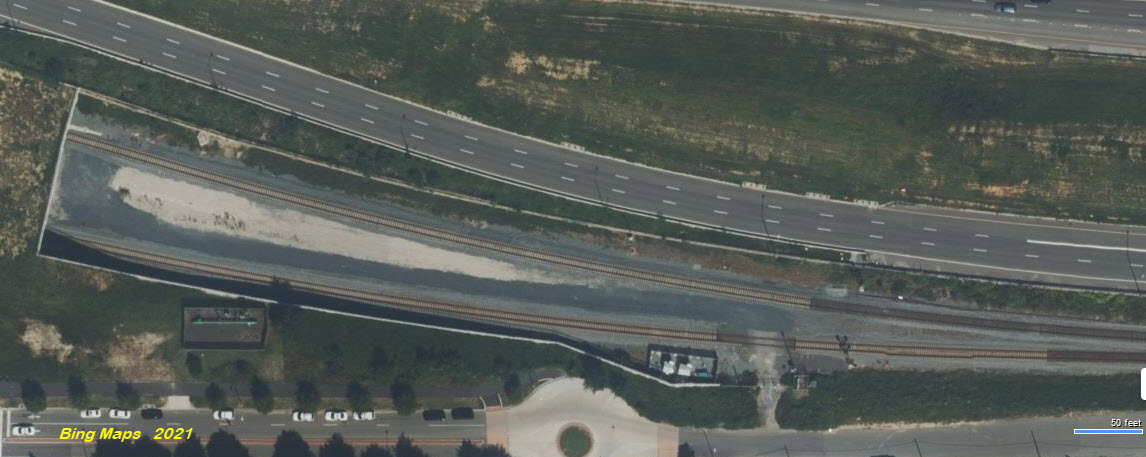
Did U Know?
None for now......
Disclaimers:
I love trains, and I love signals. I am not an expert. My webpages reflect what I find on the topic of the page. This is something I have fun with while trying to help others.
Please Note: Since the main focus of my two websites is railroad signals, the railfan guides are oriented towards the signal fan being able to locate them. For those of you into the modeling aspect of our hobby, my indexa page has a list of almost everything railroad oriented I can think of to provide you with at least a few pictures to help you detail your pike.
If this is a railfan page, every effort has been made to make sure that the information contained on this map and in this railfan guide is correct. Once in a while, an error may creep in :-)
My philosophy: Pictures and maps are worth a thousand words, especially for railfanning. Text descriptions only get you so far, especially if you get lost or disoriented. Take along good maps.... a GPS is OK to get somewhere, but maps are still better if you get lost! I belong to AAA, which allows you to get local maps for free when you visit the local branches. ADC puts out a nice series of county maps for the Washington DC area, but their state maps do not have the railroads on them. If you can find em, I like the National Geographic map book of the U.S..... good, clear, and concise graphics, and they do a really good job of showing you where tourist type attractions are, although they too lack the railroads. Other notes about specific areas will show up on that page if known.
Aerial shots were taken from either Google or Bing Maps as noted. Screen captures are made with Snagit, a Techsmith product... a great tool if you have never used it!
By the way, floobydust is a term I picked up 30-40 years ago from a National Semiconductor data book, and means miscellaneous and/or other stuff.
Pictures and additional information is always needed if anyone feels inclined to take 'em, send 'em, and share 'em, or if you have something to add or correct.... credit is always given! Please be NICE!!! Contact info is here
Beware: If used as a source, ANYTHING from Wikipedia must be treated as being possibly inaccurate, wrong, or not true.
RAILFAN GUIDES HOME
RAILROAD SIGNALS HOME
NEW 10/4/2021, OCT05-07/2021
Last Modified 07-Oct-2021