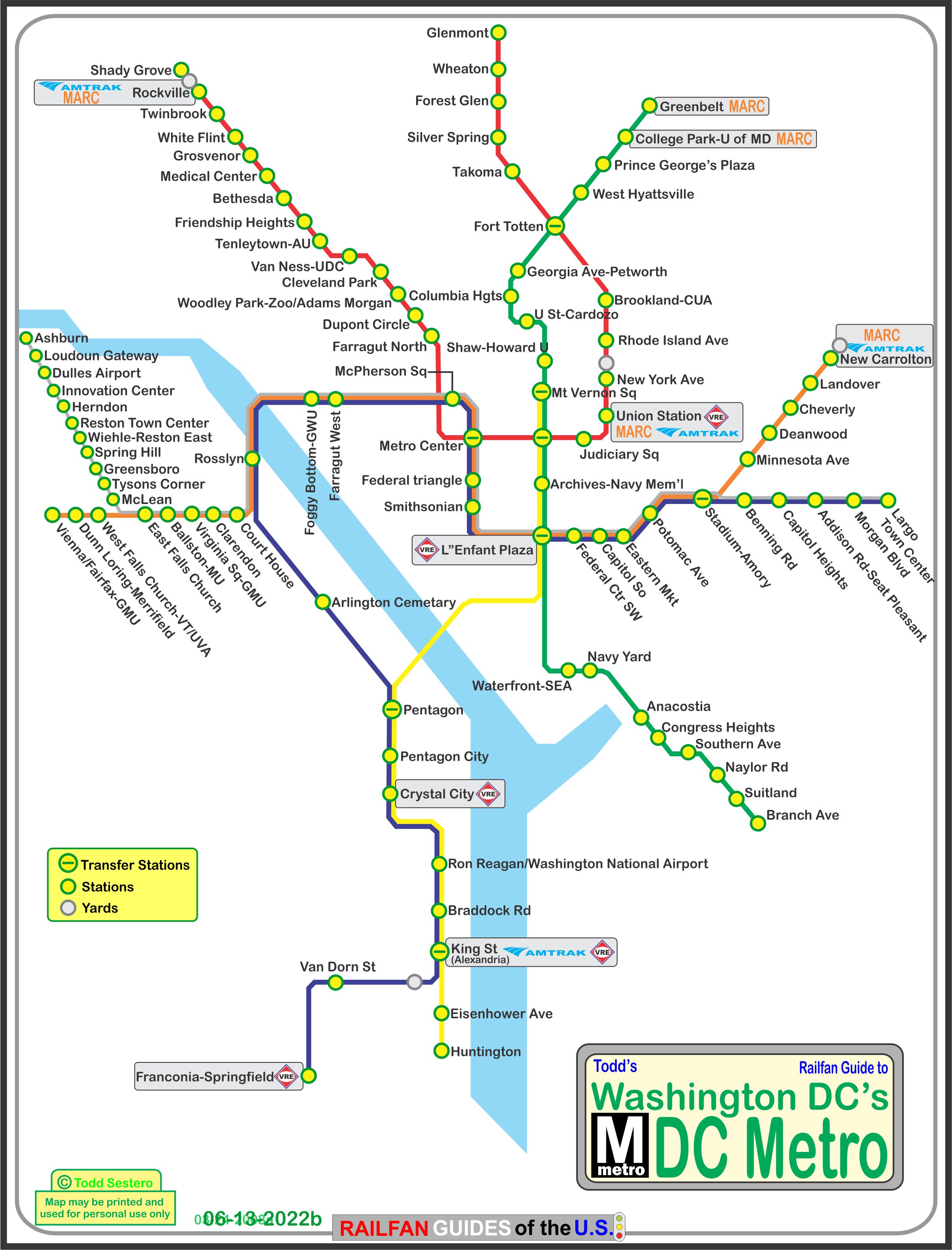
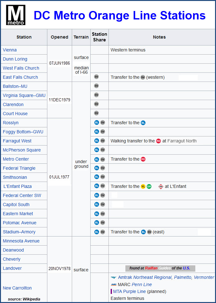
Access by train/transit:
Amtrak and MARC at New Carrollton
VRE at L'Enfant Plaza
Red Line transfer at Metro Center
Green and Yellow line transfer at L'Enfant Plaza
Shares many stations with the Blue and Silver lines
The Scoop:
The DC Metro's ORANGE LINE runs east-west, from Vienna as the western
terminus, to New Carrolton on the eastern end, where you can catch MARC and some
Amtrak trains.
The line has 26 stations, of which 17 are underground, 4 are on the surface on
the west end in the middle of I-66, and 5 stations are on the surface on the east end.
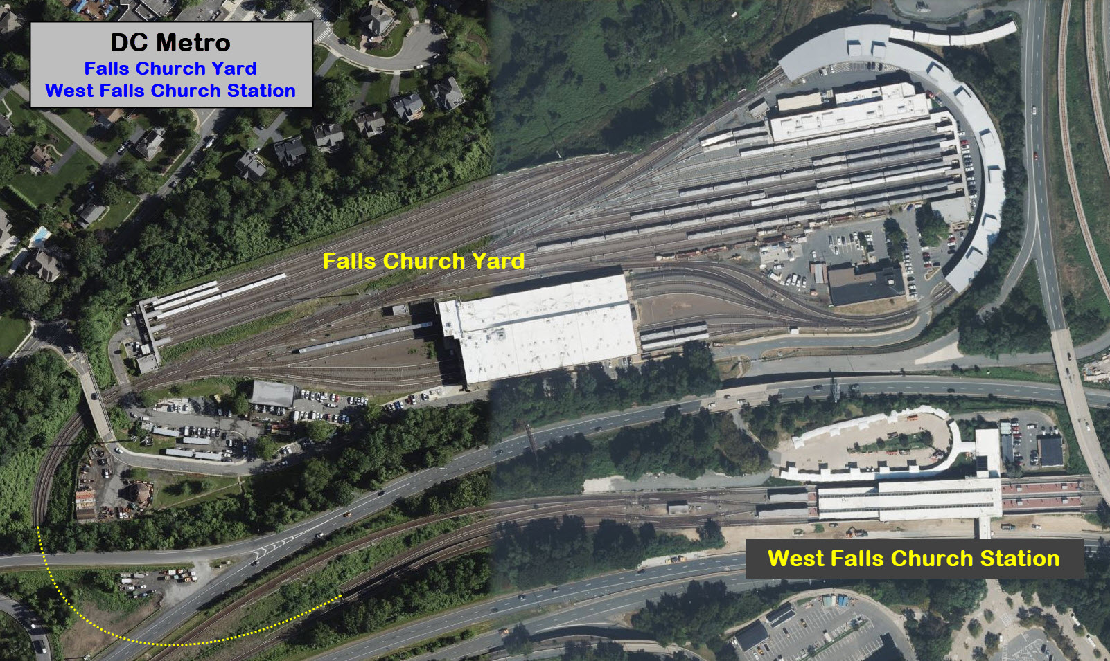
The Orange Line has the Falls Church Yard, just west of the West Falls Church station.
Acknowledgements:
Google Maps
Bing Maps
Wikipedia
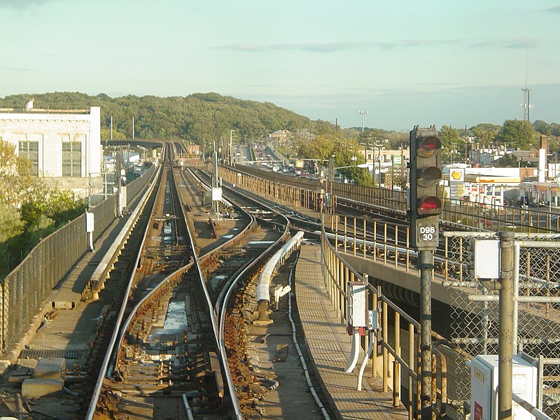
Ben Schumin
I'm going to skip "how to get here" for the most part, because the
system is spread out over such a large geographical area.
With that said, the western end rides in the middle of I-66 from the DC Beltway
west, and to the east until it goes underground.
Exit 62, Nutley Ave will get you to the Vienna station (outside the Beltway).
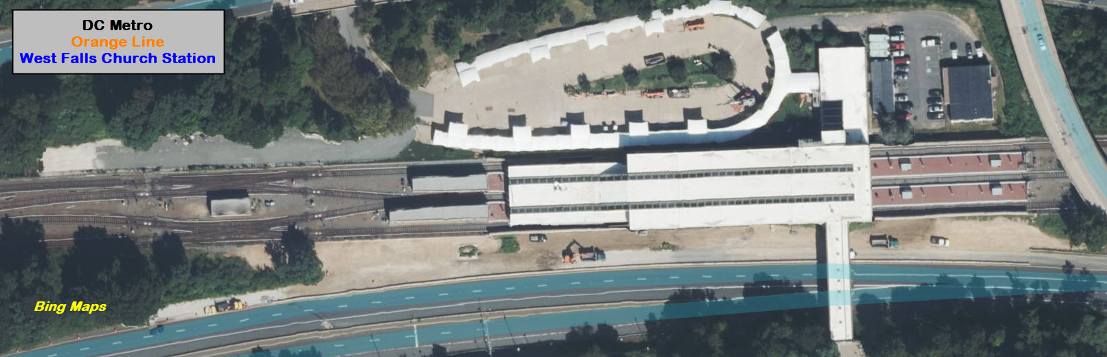
Exit 66, Leesburg Pike, will take you to the West Falls Church station (Inside the Beltway).
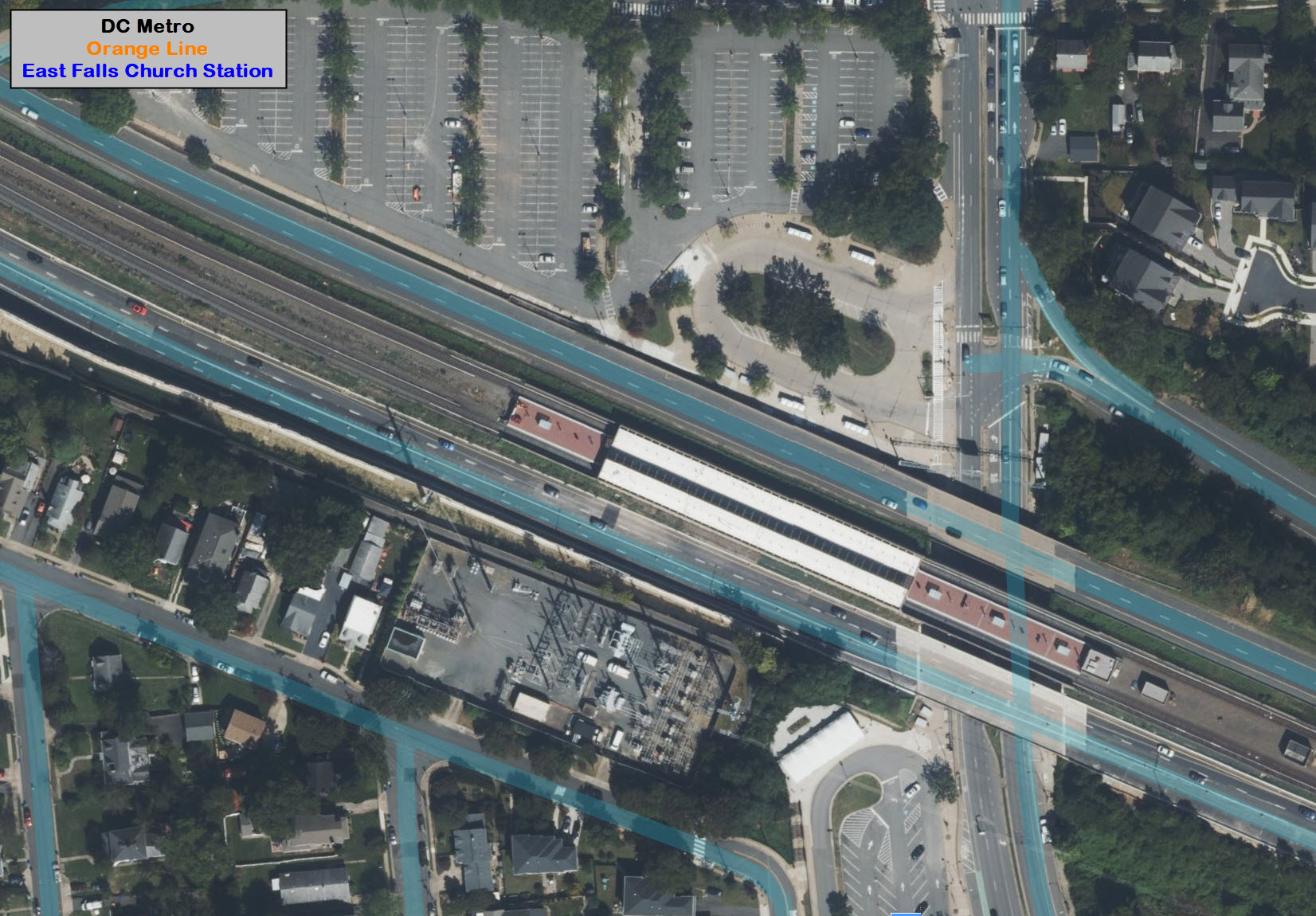
Exit 69, Langston Blvd, will get you to the East Falls Church station (also inside the Beltway).
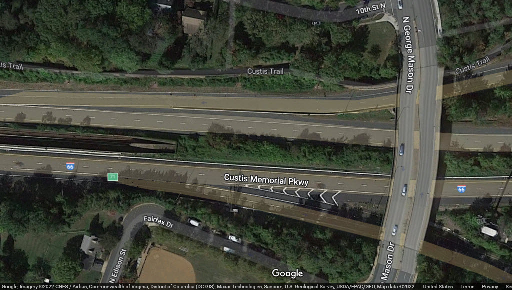
REALLY IMPORTANT NOTE: As of the summer of 2022, I-66 is in a large re-construction project, extending
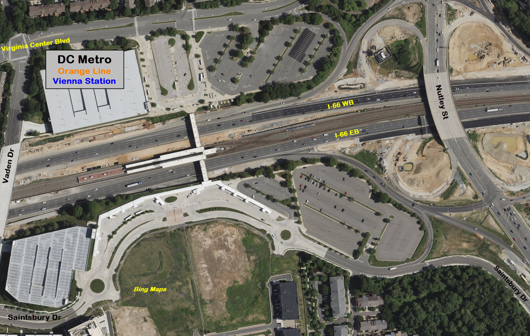
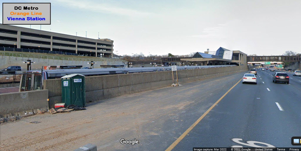
GPS Coordinates: 38.87770, -77.27177
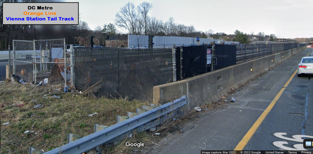
This is the western end of the Orange line. There is an approximately
2,000 foot long stub track for off peak storage to the west of the platform,
and a double crossover just before coming into the station from the line.
Easy access from I-66, exit 62, Nutley Blvd. Approx 2.5 miles to the Dunn
Loring station.
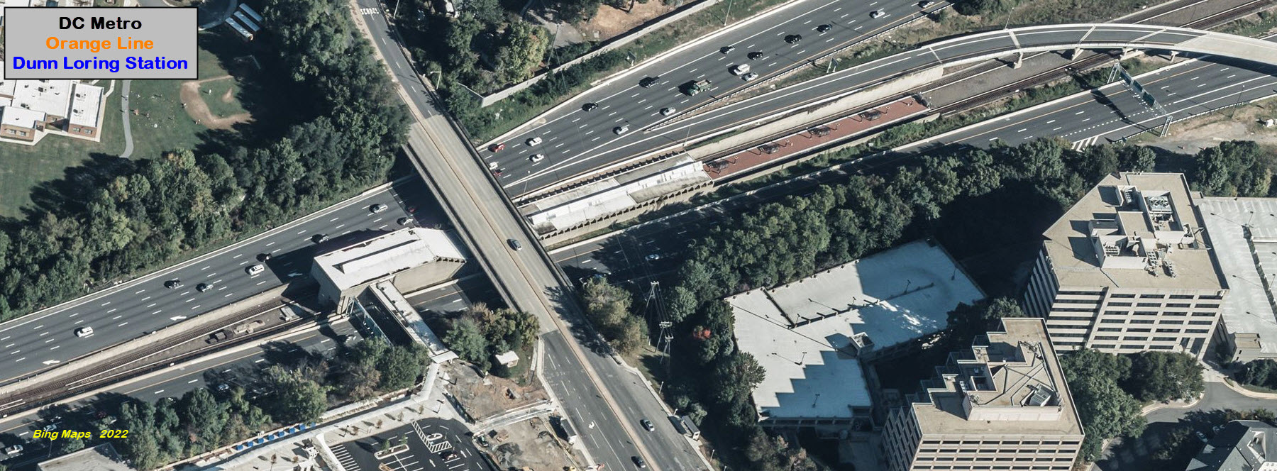
Dunn Loring Station
GPS Coordinates: 38.88345, -77.22785
Difficult to get to easily, best bet is probably the US 50 exit (just south of
the I-66 exit), and take the first exit for Gallows Rd, and head north for 1.2
miles to the station. About 2.5 miles to the Vienna station, and 2.4 miles
to the West Falls Church station.
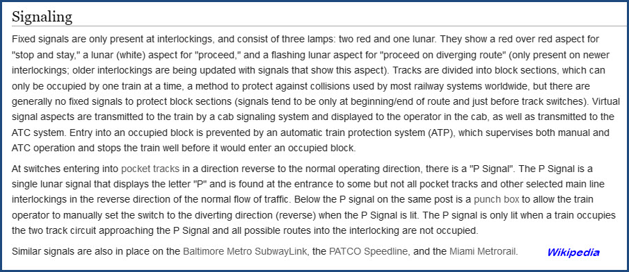
Signals for the DC Metro system are the -kinda- familiar
double-red/single-lunar white type color light signals, in housings similar to that of
the New York City subway system. These types are prevalent on systems that
are run "automatically", and the signals only appear at interlockings. The
two reds indicate stop, a solid lunar is clear for a straight thru move, and a flashing
lunar indicates
the tracks are aligned for a diverging move.
Special Features
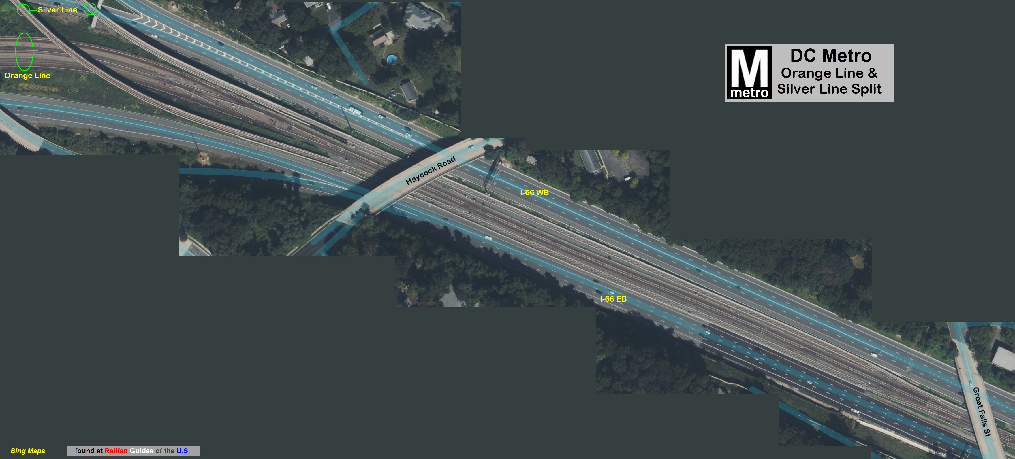
Orange/Silver Line Split
Western Tunnel Portal
Disclaimers:
I love trains, and I love signals. I am not an expert. My webpages reflect what I find on the topic of the page. This is something I have fun with while
trying to help others.
Please Note: Since the main focus of my two websites is railroad signals, the railfan guides are oriented towards the signal fan being able to locate them.
For those of you into the modeling aspect of our hobby, my
indexa page has a list of almost everything railroad oriented
I can think of to provide you with at least a few pictures to help you detail your pike.
If this is a railfan page, every effort has been made to make sure that the information contained on this map and in this railfan guide is correct. Once in a while,
an error may creep in :-)
My philosophy: Pictures and maps are worth a thousand words, especially for railfanning. Text descriptions only get you so far, especially if you get lost or
disoriented. Take along good maps.... a GPS is OK to get somewhere, but maps are still better if you get lost! I belong to AAA, which allows you to get
local maps for free when you visit the local branches. ADC puts out a nice series of county maps for the Washington DC area, but their state maps do not have the
railroads on them. If you can find em, I like the National Geographic map book of the U.S..... good, clear, and concise graphics, and they do a really good job
of showing you where tourist type attractions are, although they too lack the railroads. Other notes about specific areas will show up on that page if known.
Aerial shots were taken from either Google or Bing Maps as noted. Screen captures are made
with Snagit, a Techsmith product... a great tool if you have never used it!
By the way, floobydust is a term I picked up 30-40 years ago from a National Semiconductor data book, and means miscellaneous
and/or other stuff.
Pictures and additional information is always needed if anyone feels inclined to take 'em, send 'em, and share 'em, or if you have something to add or correct.... credit
is always given! Please be NICE!!! Contact info is here
Beware: If used as a source, ANYTHING from Wikipedia must be treated as being possibly inaccurate, wrong, or not true.
 Wikipedia, no photographer attributed