
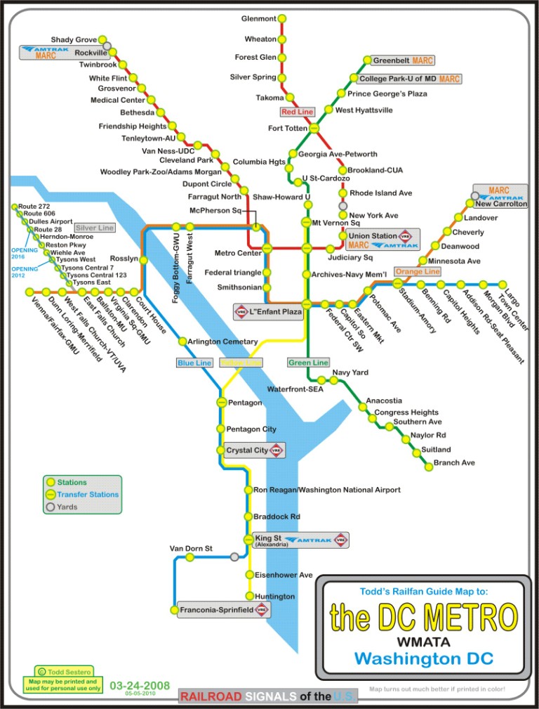
the Red Line
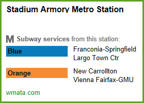
the Blue Line
the Orange Line
the Green Line
the Yellow Line
the Silver Line
Location / Name:
Fairfax County VA
Washington DC
Prince Georges County MD
What's Here:
DC Metro's Blue Line Subway System
Data:
GPS Coordinates: as needed
Phone A/C: n/a
ZIP: n/a
Access by train/transit:
None
The Scoop:
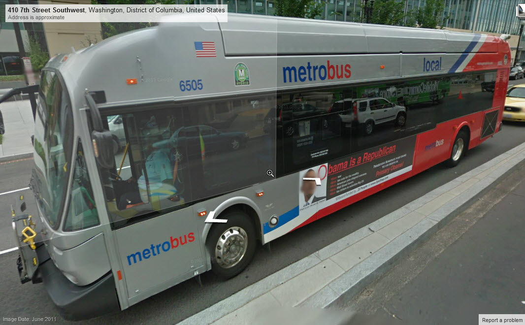
This page covers the DC Metro's Blue Line. On the south side, the line starts at Franconia/Springfield VA, runs along with the Yellow line from King St to the Pentagon station, then runs along the west side of the river to join up with the Orange and Silver lines prior to Rosslyn. The three lines then go under the Potomac River, snake their way through the downtown area, and then split after the Stadium-Amory station, with the Blue line continuing to Largo with the Silver line.
From Wikipedia: The Blue Line is a rapid transit line of the Washington Metro system, consisting of 27 stations in Fairfax County, Alexandria and Arlington VA; the District of Columbia; and Prince George's County MD. The Blue Line runs from Franconia– Springfield to Largo Town Center. The line shares tracks with the Orange Line for 13 stations, the Silver Line for 18, and the Yellow Line for six. Only three stations are exclusive to the Blue Line. end Wiki
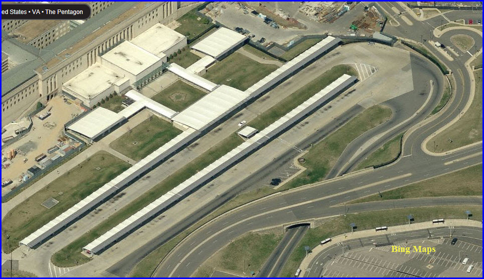
Stations without an aerial picture do not have any discernable features from the air.
Acknowledgements:
Denver Todd
Google Maps
Bing Maps
Wikipedia
Websites and other additional information sources of interest for the area:
None for now.....
Too many locations to be specific about each one, but.....
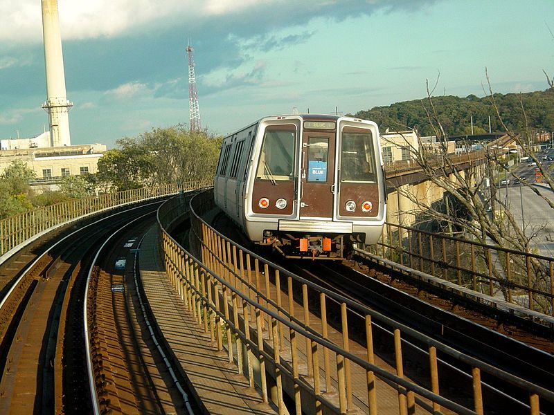
Blue Line train crosses the D Route
bridge east of Stadium-Armory station in Washington DC
Picture from Wikipedia, taken by Ben
Schumin, 25OCT2005
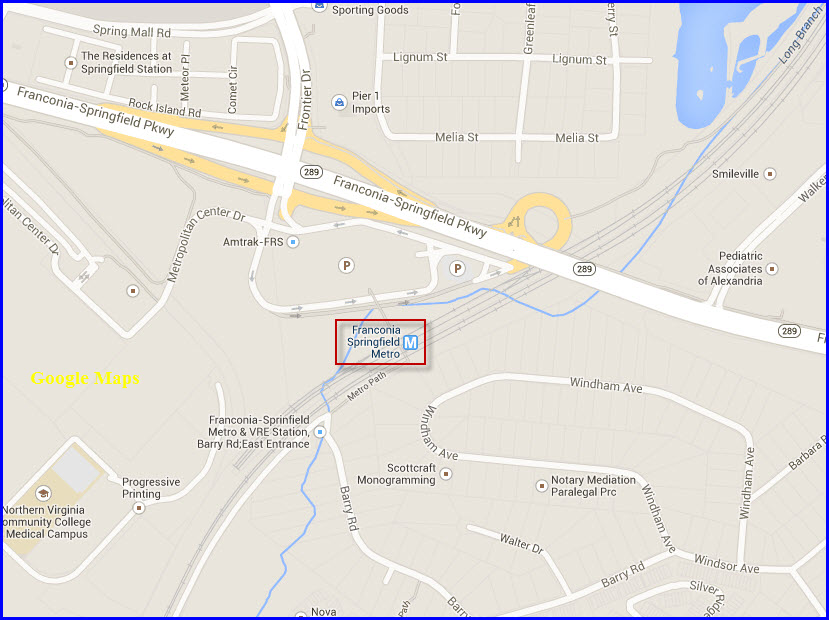
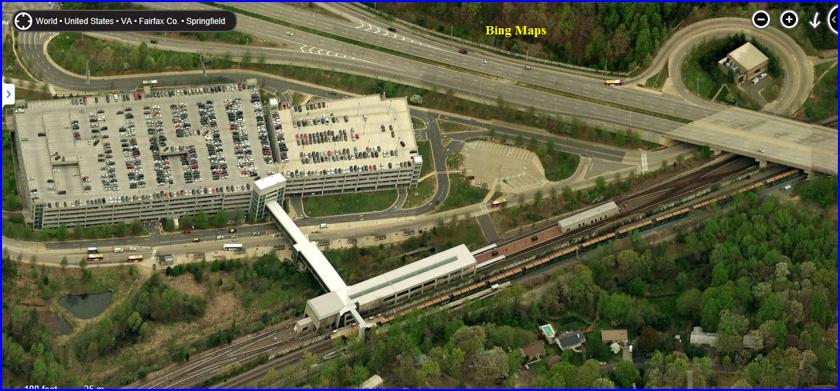
Franconia - Springfield
GPS Coordinates: 38.766114,-77.168806
Station is on the surface.
Only station on the south end that is outside the DC Beltway.
Exit off the Franconia Expy just for the station.
Large parking garage here.
Norfolk Southern tracks run parallel to the Metro here.
Area OK for railfans.
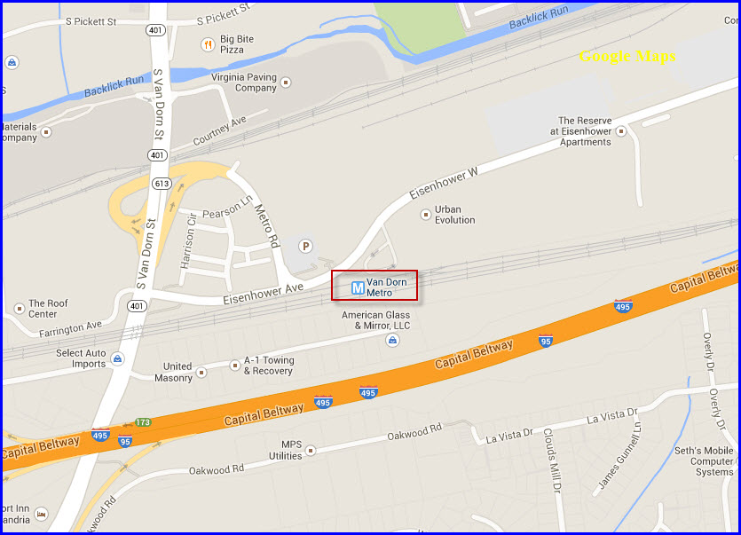
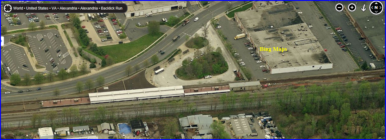
Van Dorn Street
GPS Coordinates: 38.799283,-77.128723
Station is on the surface.
Norfolk Southern tracks run parallel to the Metro here, after the Metro crosses
over the NS just north of here.
Area OK for railfans.
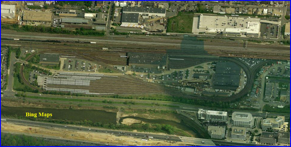
Yard and Maintenance Facility
GPS Coordinates: 38.803347,-77.086666
Tracks run adjacent to the Norfolk Southern.
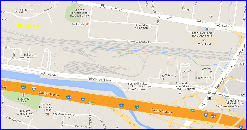
King Street - VRE and Amtrak
GPS Coordinates: 38.806373,-77.061324
Station is underground.
Area kinda OK for railfans.
Amtrak and VRE Alexandria station here.
Station serves both the BLUE and YELLOW lines.
The Yellow and Blue lines split just south of King
St.
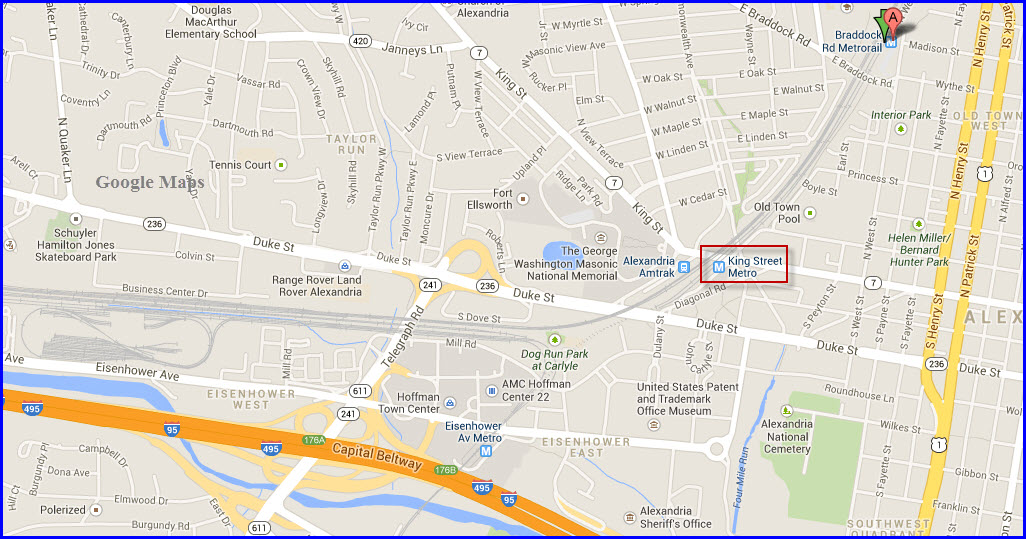
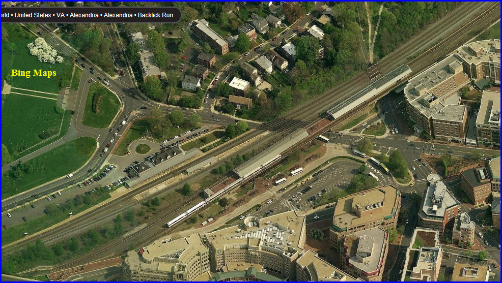
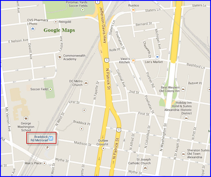
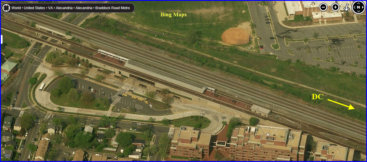
Braddock Road
GPS Coordinates: 38.813998,-77.053728
Station is above ground/elevated.
Area OK for railfans.
Station serves both the BLUE and YELLOW lines.
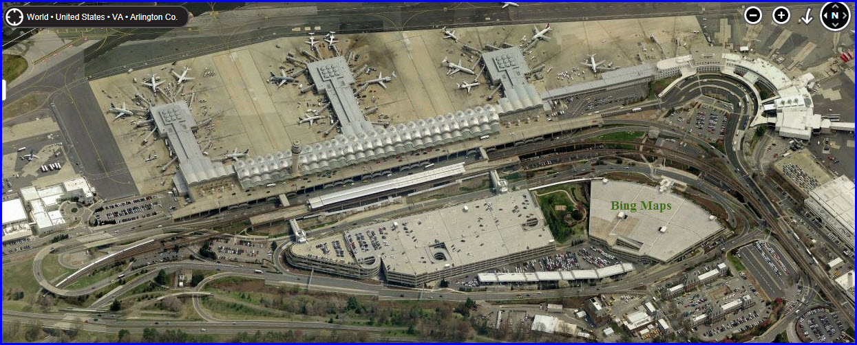
Ronald Reagan / Washington National Airport
GPS Coordinates: 38.853077,-77.043879
Station is above ground/elevated.
Area OK for railfans.
Station serves both the BLUE and YELLOW lines.
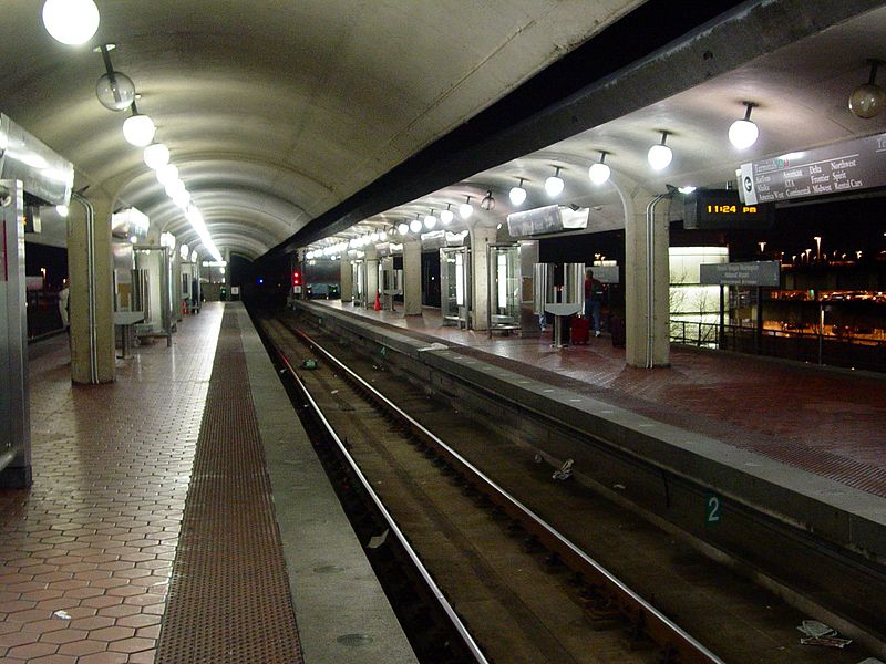
Here we are at National Airport,
courtesy Ben Shumin, 9FEB2005.
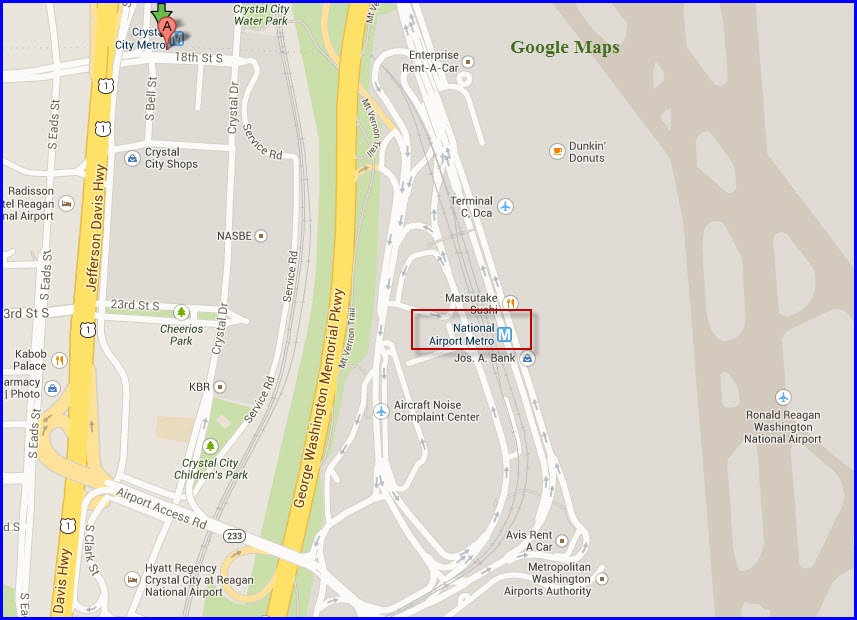
Crystal City - VRE
GPS Coordinates: 38.857973,-77.050853
Station is underground.
Area OK for railfans.
Station serves both the BLUE and YELLOW lines.
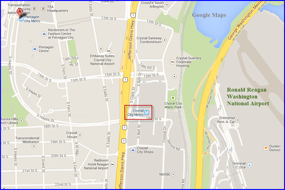
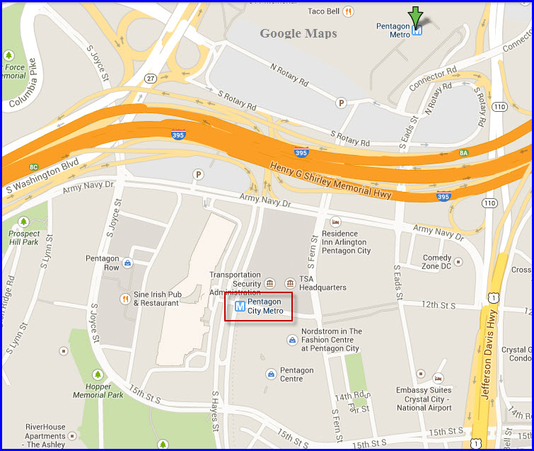
Pentagon City
GPS Coordinates: 38.862969,-77.059243
Station is underground.
Area OK for railfans.
Station serves both the BLUE and YELLOW lines.
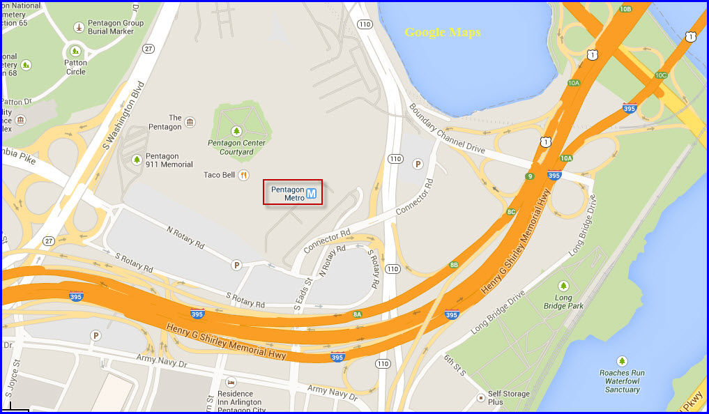
the Pentagon
GPS Coordinates: 38.869464,-77.053825
Station is underground.
Area OK for railfans.
Station serves both the BLUE and YELLOW lines.
The Yellow and Blue lines split just north of
here.
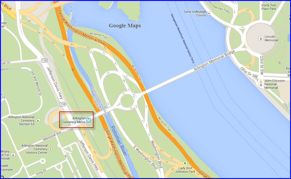
Arlington Cemetery
GPS Coordinates: 38.884523,-77.063228
Station is at ground level in an open cut.
Area OK for railfans.
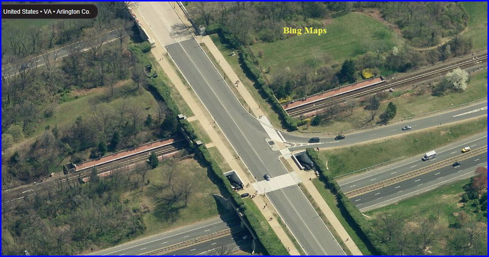
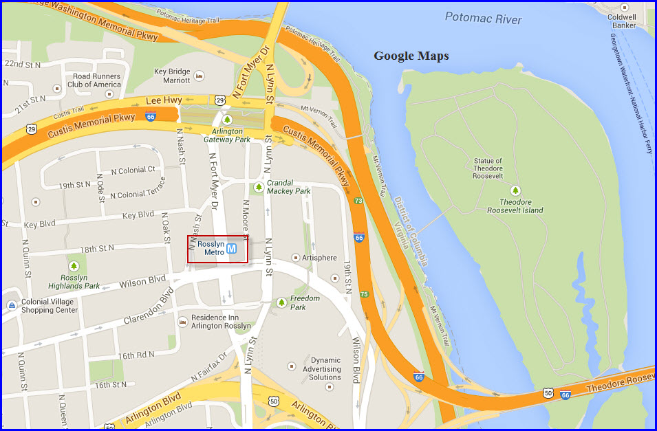
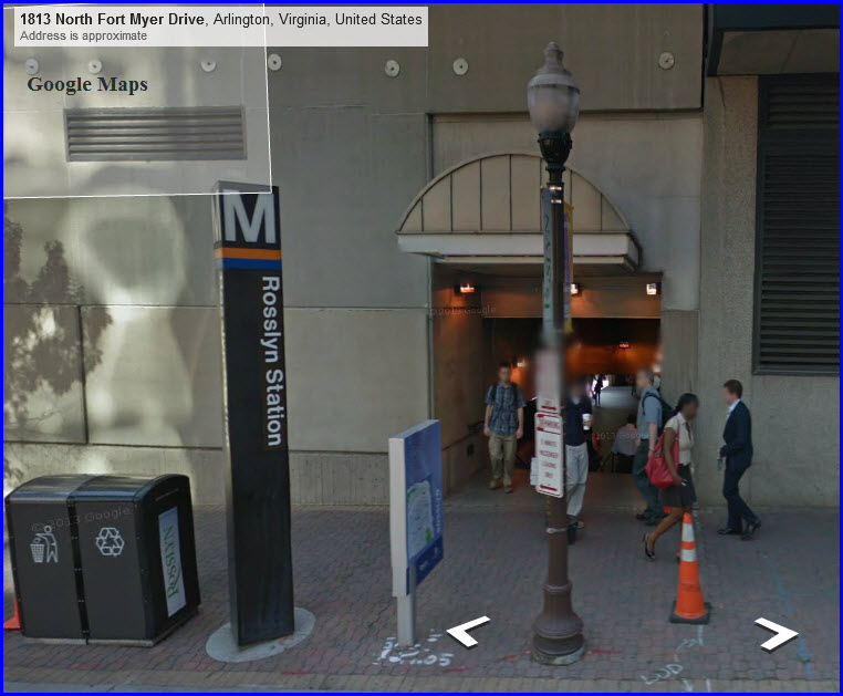
Rosslyn
GPS Coordinates: 38.895482,-77.072064
Station is underground.
Area OK for railfans.
Hyatt Hotel, Courtyard Hotel near, and Metro Mall here.
McDonalds, Quizno's, and Starbucks nearby.
Station serves both the BLUE and ORANGE lines.
The Orange and Blue lines split south of here,
then go under the river on the north side of the station to enter DC.
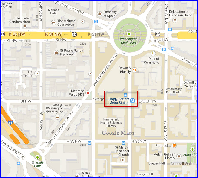
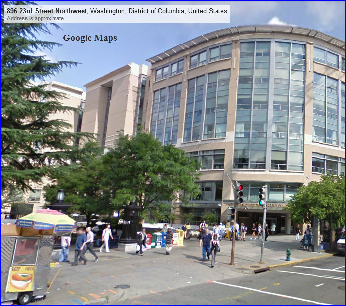
Foggy Bottom - George Washington University
GPS Coordinates: 38.900706,-77.050166
Station is underground.
Area OK for railfans.
Station serves both the BLUE and ORANGE lines.
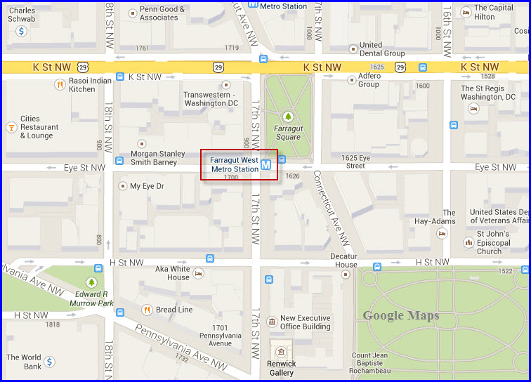
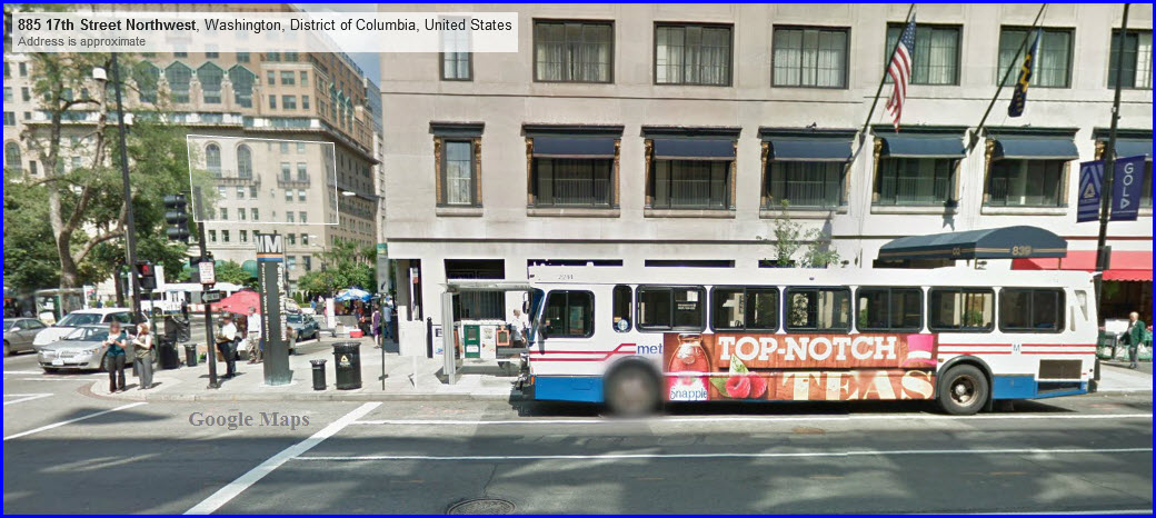
Farragut West
GPS Coordinates: 38.901349,-77.039555
Station is underground.
Area OK for railfans.
Station serves both the BLUE and ORANGE lines.
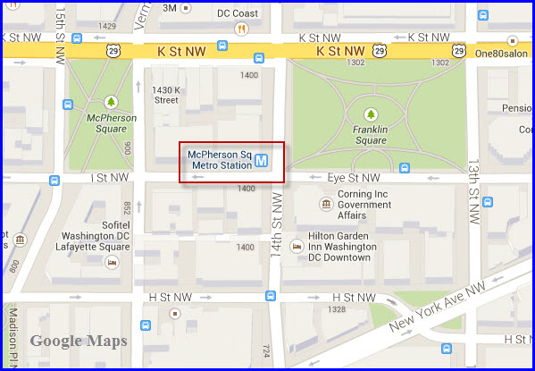
McPherson Square
GPS Coordinates: 38.901462,-77.03227
Station is underground.
Area OK for railfans.
Station serves both the BLUE and ORANGE lines.
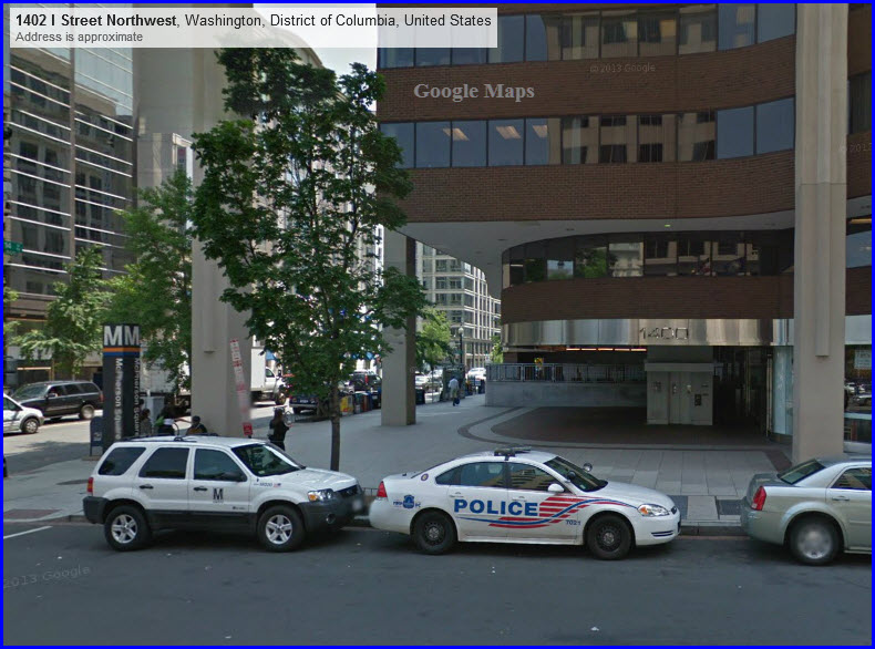
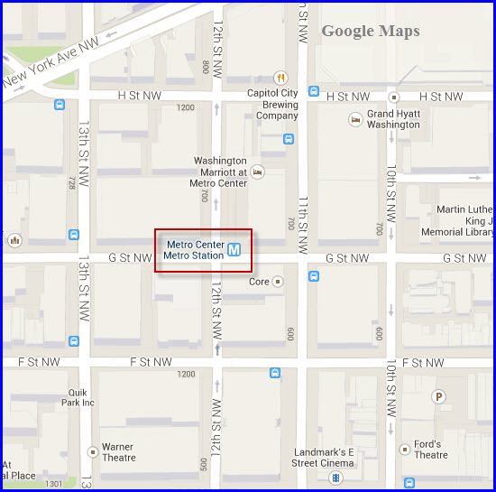
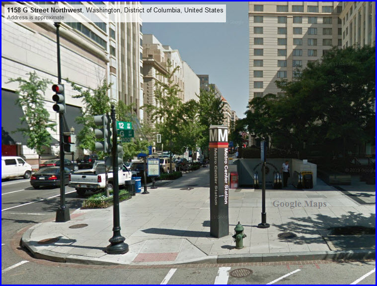
Metro Center
GPS Coordinates: 38.898348,-77.028043
Station is underground.
Area OK for railfans.
Station serves both the BLUE and ORANGE lines.
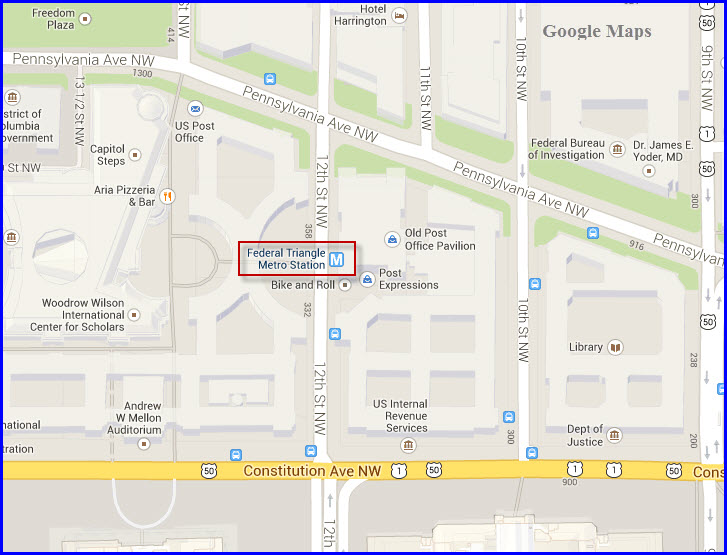
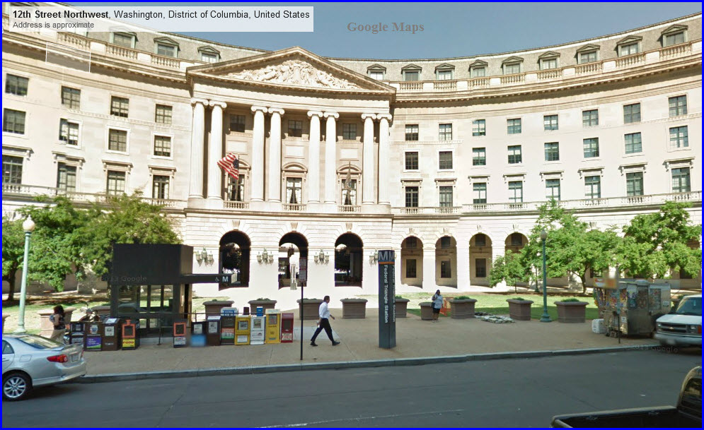
Federal Triangle
GPS Coordinates: 38.893839,-77.028043
Station is underground.
Area OK for railfans.
Station serves both the BLUE and ORANGE lines.
Smithsonian
GPS Coordinates: 38.887676,-77.028258
Station is underground.
Station serves both the BLUE and ORANGE lines.
Area OK for railfans.
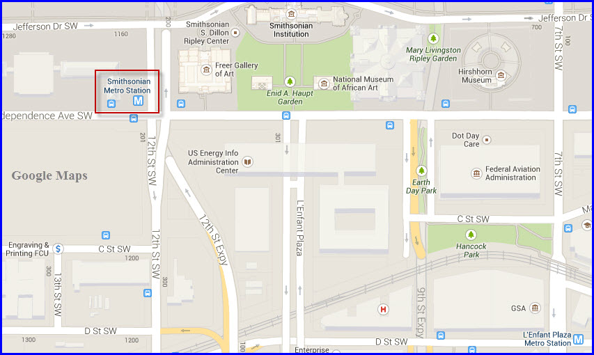
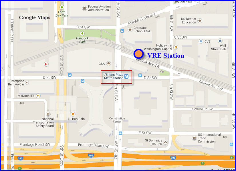
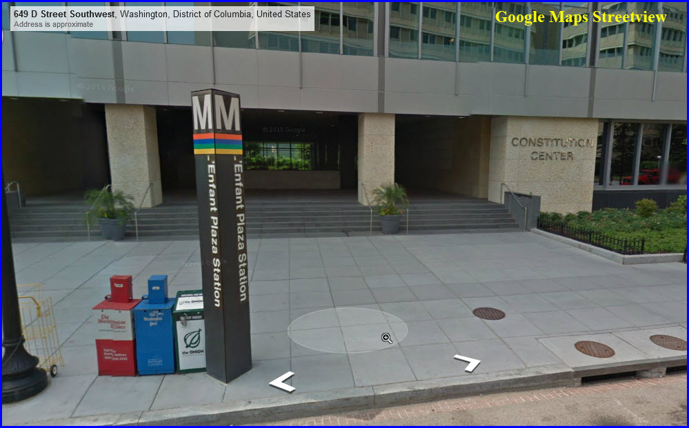
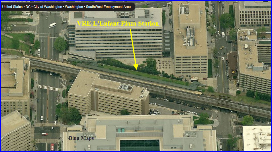
L'enfant Plaza
GPS Coordinates: 38.885008,-77.01556
Station is underground.
Station serves both the BLUE and ORANGE lines.
Area OK for railfans.
Block away from the passenger and freight line going to Virginia.
The FAA, FCC, Federal Transit Administration, and NTSB HQ's are nearby.
McDonalds and Holiday Inn nearby.
The VRE L'Enfant station is a block away.
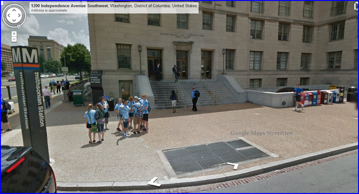
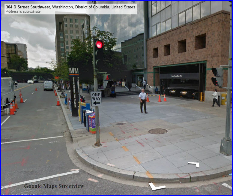
Federal Center SW
GPS Coordinates: 38.885008,-77.01556
Station is underground.
Station serves both the BLUE and ORANGE lines.
Area OK for railfans.
Block away from the passenger and freight line going to Virginia.

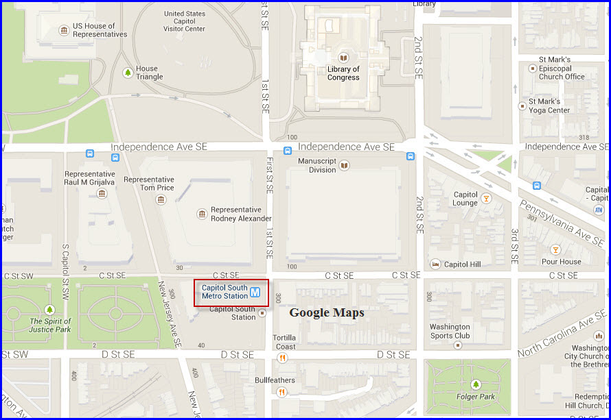
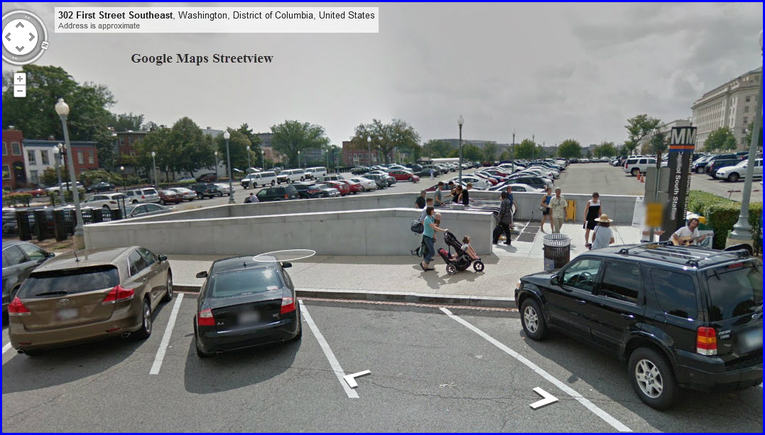
Capitol South
GPS Coordinates: 38.885713,-77.005942
Station is underground.
Area OK for railfans.
Station serves both the BLUE and ORANGE lines.
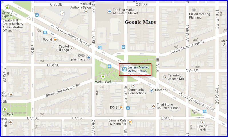
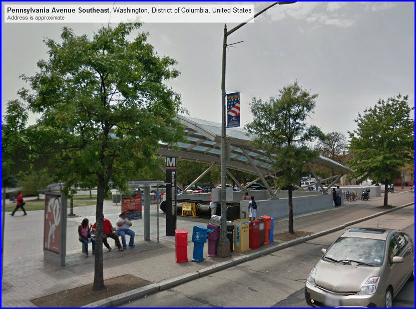
Eastern Market
GPS Coordinates: 38.884118,-76.994966
Station is underground.
Not a good area for railfans.
Station serves both the BLUE and ORANGE lines.
Line running under Pennsylvania Ave SE at this point.
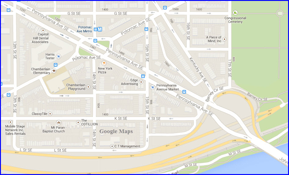
Potomac Avenue
GPS Coordinates: 38.880844,-76.98545
Station is underground.
Not a good area for railfans.
Station serves both the BLUE and ORANGE lines.
Line running under Pennsylvania Ave SE at this point.
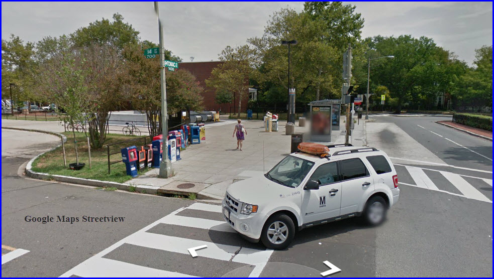
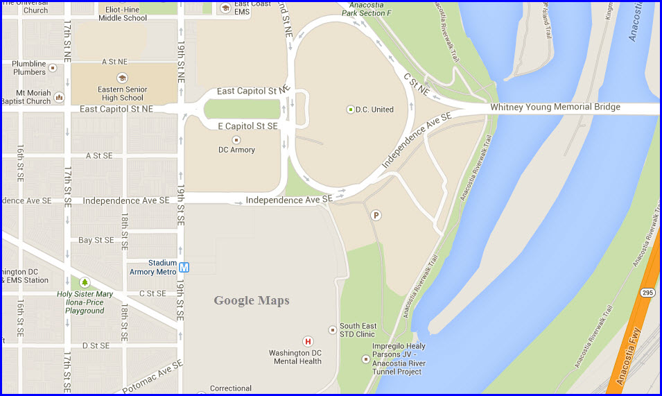
Stadium-Amory
GPS Coordinates: 38.885901,-76.977167
Station is underground.
Not a good area for railfans.
Station serves both the BLUE and ORANGE lines.
The BLUE and the ORANGE lines split going east after this station.
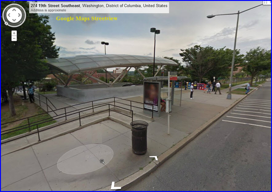
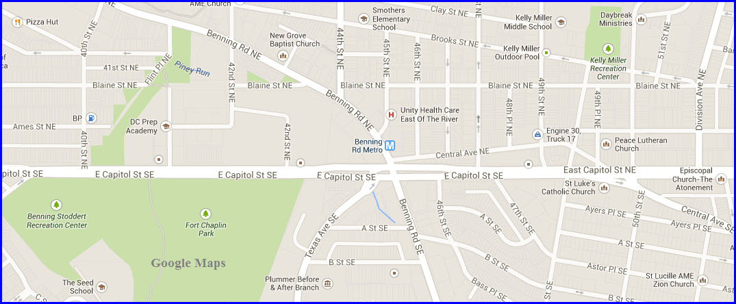
Benning Road
GPS Coordinates: 38.890379,-76.937752
Station is underground.
Not a good area for railfans.
Capitol Heights
GPS Coordinates: 38.88953,-76.913438
Station is underground.
Not a good area for railfans.

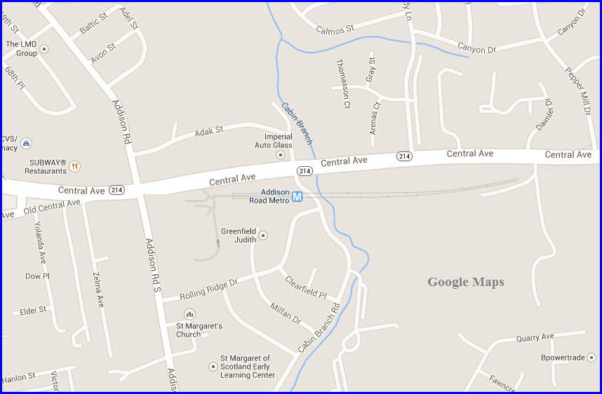
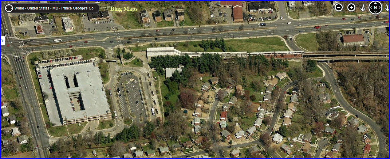
Addison Rd
GPS Coordinates: 38.886223,-76.896486
Station is at ground level in an open cut.
Not a good area for railfans.
Huge parking garage available.
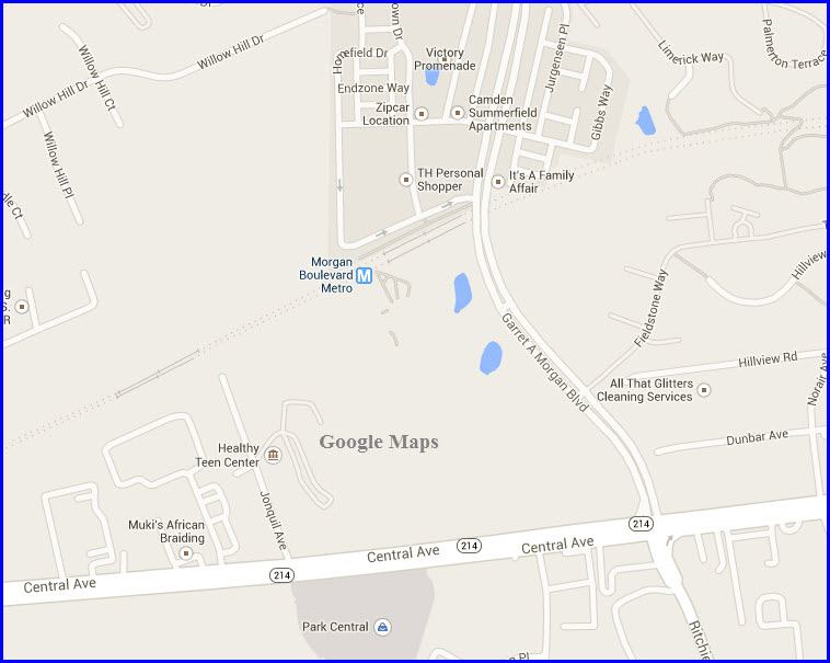
Morgan Blvd
GPS Coordinates: 38.893655,-76.868312
Station is at ground level in an open cut.
Not a good area for railfans.
Good size parking lot available.
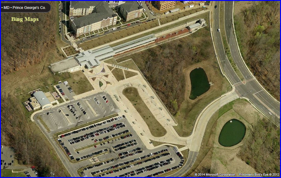
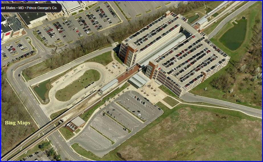
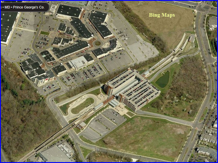
Largo Town Center
GPS Coordinates: 38.900485,-76.84443
Station is above ground/elevated.
Area so-so for railfans.
Huge parking garage available (and it fills up!)
New 03FEB2013 Ravens Superbowl
Sunday!
Mod: 25-Jun-2022