
In General
Getting Here
Map
Sights
RAILROAD SIGNALS HOME
Location / Name:
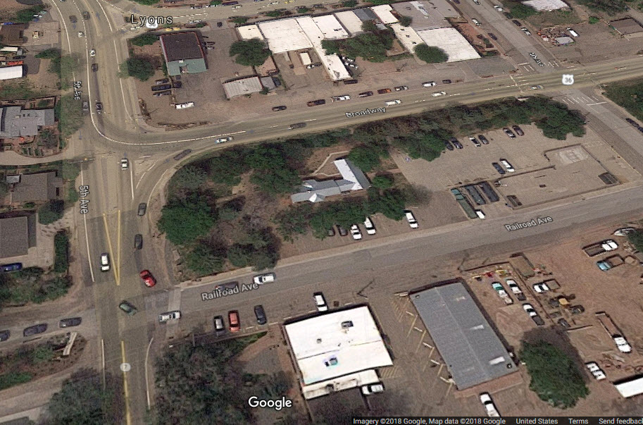
Lyons CO, Boulder County
What's Here:
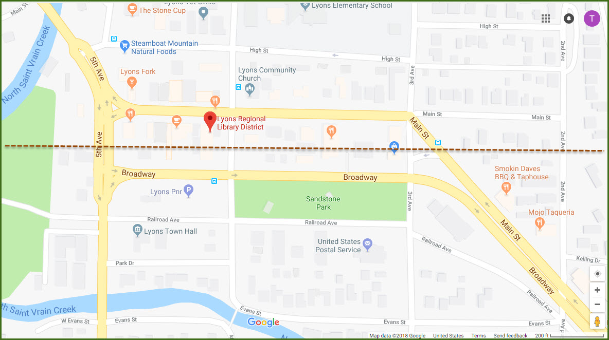
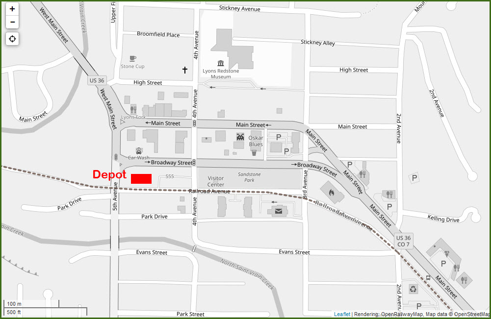
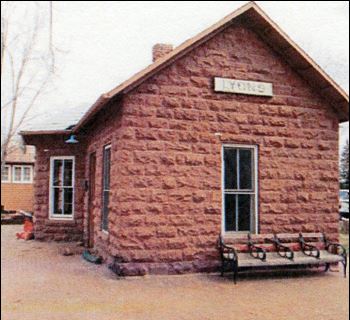
the Lyons Depot
Data:
GPS Coordinates: 40.223788, -105.270994
Phone A/C: 303
ZIP: 80540
Access by train/transit:
None
The Scoop:
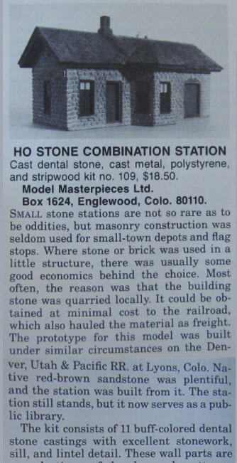
The building used by the Library and the town administration was a railroad depot built originally by the Denver, Utah & Pacific Railroad in 1885. The depot is kind of unique in that it is constructed out of stone: with locally occurring/available red-brown sandstone. When the depot stopped being used, it was owned by the CB&Q - the Burlington.
This is from MR Magazine: Small stone stations are not so rare as to be oddities, but masonry construction was seldom used for small-town depots and flag stops. Where stone and brick was used in a small structure, there was usually some good economics behind the choice. Most often, the reason was that the building was quarried locally. It could be obtained locally at minimal cost to the railroad, which also hauled the material as freight.
The info from MR comes from a model review they did on a model by Model Masterpieces Ltd of this station:
Acknowledgements:
Model Railroader Magazine, June 1978
Ron Reiring
Bryan Construction
Denver Todd
Open Railway Map
Google Maps
Websites and other additional information sources of interest for the area:
https://yourboulder.com/roadhouse-boulder-depot/
https://lyons.colibraries.org/about-the-library/history-of-the-library/
http://www.townoflyons.com/407/2387/Lyons-Depot?activeLiveTab=widgets
http://www.lyonscolorado.com/go/train-depot-1881-now-lyons-depot-library
https://www.historycolorado.org/location/lyons-railroad-depot-lyons-train-depot
https://bryanconstruction.com/portfolio/lyons-depot-restoration/
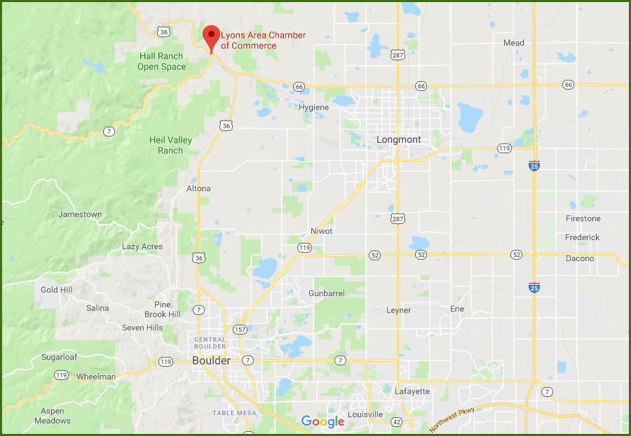
North on US 36 from Boulder into Lyons, it's about 16 miles.
Or we're about 13 miles from Longmont via US 287 north to CO 66 where you want to hang a left and travel west to US 36.
From Denver, it's I-25 north to CO 66 at exit 243. 16 miles from the interstate to Lyons, and about 38 miles from downtown Denver to 66.
HISTORY - From the Library's Page: A Brief History of the Library in Lyons
1885 — The Lyons train depot was built using local red sandstone. Lyons became an important railhead for shipping sandstone and gold ore and was also used for tourism. The train depot operated until the 1960s.
Late 1970s — The community pooled efforts to transform the abandoned building into the Depot Library. The Town of Lyons Board of Trustees helped resolve the complex ownership dispute while the Lyons Historical Society spearheaded a fundraising drive. Much of the money for the purchase of the building came from bake sales. Residents cleaned up the site, obtained grants, and did restoration work. Graffiti over 100 years old was discovered behind boarded walls. An interior sandstone wall near the checkout desk shows the marks of the masons’ tools. Functioning, historic rolling doors opened the space up and allowed for special indoor-outdoor programs. The Longmont Pioneer Museum returned the original station identification sign, which was placed inside.
1974 — The Depot building was placed on the National Register of Historic Places.
Oct. 18, 1977 — The Library opened with a 1,500 book collection and without a heating or cooling system. Red sandstone heats and cools slowly, so the building interior was often either very cold or very hot. Until the Town of Lyons was able to afford heat and air conditioning, staff and patrons had no difficulty imagining what it was like living in the 1880s.
1980s — The original wooden luggage annex was located and reattached to the Depot building, doubling the size of the Library.
2005 — An original Lyons railroad depot bench was donated to the Library by the Tisone family.
2006 — The family of F. LaVerne Johnson donated a historic railroad baggage cart located on the west lawn of the Depot building.
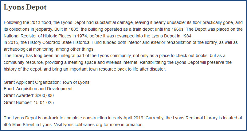
September 12, 2013 — A devastating flood hit Lyons and the region destroying many homes and severely damaging roads and buildings, including the Depot building. Many Library materials were destroyed, and everything else was placed in a storage pod for safekeeping. For a few months, the Library was located in the tiny Visitor’s Center building in Sandstone Park.
September, 2013 — the Lyons area community renewed its efforts to build and operate a new library following the disastrous flood that destroyed much of the Library and the surrounding areas.
April 2014 — The Library moved again to its current (and temporary) location at 405 Main St. This larger space provides more room for materials and programming.
April 2016 — The Depot building is completely renovated and is serving as badly needed administration space for the Town of Lyons who owns the building.
July 1, 2015 the Lyons Regional Library District began operations to serve its expanded population. The Library District is governed by a separate board of trustees appointed by the Town of Lyons, Boulder County and Larimer County.
Now — A new larger Library is being planned and designed to serve the present and future needs of the patrons served by the Lyons Regional Library District!
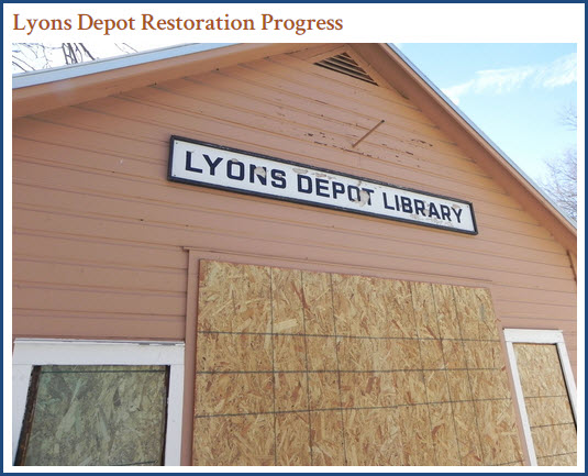
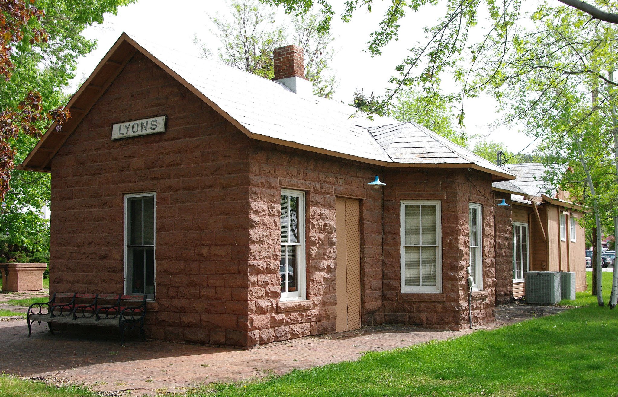 photo by Ron Reiring
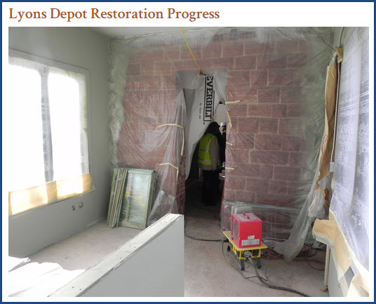
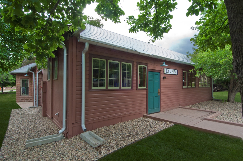 Bryan Construction
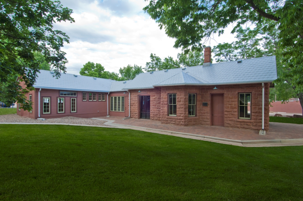 Bryan Construction
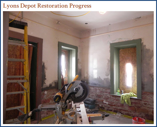
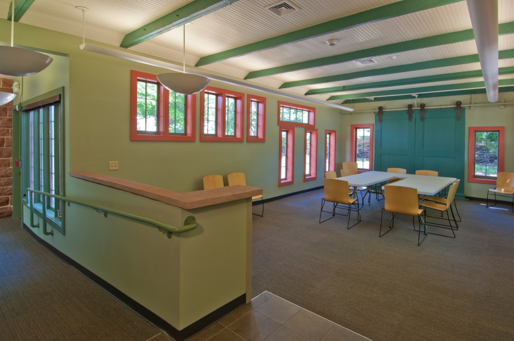 Bryan Construction
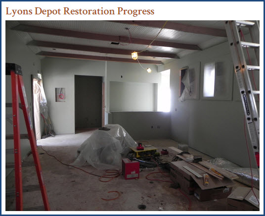
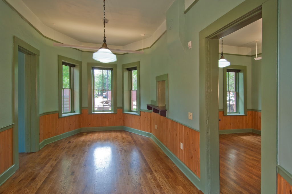 Bryan Construction
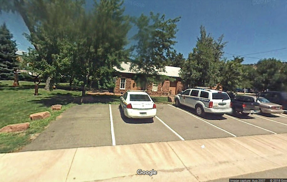

None to report.
Did U Know? I didn't.....
None for now......
Disclaimers:
I love trains, and I love signals. I am not an expert. My webpages reflect what I find on the topic of the page. This is something I have fun with while trying to help others.
Please Note: Since the main focus of my two websites is railroad signals, the railfan guides are oriented towards the signal fan being able to locate them. For those of you into the modeling aspect of our hobby, my indexa page has a list of almost everything railroad oriented I can think of to provide you with at least a few pictures to help you detail your pike.
If this is a railfan page, every effort has been made to make sure that the information contained on this map and in this railfan guide is correct. Once in a while, an error may creep in :-)
My philosophy: Pictures and maps are worth a thousand words, especially for railfanning. Text descriptions only get you so far, especially if you get lost or disoriented. Take along good maps.... a GPS is OK to get somewhere, but maps are still better if you get lost! I belong to AAA, which allows you to get local maps for free when you visit the local branches. ADC puts out a nice series of county maps for the Washington DC area, but their state maps do not have the railroads on them. If you can find em, I like the National Geographic map book of the U.S..... good, clear, and concise graphics, and they do a really good job of showing you where tourist type attractions are, although they too lack the railroads. Other notes about specific areas will show up on that page if known.
Aerial shots were taken from either Google or Bing Maps as noted. Screen captures are made with Snagit, a Techsmith product... a great tool if you have never used it!
By the way, floobydust is a term I picked up 30-40 years ago from a National Semiconductor data book, and means miscellaneous and/or other stuff.
Pictures and additional information is always needed if anyone feels inclined to take 'em, send 'em, and share 'em, or if you have something to add or correct.... credit is always given! Please be NICE!!! Contact info is here
Beware: If used as a source, ANYTHING from Wikipedia must be treated as being possibly being inaccurate, wrong, or not true.
RAILFAN GUIDES HOME
RAILROAD SIGNALS HOME
NEW 10/23/2018
Last Modified
24-Oct-2018