In General
Getting Here
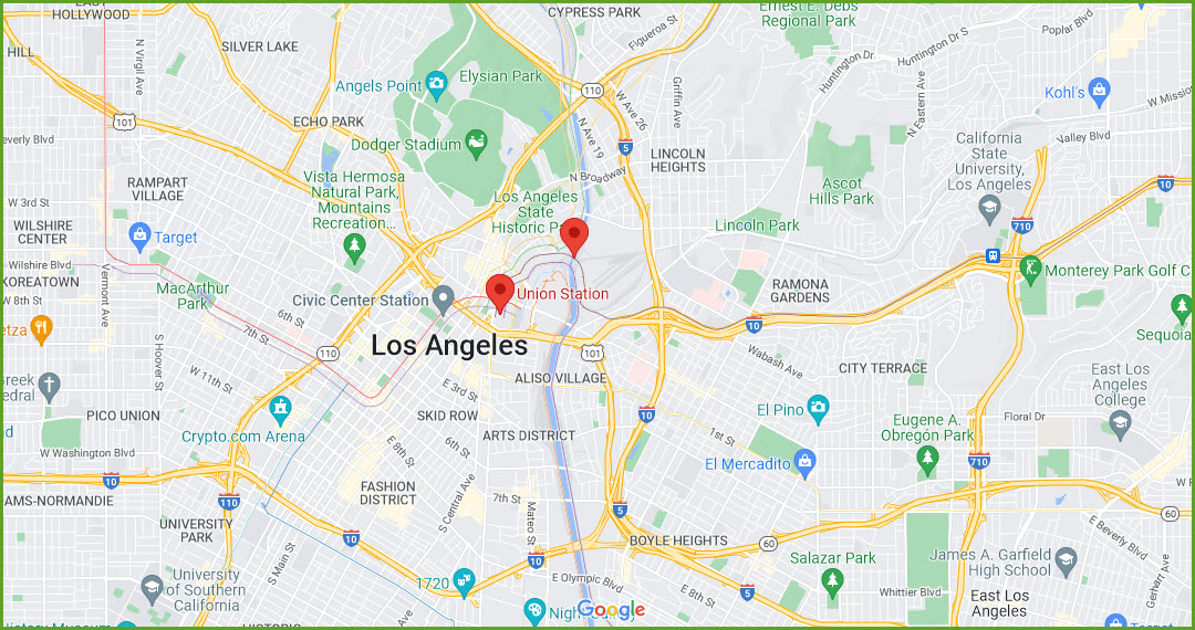
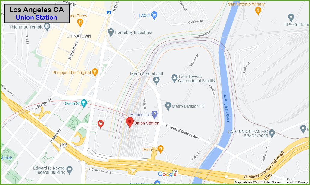
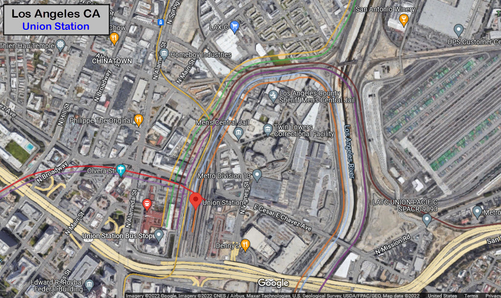
Map
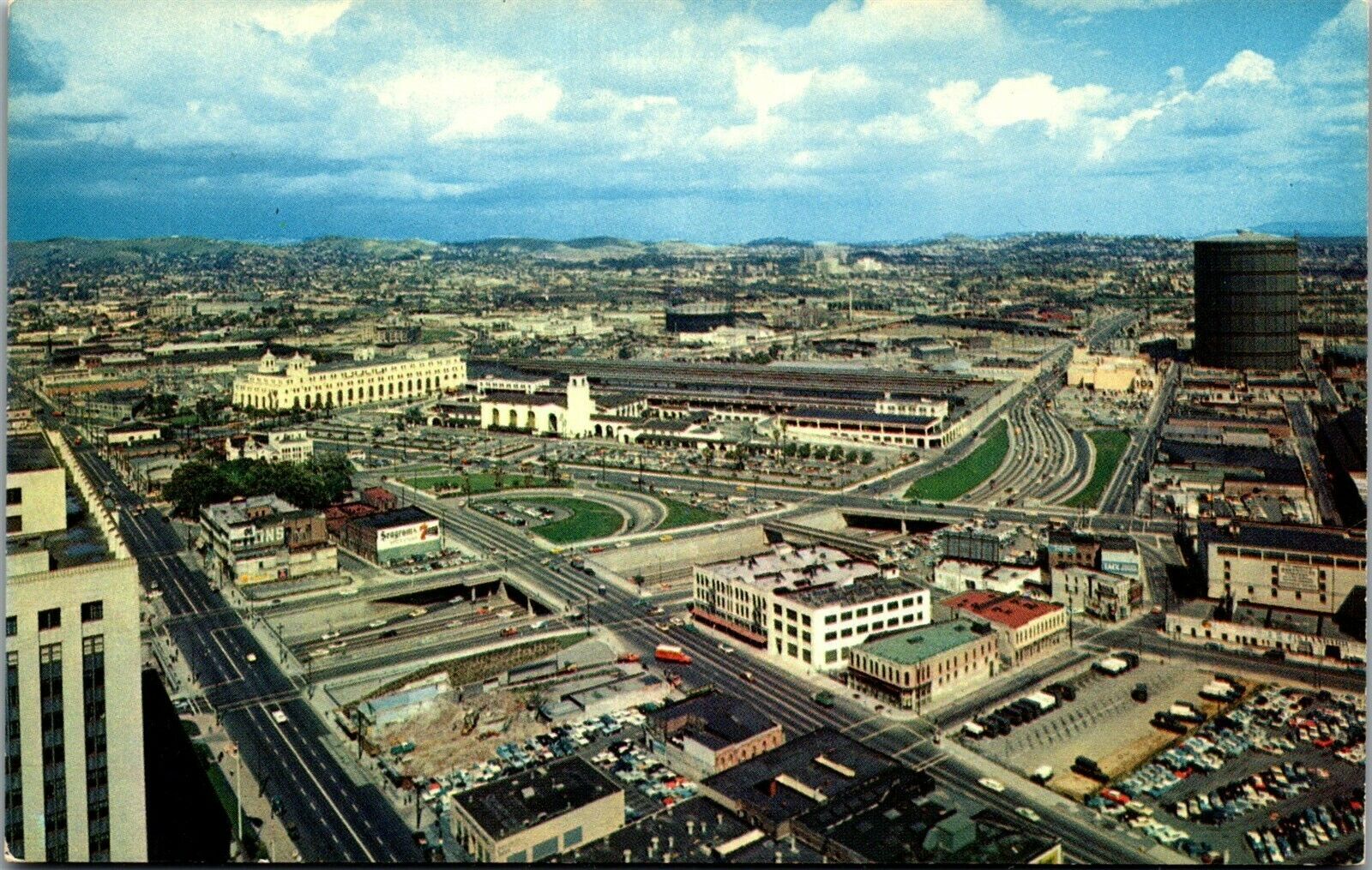
Pictures
Signals
Bridges
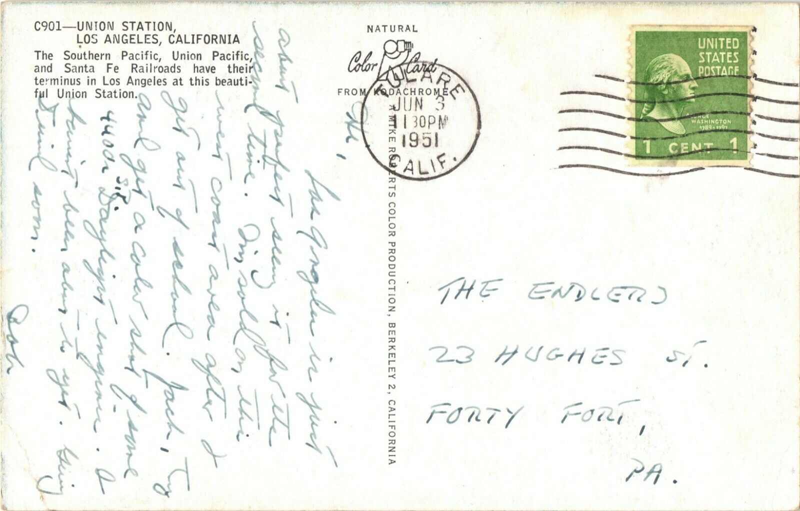
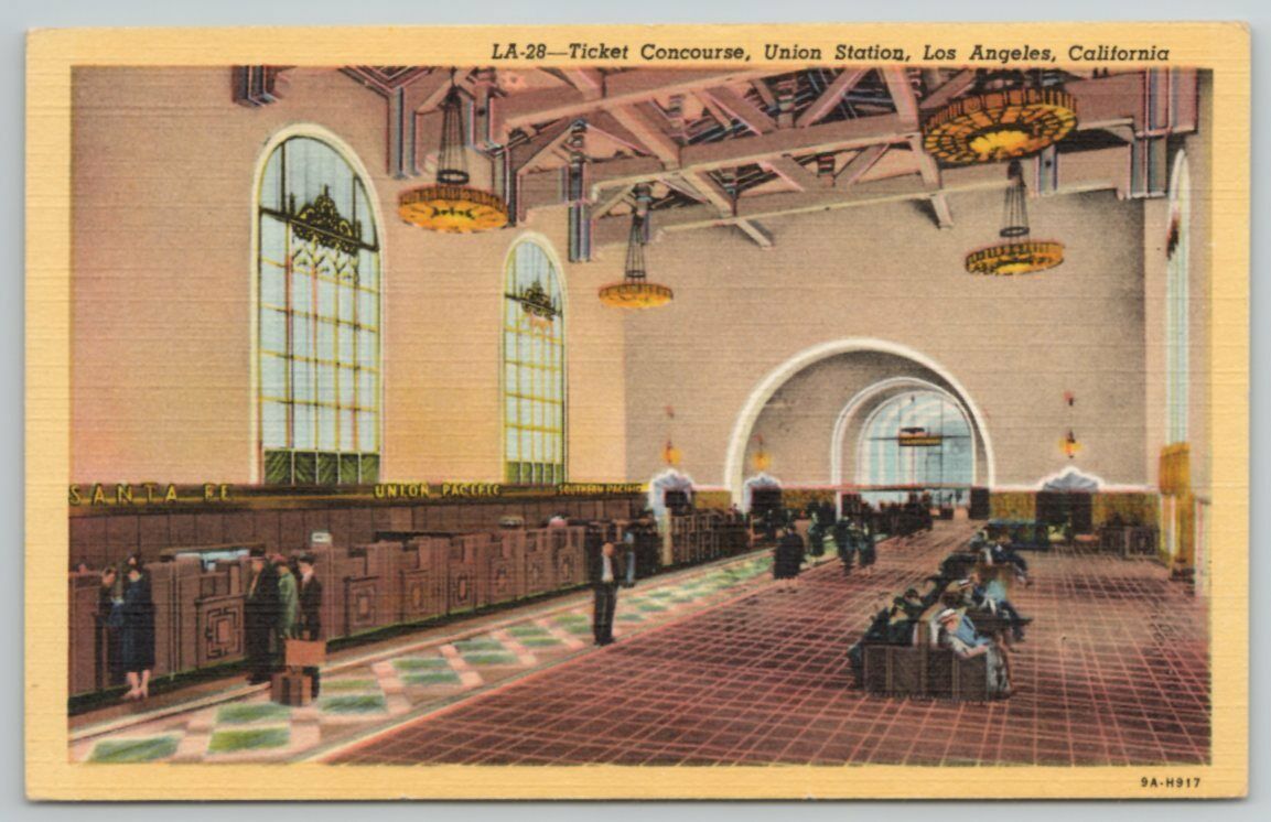
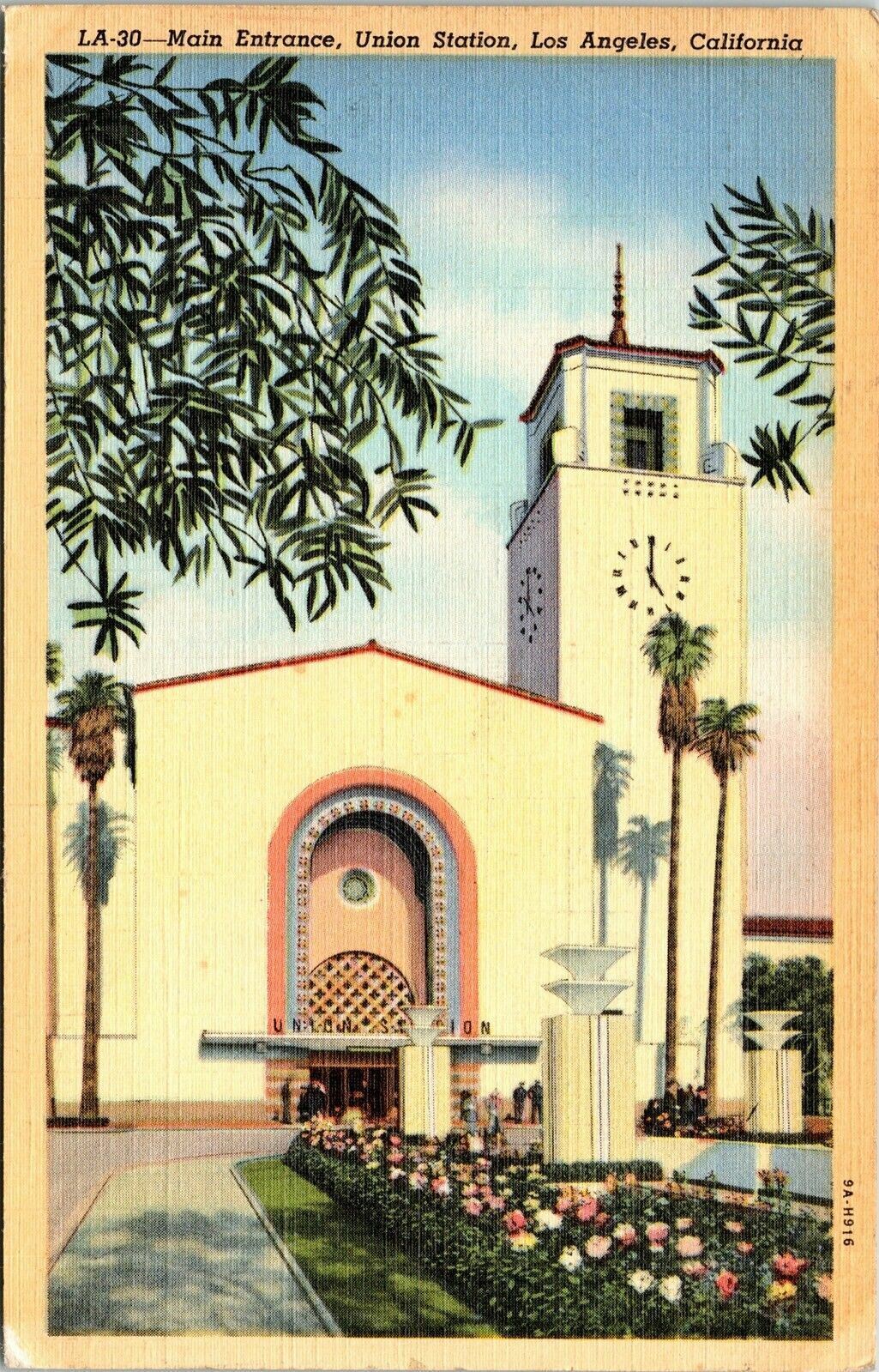
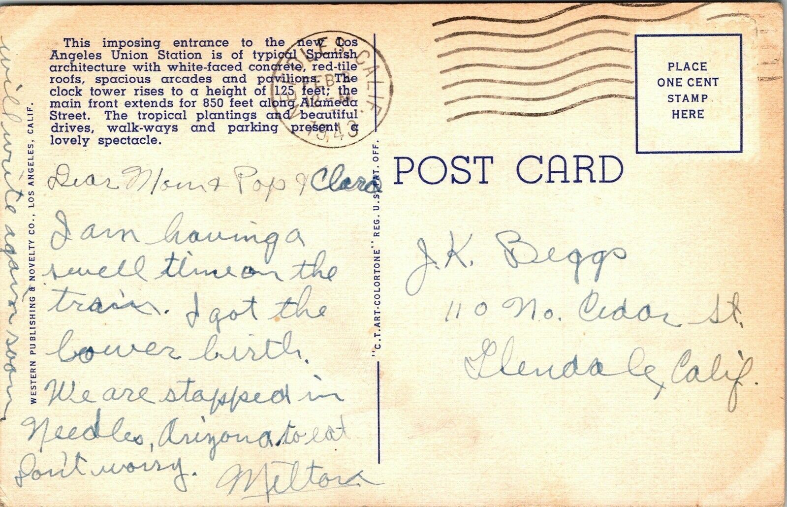
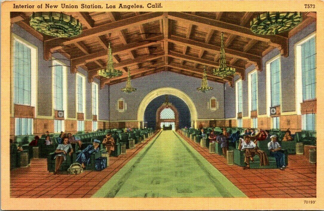
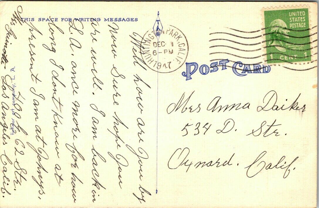
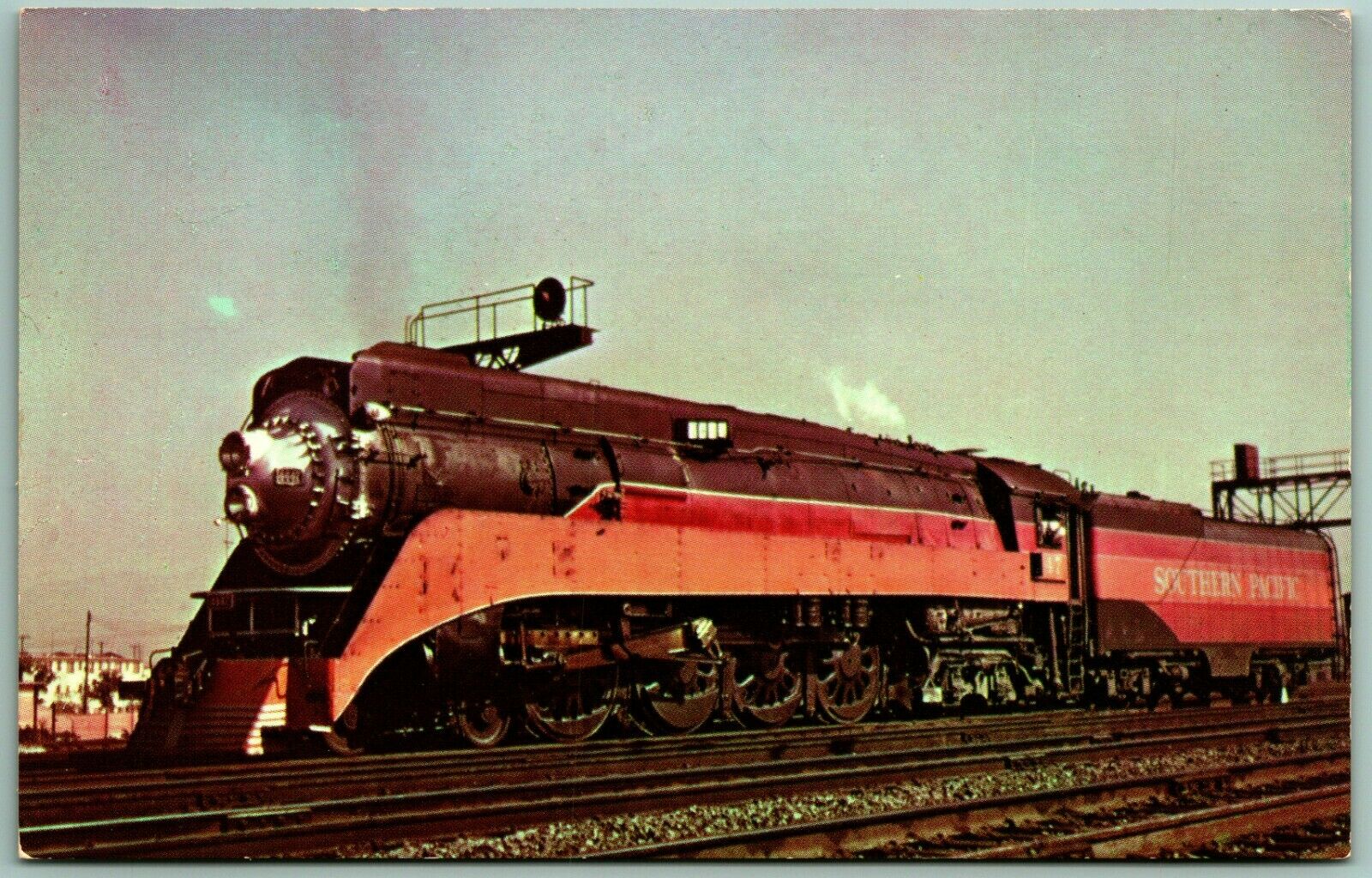
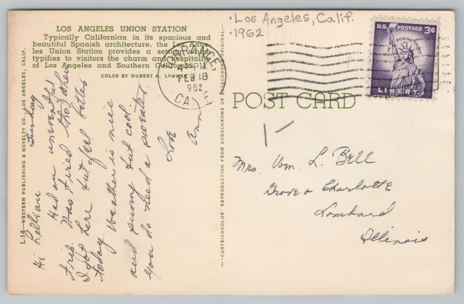
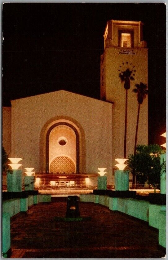
Postcards
Pacific Surfliner Schedules
Floobydust
USGS Maps
RAILROAD SIGNALS HOME
Location / Name:
Los Angeles, LA County
What's Here:
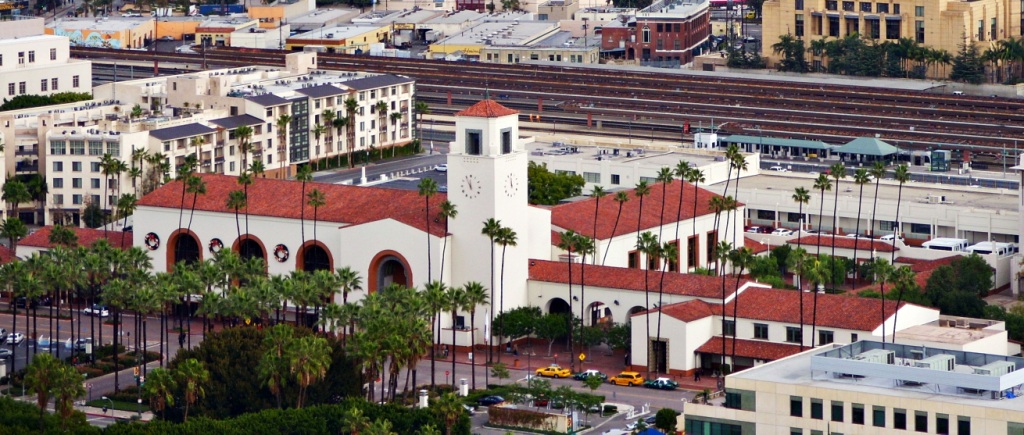
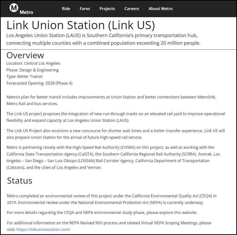
Los Angeles Union Station
Data:
GPS Coordinates: 34.05605, 118.23612
800 N Alameda St, Los Angeles CA
Amtrak Station Code: LAX
Phone: 213-617-0111
ZIP: 90012
Access by train/transit:
Amtrak
Metrolink Regional Commuter Rail
Metro Subway and Light Rail
The Scoop:
From Wikipedia: Los Angeles Union Station is the main railway station in Los Angeles, and the largest railroad passenger terminal in the Western United States. It opened in May 1939 as the Los Angeles Union Passenger Terminal, replacing La Grande Station and Central Station.
Approved in a controversial ballot measure in 1926 and built in the 1930s, it served to consolidate rail services from the Union Pacific, Santa Fe, and Southern Pacific Railroads into one terminal station. Conceived on a grand scale, Union Station became known as the "Last of the Great Railway Stations" built in the United States. The structure combines Art Deco, Mission Revival, and Streamline Modern style. It was placed on the National Register of Historic Places in 1980.
Today, the station is a major transportation hub for Southern California, serving almost 110,000 passengers a day. It is by far the busiest train station in the Western United States; it is Amtrak's fifth-busiest station, and is the twelfth-busiest train station in North America. end Wiki
Four of Amtrak's long-distance trains originate and terminate here:
- the Coast Starlight to Seattle
- the Southwest Chief and Texas Eagle to Chicago
- the Sunset Limited to New Orleans.
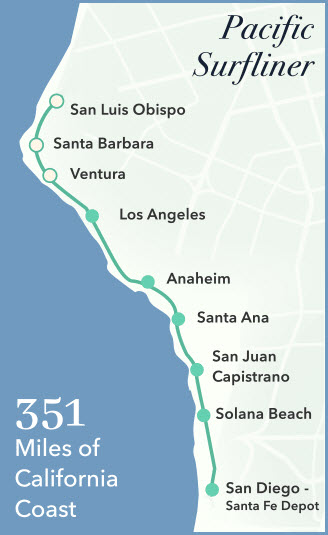
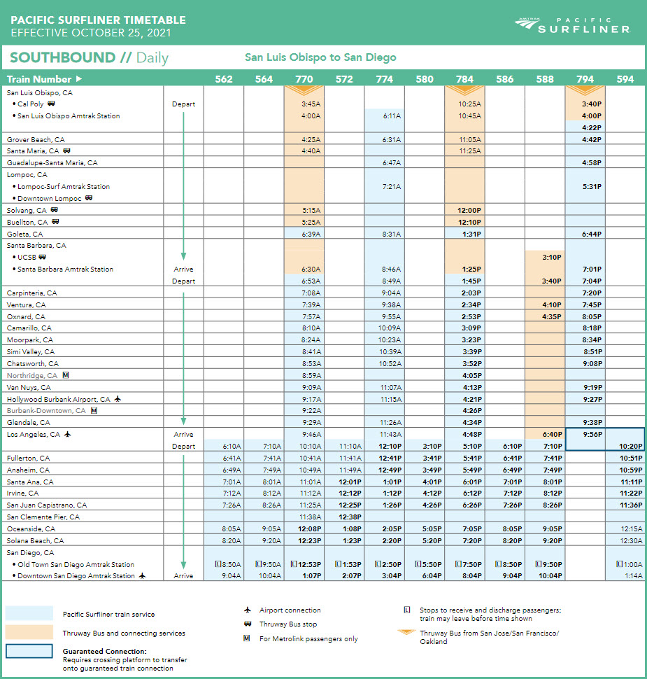
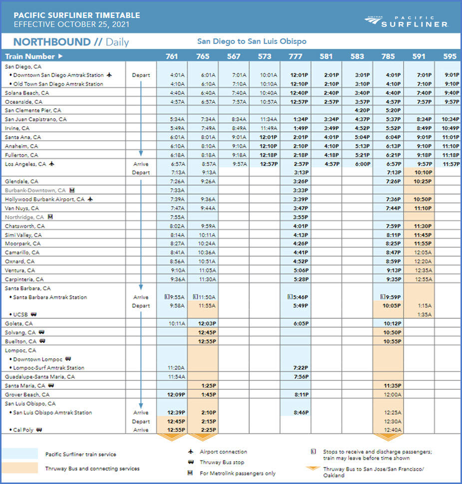
Amtrak's Pacific Surfliner has quite a few trains running between San Luis Obispo and San Diego via Union Station:
- There are 10 roundtrip trains a day going through Union Station... out of these: (schedules below in the Floobydust section)
- 4 SB's originate from San Luis Obispo - the late one changes train number at Union Station
- One SB from Santa Barbara at 3:40pm
- Of the 10 NB's from San Diego, 4 continue on to San Luis Obispo, one continues on to Santa Barbara
Six of Metrolink's seven lines originate out of Union Station:
- the San Bernardino Line, Union Station to San Bernardino (east)
- the 91 Line, Union Station to Riverside-Downtown by way of Buena Park and Fullerton (north)(dips south)
- the Orange County Line, Union Station to Oceanside via Anaheim (south)
- the Riverside Line, Union Station to Riverside-Downtown (east)
- the Ventura County Line, Union Station to Oxnard and Montavalvo (west)
- the Antelope Valley Line, Union Station to Lancaster (north)
- the 7th line runs between San Bernardino and Oceanside
Transit available at Union Station:
- Metro "L" Line Light Rail (Gold), to Pasadena (east) and East LA (passes thru/by Union Station)
- Metro "B" Line Subway (Red), to North Hollywood (terminates at Union Station)
- Metro "D" Line Subway (Purple), to Koreatown (terminates at Union Station)
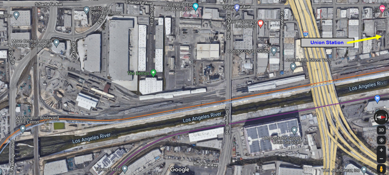
The Amtrak yard that services Union Station is a bit south, along the Los Angeles River, and (if I'm correct), is a former ATSF yard. Also, adjacent to the yard and facility, is a "new" flyover, built in the 1990's I believe, to carry passenger trains over the freight lines and the river. Again, I have some early photos of the area, if I can find them.
The yard is near East Washington Blvd and South Santa Fe Ave., and includes a turntable. One of the above videos has shots of the trip starting at the yard, going up a long the river, passing by the Red Line's shops, and ending up at Union Station... it starts on the turntable! :-)
Metrolink:
Metrolink's opening day was October 26, 1992 - The first Metrolink service begins with three routes as alternatives to freeway congestion in busy transit corridors: The Ventura County Line, the San Bernardino Line, and the Santa Clarita Line, which will become the Antelope Valley Line. Somewhere I have pictures from opening, I kinda just stumbled into it, as I didn't pay attention to the news back then :-) :-).
The station is the hub of the Metrolink regional commuter rail system and is a major transfer point for several Metro Rail subway and light rail lines.
Metrolink has been providing service to Southern California for 28 years. During this time, Metrolink has enhanced the quality of life by providing safe, efficient and reliable transportation service that offers an exceptional customer experience.
What began with three lines, 11 stations and 2,300 daily passengers, has now grown to seven lines, 62 stations, and passengers who travel approximately 406 million passenger miles per year.
Additionally, Metrolink is Southern California's commuter rail service enabling people to connect to their jobs and explore all that the region has to offer. Every year, Metrolink has nearly 12 million boardings from people who ditch their cars to avoid gridlock, removing an estimated 9.3 million vehicles from the roads and reducing greenhouse gas emissions by 130,000 metric tons. Metrolink is the largest commuter rail agency in California and the third largest in the United States operating seven lines along a 538-mile network that travels across Los Angeles, Orange, Riverside, San Bernardino and Ventura counties
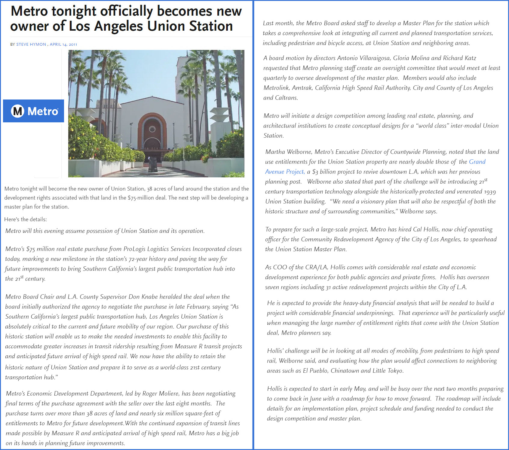
Metro took over the ownership of Union Station on April 14, 2011. I like the one phrase from the press release that says: "We now have the ability to retain the historic nature of Union Station". Uh, are we supposed to believe they are the only ones capable of preserving the historic nature? It's just my snide observation, pay it no mind.
The Patsaouras Transit Plaza, on the east side of the station, serves dozens of bus lines operated by Metro and several other municipal carriers. end Wiki
Bus service to Union Station is provided by (I believe) the following lines: 4, 40, 78, 106, 600, DASH B.

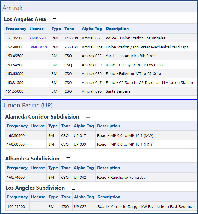
Listening In:
Here are a few of the railroad channels in the Los Angeles area, additional info at the link above:
Railfanning:
Union Station is in a "weird" area for railfanning. On one side, you have a county jail. Across the river, you have an Intermodal yard. Both of these limit your accessibility. There are NO good places to catch trains at the number of diamonds on both sides of the river without trespassing.
Just make sure, that if you decide to catch pictures outside of the station, you should not do it alone. Several of the side streets that lead to the tracks on the north side of the approach, have been known to be large areas of homeless - at one time, the whole street was covered with tents :-)
The flyover adjacent to the Amtrak yard provides some interesting pictures, I was impressed the first time I saw it!
Some stations, like Richmond VA, and Penn Station in NYC, limit your access to the platforms if you don't have a ticket for a train, and even then, you can't just go strolling out on the platforms at will. Not sure what the scene here is since I haven't been on the platforms since it's been Amtrak.
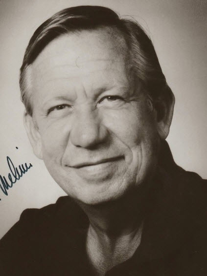
Additional credits and completely useless personal info: I first came out to LA back in 1970, for a couple of reasons - the biggest one of which was to escort my 80 year old grandmother, who had never been on an airplane before, to come out to LA to visit her daughter, Amalia. Amalia had moved out to LA back in the early 60's when her husband, Allan Melvin, moved out here to further his career. I also came out to LA to visit a girl I had met back east in Baltimore, Piper Hood. It was because of her that I visited Union Station for the first time, for she brought me down here one weekend. And, sidebar, if you can believe it - one of the reasons for the tough anti-pollution laws Los Angeles and California has is because you would drive at night on the freeways, and the headlights coming at you were a brownish color due to the pollution.... YUK! (A small tribute to these folks, as they have all "left us", and contributed greatly to my love of railroading!)
 Palmina (~1945)
 Allan (~1980)
 Amalia (2018)
 Piper (1970)
Acknowledgements:
Denver Todd
Basil D Soufi
Gary Leonard
Michael Armstrong
Clay Gilliland
Google Maps
Bing Maps
Open Railway Map
Wikipedia
Websites and other additional information sources of interest for the area:
https://unionstationla.com/
https://en.wikipedia.org/wiki/Union_Station_(Los_Angeles)
https://www.facebook.com/UnionStationLA
https://www.hotels.com/go/usa/union-station-los-angeles
https://metrolinktrains.com/about/agency/history-of-metrolink/
https://www.youtube.com/watch?v=xVbu5eVyCH4 Video going from Amtrak yard into Union Station.... nice
https://moovitapp.com/index/en/public_transit-L_A_Union_Station_Metrolink_Station-Los_Angeles_CA-site_43444737-302
https://www.american-rails.com/laupt.html
https://www.kcet.org/shows/lost-la/lost-train-depots-of-los-angeles-history
https://www.laalmanac.com/transport/tr35.php
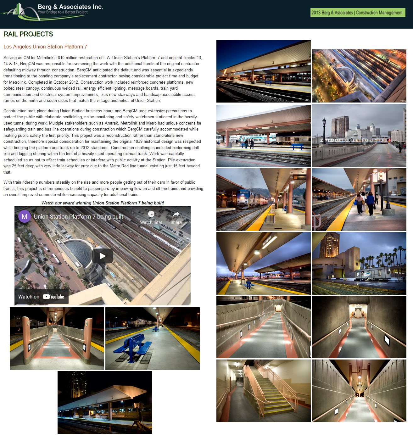
https://www.bergcm.com/projects_rail_union_station.html
https://www.radioreference.com/db/aid/4010
https://www.youtube.com/watch?v=VimPg24Uwsg by "Fan Railer"
https://www.youtube.com/watch?v=XwST0aWQqu0 by "Amtrak and AWVR Fan"
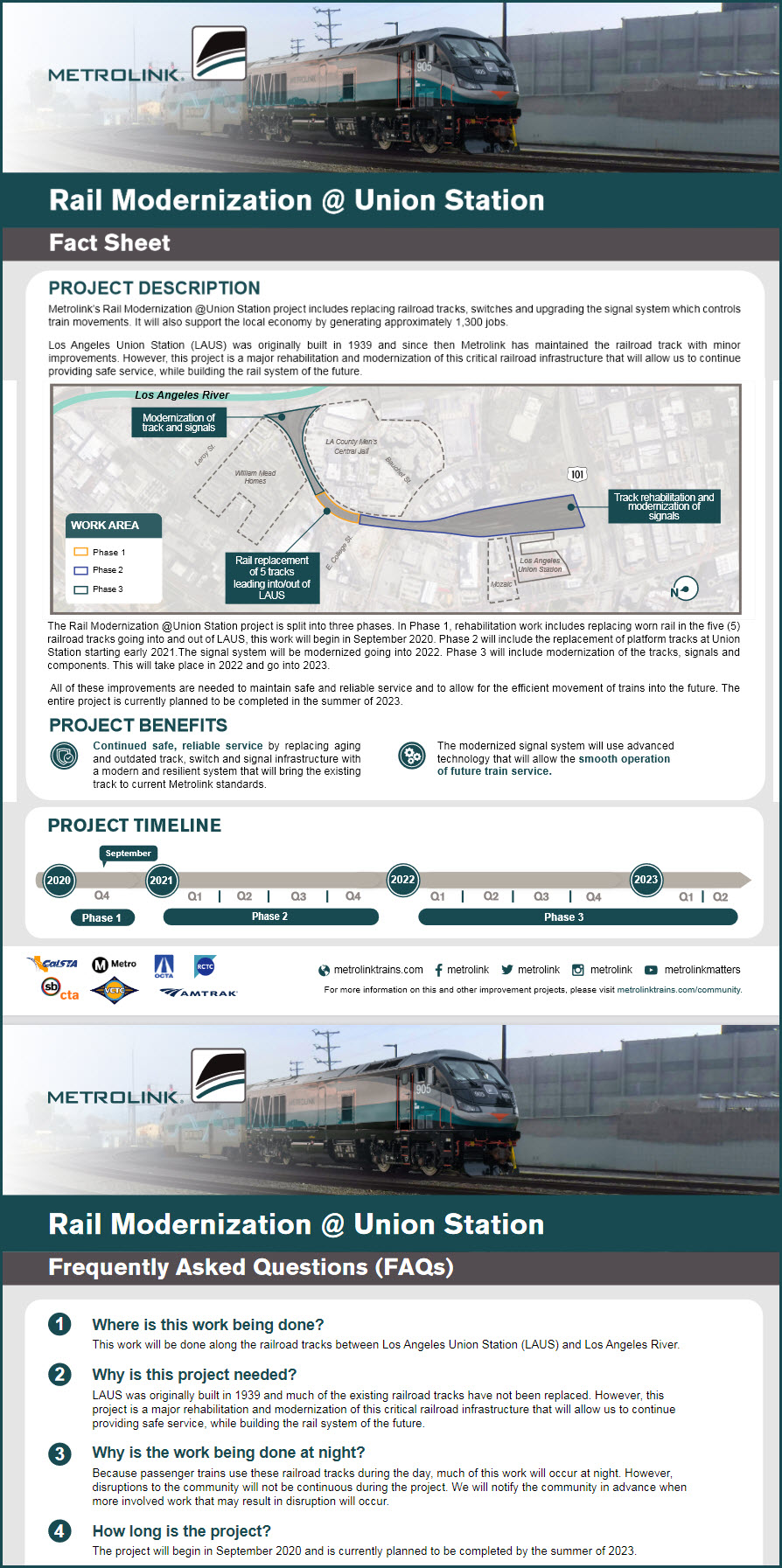
https://www.trains.com/trn/news-reviews/news-wire/01-metrolink-set-to-begin-work-on-la-union-station-project/
https://waterandpower.org/museum/Early_City_Views%20(1925%20+)_Page_4.html tons of pictures from the 1930's thru the 1960's
https://www.amtrak.com/content/dam/projects/dotcom/english/public/documents/timetables/Pacific-Surfliner-Schedule-LOSSAN-102521.pdf
https://commons.wikimedia.org/wiki/File:Pacific_Surfliner_trains_at_Los_Angeles,_May_2005.jpg
Find your way, if traveling via the freeways, to the 101 - the Santa Ana Freeway.
Like any other major metropolitan area, you need to pay attention to where you are, exits appear quickly in L.A. If you have never been to L.A. before, it is advisable to have someone with you to help navigate! :-)
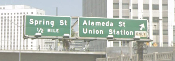
Westbounders take the exit for Alameda St, exit 2A. Then take a right onto Alameda, you will be right on top of Union Station.
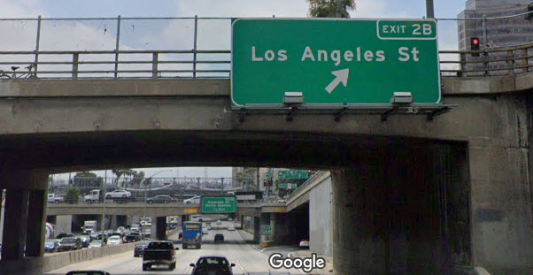
Eastbounders will want to take exit 2A for Los Angeles St, and then take a left, this will take you to the entrance of the station.

 Basil D Soufi, via Wikipedia
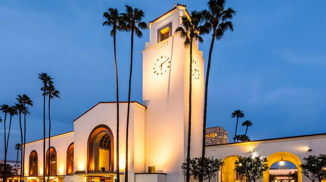
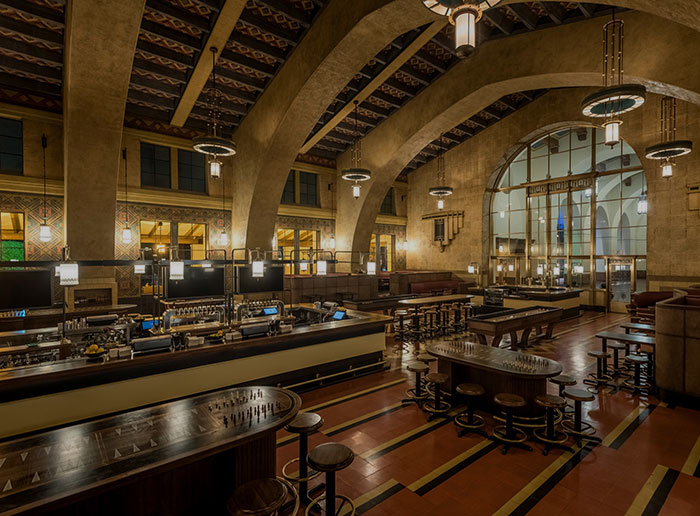
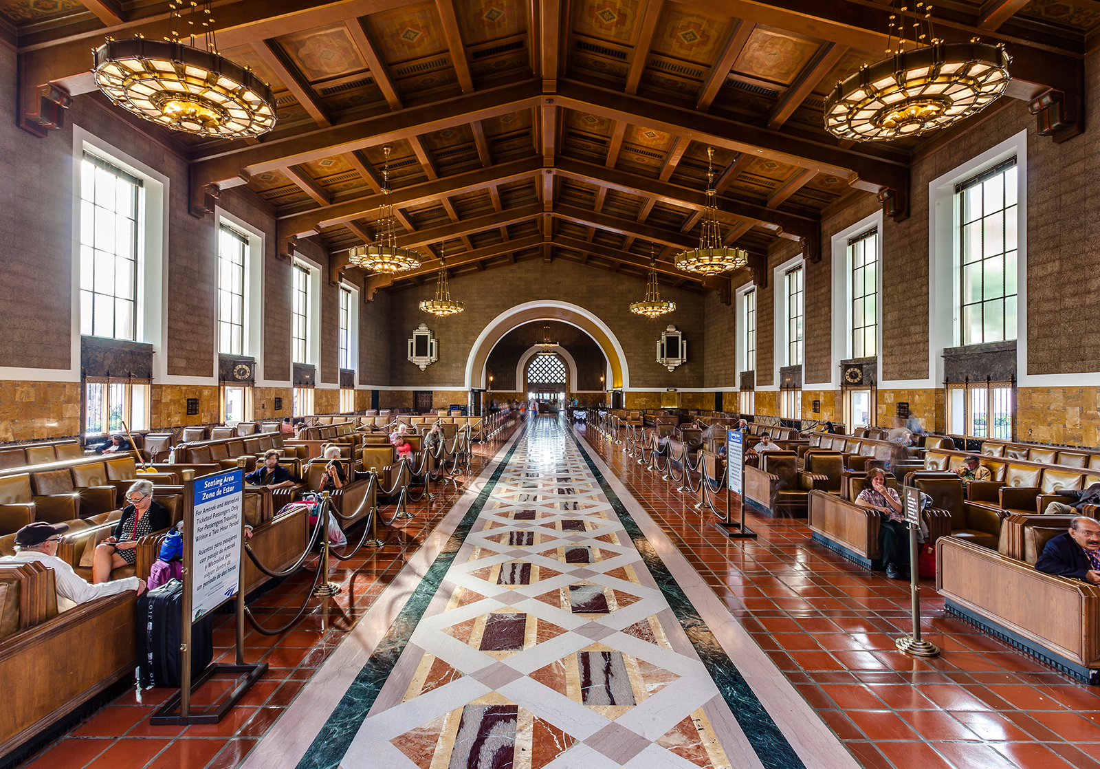
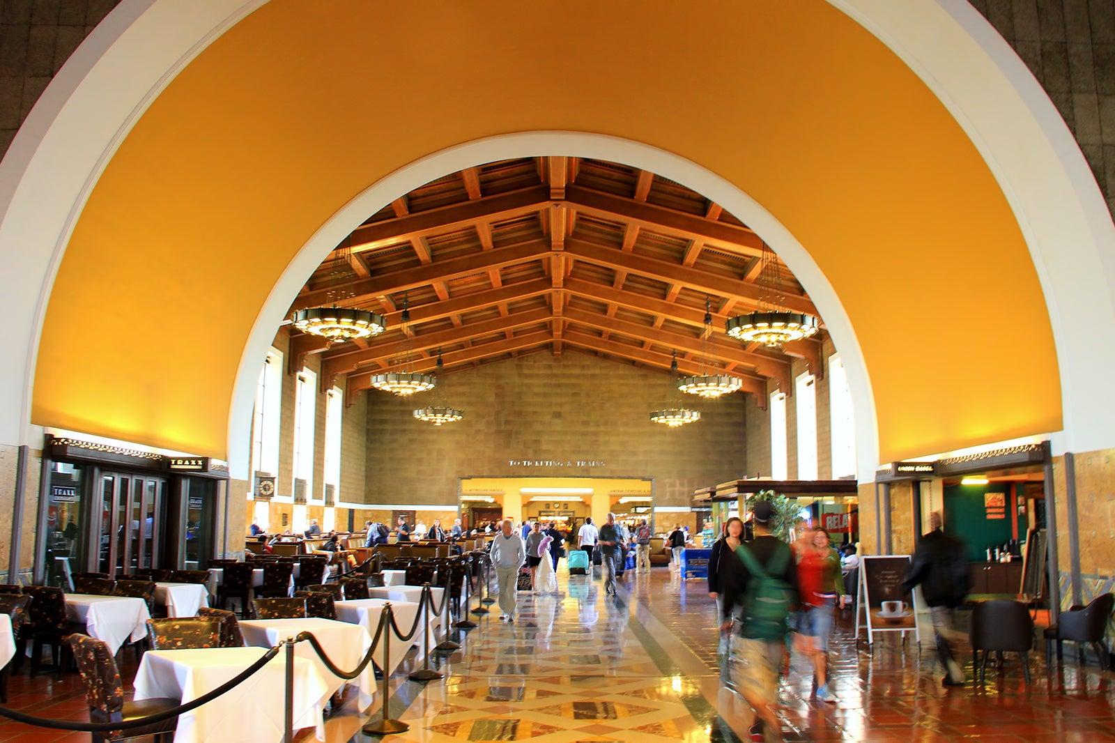

 photo by Gary Leonard
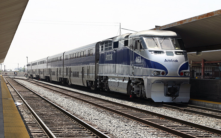
 from the Fan Railer video
 from the Amtrak and AWVR Fan video
 David Larsen/Trains Magazine
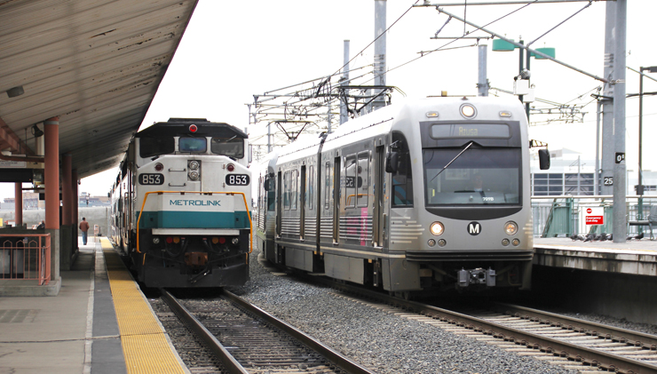 David Larsen/Trains Magazine
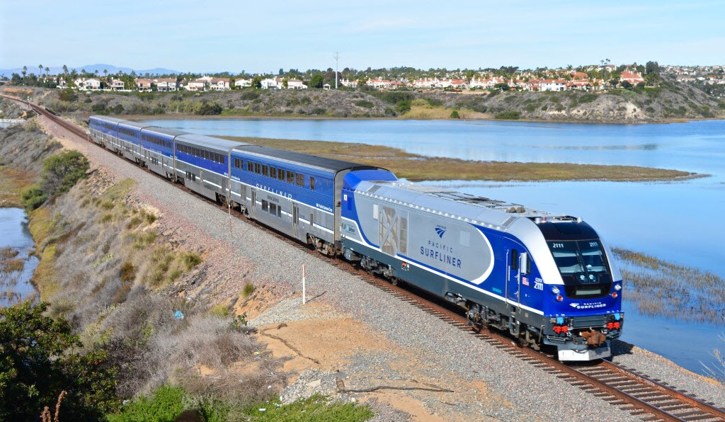 Michael Armstrong
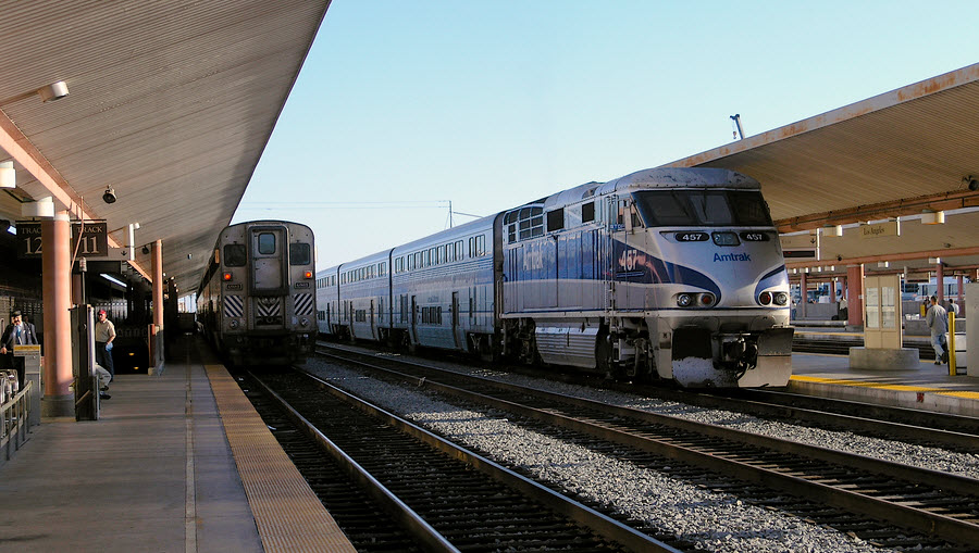 2005, Clay Gilliland via Wikimedia
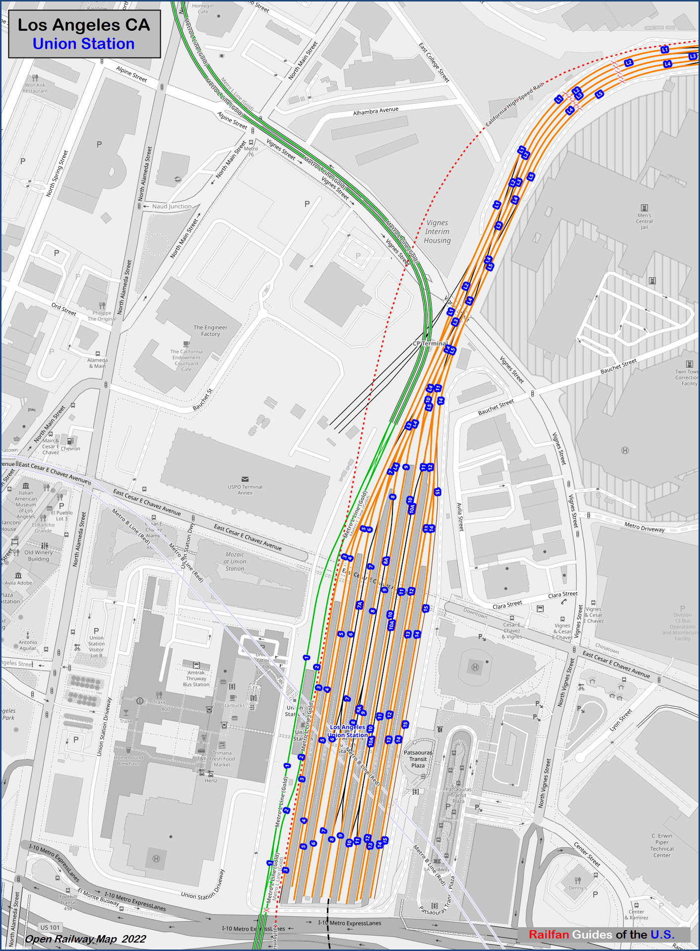
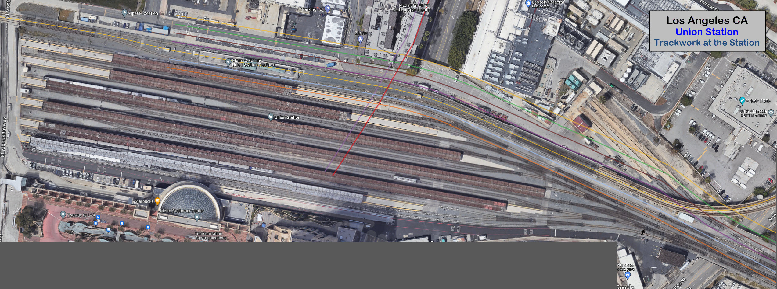
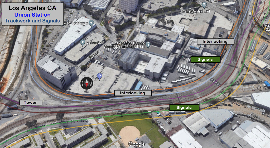
There are 15 tracks in the station, with an extra track in between tracks 6 & 7, 8 & 9, and 10 & 11 for engine run-arounds.
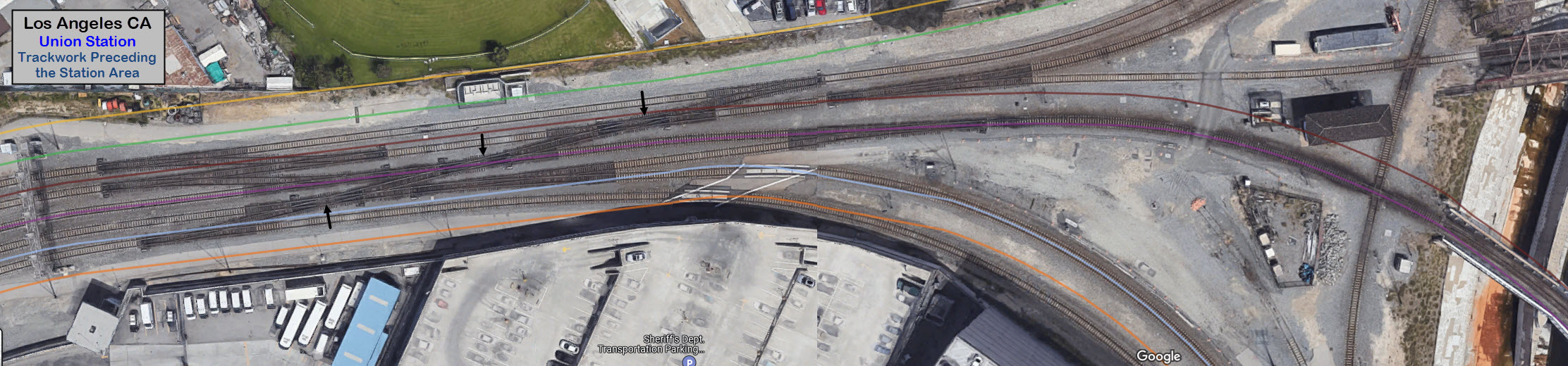
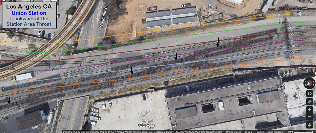
There are five tracks in the station throat, which opens up after crossing Vignes St.
Looks like there are seven double-slip switches (black arrows).
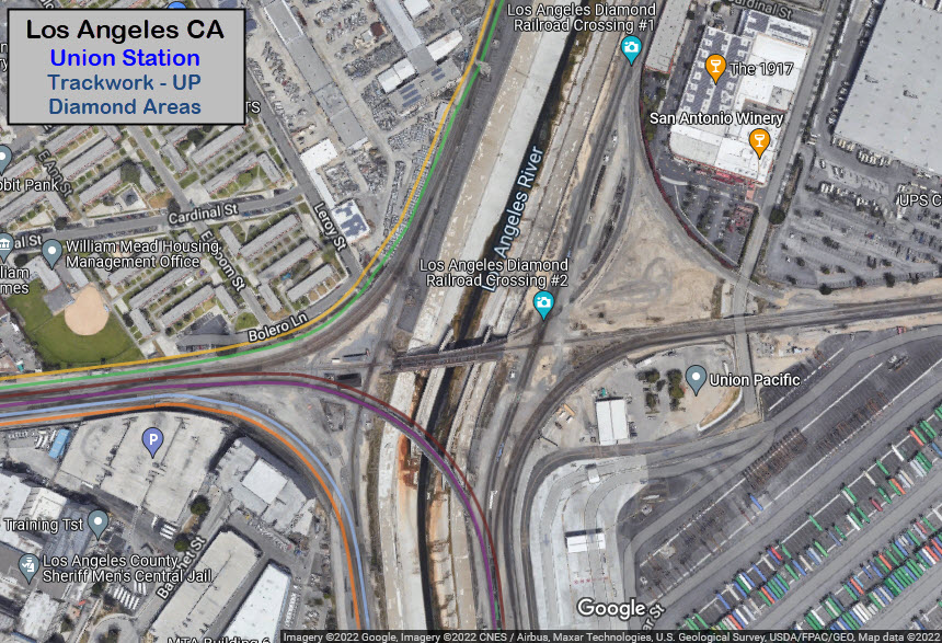
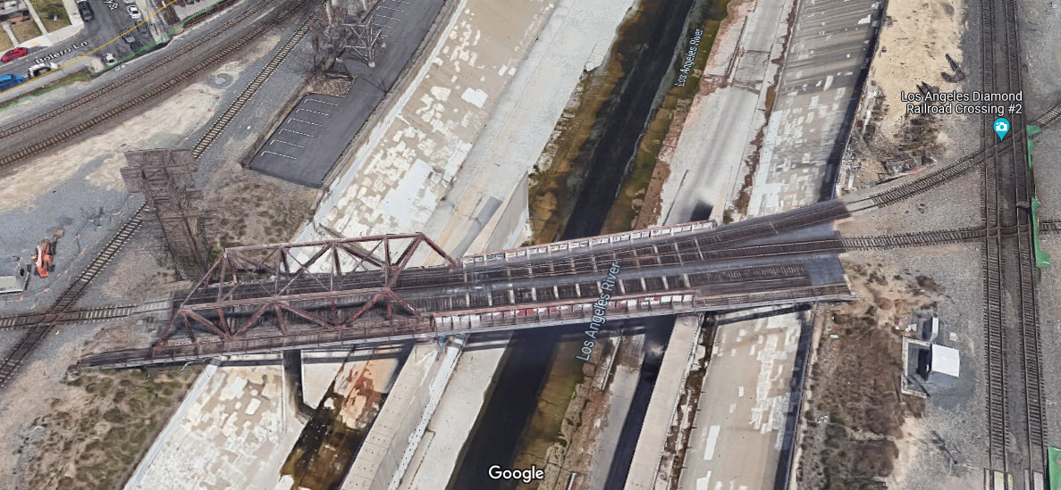
Before crossing the Los Angeles River, the tracks split up -- with two heading north, one crossing the river to head south on the east side of the river, and two tracks heading south on the west bank of the river.
GPS Coordinates: 34.06102, -118.23230
GPS Coordinates: 34.06182, -118.23096
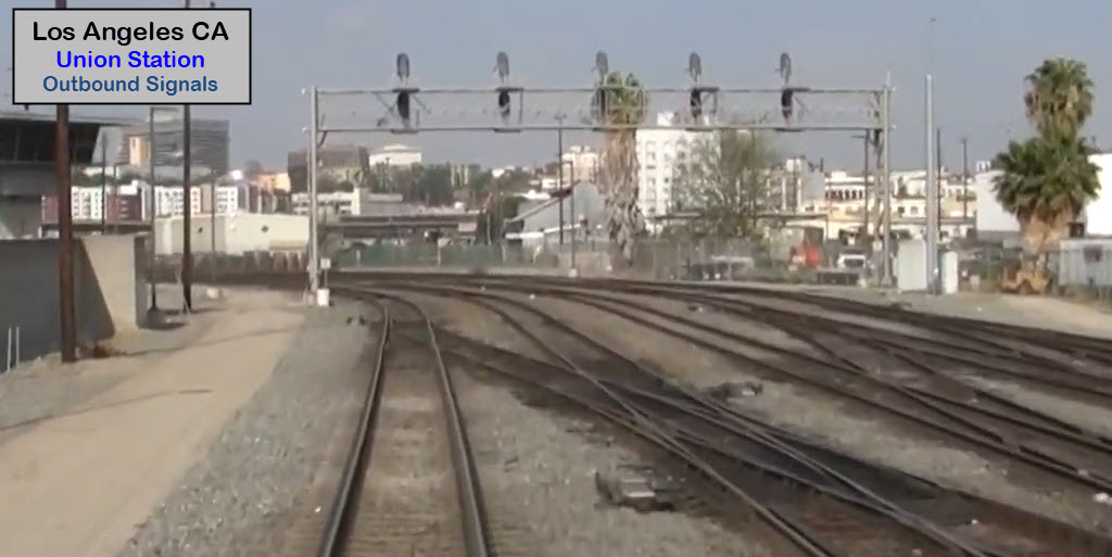
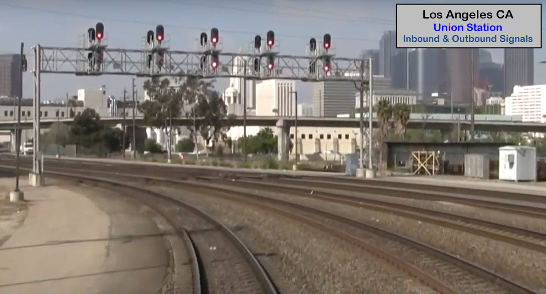
Found in the terminal area. Looks like they are R/G/Y type LED lamps, replacing the old mechanical "H5" type searchlight signals.

From Main Street looking south, we have a set of signals for a pair of crossovers (A), then the interchange track (B), and finally, the diamond (C).
I believe this is freight only trackage.
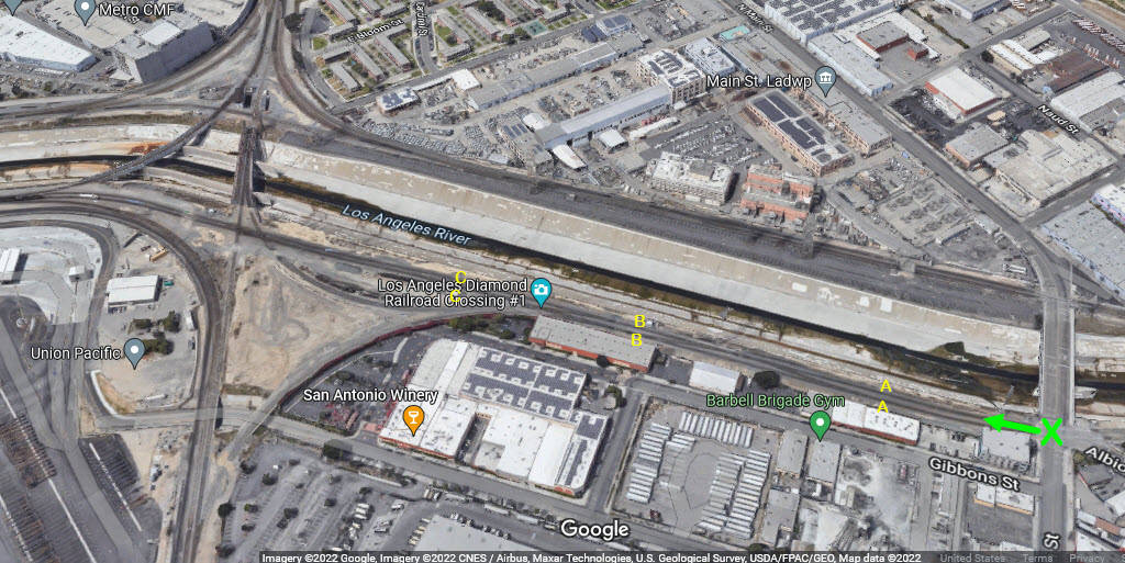
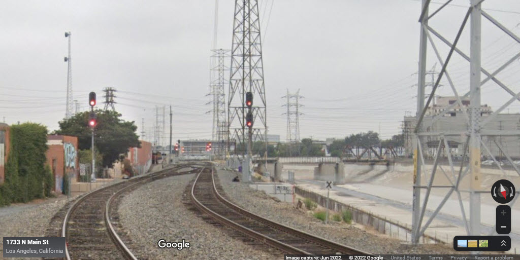
GPS Coordinates: 34.06234, -118.22639
Most of the overpasses around the station are pretty boring, so at this time, I'm not going to cover them. The one exception is the one bridge crossing the Los Angeles River where the tracks fan out into the different directions.
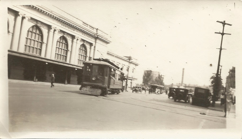
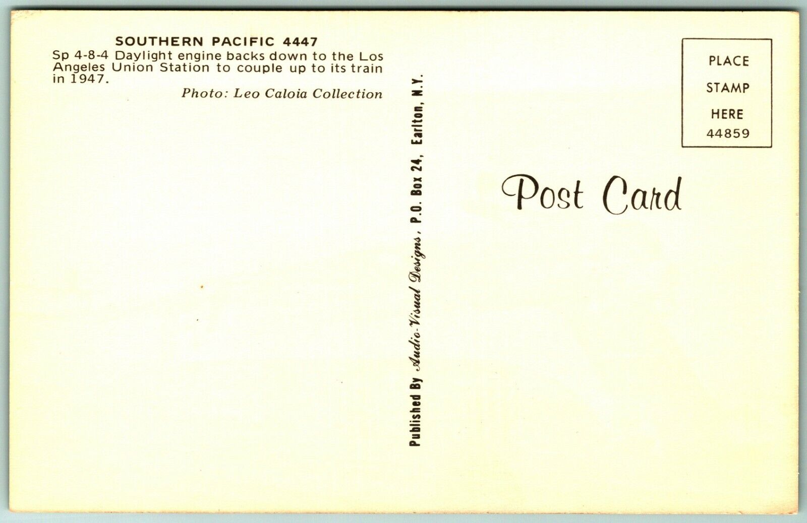
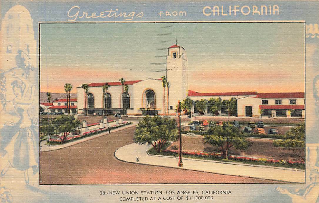
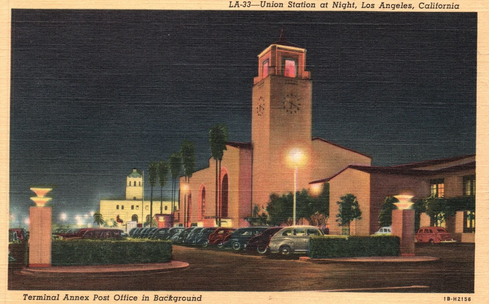
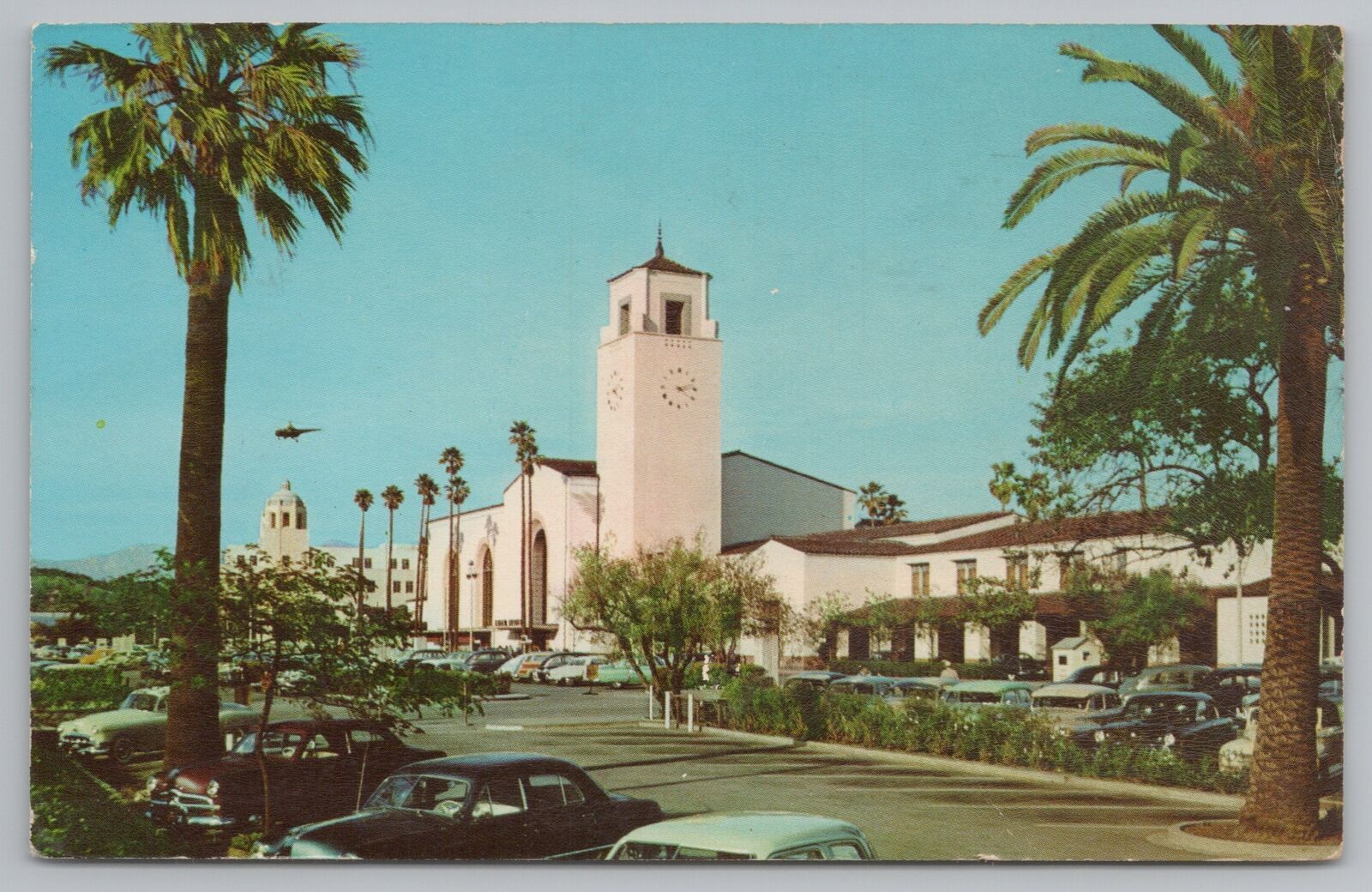
Postcards of the station are in abundance, however, pictures of trains in the station, are RARE!!!


Pacific Surliner Schedules
Assorted Articles About Union Station

Quick history of Metrolink:
1988 - Riverside County residents approve Measure A
1989 - San Bernardino County residents pass Measure I
1990 - 173 miles of active and abandoned right-of-way from Southern Pacific Railroad
1991 - The Southern California Regional Rail Authority (SCRRA) is formed
1992 - Metrolink purchases 366 miles of track from Atchison, Topeka and Santa Fe Railway
1993 - The Riverside Line opens to the public
1994 - A major earthquake strikes Northridge
1995 - The San Bernardino Line’s Saturday Explorer debuts
1996 - Beach Trains make their debut on the IEOC Line
1997 - Saturday Explorer service is added to the Antelope Valley Line
1998 - Extension of six routes in Moorpark
1999 - Metrolink experiences a boost in ridership
2000 - Metrolink riders take advantage of a “First Month Free” promotion
2001 - Strengthen system security in response to the 9/11 attacks
2002 - The 91 Line opens
2004 - Approve the extension of the Measure I sales tax for transportation improvements
2005 - A Metrolink train collides with an abandoned SUV
2006 - Metrolink’s awards Hyundai Rotem a contract to build 117 safety-enhanced railcars
2007 - Metrolink breaks ground on its Sealed Corridor Program
2008 - A Metrolink train collides head-on with a Union Pacific freight train
2009 - First railroad agency to install inward-facing cameras in the operator’s cab of its trains
2010 - Delivery of the first safety-enhanced Hyundai Rotem railcars
2011 - Metrolink's goal to implement Positive Train Control (PTC) ahead of the federal mandate
2012 - Metrolink secures Tier 4 Locomotives
2013 - Metrolink receives the last of its new Hyundai Rotem railcars
2014 - Metrolink achieves a milestone in Positive Train Control (PTC)
2015 - Oxnard Incident and Response
2016 - Metrolink’s first Tier 4 locomotive arrives to Los Angeles Union Station
2017 - Metrolink extends service with a new station in downtown San Bernardino
2018 - Online Ticketing Portal allows riders to print tickets at home
2019 - Lifesaving Automated External Defibrillators are installed on all trains
If we look at the downtown area, we can see how "today's" L.A. has been shaped by the railroads of yesterday:
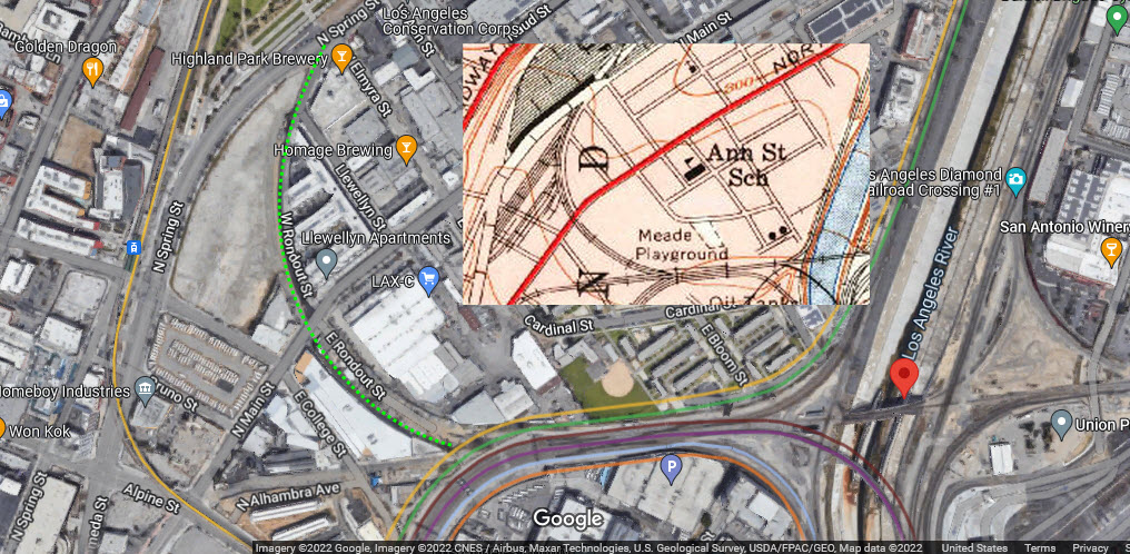
And how a park has replaced most of the old Espee Yard:
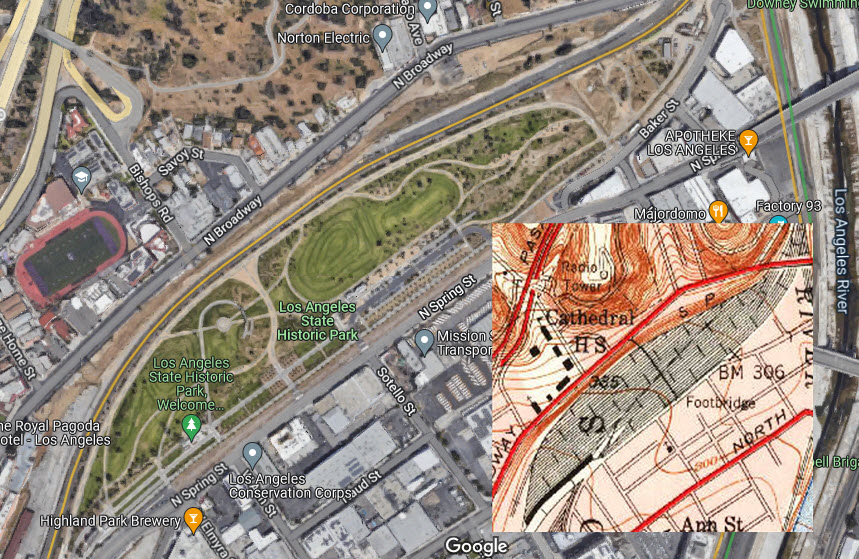
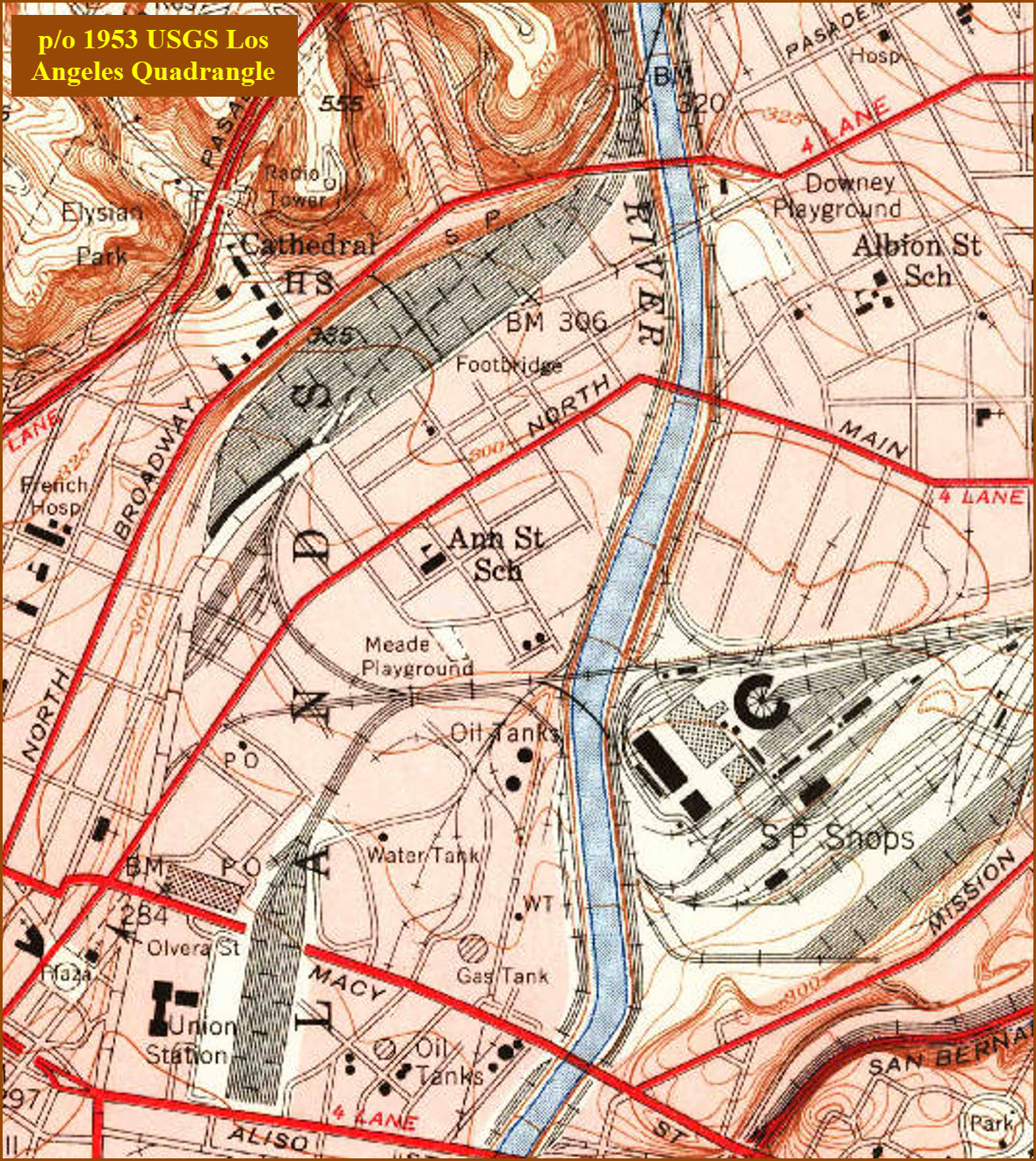
Courtesy of the USGS, click here for their index page.
From these two maps, we can see the changes made to the Los Angeles landscape to accommodate Union Station.

Disclaimers:
I love trains, and I love signals. I am not an expert. My webpages reflect what I find on the topic of the page. This is something I have fun with while trying to help others.
Please Note: Since the main focus of my two websites is railroad signals, the railfan guides are oriented towards the signal fan being able to locate them. For those of you into the modeling aspect of our hobby, my indexa page has a list of almost everything railroad oriented I can think of to provide you with at least a few pictures to help you detail your pike.
If this is a railfan page, every effort has been made to make sure that the information contained on this map and in this railfan guide is correct. Once in a while, an error may creep in :-)
My philosophy: Pictures and maps are worth a thousand words, especially for railfanning. Text descriptions only get you so far, especially if you get lost or disoriented. Take along good maps.... a GPS is OK to get somewhere, but maps are still better if you get lost! I belong to AAA, which allows you to get local maps for free when you visit the local branches. ADC puts out a nice series of county maps for the Washington DC area, but their state maps do not have the railroads on them. If you can find em, I like the National Geographic map book of the U.S..... good, clear, and concise graphics, and they do a really good job of showing you where tourist type attractions are, although they too lack the railroads. Other notes about specific areas will show up on that page if known.
Aerial shots were taken from either Google or Bing Maps as noted. Screen captures are made with Snagit, a Techsmith product... a great tool if you have never used it!
By the way, floobydust is a term I picked up 30-40 years ago from a National Semiconductor data book, and means miscellaneous and/or other stuff.
Pictures and additional information is always needed if anyone feels inclined to take 'em, send 'em, and share 'em, or if you have something to add or correct.... credit is always given! Please be NICE!!! Contact info is here
Beware: If used as a source, ANYTHING from Wikipedia must be treated as being possibly inaccurate, wrong, or not true.
RAILFAN GUIDES HOME
RAILROAD SIGNALS HOME
NEW 07/29/2022, JUL30/31/2022, AUG1/2/3/2022
Last Modified 03-Aug-2022