
In General
Getting Here
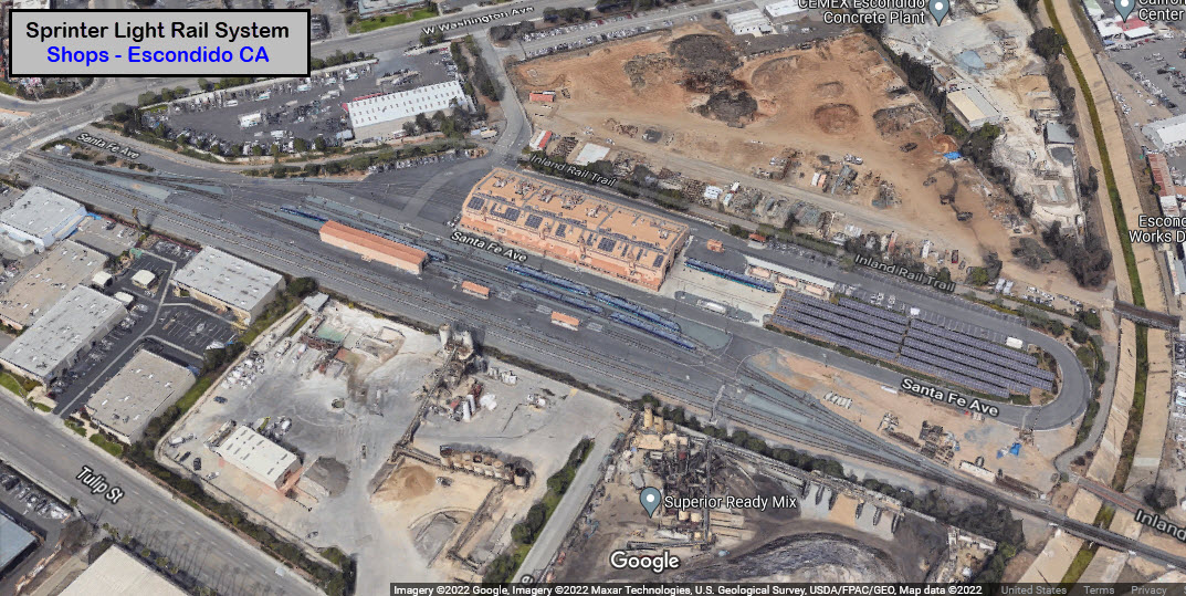
Map
Sights
Pictures
Bridges
Signals
Fire & Police
Postcards
Floobydust
USGS Maps
RAILROAD SIGNALS HOME
Location / Name:
Escondido CA, San Diego County
What's Here:
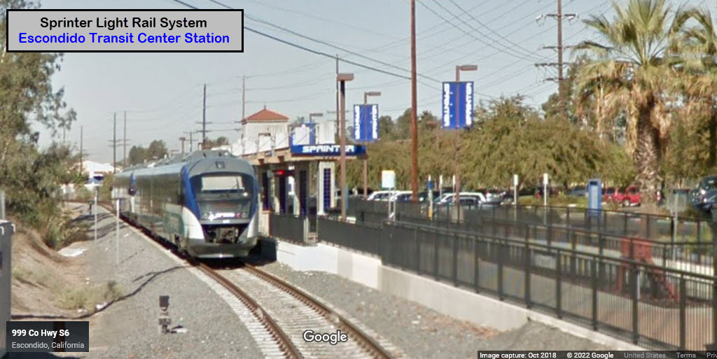
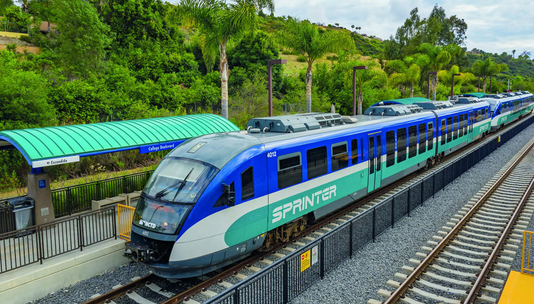
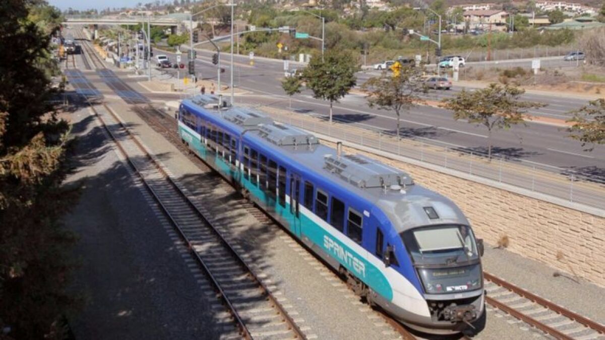
Sprinter Light Rail
Escondido History Center (Depot)
Data:
GPS Coordinates: as needed
Phone A/C: 760 / 442
ZIP: 92025
Access by train/transit:
Sprinter Light Rail System
The Scoop:
Brief History: In 1887, the Escondido Land & Town Co. invested in the railroad. Construction was started in March 1887 and completed January 1888 of the Oceanside to Escondido line. A load of wheat was the first freight to leave Escondido. The Lime Street School, in what will later become Grape Day Park, opened. The first stage traveled between San Diego and Escondido.
The city of Escondido was incorporated on October 8, 1888. It consisted of 1854 acres.
Passenger service between Escondido and Oceanside was discontinued in 1945.
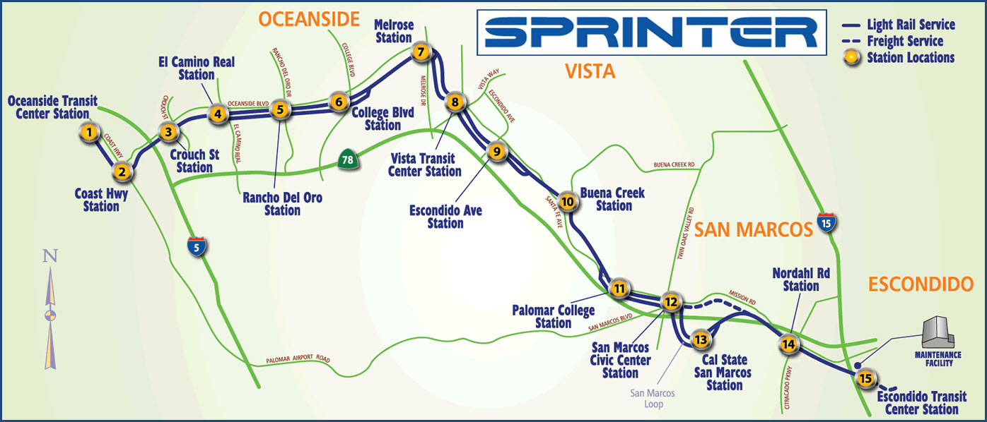
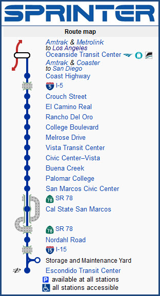
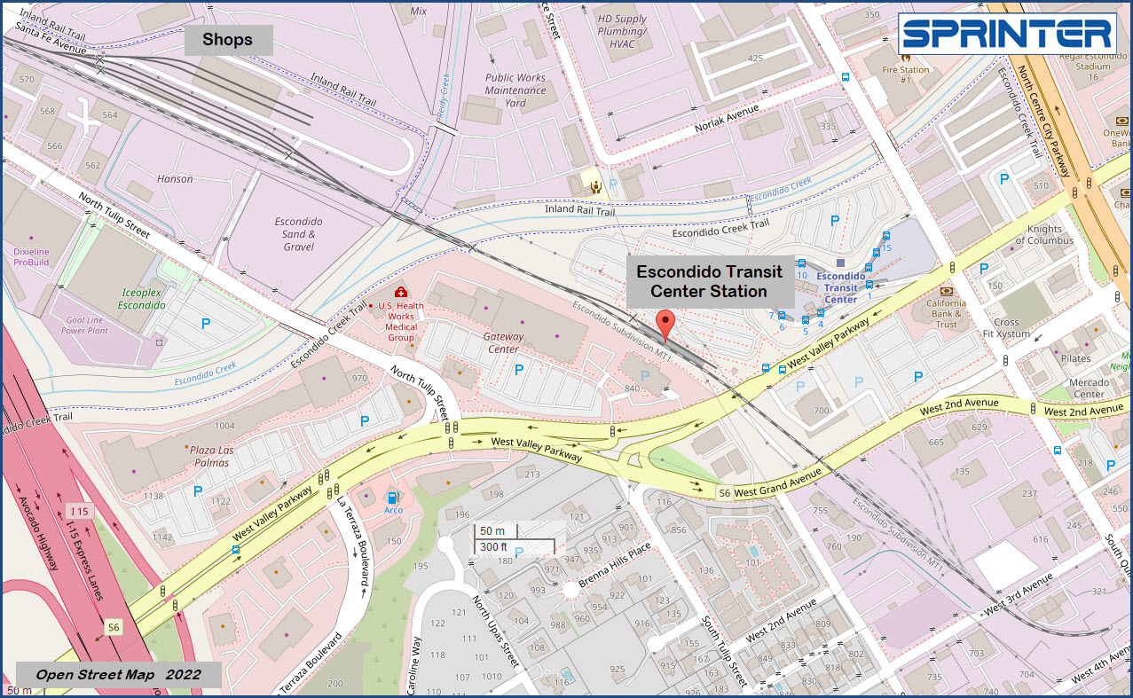
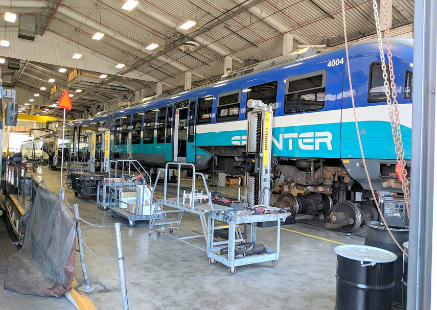
Sprinter's 22 mile east-west route includes 15 stations in the towns of Oceanside, Vista, San Marcos, and Escondido (see map, below). Trains run every half hour between 04:00 (4:00 a.m.) and 21:30 (9:30 p.m.) Monday through Friday, and hourly on weekends. A project of the North County Transit District (NCTD), the Sprinter service takes 53 minutes to go from one end of the line to the other. The system uses "DMU's", they are light rail cars powered by a diesel engine instead of an overhead catenary line.
The old Escondido train depot now resides in Grape Day Park, about a mile from where it was previously located, and serves the Escondido Historical Center.
Acknowledgements:
Bill Morrow
Amtrak455
Google Maps
Bing Maps
Open Street Map
Wikipedia
Websites and other additional information sources of interest for the area:
https://en.wikipedia.org/wiki/Sprinter_(light_rail)
https://www.lightrailnow.org/news/n_sd_2008-05a.htm
https://passporttosandiego.com/company/north-county-transit-district/
https://gonctd.com/wp-content/uploads/transit/NCTD%20System%20Map%20Only%20October%202022.pdf
https://www.escondidohistory.org/
https://en.wikipedia.org/wiki/Escondido_Transit_Center
Exit 31 from I-15, the Escondido Freeway, for the Sprinter station. Take West Valley Parkway east, it splits into one-way streets, and West Grand Ave continues east. Take a left at N Quince St, and another left at W Valley Parkway to the station.
I-15 comes down from the Rancho Cucamonga and San Bernardino CA area off I-10, and comes up from downtown San Diego.
If your coming via I-5, take exit 31 (Vista Way) and then travel east on the Ronald Packard Pkwy, CA-78 into Escondido.
GPS Coordinates:
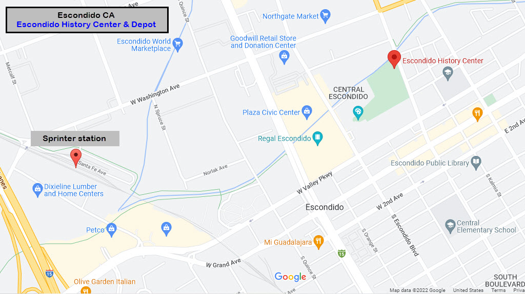
321 N Broadway, Escondido, CA 92025
In Grape Day Park
760-743-8207
Historically speaking, this station is one of San Diego County’s most significant. Another centenarian, this 1887 depot served Escondido passengers from 1888 to 1945. Freight operations continued until 1981 when Santa Fe served notice that they would raze the building. City preservationists rallied enough support to purchase and move the building to Grape Day Park in 1985. The depot now sits approximately 1 mile east of the original trackside site.
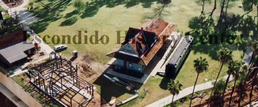
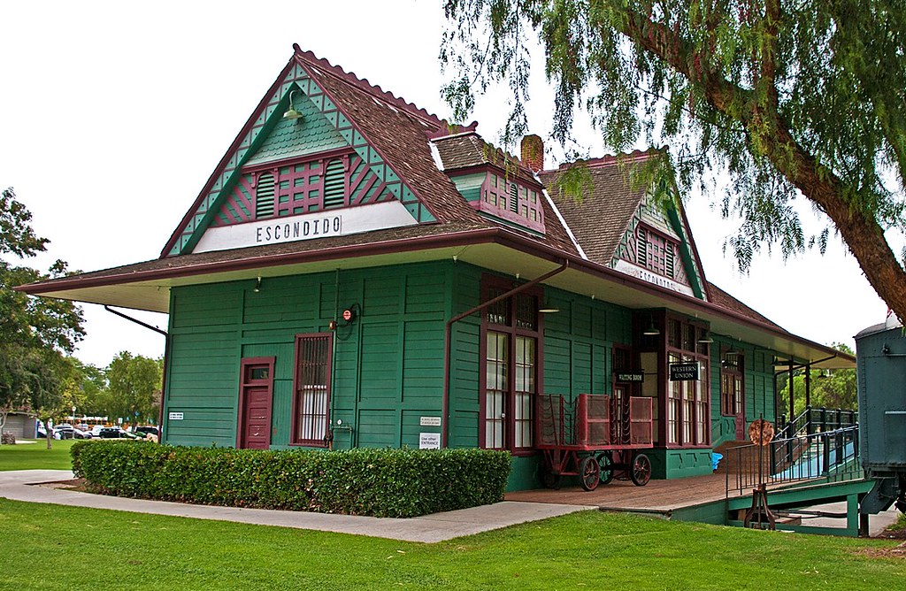

 In 1887 just after completion
GPS Coordinates: 33.11842, -117.09228
796 West Valley Parkway
Sprinter's 22 mile east-west route includes 15 stations in the towns of Oceanside, Vista, San Marcos, and Escondido. Trains run every half hour between 4:00am and 9:30pm, Monday through Friday, and hourly on weekends. A project of the North County Transit District (NCTD), the Sprinter service takes 53 minutes to go from one end of the line to the other, and trips average 20 to 30 minutes.
One of the major functions of Sprinter is to feed NCTD's Coaster regional passenger rail ("commuter") service running between Oceanside and downtown San Diego; in addition, Sprinter complements the San Diego Trolley light rail transit system that connects parts of the central, eastern, and southern sections of the county. Bus routes (NCTD also operates a 165-vehicle fleet) have been adjusted to serve Sprinter stations. Veolia Transportation is under contact to operate the Sprinter trains.
All of the Sprinter stations have concrete platforms with benches and overhanging shelters. All stations except for Cal State San Marcos have free parking.
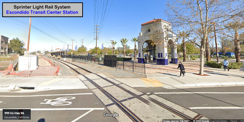

GPS Coordinates: 33.12155, -117.09791 (front gate)

 Bill Morrow, 2021, via Wikipedia
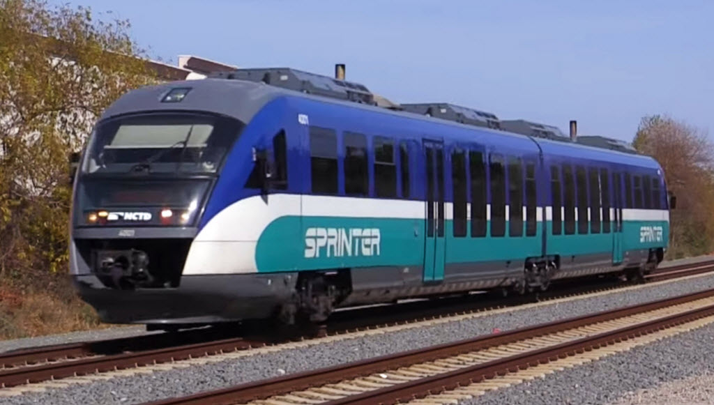 Amtrak455, 2021, via Wikipedia
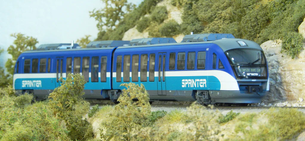 Sprinter in HO by Piko, $300
 CA Times
The
The
The
The
![]() Xxx
Xxx
![]() Xxx
Xxx
![]() Xxx
Xxx
Did U Know?
None for now......
Courtesy of the University of Texas Library, click here for their index page.
Disclaimers:
I love trains, and I love signals. I am not an expert. My webpages reflect what I find on the topic of the page. This is something I have fun with while trying to help others.
Please Note: Since the main focus of my two websites is railroad signals, the railfan guides are oriented towards the signal fan being able to locate them. For those of you into the modeling aspect of our hobby, my indexa page has a list of almost everything railroad oriented I can think of to provide you with at least a few pictures to help you detail your pike.
If this is a railfan page, every effort has been made to make sure that the information contained on this map and in this railfan guide is correct. Once in a while, an error may creep in :-)
My philosophy: Pictures and maps are worth a thousand words, especially for railfanning. Text descriptions only get you so far, especially if you get lost or disoriented. Take along good maps.... a GPS is OK to get somewhere, but maps are still better if you get lost! I belong to AAA, which allows you to get local maps for free when you visit the local branches. ADC puts out a nice series of county maps for the Washington DC area, but their state maps do not have the railroads on them. If you can find em, I like the National Geographic map book of the U.S..... good, clear, and concise graphics, and they do a really good job of showing you where tourist type attractions are, although they too lack the railroads. Other notes about specific areas will show up on that page if known.
Aerial shots were taken from either Google or Bing Maps as noted. Screen captures are made with Snagit, a Techsmith product... a great tool if you have never used it!
By the way, floobydust is a term I picked up 30-40 years ago from a National Semiconductor data book, and means miscellaneous and/or other stuff.
Pictures and additional information is always needed if anyone feels inclined to take 'em, send 'em, and share 'em, or if you have something to add or correct.... credit is always given! Please be NICE!!! Contact info is here
Beware: If used as a source, ANYTHING from Wikipedia must be treated as being possibly inaccurate, wrong, or not true.
RAILFAN GUIDES HOME
RAILROAD SIGNALS HOME
NEW 10/23/2022, OCT24/2022
Last Modified 24-Oct-2022