
In General
Getting Here
Map
Pictures
Articles
RAILROAD SIGNALS HOME
Location / Name:
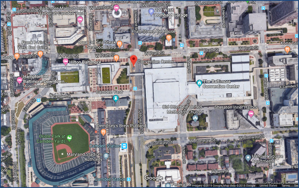
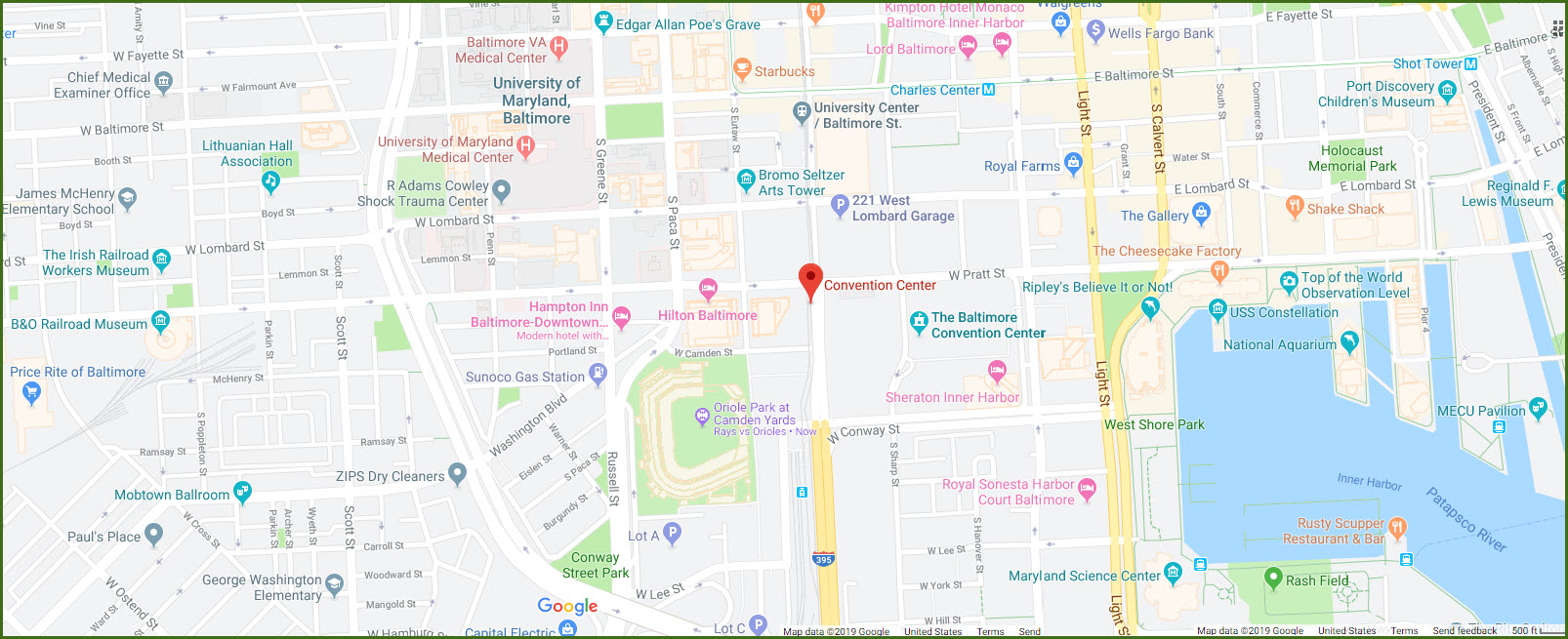
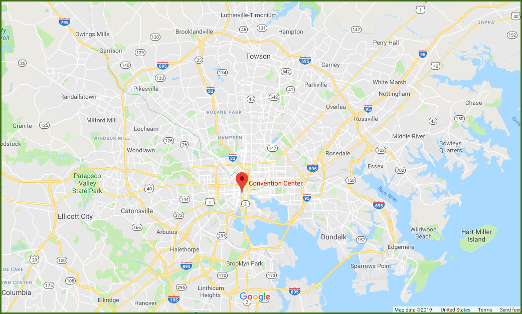
Baltimore MD, Howard Street and Pratt Street
What's Here:
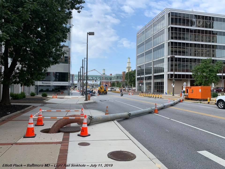
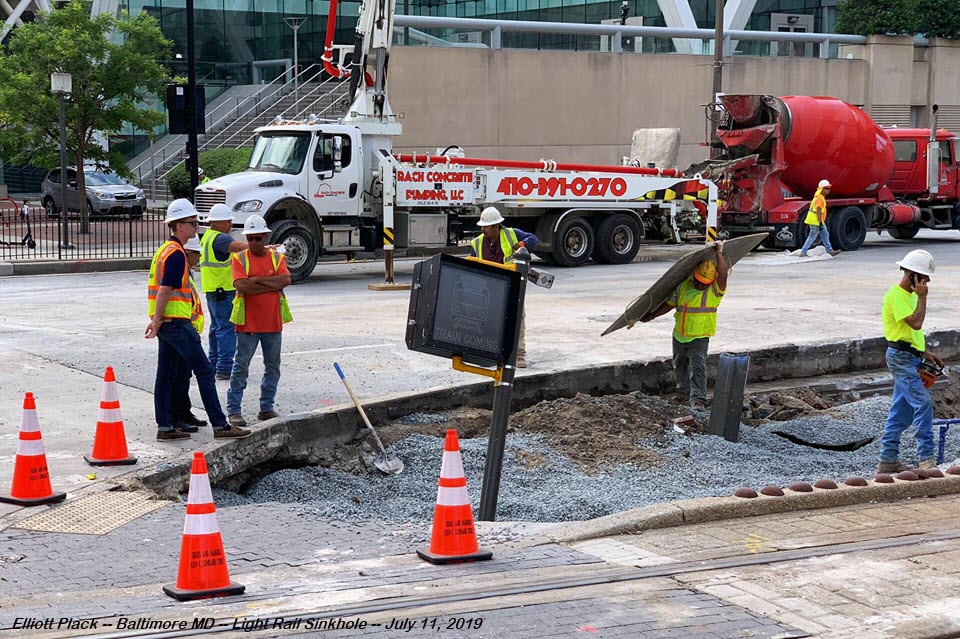
Sinkhole at the Light Rail Station
Data:
GPS Coordinates: 39.286160, -76.619349
Phone A/C: 410 & 443
ZIP: 21201
Access by train/transit:
None at the time! :-)
The Scoop:
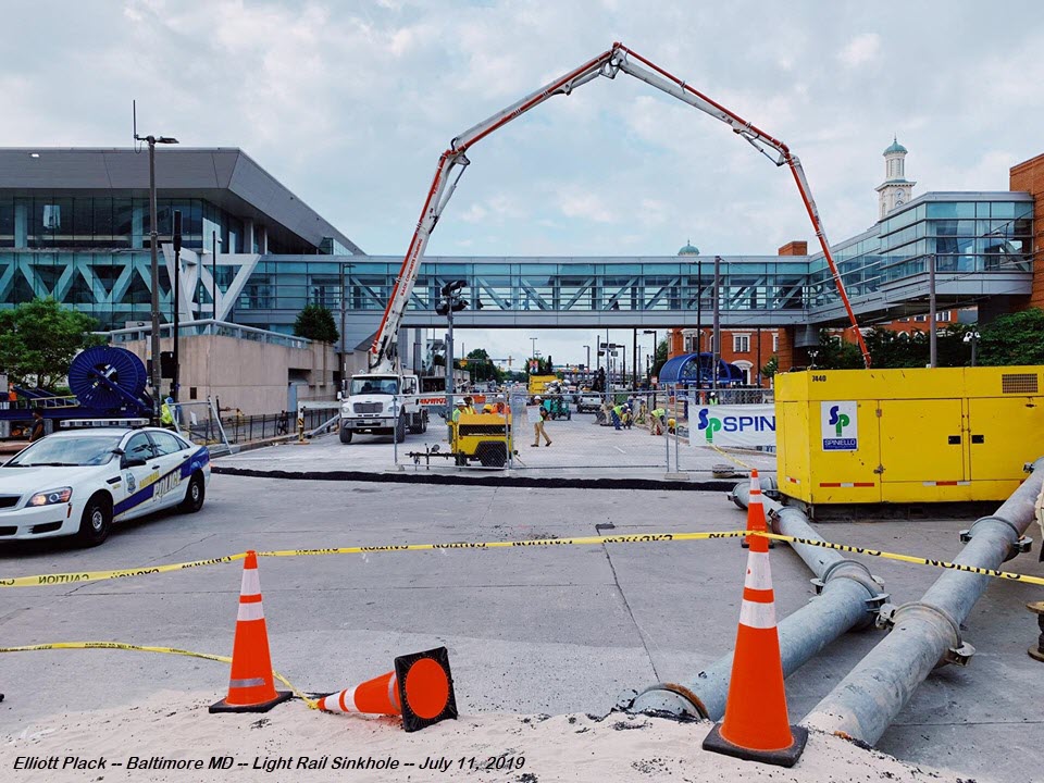
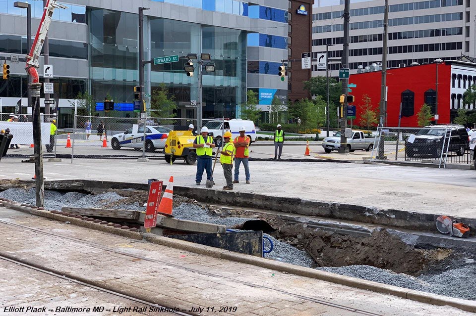
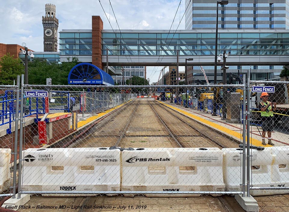
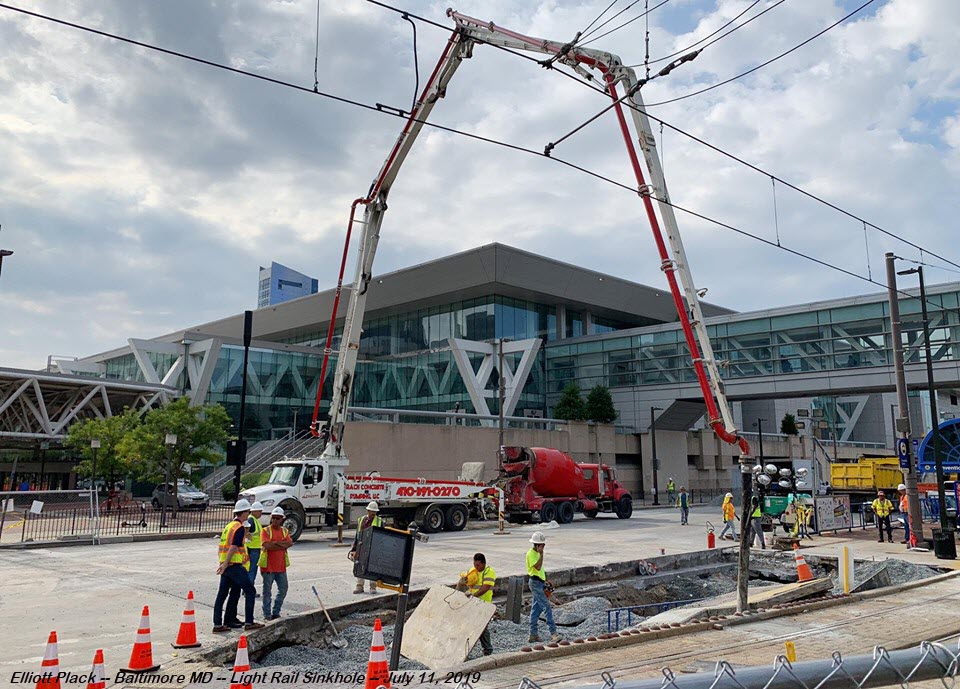
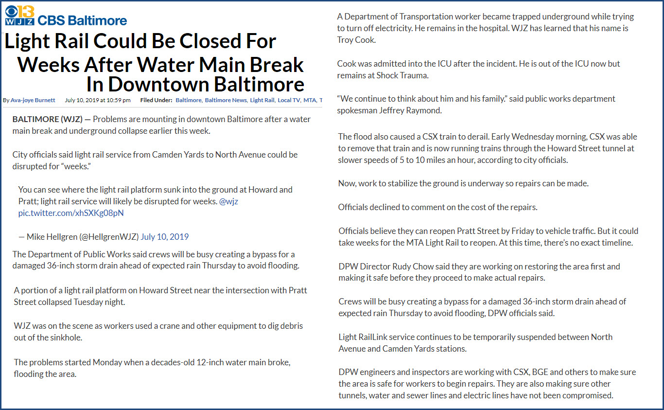
Another sinkhole in Baltimore, of which they seem to be occurring with almost some sort of regularity, but this time, it swallowed part of a light rail platform at the Convention Center stop, so the MTA has suspended operations between North Avenue and Camden Station. I guess the suspended operations also includes the Penn Station shuttle since it comes off the main line at Mt Royal, and trains aren't going there for now.
To make matters worse, it happened about the same time as a CSX train derailment in the tunnel below the light rail, which runs under Howard Street. It seems like we (Baltimore) can't get a break from these mishaps! The last of which was CSX's derailment in March, where a number of cars derailed off the North Avenue bridge, and came down on the Streetcar Museum's power substation, putting the museum out of operation until last week when they ran their first car to the end of the line since the mishap.
This couldn't have happened in a worse place or at a worse time. Thursday started a baseball series at Oriole Park, a block away, and of course people depend on the light rail to get to the game. Pratt St, which runs east-west, is a major thoroughfare thru the downtown area. And I-395, which comes in from I-95, dumps you off on Howard Street, which is what 395 turns into when it reaches Conway Street - cars coming into town via 395 now have to take a right at Conway Street, or go around via MLK Blvd.
I had to laugh when I saw this question on the MTA's FB info page..... Obviously clueless as to how long it takes to fix and repair things!

Acknowledgements:
Elliott Plack
Channel 11 WBAL
Channel 13 WJZ
Baltimore Sunpapers
Websites and other additional information sources of interest for the area:
https://www.facebook.com/groups/baltimoretransit/
It's in the center of downtown Baltimore at Howard and Pratt Streets, so it is easy to get to via I-395 from the south and I-95, or from the north via I-83 and almost any of the exits like Maryland Avenue, and taking it down to Lombard Street and going to the right, or west.
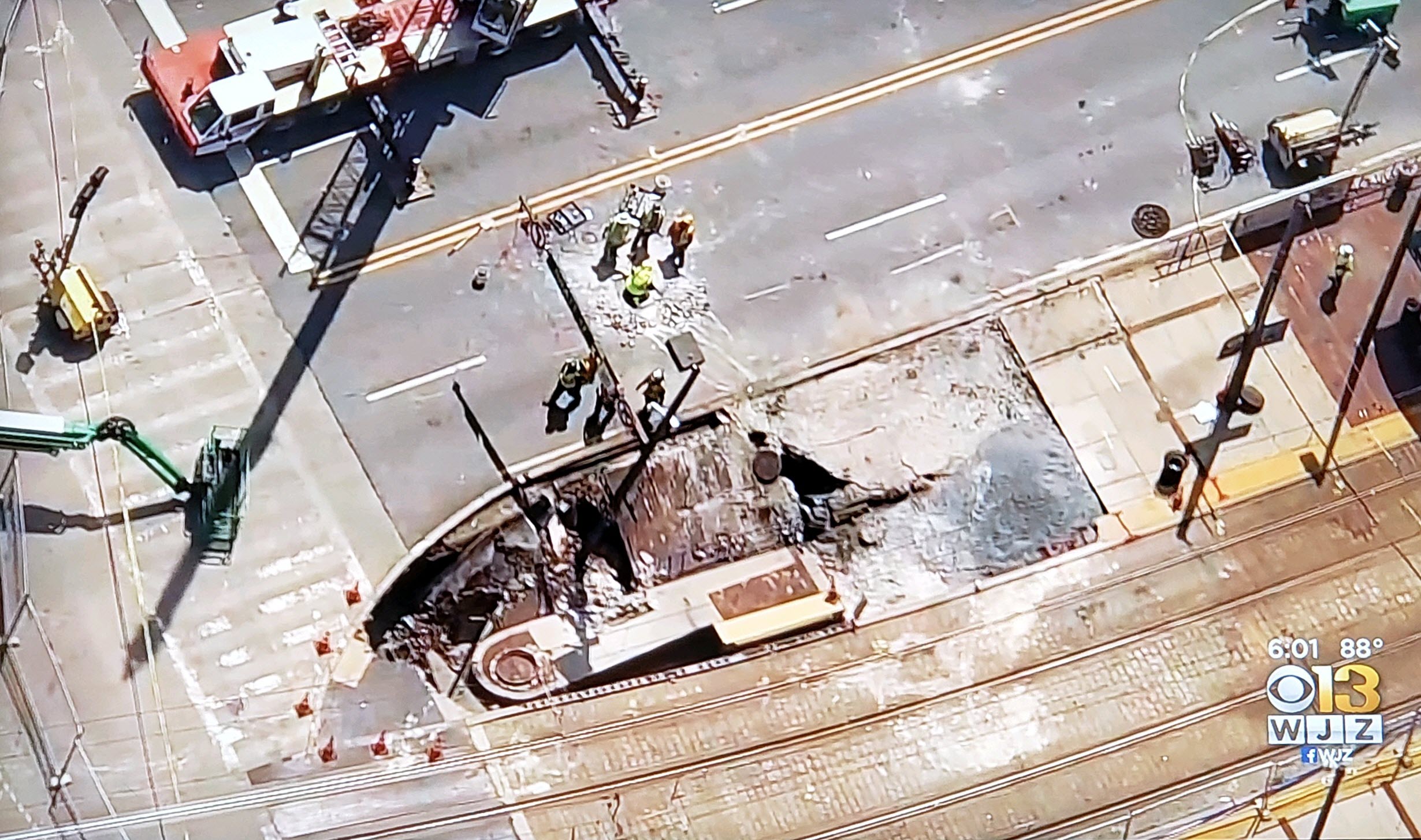
Below, they closed off more of Howard Street to put in temporary pumps in anticipation of the severe rain that hit on Thursday evening, July 11th, 2019.
Disclaimers:
I love trains, and I love signals. I am not an expert. My webpages reflect what I find on the topic of the page. This is something I have fun with while trying to help others.
Please Note: Since the main focus of my two websites is railroad signals, the railfan guides are oriented towards the signal fan being able to locate them. For those of you into the modeling aspect of our hobby, my indexa page has a list of almost everything railroad oriented I can think of to provide you with at least a few pictures to help you detail your pike.
If this is a railfan page, every effort has been made to make sure that the information contained on this map and in this railfan guide is correct. Once in a while, an error may creep in :-)
My philosophy: Pictures and maps are worth a thousand words, especially for railfanning. Text descriptions only get you so far, especially if you get lost or disoriented. Take along good maps.... a GPS is OK to get somewhere, but maps are still better if you get lost! I belong to AAA, which allows you to get local maps for free when you visit the local branches. ADC puts out a nice series of county maps for the Washington DC area, but their state maps do not have the railroads on them. If you can find em, I like the National Geographic map book of the U.S..... good, clear, and concise graphics, and they do a really good job of showing you where tourist type attractions are, although they too lack the railroads. Other notes about specific areas will show up on that page if known.
Aerial shots were taken from either Google or Bing Maps as noted. Screen captures are made with Snagit, a Techsmith product... a great tool if you have never used it!
By the way, floobydust is a term I picked up 30-40 years ago from a National Semiconductor data book, and means miscellaneous and/or other stuff.
Pictures and additional information is always needed if anyone feels inclined to take 'em, send 'em, and share 'em, or if you have something to add or correct.... credit is always given! Please be NICE!!! Contact info is here
Beware: If used as a source, ANYTHING from Wikipedia must be treated as being possibly being inaccurate, wrong, or not true.
RAILFAN GUIDES HOME
RAILROAD SIGNALS HOME
Last Modified 12-Jul-2019