Data:
GPS Coordinates: as needed
Phone A/C: 410
ZIP: 21043
Access by train/transit:
None
The Scoop:
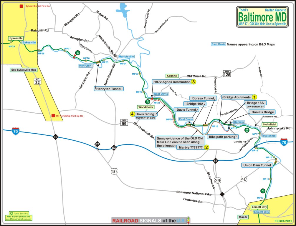
The map below continues our tour of the Baltimore area to the far west of the city, starting
at Ellicott City where MAP 6 ends coverage, continuing westward to Sykesville.
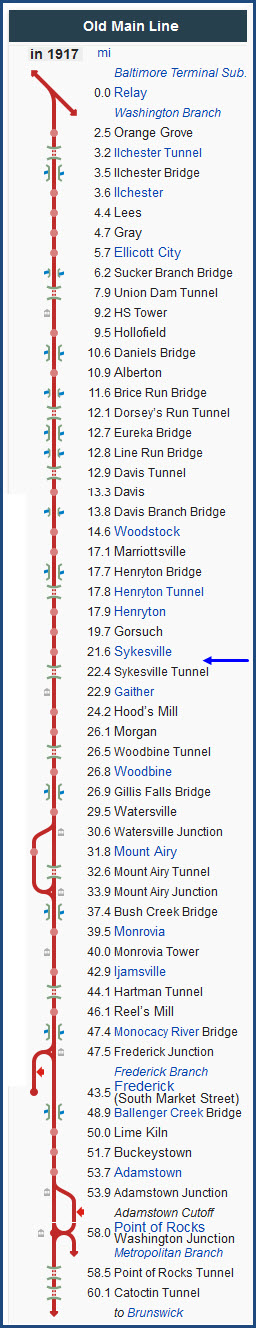
Most of the track along the Old Main Line is
inaccessible except at crossings, unless you are willing to do some hiking.
If you are not in good physical shape, please don't attempt to wander into the
hills! :-) One of the few places you can photograph
the line is from across the river from the bike and walk path starting at Davis
Road and going west. Along this path, you are also traversing part of the
original Old Main Line.
One of the other things the Old Main Line has to it's credit (not in this
section of it however), according to the B&O and a sign they posed along Rt
40 back in the 1960's or 70's, is that this section of track
was the first main line application of ribbon rail. I will have to see if
I can find my picture of the sign. It was around the Mt Airey area on the
(then) Route 40.
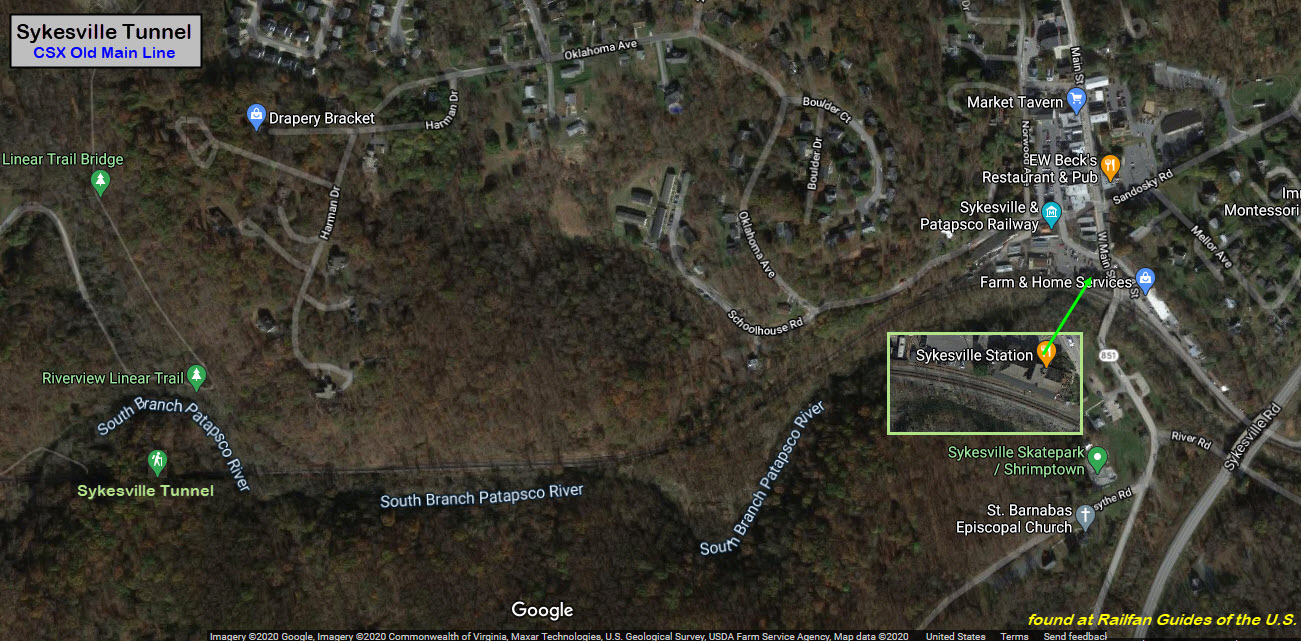
Since Google last came thru Sykesville in 2019,
it looks like the B&O depot turned restaurant: the Baldwin
Station, has been renamed "the Sykesville Station".
Acknowledgements:
Steve Okonski
David Larrabee
Wikipedia
Bing Maps
Google Maps
Depending on where you are coming from, and where you want to go,
there are a number of ways to get to the locations on this map.
For the western side of the map, the Sykesville area, use I-70 exit 80, and head
north on Rt 32 approx 3.8 miles. Just before you cross the tracks and
river in Sykesville, make a left turn onto MD 851, which turns into Main Street
in Sykesville. This will take you to the tracks and the B&O depot (now a restaurant).
For Marriottsville Road, there are two ways to get there, depending on
whether you are going eastbound or westbound on I-70. if you're heading
away from Baltimore, westbound, take exit 83 and go north about 3.5 miles to the tracks.
There is plenty of parking here.
If you are traveling eastbound on I-70, YOU NEED TO TAKE exit 82 for US Route 40
eastbound. Go about 8/10 of a mile, and take a left onto Marriottsville
Rd. You'll cross the tracks in about 4.0 miles.
For the Woodstock Road grade crossing, follow the directions for Marriottsville
Road, but only go about 4/5 of a mile to MD 99 / Old Frederick Rd, and take a
right. Woodstock Road is about 3/4 mile on your left.
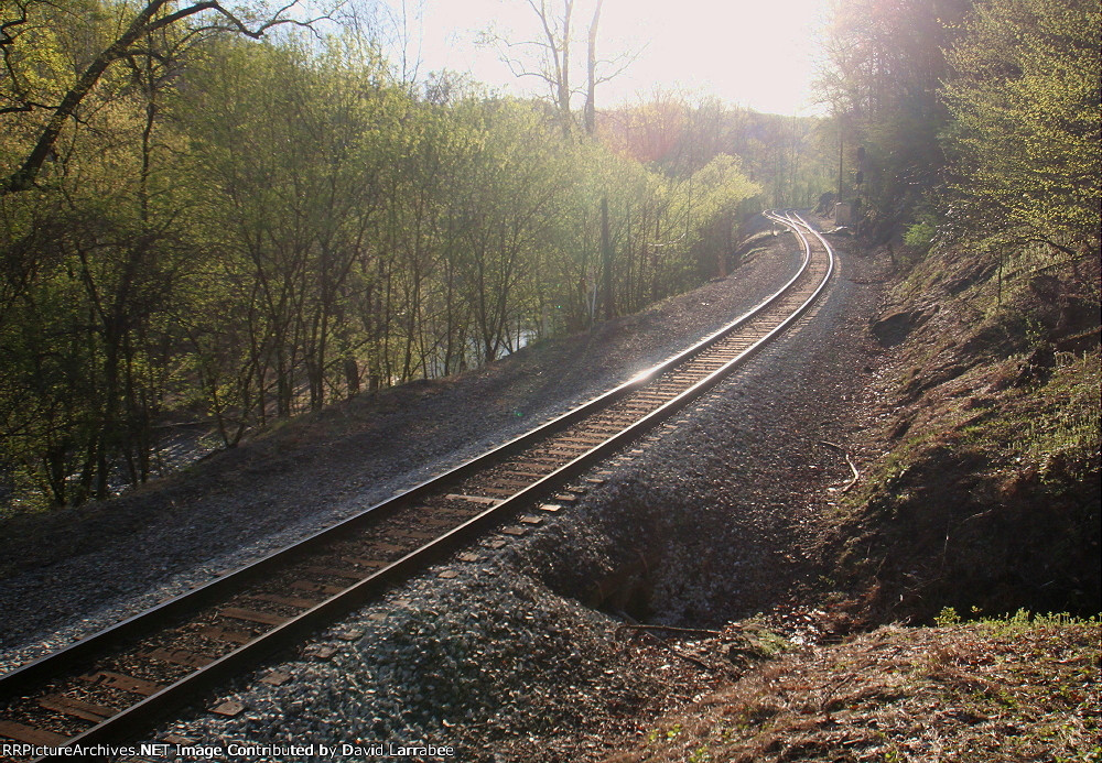
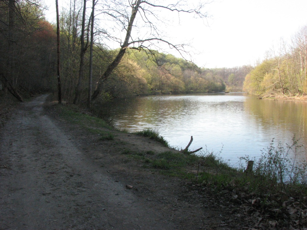
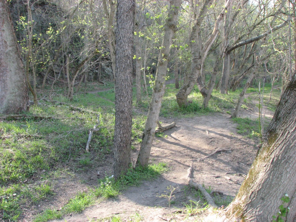
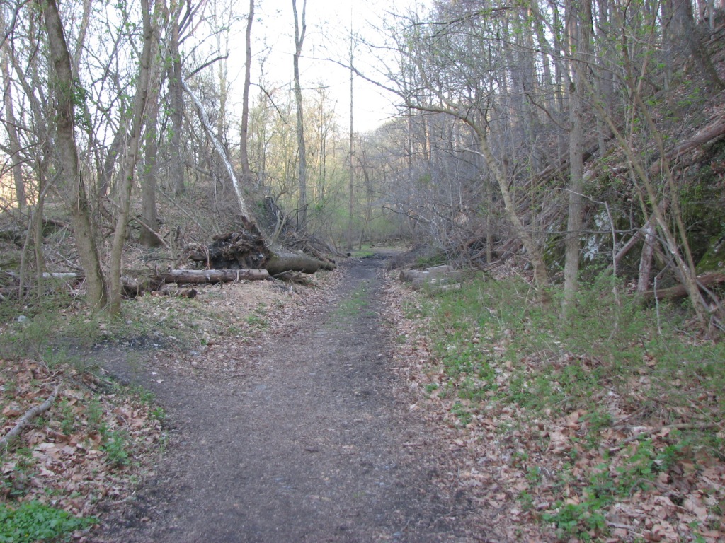
The Old Main Line crossed the Patapsco River
here, and followed the southern bank of the river, to the point where (now)
Davis Siding starts. The bike path also officially ends at this point,
altho many will cross the tracks and continue west to Old Court Rd via a very
steep climb over an outcropping (probably the reason the RR choose to cross the
river).
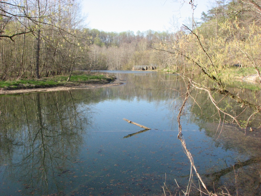
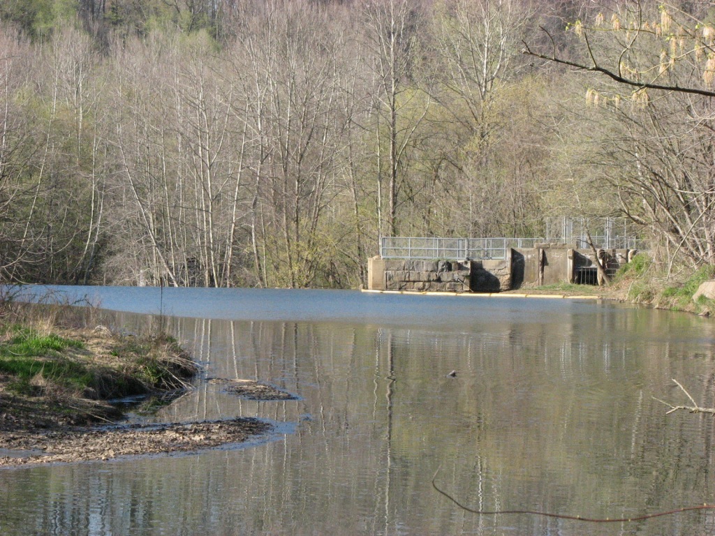
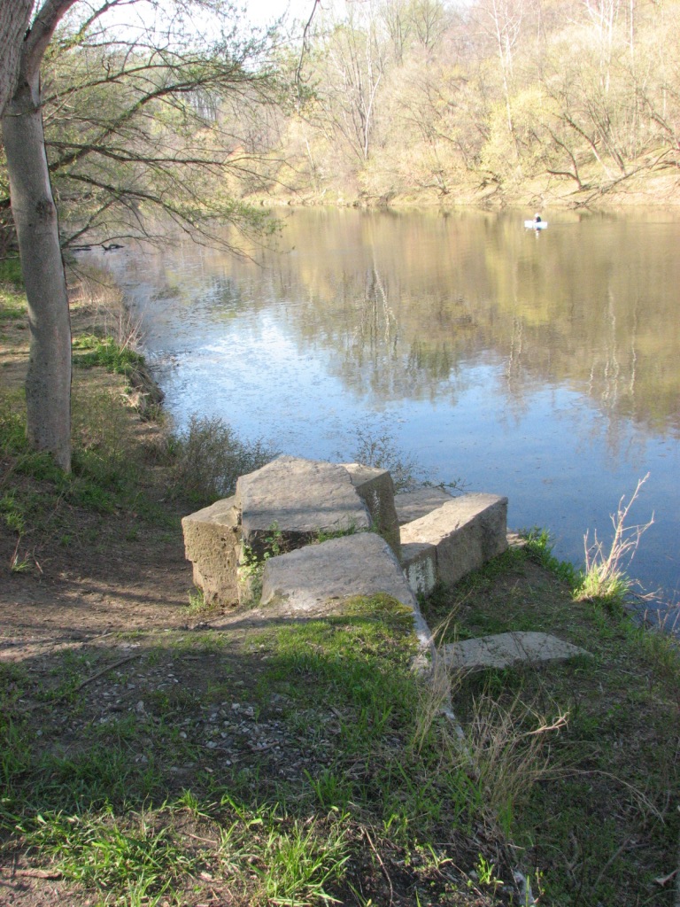
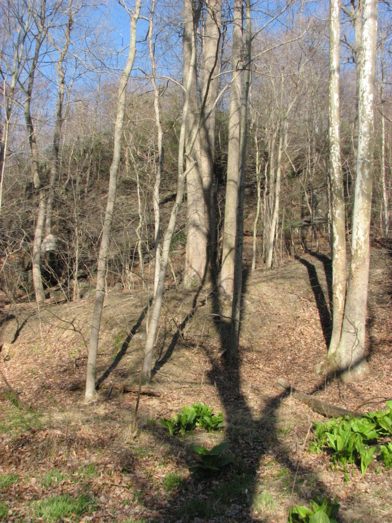
After you start walking on the bike path and round the first
bend, you get a great view of both up and down stream. The two pictures
above are looking downstream towards a small dam.
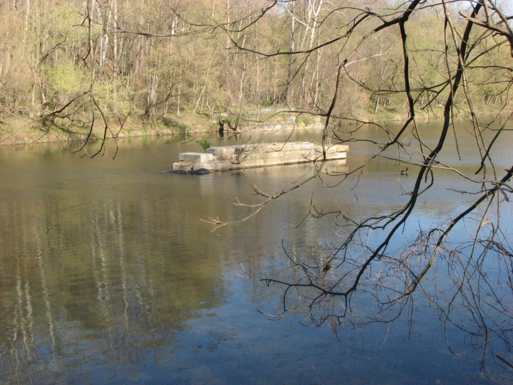
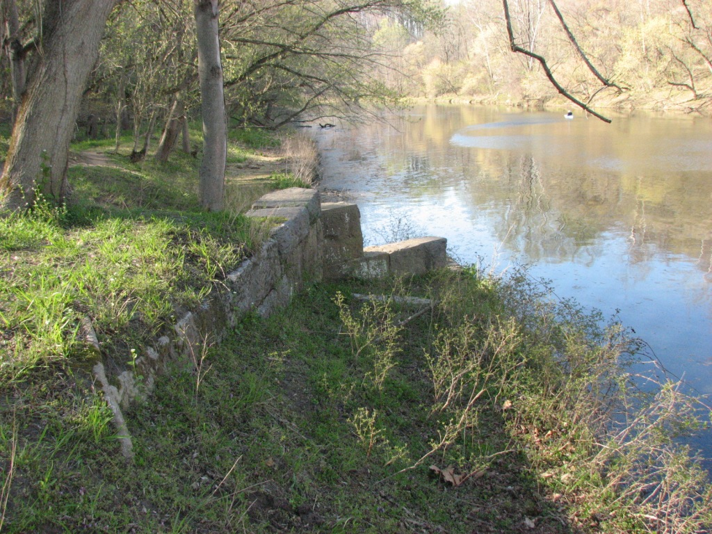
The two pictures below were taken from the same spot looking
upstream. You can see the stone abutments from here.
Views of the abutments:
Looking up and down the path from the southern shore abutment.
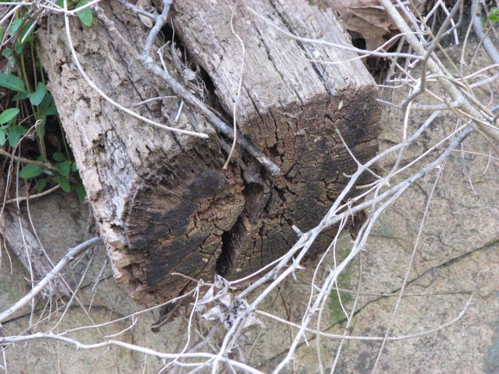
Here and there you can still find a tie or two leftover from when the B&O still ran on the OLD Old Main Line.
OLD Old Main Line Marble Leftovers
These are old marble stringers (ties) leftover from the very first track laid down in the 1830's
on the original alignment thru the Patapsco Valley. Much more
great information can be found on Steve's page here.
The marble stringers may have been used as late as 1846 in some places, but
generally saw replacement come as early as (around) 1836/1838.
Take time to enjoy the scenery if you come here, it's fabulous!
If there was ever a section of railroading in the U.S. that is defined by the
bridges and tunnels trains have to traverse, the Old Main Line has to be the "poster boy"
for it.
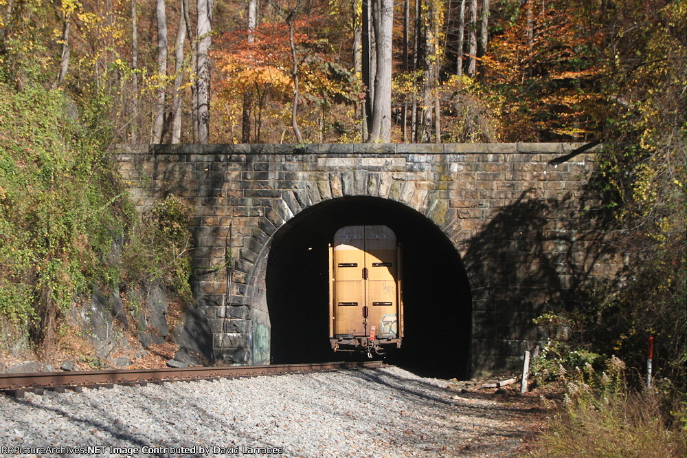
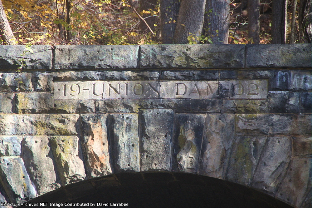
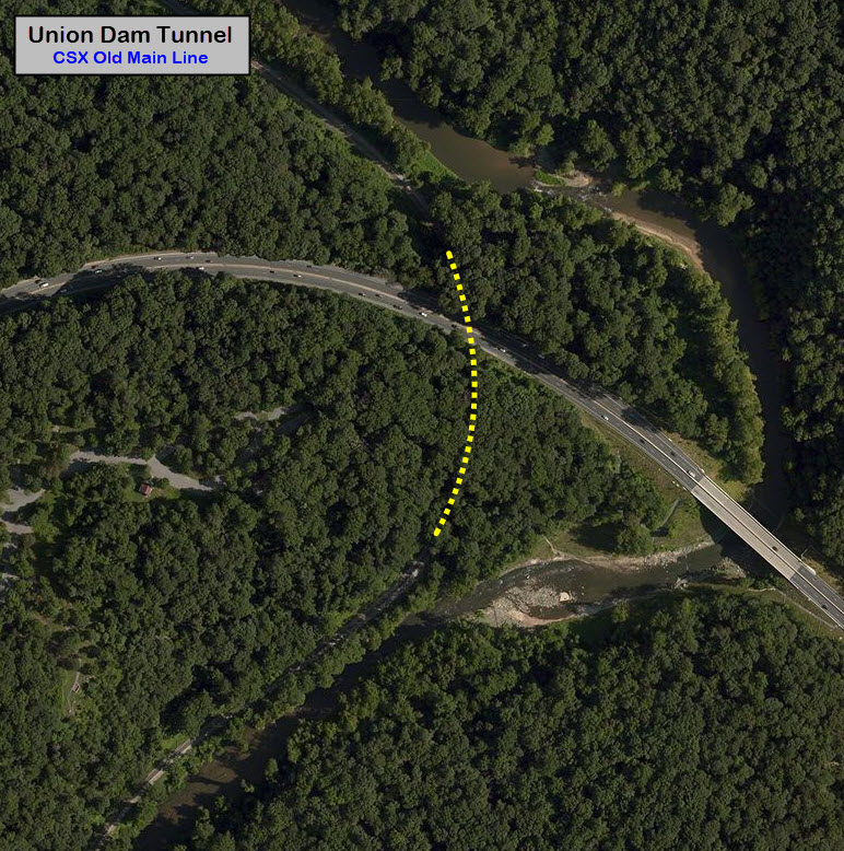
Union Dam Tunnel
GPS Coordinates: 39.296332, -76.781095 (under Rt 40)
This tunnel takes the R-O-W under US Route 40, in the Catonsville area of Baltimore County.
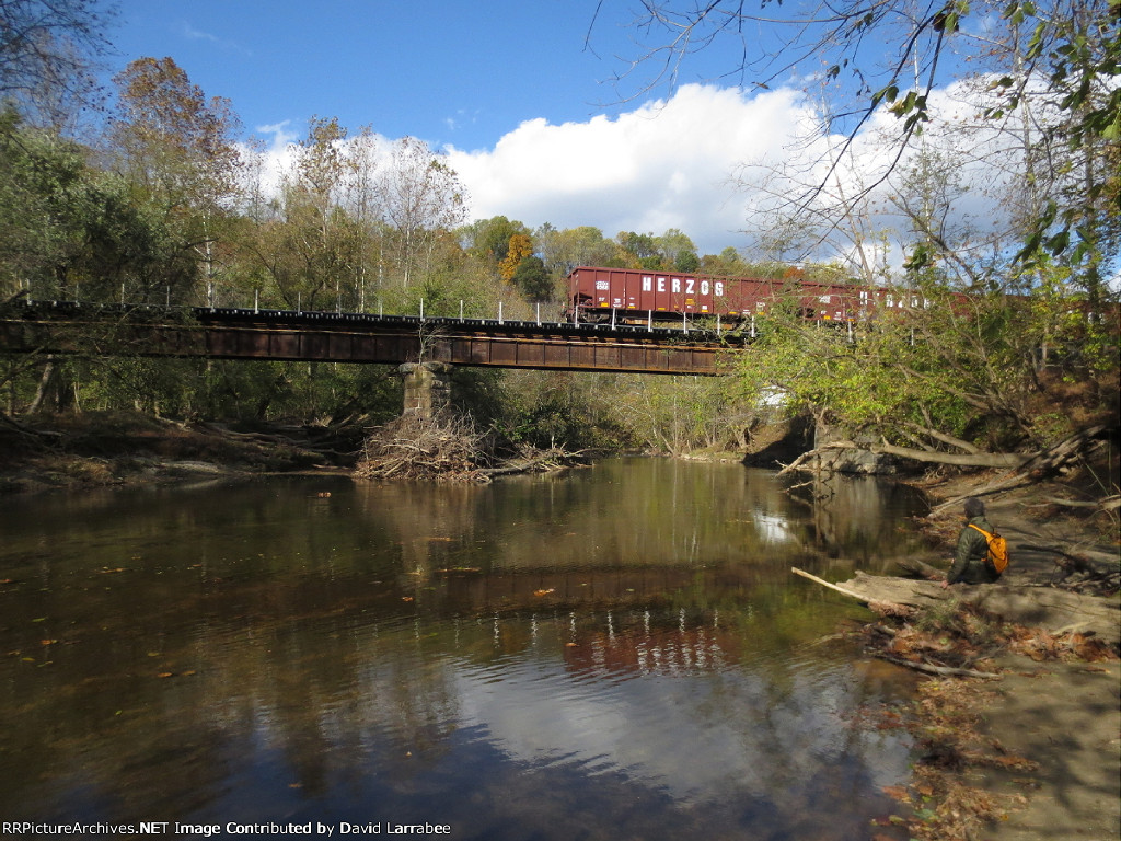
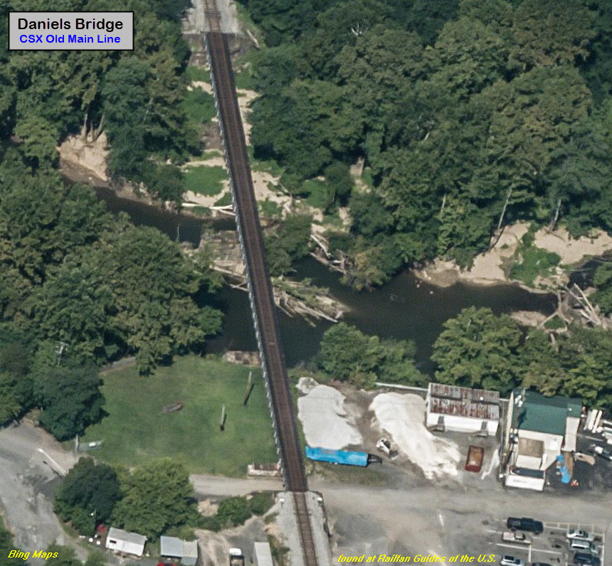
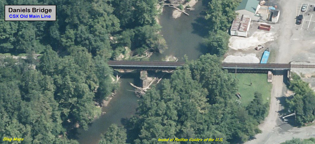
Daniels Bridge
GPS Coordinates: 39.316624, -76.815345
Bridge 18a/Brice Run Bridge
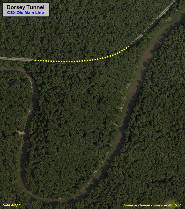
Dorsey Tunnel
GPS Coordinates: 39.316698, -76.831011 (east portal)
One of the longer tunnels at about 1000 feet (Google Maps measures it at
around 1,143feet).
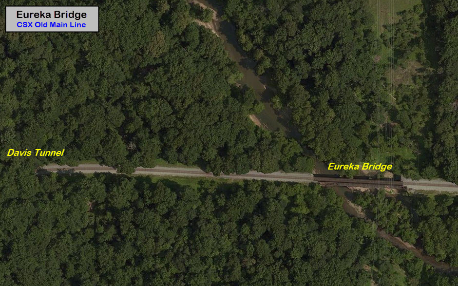
Eureka Bridge
GPS Coordinates: 39.316511, -76.842063
Line Run Bridge
Contrary to the strip map on the Wikipedia page for the Old Main Line, I
do not see another bridge between Eureka Bridge and Davis Tunnel, as the aerial
view from Bing Maps above shows. With that said, David Larrabee has a
picture of a culvert a few hundred feet east of the eastern Davis Tunnel portal.
Maybe this is "the bridge", maybe not.
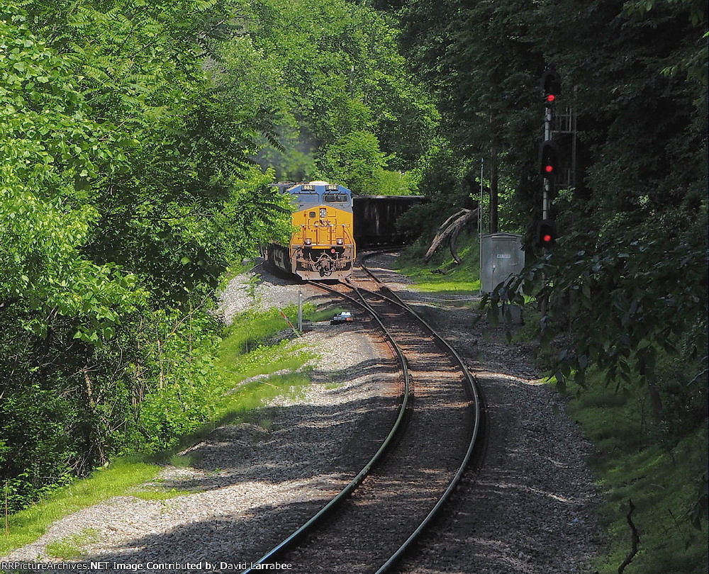
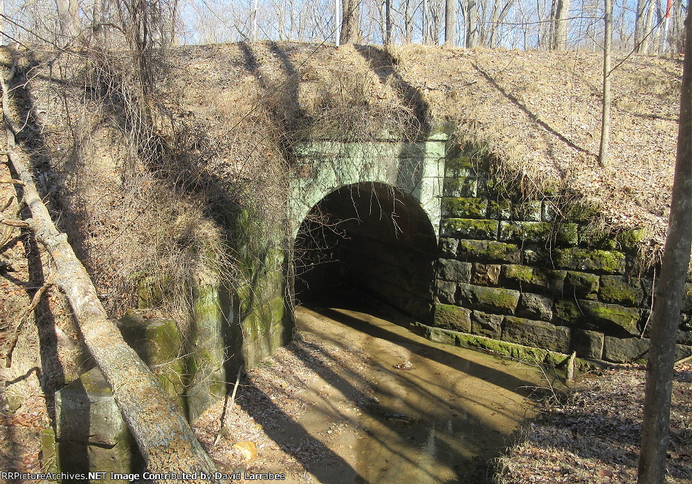
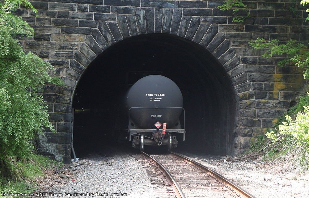
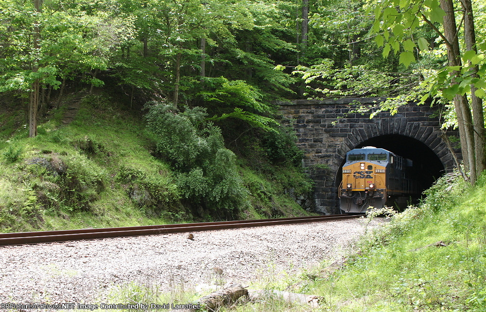
Davis Tunnel
EB coming out of the east portal
east portal
west portal
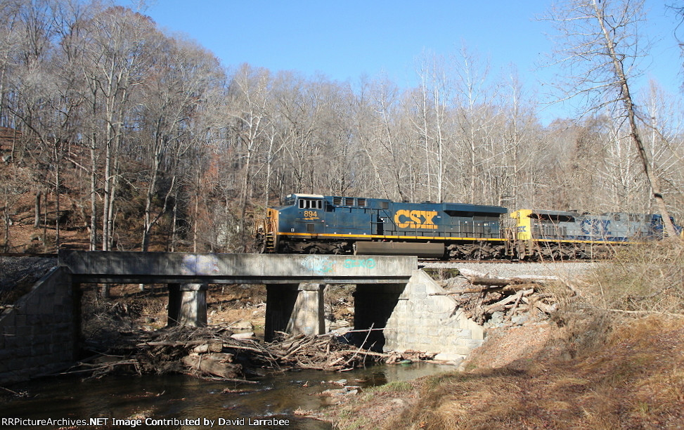
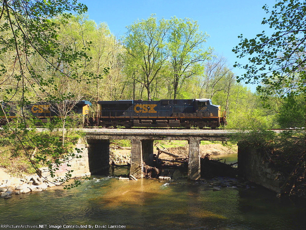
Davis Bridge
Henryton Bridge
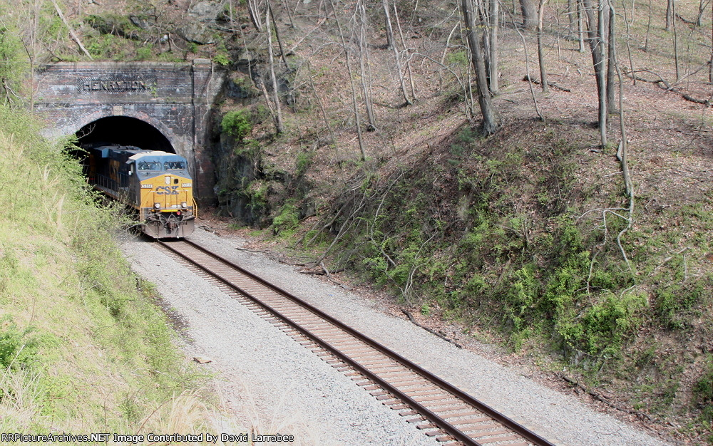
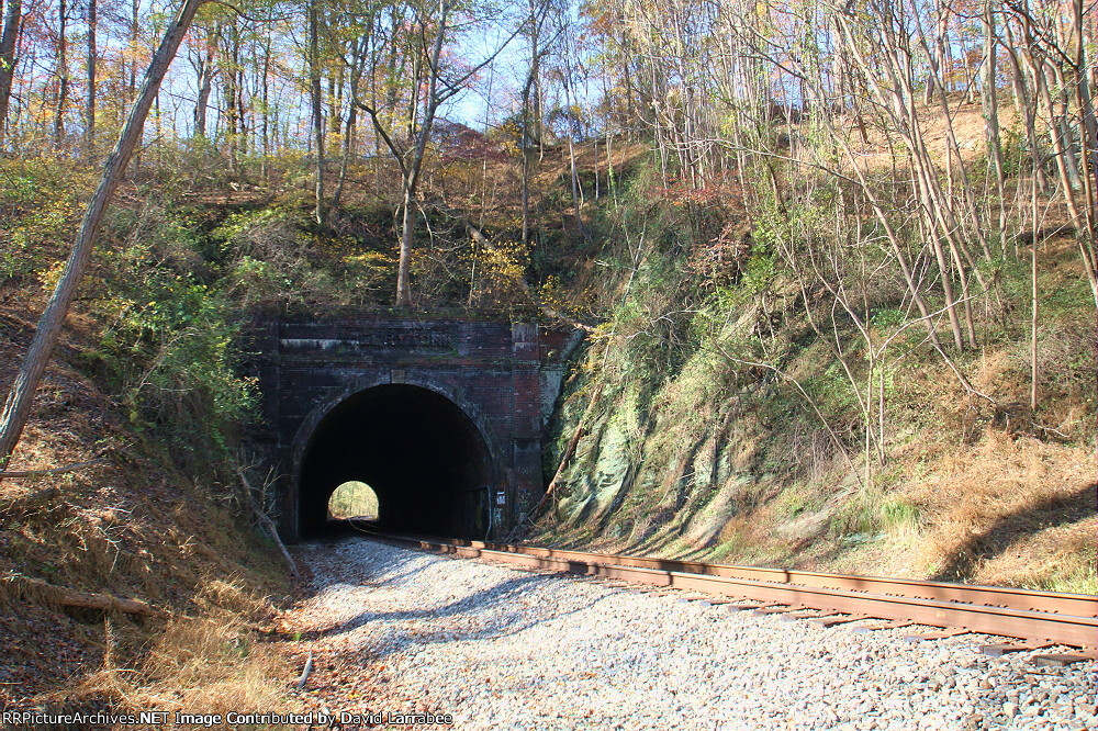
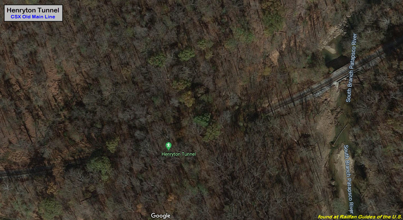
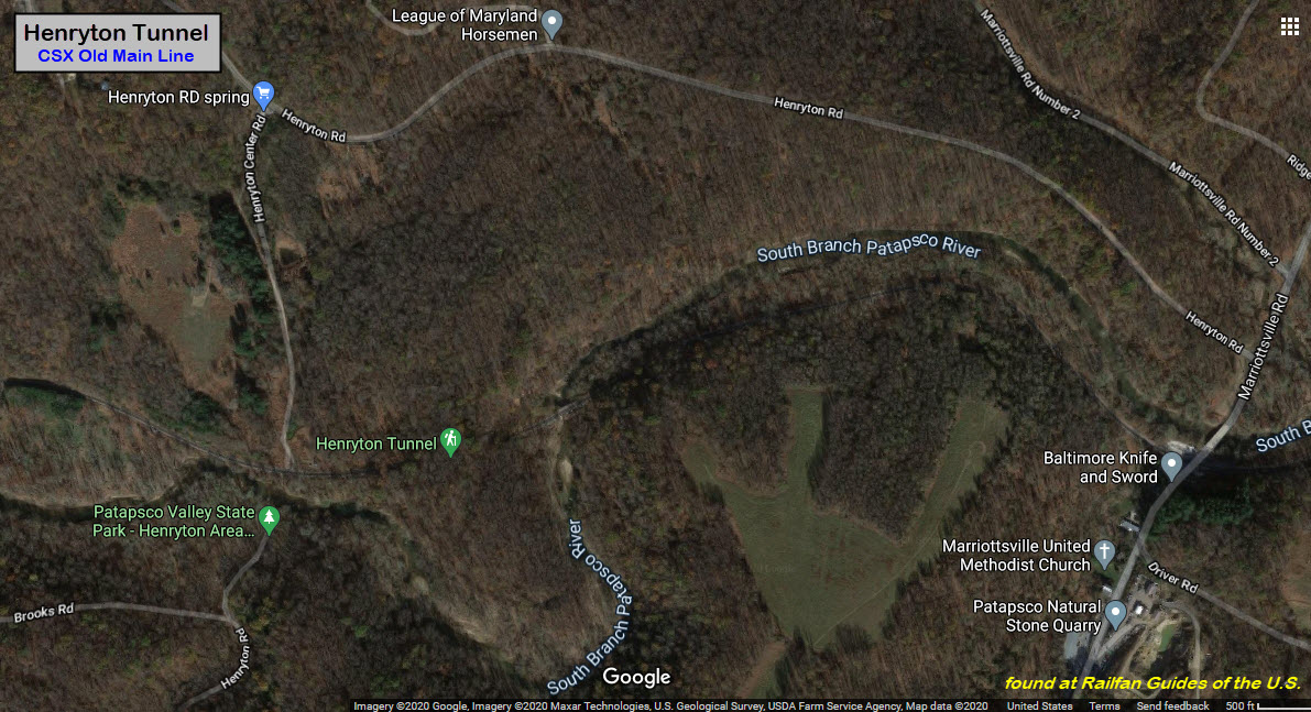
Henryton Tunnel
GPS Coordinates: 39.351812, -76.909950 (eastern portal)
The Henryton bridge (above), is seen at the right hand side of the aerial picture below.
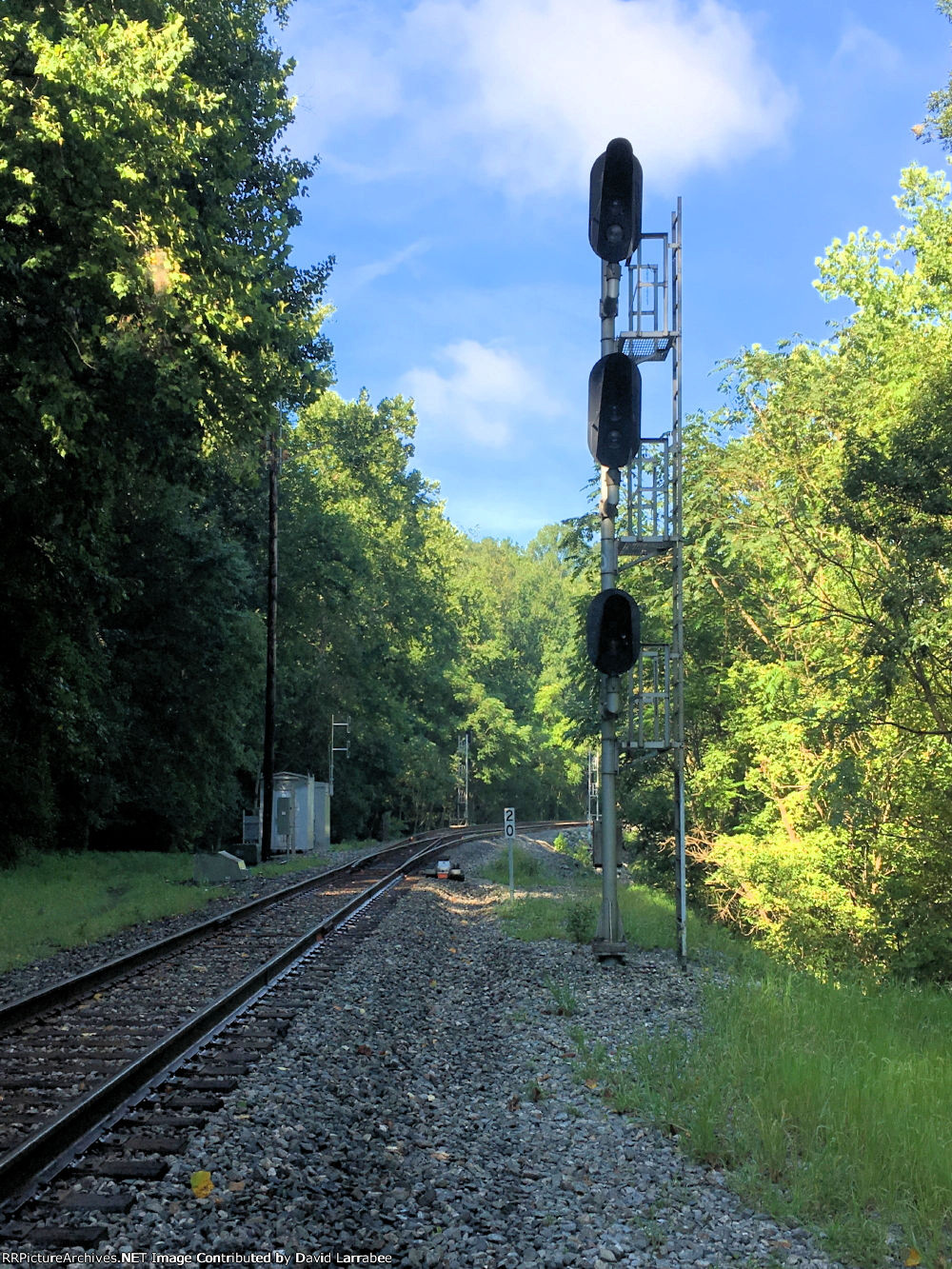
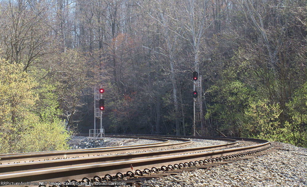
Signals on the Old Main Line were upgraded from the old B&O CPL's to color
light signals in 2005.... so don't be disappointed when you go out to take pictures.
Notice the signals are approach lit.
We have to give David a commendation for hiking in to these remote
locations, AND for having the patience to capture all
of the trains he did on the OML, because trains are not that plentiful.
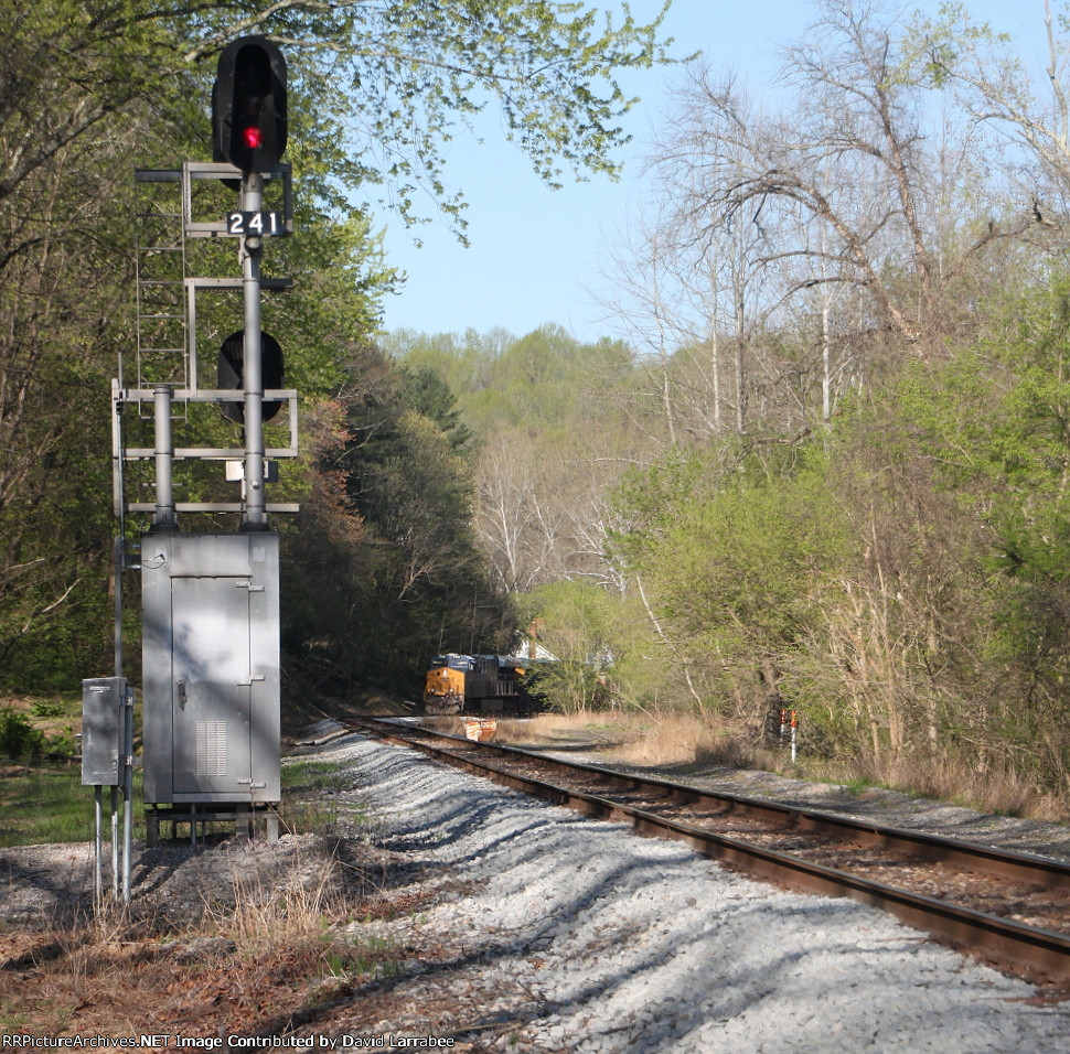
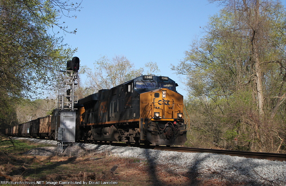
East End Davis Siding
Notice with the EB set of signals, the right ones are much higher than the set
on the left. This is probably because of where the signals are located on
the curve, and if they were mounted at the same level as the signals on the
left, the engineer would not be able to see them over an oncoming (WB) train.
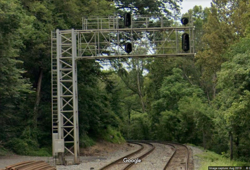
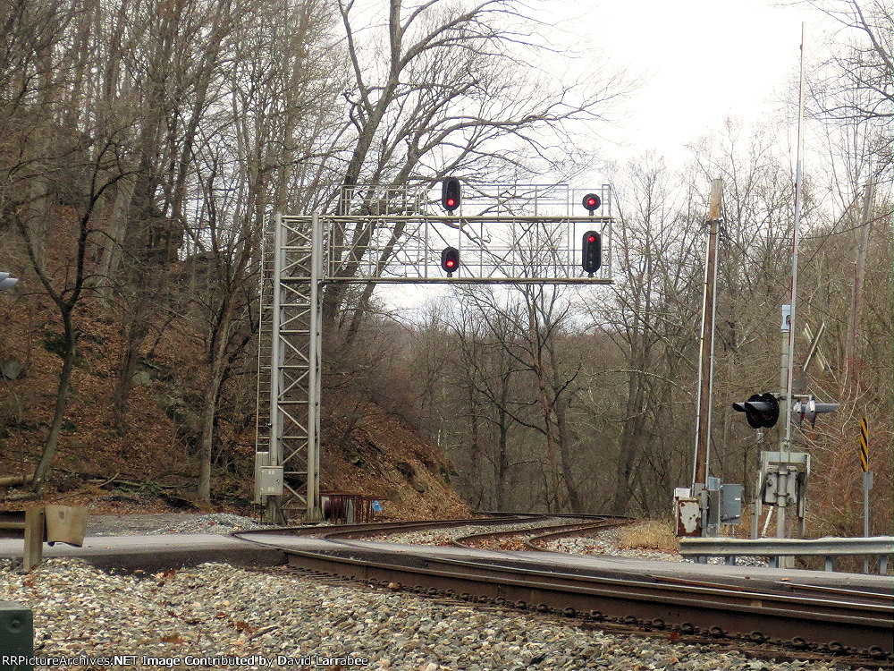
West End Davis Siding
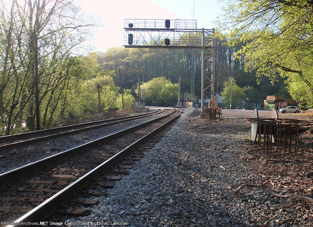
Marriottsville Road
A pair of back to back intermediate signals.
Disclaimers:
I love trains, and I love signals. I am not an expert. My webpages reflect what I find on the topic of the page. This is something I have fun with while
trying to help others.
Please Note: Since the main focus of my two websites is railroad signals, the railfan guides are oriented towards the signal fan being able to locate them.
For those of you into the modeling aspect of our hobby, my
indexa page has a list of almost everything railroad oriented
I can think of to provide you with at least a few pictures to help you detail your pike.
If this is a railfan page, every effort has been made to make sure that the information contained on this map and in this railfan guide is correct. Once in a while,
an error may creep in :-)
My philosophy: Pictures and maps are worth a thousand words, especially for railfanning. Text descriptions only get you so far, especially if you get lost or
disoriented. Take along good maps.... a GPS is OK to get somewhere, but maps are still better if you get lost! I belong to AAA, which allows you to get
local maps for free when you visit the local branches. ADC puts out a nice series of county maps for the Washington DC area, but their state maps do not have the
railroads on them. If you can find em, I like the National Geographic map book of the U.S..... good, clear, and concise graphics, and they do a really good job
of showing you where tourist type attractions are, although they too lack the railroads. Other notes about specific areas will show up on that page if known.
Aerial shots were taken from either Google or Bing Maps as noted. Screen captures are made
with Snagit, a Techsmith product... a great tool if you have never used it!
By the way, floobydust is a term I picked up 30-40 years ago from a National Semiconductor data book, and means miscellaneous
and/or other stuff.
Pictures and additional information is always needed if anyone feels inclined to take 'em, send 'em, and share 'em, or if you have something to add or correct.... credit
is always given! Please be NICE!!! Contact info is here
Beware: If used as a source, ANYTHING from Wikipedia must be treated as being possibly inaccurate, wrong, or not true.


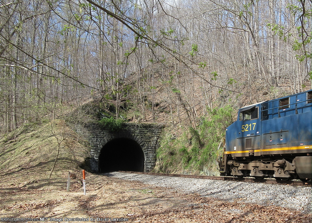
 EB coming out of the east portal
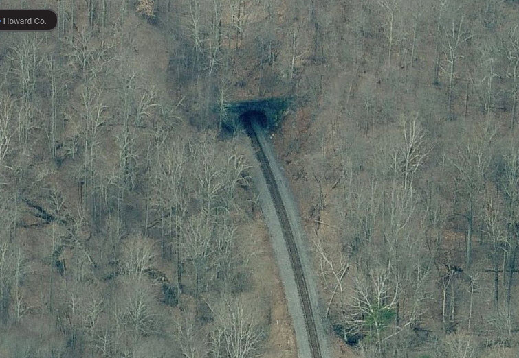 east portal
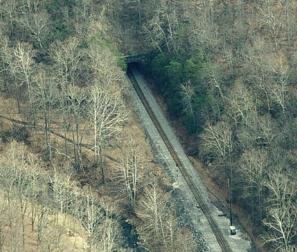 west portal