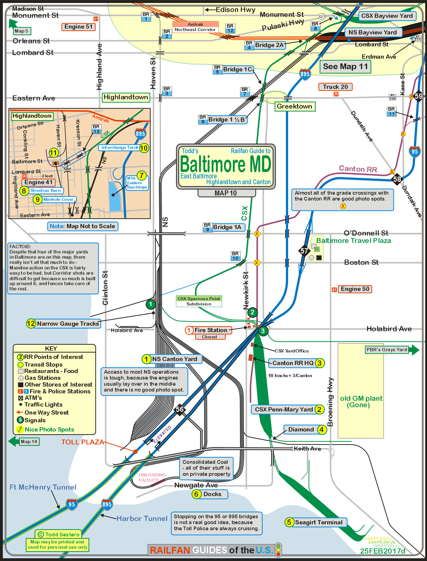
The map below shows part of the eastern side of
Baltimore. This map shows you
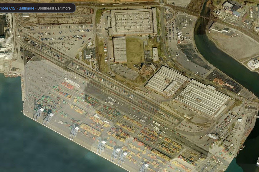
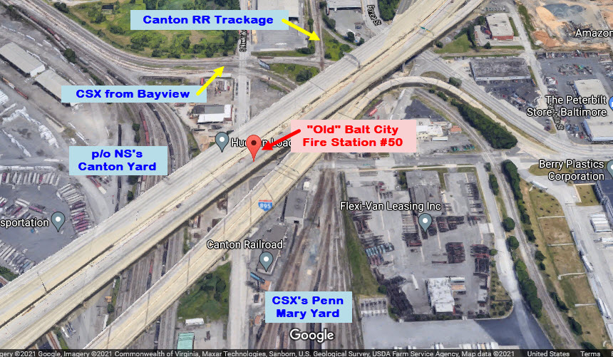
the two Bayview yards, one for CSX and one for the Norfolk Southern in addition
to CSX's Penn-Mary yard and Norfolk Southern's Canton yard. The Bayview
yards are covered on
Map11.
We also look at the numerous bridges the area
has to offer, some historic things in the Highlandtown area and a few signal
installations. There is
no Light Rail or Metro on this map, but we have the state run Canton RR to offer
you.
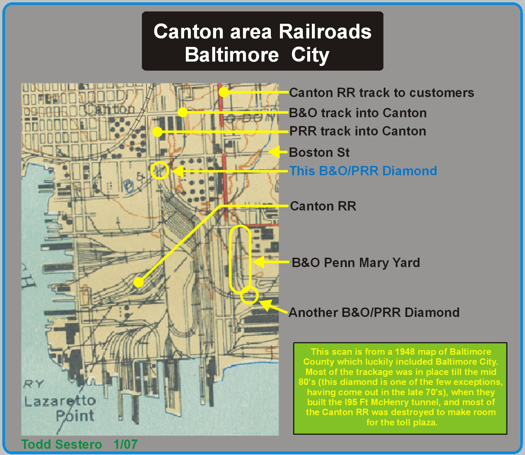
The face of Canton (and Riverside on the other
side of the port) changed drastically when I-95 came through and built the Fort
McHenry tunnel. Lots of land was needed for the toll plaza on the Canton
side, and what was once a huge operation for the Canton RR, became a single
engine affair for a number of years as a lot of their customers went away.
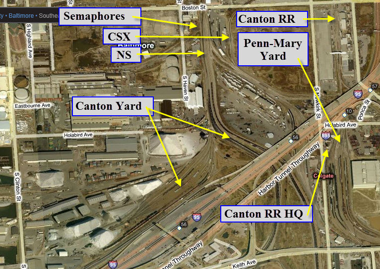
There's not much in the way of signals in the
area except on the two main lines, and at the upper end of Penn Mary yard.
The Canton has a few here and there along their line,
but I don't know why since only one train ever goes out at any time these days.
Note: even though when B&O's tracks go north
and south, the B&O referred to the directions as East (north) and West (south).
I use the north and south terms mostly, only because it is easier to reference
to the maps.
Acknowledgements: Thanks to G. Kolman, Alexander Mitchell, and Michael Watnoski for their help
with this section of the guide.
http://www.fundinguniverse.com/company-histories/asarco-incorporated-history/
Most, if not all of the aerial pictures are
from: http://www.bing.com/maps/, and the
screen captures were taken using Techsmith's Snag-It
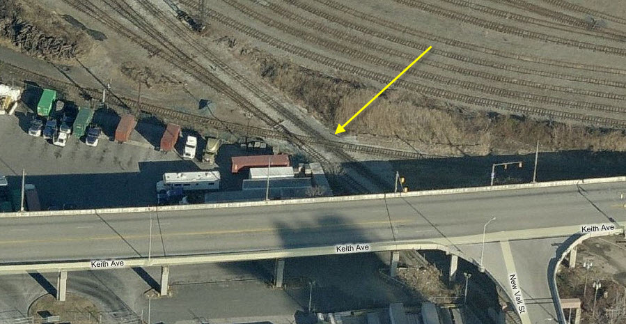
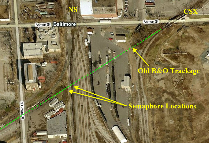
The diamond labeled in blue is where the semaphores shown below used to be located. The diamond
labeled another B&O/PRR diamond, is sight number 4 below.
One of two big yards Norfolk Southern has in Baltimore.
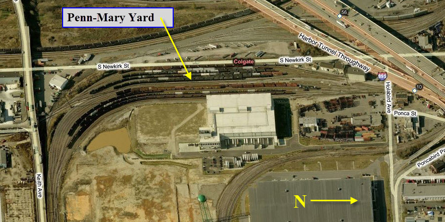
CSX's Penn-Mary Yard
One of many CSX yards in the Baltimore area.
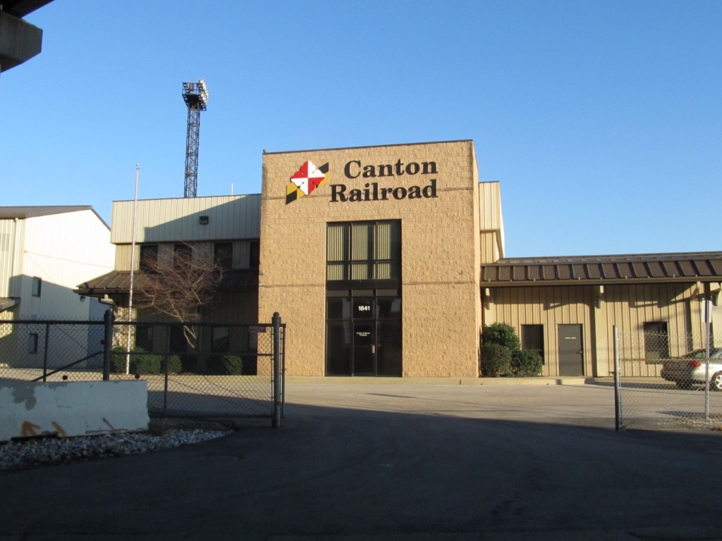
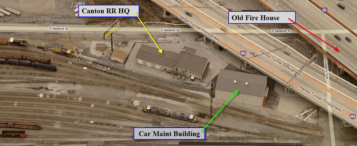
Canton Railroad's Headquarters Building
Diamond
For pictures of the signals here, please check out
this page.
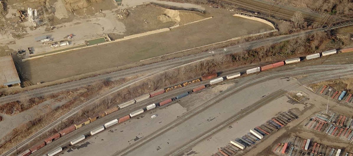
Seagirt Terminal
Docks
Up until the late 90's there used to be a grain silo with train service. The dotted green line shows where the tracks used to be.
The B&O/Pennsy (CSX/NS) Interchange track.
This track comes off the CSX just after crossing "the
first bridge" out of Bayview. I don't know how much it is currently
being used, as Michael points out, it was put in to allow CSX coal trains access
to Consolidated Coal, located at the water front in Canton. The
NS end winds up coming in at the south end of the small intermodal yard.
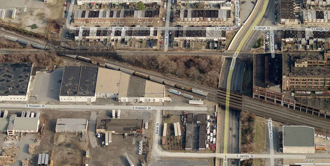
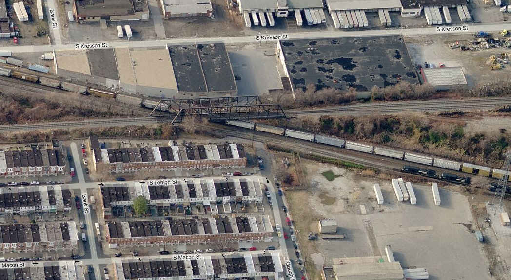
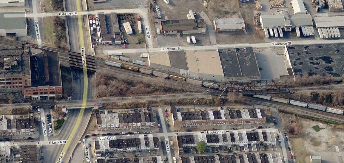
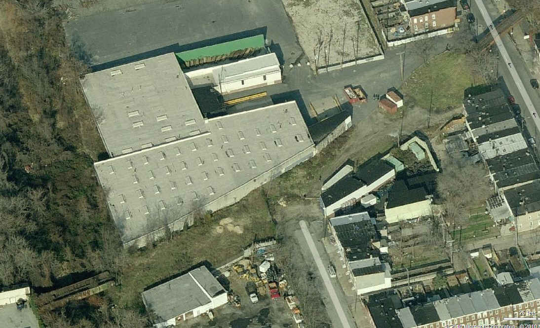
The Pennsy's branch into Highlandtown.
The top picture is a close-up of the former Pennsy tracks into the Eskay plant, and the second picture shows both of the branches.
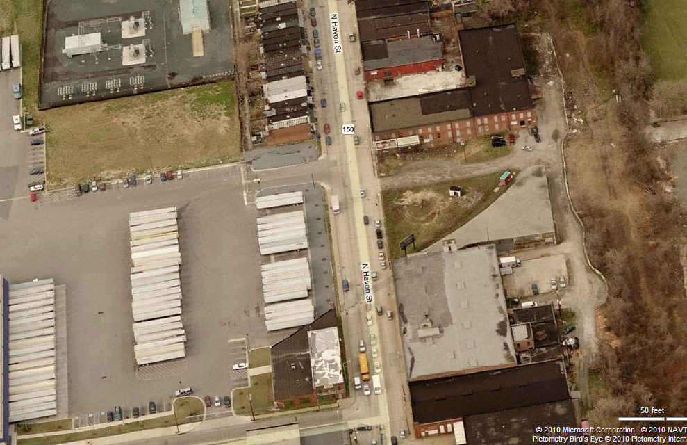
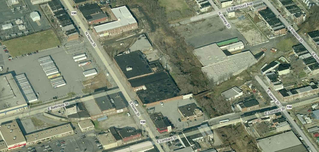
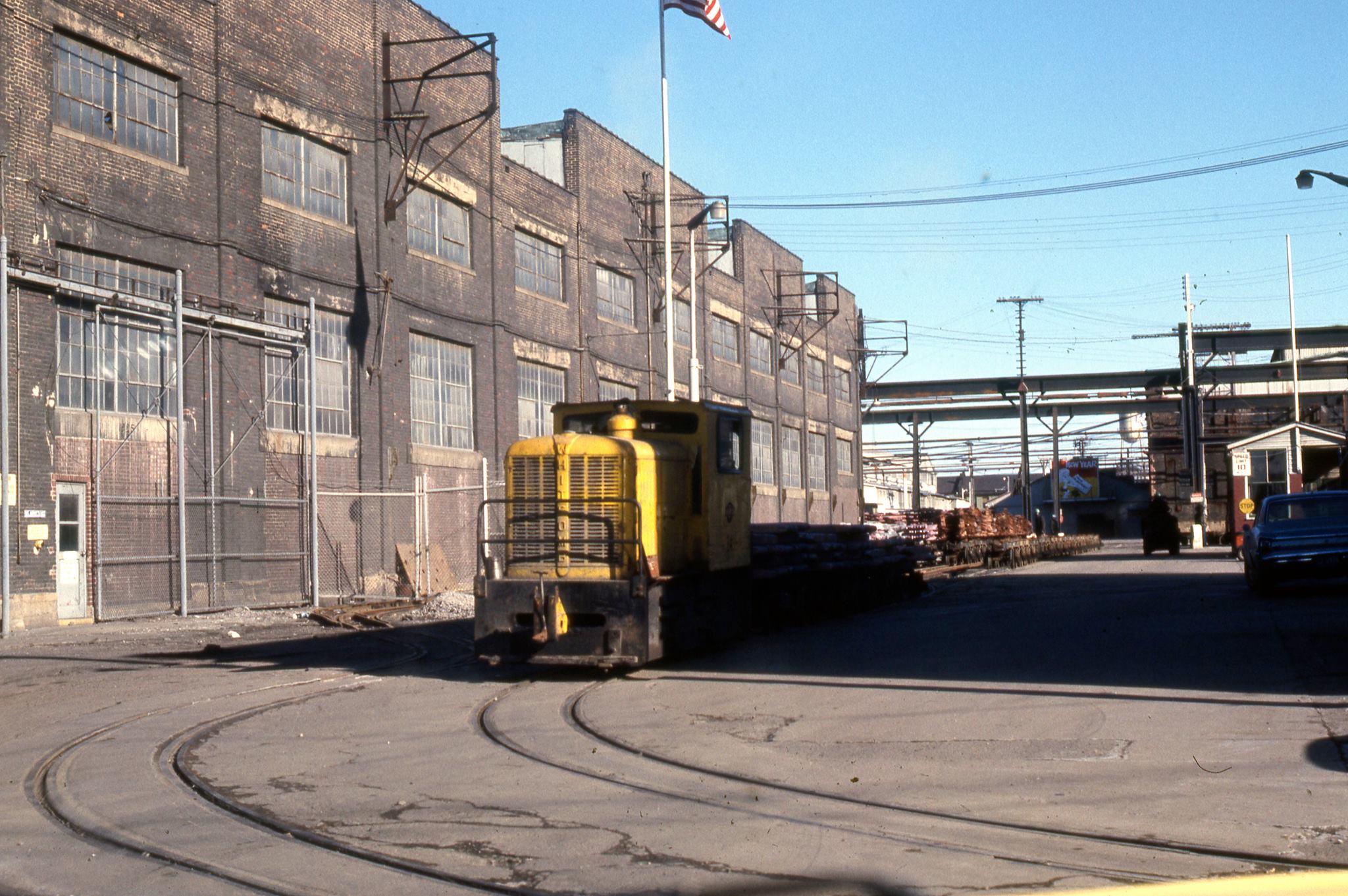
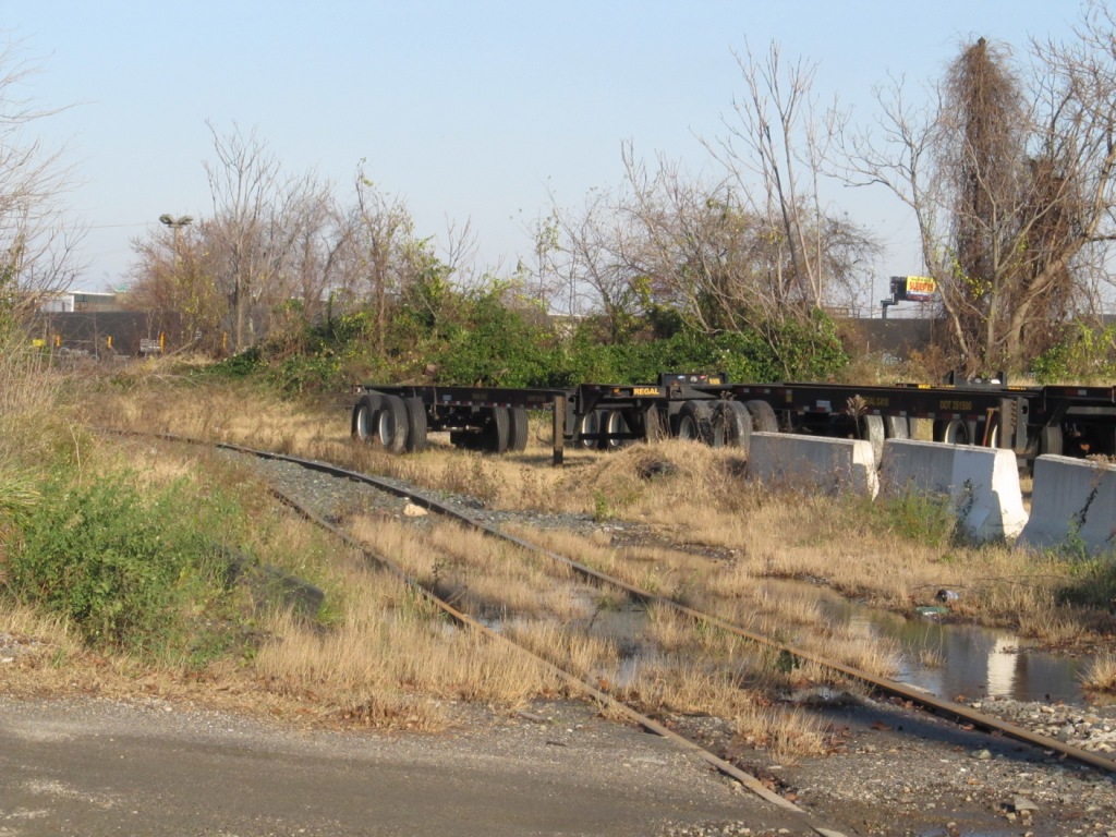
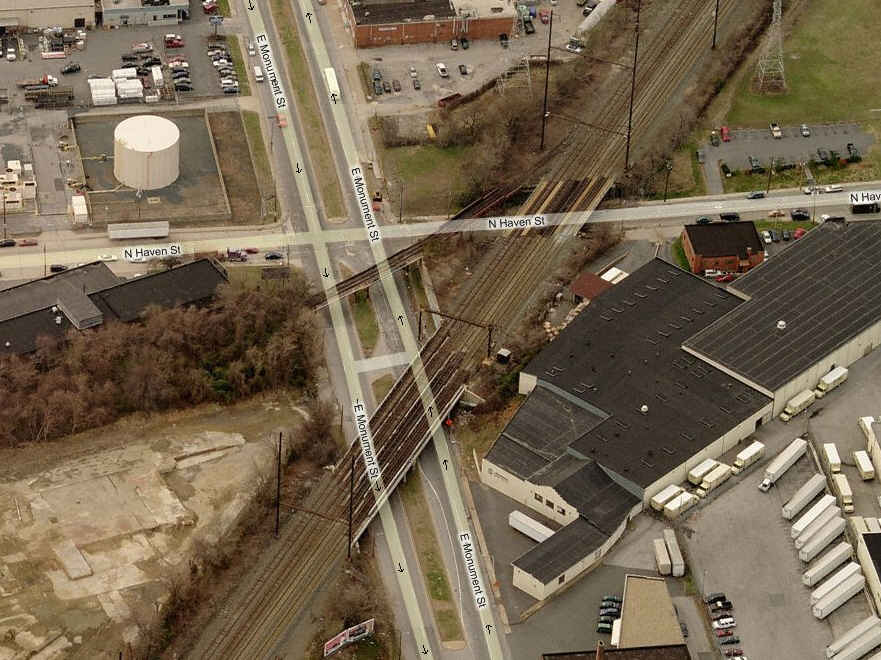
Old Narrow Gauge Tracks.
Up into the mid 70's, there used to be a street running narrow gauge
railroad that operated on the south end of Haven Street. According
to Alexander Mitchell: This was the American Smelting & Refining
Co. (ASARCO) branch in Canton. I don't know when it was discontinued,
but here's a March 1971 photo from the late Lee Rogers, courtesy of the Maryland
Rail Heritage Library at the Baltimore Streetcar Museum. For some
reason, as many times as I have been down Haven St, I never noticed these tracks,
and I used to live only a few blocks away on Fagley Street.
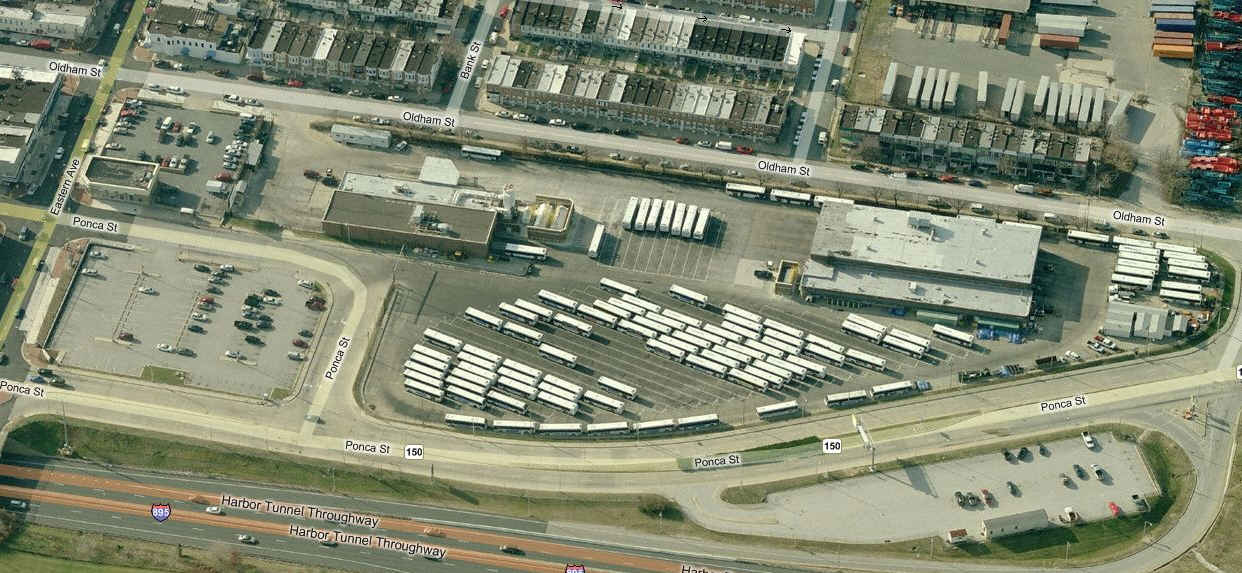
Conveniently located off of Eastern Avenue on the fringe of Greektown, this is
one of four MTA bus yards. Busses from here will have a small "E"
with the number. If you like Greek food, there are many places along
Eastern Ave between here and the "underpass" in Highlandtown.
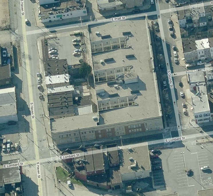
Old Streetcar Barn
This is what remains of the old streetcar barn on the corner of Lombard and Haven.
It is now senior housing.
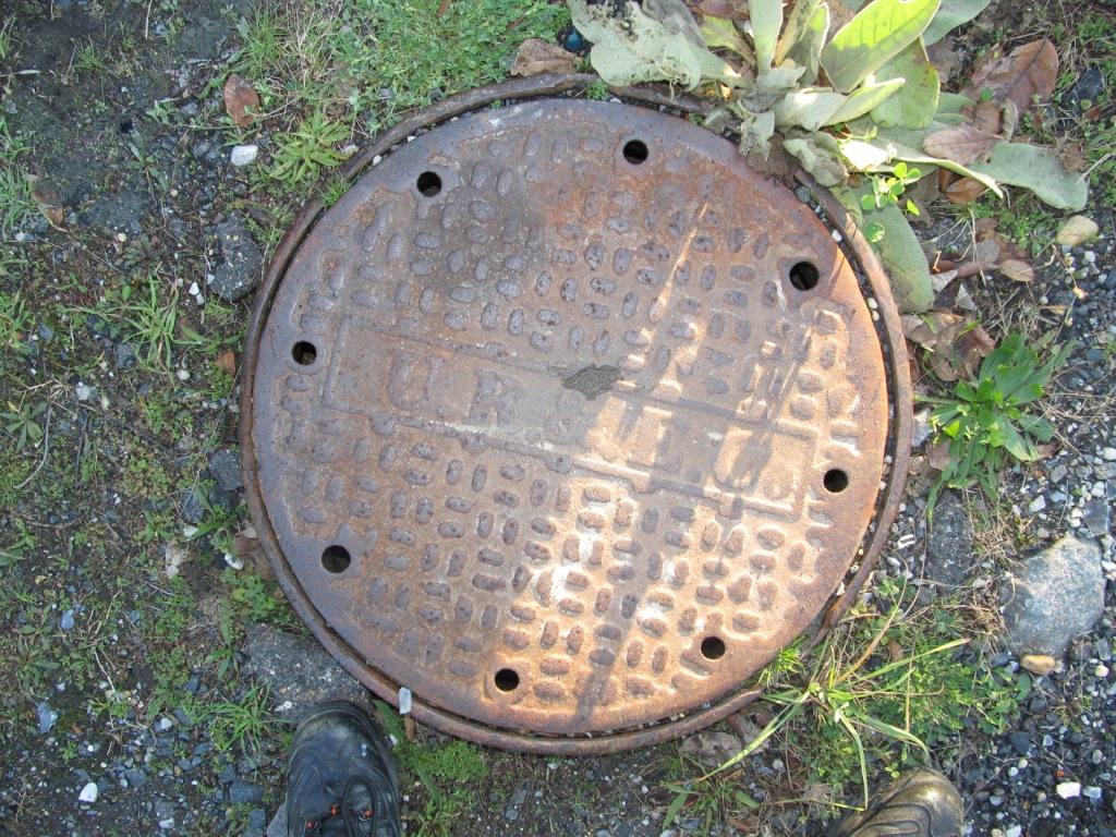
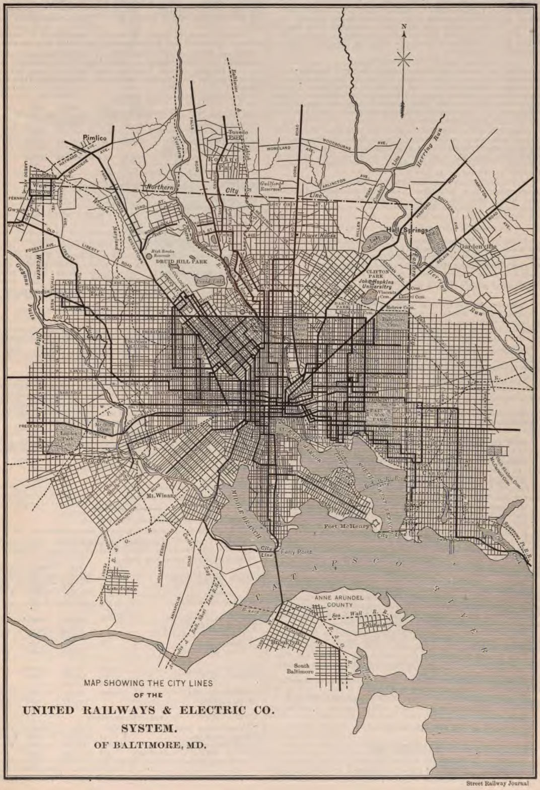
Old Manhole Cover
A manhole cover left over from the bygone days of the United Railway &
Electric Company, who had an extensive streetcar network around Baltimore
in the early days of the 1900's. A map of the UR&E system is below
from 1900, and if you notice, the city limits are not quite as far out
as they are today.
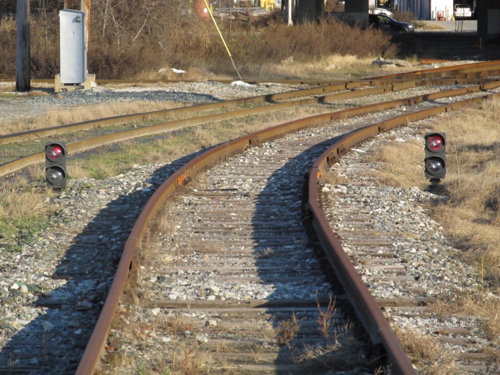
The pictures of the semaphores are from 1972
or thereabouts. The B&O used to cross the Pennsy here, to service docks
where the B&O would unload passenger trains to meet boats. Not sure when
the crossover was removed.... maybe the late 70's? The mast for the signal
in the right picture still remains till today, covered by vines during the
summer which makes it difficult to find. Wish I had taken more pictures! :-(
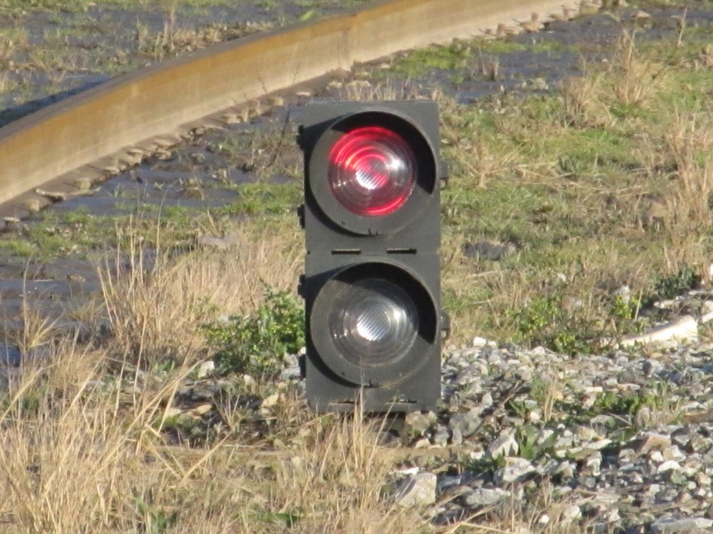
In the upper photo below, where the tracks
curve off to the left, the old B&O tracks would have gone straight. In the
lower picture, you can just barely make out the old semaphore mast covered in
vines, making it impossible to see when they get green.
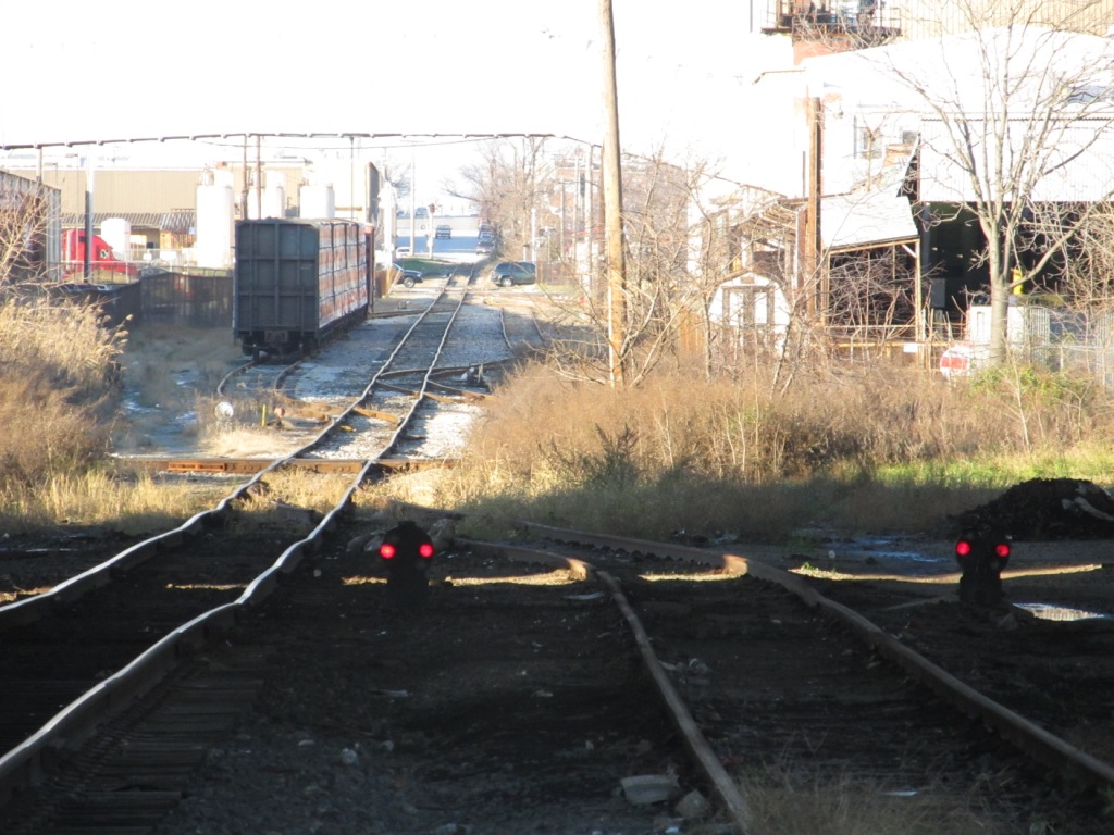
Dwarf Colorlight Signals
As CSX snakes it's way thru what used to be an oil/gas storage field,
and gets ready to cross the Canton RR, these dwarf signals protect
the diamond with the Canton.
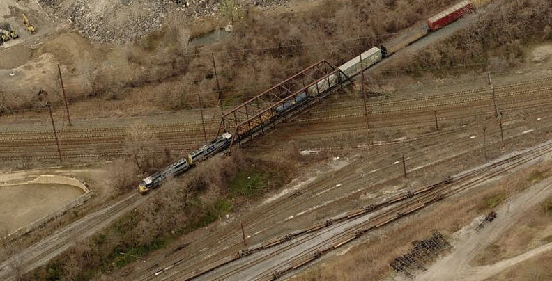
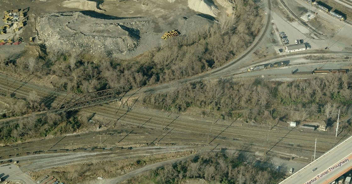
Both the Pennsy and the B&O had a vast number of bridges between the two Bayview Yards and the yards in Canton.
For a more complete coverage of these bridges, please check out my stations and bridge page here:
https://railfanguides.us/stations/md/#Highlandtown1
Where the Pennsy's shortcut to Canton
comes off the mainline, aka, Canton Junction.
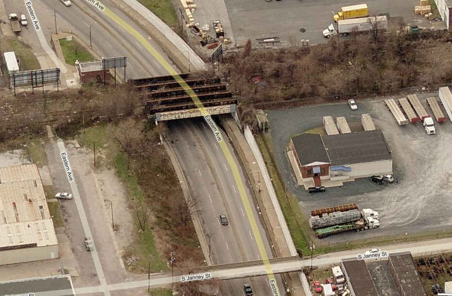
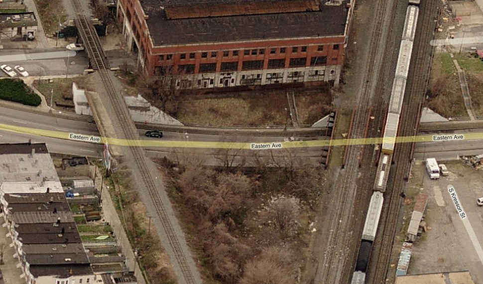
Abandoned PRR Canton branch going over Eastern Avenue
First of two truss bridges on the B&O out of Bayview.
A close-up view of the CSX going over Amtrak's NEC, the first of two trestle's
a freight going from Bayview Yard to Penn Mary yard will go over.
Second of two B&O truss bridges on the way
to Penn Mary, going over the Pennsy.
Bridges over Eastern Avenue
ex B&O bridges into Highlandtown
Coming off the B&O line into Penn Mary yard,
was a line going into Highlandtown. The abandoned bridge on the left goes
over an abandoned line coming off the Pennsy main line that paralleled Haven
Street, joining up with the current Pennsy/NS tracks under Orleans Street, and
then wound up going up Boston Street towards the downtown area.
The end of the short B&O branch into Highlandtown, notice the curved building built to
accommodate the tracks crossing Baltimore Street to the old Esskay Meat processing plant.
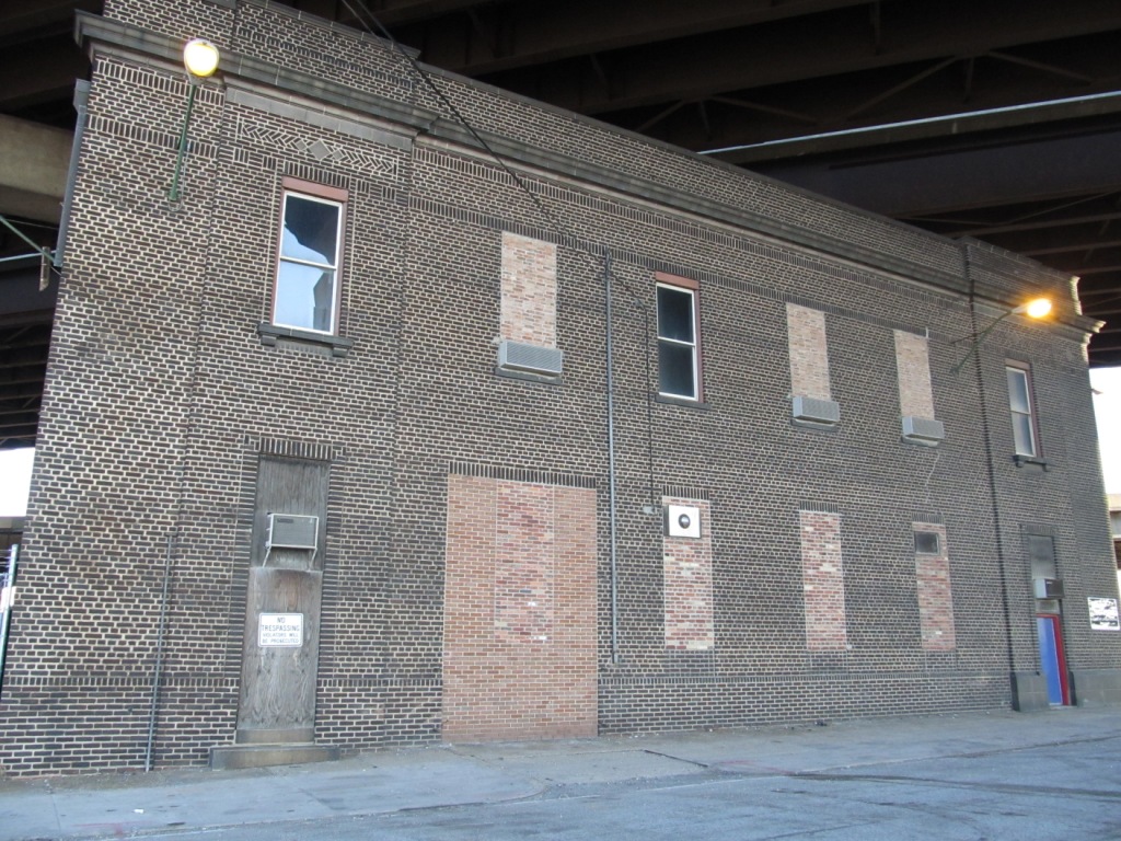
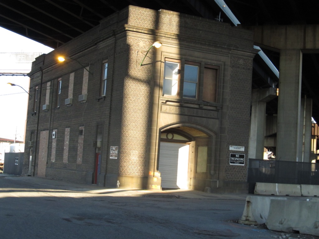
Baltimore City Fire Department - Old Engine 50 Fire House
Hidden away under Interstate 95, is the station house that used to be used for Engine 50.
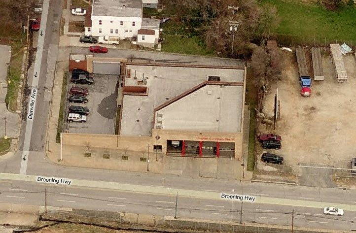
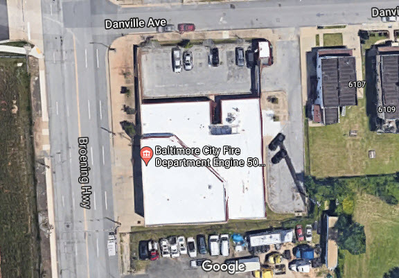
Baltimore City Fire Department - Engine 50
Located at the corner of Broening Highway and Danville Ave
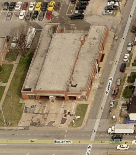
Baltimore City Fire Department - Truck 20
Located at Eastern Ave and Anglesea St
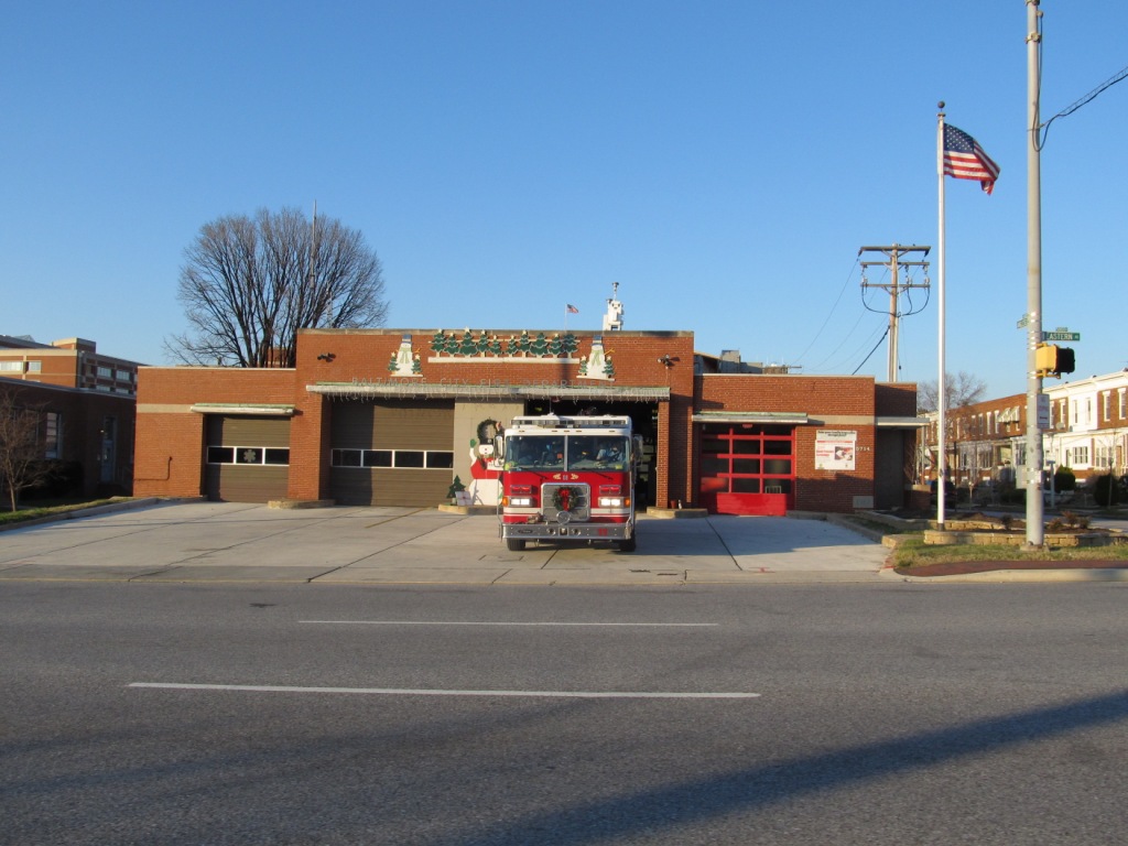
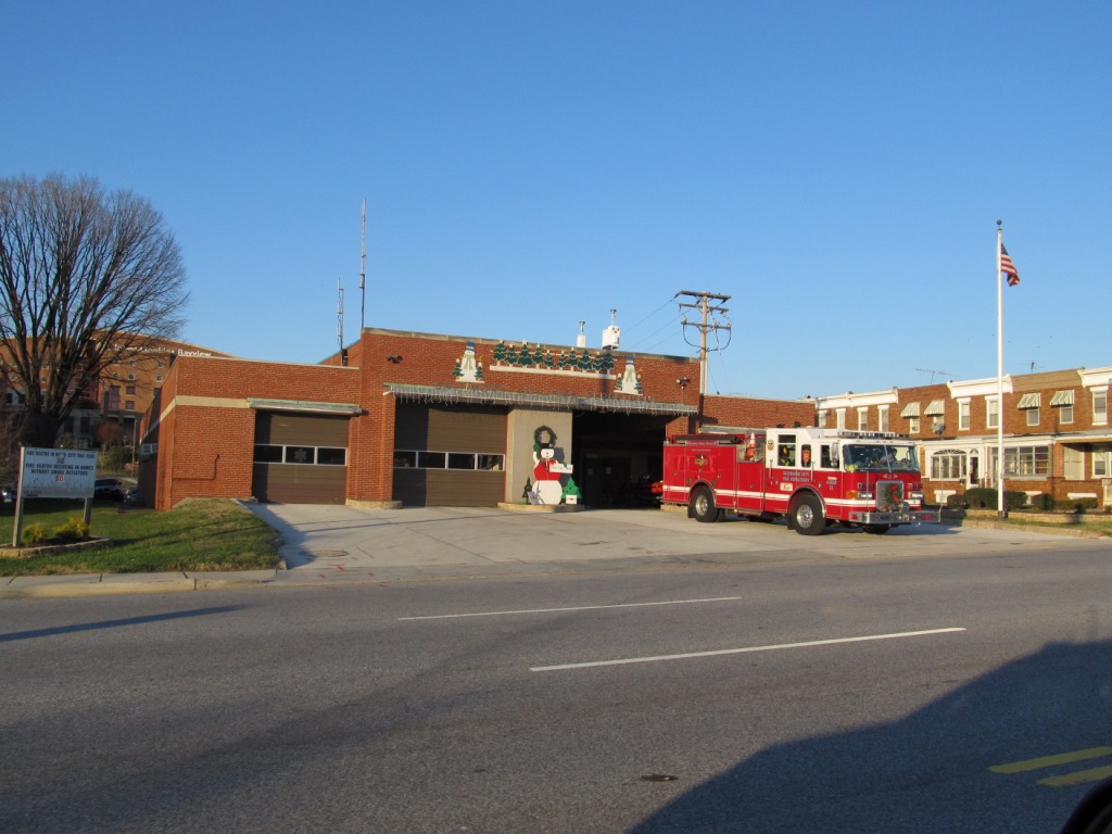
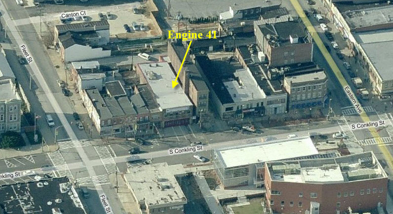
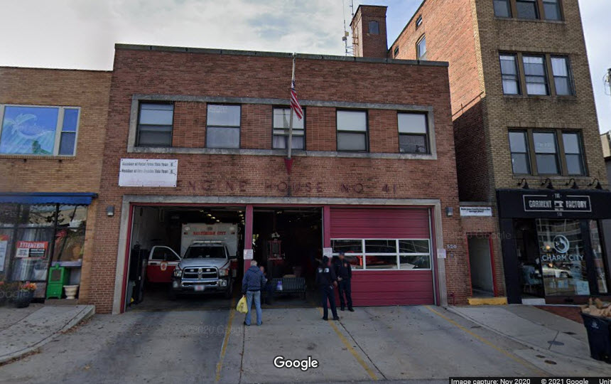
Baltimore City Fire Department - Engine 41
Located on South Conkling Street in Highlandtown, between Fleet
Street and Eastern Avenue. During the Christmas season, they usually
set up a train layout.
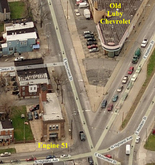
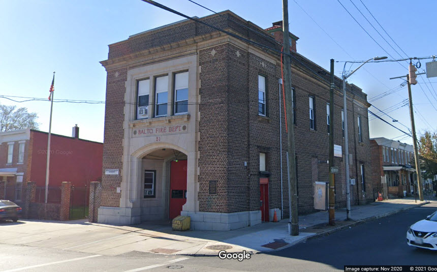
Baltimore City Fire Department - Engine 51
Located on the corner of East Monument Street and North Highland Avenue
A pretty good spot for catching freights coming out of either of the Bayview Yards is Lombard
St, seen in the Highlandtown insert. Lombard Street goes over the NS and under CSX.
2010-0514, 2005-1002,
Disclaimers:
I love trains, and I love signals. I am not an expert. My webpages reflect what I find on the topic of the page. This is something I have fun with while
trying to help others.
Please Note: Since the main focus of my two websites is railroad signals, the railfan guides are oriented towards the signal fan being able to locate them.
For those of you into the modeling aspect of our hobby, my
indexa page has a list of almost everything railroad oriented
I can think of to provide you with at least a few pictures to help you detail your pike.
If this is a railfan page, every effort has been made to make sure that the information contained on this map and in this railfan guide is correct. Once in a while,
an error may creep in :-)
My philosophy: Pictures and maps are worth a thousand words, especially for railfanning. Text descriptions only get you so far, especially if you get lost or
disoriented. Take along good maps.... a GPS is OK to get somewhere, but maps are still better if you get lost! I belong to AAA, which allows you to get
local maps for free when you visit the local branches. ADC puts out a nice series of county maps for the Washington DC area, but their state maps do not have the
railroads on them. If you can find em, I like the National Geographic map book of the U.S..... good, clear, and concise graphics, and they do a really good job
of showing you where tourist type attractions are, although they too lack the railroads. Other notes about specific areas will show up on that page if known.
Aerial shots were taken from either Google or Bing Maps as noted. Screen captures are made
with Snagit, a Techsmith product... a great tool if you have never used it!
By the way, floobydust is a term I picked up 30-40 years ago from a National Semiconductor data book, and means miscellaneous
and/or other stuff.
Pictures and additional information is always needed if anyone feels inclined to take 'em, send 'em, and share 'em, or if you have something to add or correct.... credit
is always given! Please be NICE!!! Contact info is here
Beware: If used as a source, ANYTHING from Wikipedia must be treated as being possibly inaccurate, wrong, or not true.
RAILFAN GUIDES HOME RAILROAD SIGNALS HOME New 4MAY2007, JAN20/2012, OCT08/2012, SEP30/2013, JUL05/2015, JAN20/2017, FEB25/2017, JUL30/31/2021
Last Updated: 07/31/2021