What's Here:
Former Pennsylvania Railroad's Green Spring Branch
Data:
GPS Coordinates: as needed
Phone A/C: 410/443
ZIP: 21210 (at Hollins), 21093 (Valley Station), 21153 (Stevenson Station), to 21117 (Turnpike
(Garrison/Junction with the WM))
Access by train/transit:
None
The Scoop:
The Green Spring Branch was the
Baltimore and Susquehanna's original option for getting out of Baltimore when Pennsylvania said no to
going through York on its way to the Susquehanna. Construction out of Baltimore started in
1829, and reached Owings Mills in 1832. The track was strap rail, and
service used horses for power. Service wasn't too popular after the
Western Maryland completed its own mainline into Baltimore from "Turnpike", and it
was almost abandoned except for summer service. Traffic picked up for a
while in 1916 when the branch was used as a bypass during B&P Tunnel repairs.
Passenger service ended in 1933, and the last train to run up the branch was in 1962
(four years before I moved into Ruxton, darnit).
Acknowledgements:
Adam Paul
Lake Roland Nature
Council
Google Maps
2/13/1829 - The Baltimore & Susquehanna RR is chartered in MD.
8/8/1829 - The first stone is laid in Baltimore City.
2/7/1830 - Charter granted for the B&S to go to Westminster.
7/4/1831 - The first 7 miles of track opened from the Belvedere Depot in downtown to
Relay House (Hollins).
5/26/1832 - The 8 miles from Relay House to Turnpike completed.
6/14/1932 - Regular horsecar passenger service begins.
8/7/1832 - First run of the B&S steam engine the "Herald", bought from the U.K.
8/20/1832 - Track extended another 2 miles to Owings Mills.
1833-34 - The PA legislature grants a Charter to the B&S to build through York to the Susquehanna.
5/27/1852 - The Baltimore, Carroll & Frederick RR chartered by MD.
3/21/1853 - The BC&F is re-organized as the Western Maryland RR.
12/31/1854 - The B&S formally merges with its "paper" subsidiaries to form the Northern Central RR.
3/37/1851 - Contracts by the WM go out for construction from Relay House to Union Bridge.
1/1858 - NC ends horsecar service so reconstruction by the WM can begin.
5/23/1859- First track laid by the WM on the Green Spring Branch.
8/11/1859 - WM formally opens for business between Relay House and Owings Mills, to Reisterstown 12/14.
1860 - The Pennsylvania RR purchases controlling interest in the Northern Central.
7/2/1863 - WM taken over by the U.S. Military RR for battle in Gettysburg, returned to WM 7/7/63.
12/17/1873 - WM completes line from 1.5miles south of Owings Mills to Baltimore City,
eliminating the need for the Green Spring Branch.
7/15/1874 - Control of the Green Spring Branch returned to the Northern Central.
-- The western junction between the branch and the WM named "Turnpike".
-- The eastern junction between the branch and the NC mainline at Relay House is renamed to "Hollins".
12/8/1874 - The PRR takes control and active management of the Northern Central.
12/1876 - New station built at Hollins.
1881 - Station built at Turnpike, where it crosses Reisterstown Road.
1890 - New station built at Chattolanee, formerly called "Green Springs".
1892 - Station "established" at Lake Roland at Sorrento, no building.
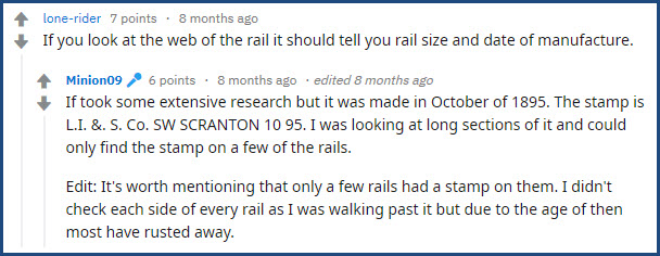
1895 - Date of manufacture of the remaining visible track on the branch, per
Minion09's personal inspection.
1896 - New station built at Rockland.
1899 - New station built at Lystra and Garrison.
1900 - New station built at Eccleston.
1901 - New station built at Stevenson.
1905 - New station built at Rogers.
1906 - New station built at Brooklandville.
7/29/1914 - The Northern Central is leased to the PRR for 999 years retroactive to 1/11/11.
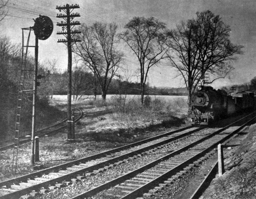
1916 - Dedicated local service on the Green Spring Branch ends,
service now provided by the Parkton Local.
5/28/1916 - The Western Maryland and PRR start using the Green
Spring Branch as a detour while B&P Tunnel gets rebuilt.
11/25/1917 - Detour over the Green Spring Branch ends.
Early 1920's - Gas-Electric cars replace steam powered passenger service.
5/20/1925 - Block Stations abolished.
7/3/1932 - United Railways & Electric abandons the line to Reisterstown and removes
crossing with the branch.
6/23/1933 - Passing track between Lystra and Rogers removed.
8/17/1933 - Passenger service discontinued.
by 10/1933 - Standard grade crossing crossbucks and flashing lights replaced Banjo signals.
12/20/1933 - PRR General Order #1807 abolishes HK Interlocking and Block Station at Hollins.
4/8/1935 - The PRR leases the Eccleston Station lands to Osborne Beal for $12 a year.
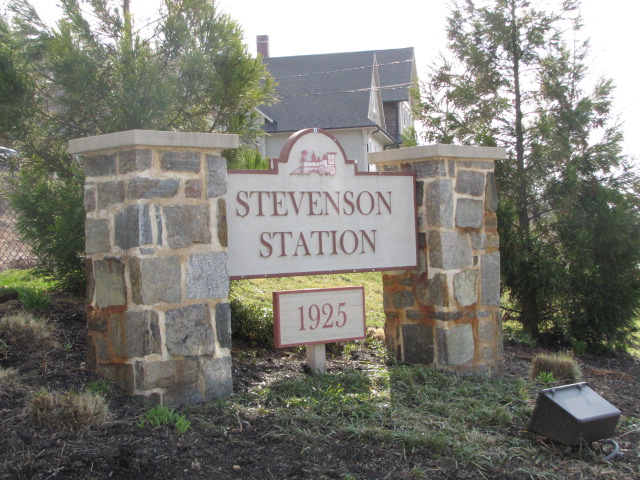
9/7/1937 - The Stevenson Station and 2.5 acres was sold to Oden Long and his wife Helen for $5,000.
Late 1930's- Traffic interchange with the Western Maryland comes to an end.
Late 1930's/early 1940's - The Green Spring Branch downgraded to the
Green Spring Secondary Track.
1/1944 - PRR made a study to determine the extent of changes to support the war effort if needed.
4/18/1950 - 2.7 acres at Chattolanee sold to Wethered Woodward for $1500, the station
stood on this parcel.
1951 - Traffic volume on the line was 24 cars.
4/7/1952 - 1.9 acres at Lystra sold to Norman Stump for $900.
1954 - Burnham Fuel quits being a customer.
Mid 1950's - The Green Spring Branch
is still considered a viable bypass for the B&P Tunnel until a gauntlet track installed in the tunnel in 1956.
Mid 1950's - The Green Spring Branch further
downgraded to the Green Spring Track, as in tracks other than main, secondary, or siding.
Late 1950's - 6 acres at Green Spring Junction sold to Irvin Tillman
for $2500, including the area of the wye.
1954 - Last train to Chatolanee.
1955 - Last train to Stevenson.
1957 - One section of track removed 1000 feet west of Rockland
1959 - The PRR applies for abandonment west of Rockland.
9/14/1959 - The middle siding at Sorrento abandoned after being used to unload cement for
sewer work, removed in 1961.
10/21/1959 - ICC gives approval to abandon track west of Rockland on 12/18/1959.
By 6/1960 - Track through the valley to Rockland was removed.
Spring 1962 - Service on the branch just faded away, no formal
abandonment procedure was carried out.
1962 - Track from Rockland to edge of Robert E. Lee park taken up, remainder of track
sold to National Capital Historical Museum of Trans.
1966 - National Capital Museum moves to Wheaton and transfers track to the Baltimore
Streetcar Museum (BSM).
1968 - BSM establishes itself in Baltimore City at it's present location and
moves trolleys there.
1971? - Most of the track within the park limits removed, a short stretch near the main line/light
rail was never taken up.
-- Note: I moved into Ruxton in 1967, and don't remember if the track over the girder bridge at 1.19 was there or not --
Much of the information provided here comes from the book "Green Spring Accommodation" by Martin K. Van
Horn and Robert L. Williams, published in 1996 by Transportation Trails.
When the B&S proceeded north to York, a local quarry provided stones for the first
"ties", or "sleepers" used on this line. For more info on them click
here.
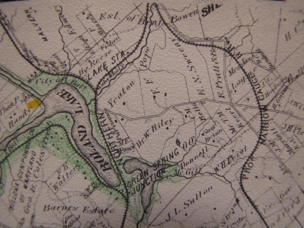
The junction where the Green Spring
Branch starts (off the mainline to York and Harrisburg) was originally called Relay
House, but later changed to avoid confusion with the B&O's town of a similar name
(Relay) on the southwest side of
Baltimore (see
map6 ). The stop on the B&O was later changed to St Denis.
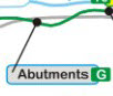
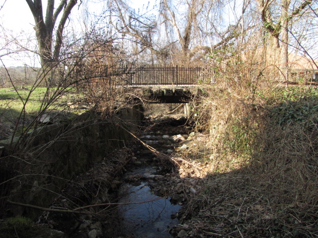
Most of the line was built at grade level, there were few exceptions. One place was around the girder bridge
at location #6, were they had to put fill in to cross the creek. Another
place was at the Hillside "bump" (location G on my map), where the topography is
considerably lower and they had to detour in closer to the ridge and put some
fill in to level the route - driving by this location you will notice the road
dipping a fair bit while the right-of-way stays above you, and crosses Hillside twice.
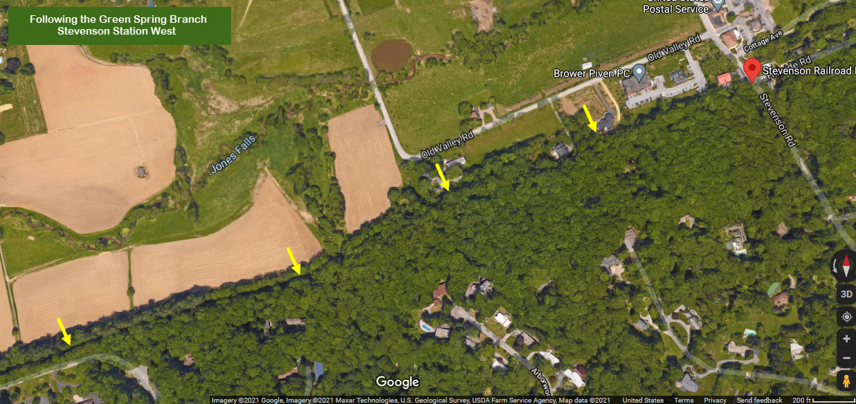
West of the Stevenson Station, hardly anything remains that gives a visitor the sense the a railroad ever existed.
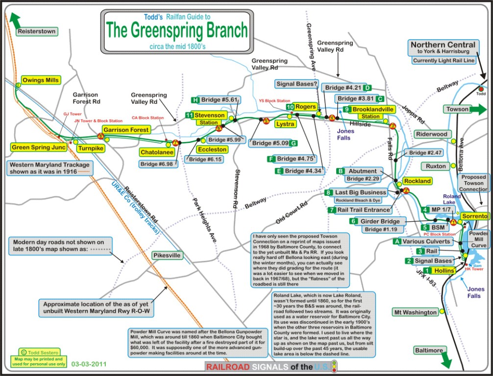
A portion of a 1936 map of Baltimore MD, showing the Green Spring Branch and the M&Pa in Towson
A portion of an 1853 James Slade Survey
Map courtesy the Lake Roland Nature Council
A Pennsy Track Plan for the Green Spring Branch, edited with SnagIt because it
is part of a much larger strip map with 3 branches on it - Click on it for the full size version of this section (4m JPEG)
We came across the map on EBay during December of 2015.
This two section map shows you the proposed connecting track between Lake Roland and Towson (and the Ma & Pa)
This map was in a 1969 reprint by Baltimore County of original maps from 1877
Toddo here colored the map as a kid, and we grew up where the yellow dot is....
If you drive thru the area, notice the name of the land owners, and you'll realize where the some of the street names come from!
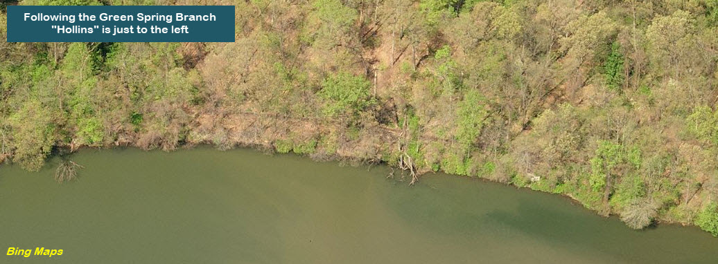
Originally called Relay, this is where the
Green Spring Branch had its beginning
once the mainline to York was built.
In the bottom screen capture, you can still make out the rail-trail right-of-way. The
purple line is/was the Northern Central's main line, and the green line is the
branch. Confusion with Relay (later St Denis) on the B&O caused
the PRR to change the name to Hollins.
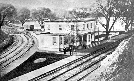
At one time, there was a beautiful Station and Hotel located at the
junction, known as the Hollins Station, or the Relay House.
The hotel was closed in 1926, and fire destroyed it in 1933 (according to
the Park page).
Just north of the split, where the mainline crosses Lake Roland, is a short
steel beam bridge. I wish I had spent more time here as a kid for better
pictures, with something other than a Kodak Instamatic camera, but then, I was
only 16 at the time. I took the pictures where the purple arrow is in the
above picture, and the bridge is at the "X". Sorry the
pictures aren't any better, but that's all you got from them little box cameras.
From November 1967, just a few months after moving into Ruxton.
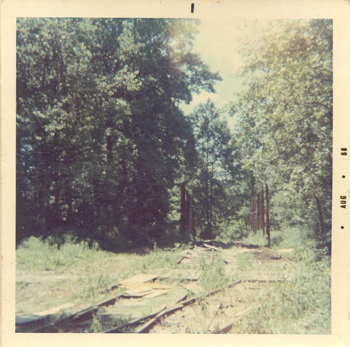
Signal Bases
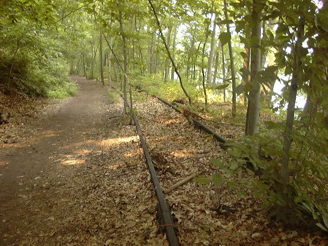
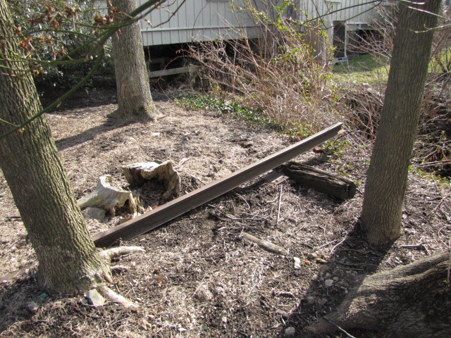
Remaining Track
GPS Coordinates: 39.38204, -76.64545 (approx)
Most of the remaining track leftover from the end of
service was removed in the early 70's? For some unknown reason, this short
section of maybe 300 feet of track was left, maybe the scrappers didn't deem it
worthwhile for the amount of trouble they had to go to in order to get it, or
maybe their truck was filled up and didn't feel this little bit wasn't worth
coming back for... we'll never know! Photo by Adam Paul.
Various Culverts and "Bridges"
Mile Marker 1/7
GPS Coordinates: 39.38995, -76.64211 (approx)
This side has a "7" on it, for seven miles to the junction with
the Western Maryland; the other has a "1", for one mile to the junction with the mainline.
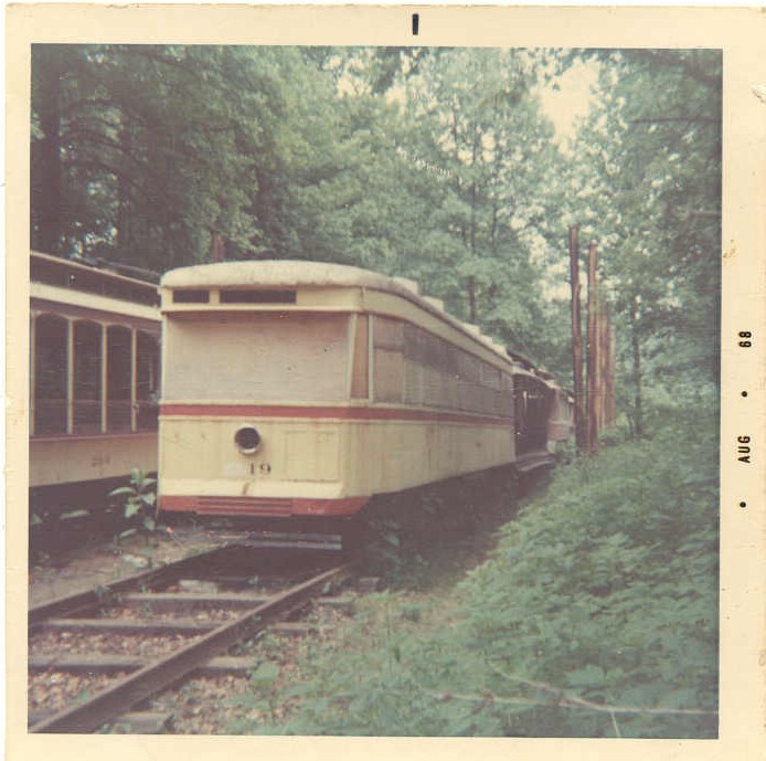
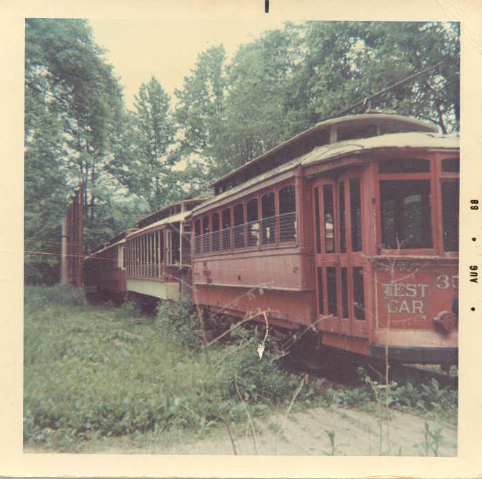
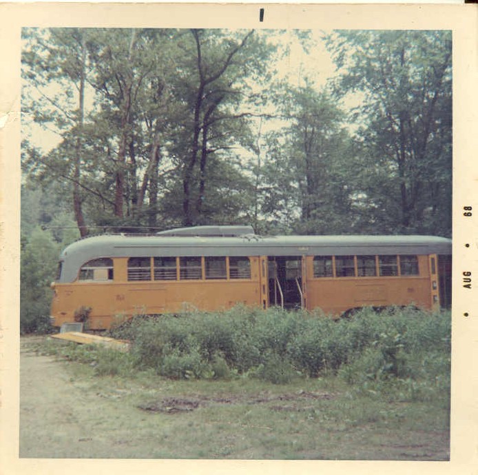
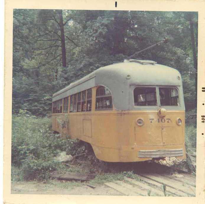
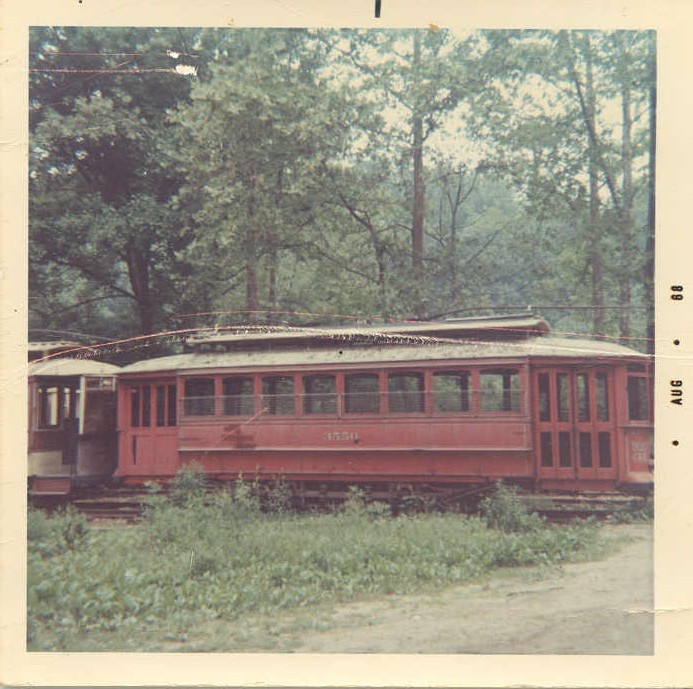
Former Site of the Baltimore Streetcar Museum
GPS Coordinates: 39.39028, -76.65269 (approx)
The BSM's original's plan was to have the museum situated
at Lake Roland. They moved the cars to the lake in the mid 60's, but by
1968, a local resident (Mr. Guntrum) on L'Hirondelle Club Road was well
connected with people in the government and forced the BSM to move the cars out
of the park, in fear of the noise that "might" be produced by having a museum
located across the Falls from him. I was fortunate enough to have moved
into the area the summer before the cars moved down to Falls Road, and snapped
these 6 pictures in 1968 before and after the move. It's too bad they had
to move, the site would have been ever so much nicer than where they are now,
especially along the southern part where they would have been running along the water.
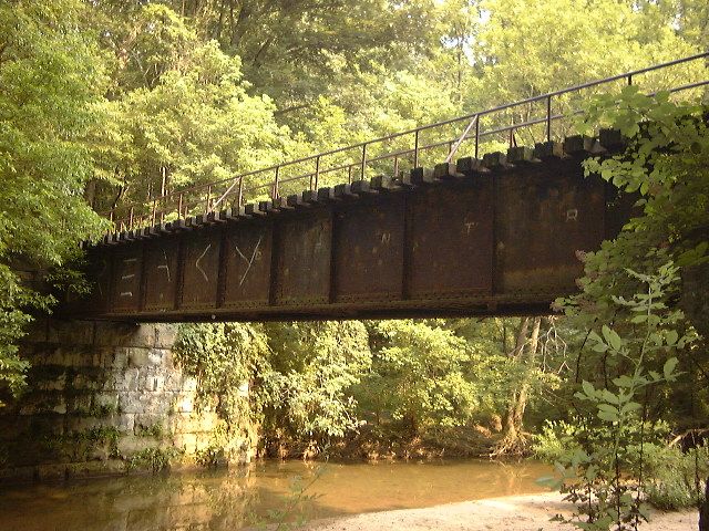
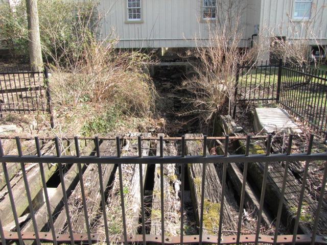
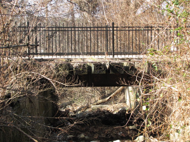
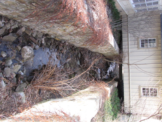
Girder Bridge
GPS Coordinates: 39.38988, -76.65489
This is the only bridge remaining on the branch, and is at mile 1.19. Photos are by Adam Paul. More of his
Green Spring Branch page at:
http://www.btco.net/ghosts/railroads/gs/Greenspring.html (unfortunately, the links to anything at the BTCO website are gone, I guess I
should have saved them)
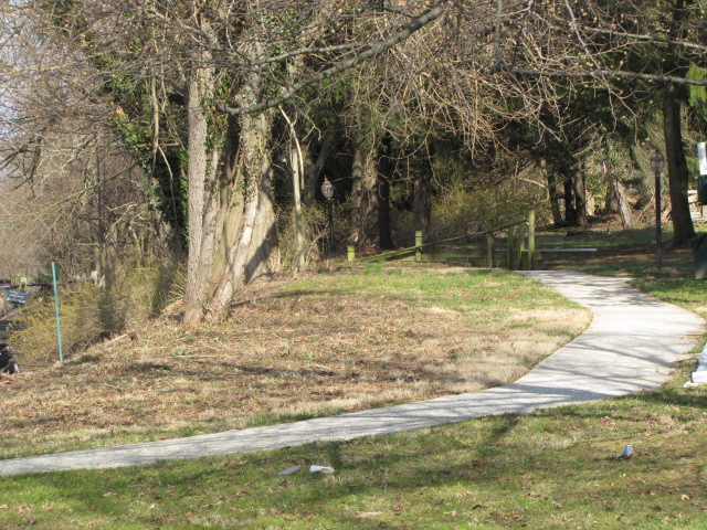
the West End of the Rail Trail
GPS Coordinates: 39.39629, -76.66349
Looking west from Brooklandville Fire Station - this is on private property.
Looking east from the fire station, towards the JFX, I83.
Looking west from the rail trail, the R-O-W was to the right of Falls Road.
Looking west from the head of the rail trail, this and the next shot are from the same spot.
Looking east (towards the main line) down the rail trail where trains once ran.
You can just make out the dark cinder surface of the path through the bare trees from Falls Road.
Last Business on the Green Spring Branch
GPS Coordinates: 39.39659, -76.66486
When I first moved into Baltimore in 1966, there were still buildings here,
too bad I didn't get pictures of them. This was the last major business
to have rail service and gave the Green Spring Branch
it's last breath of air.
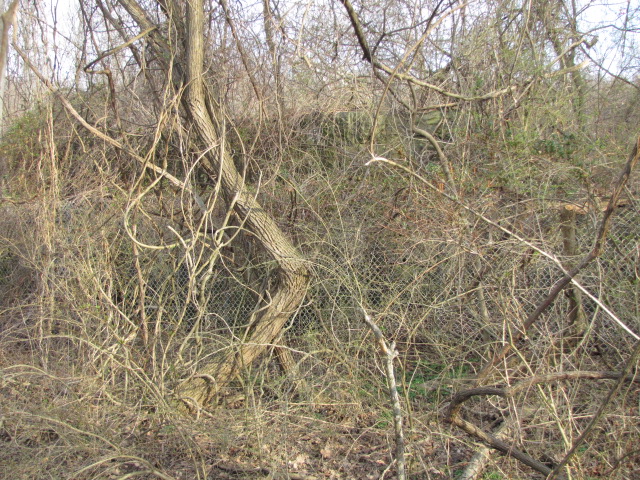
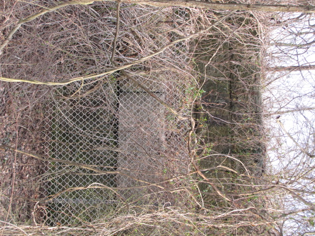
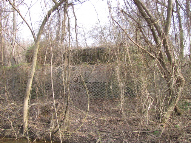
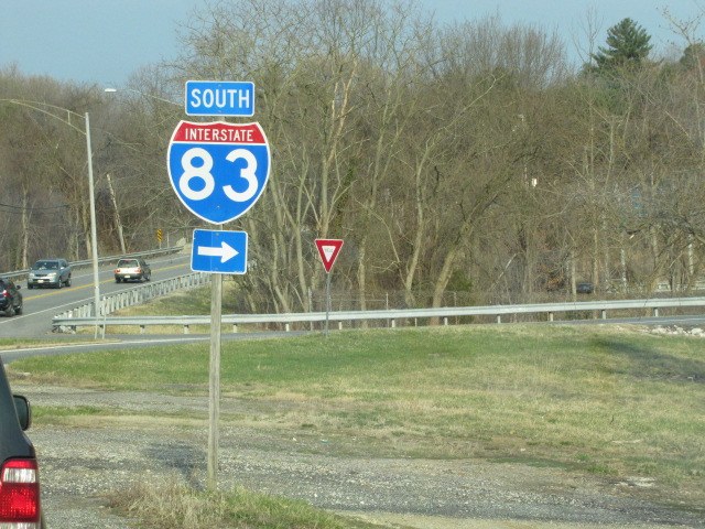
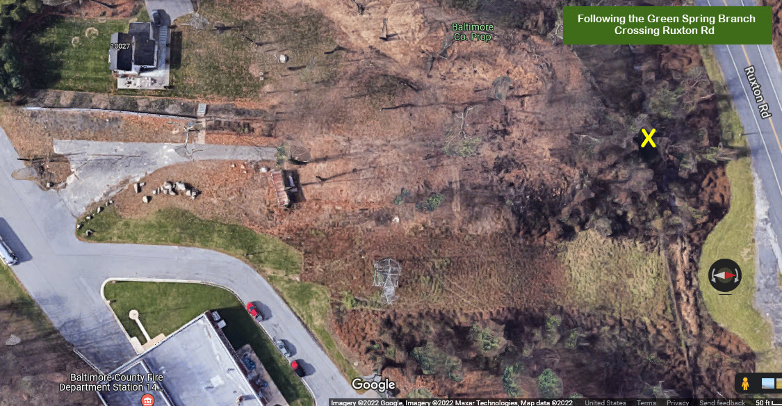
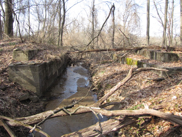
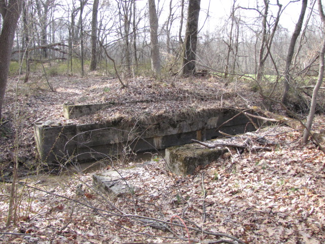
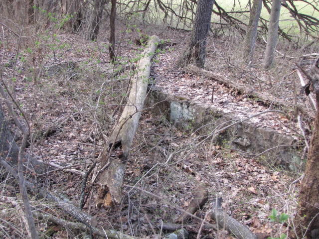
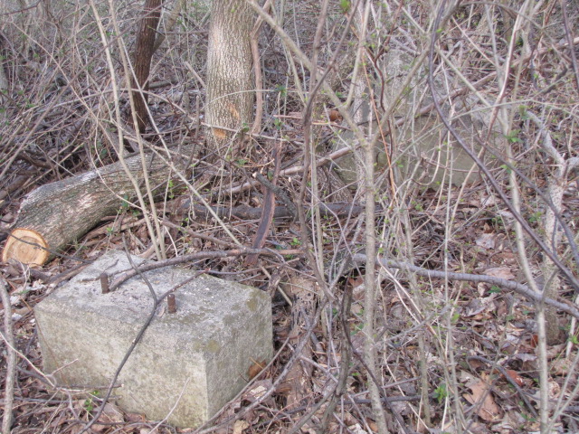
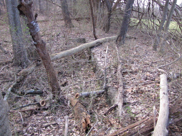
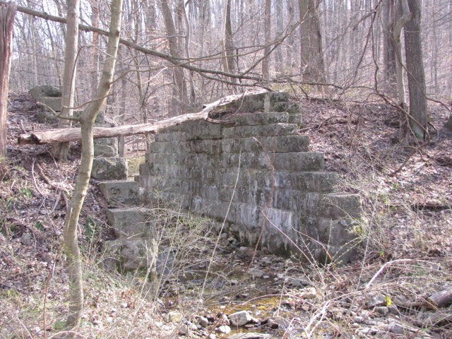
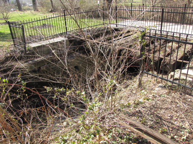
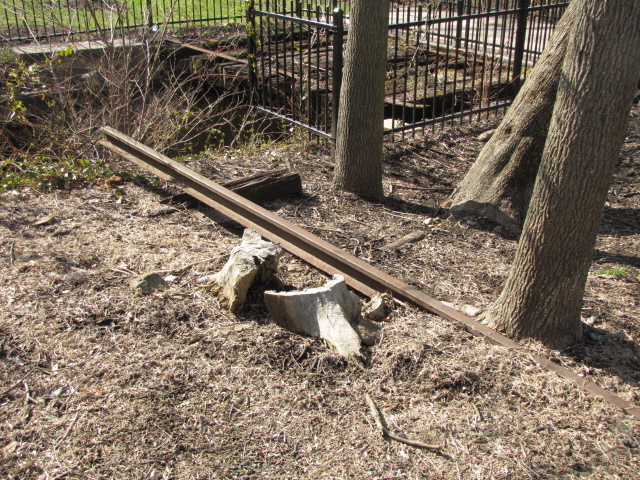
Bridge Abutment
GPS Coordinates: 39.40040, -76.66642
Well covered by vines, even during the winter months, you can just barely make out
the one abutment at this site for a bridge that went over a small feeder stream into
the Jones Falls. It is adjacent to the SB entrance ramp of I-83.
The abutment is located where the yellow "X" is. It looks like the
abutment sits on Baltimore County property, next to Station 14.
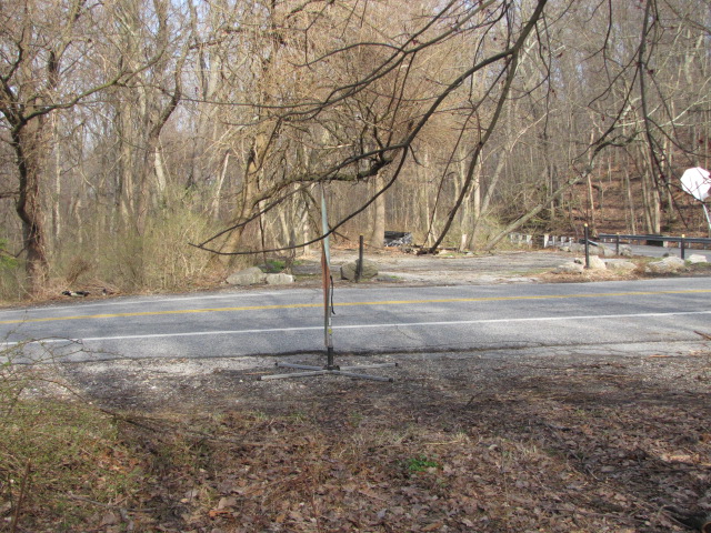
The area between Fire Station #14 and the Brooklandville station.
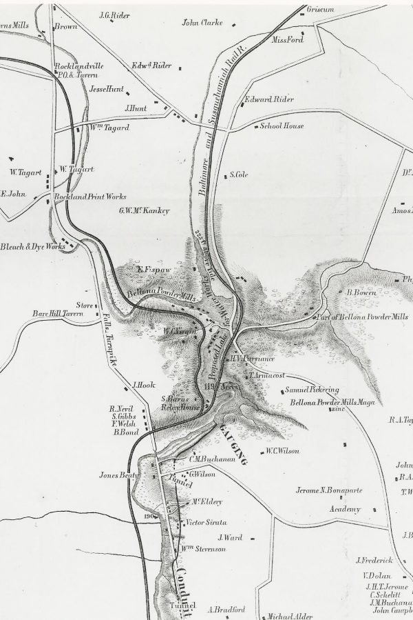
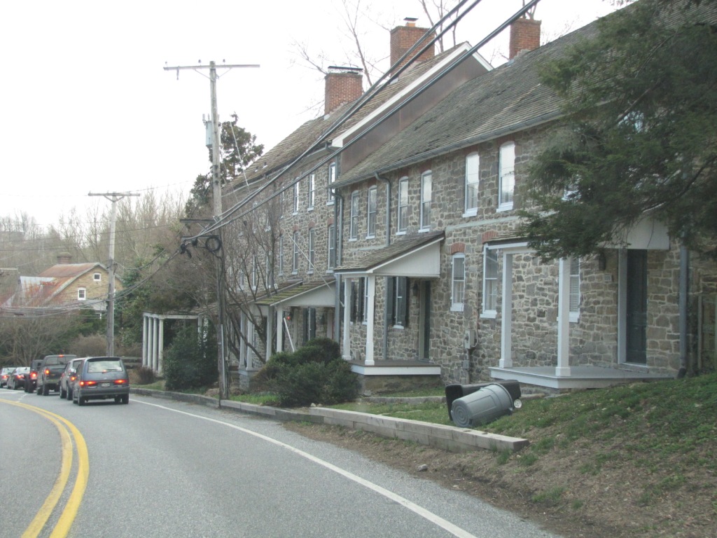
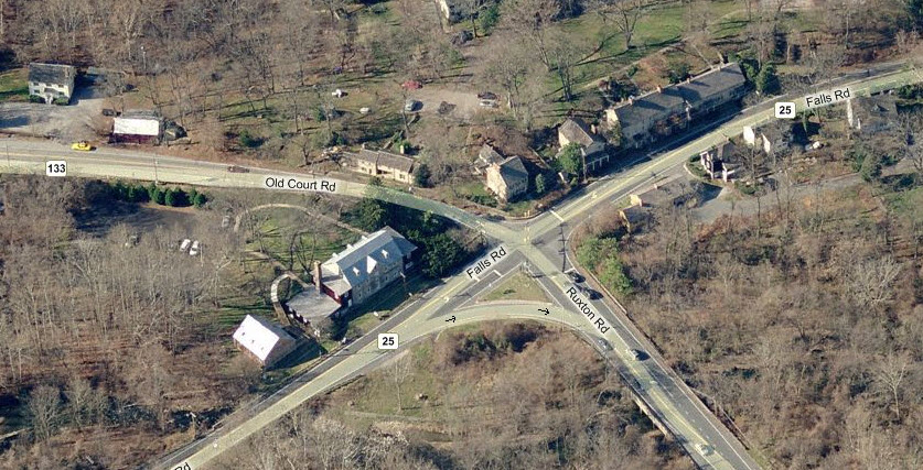
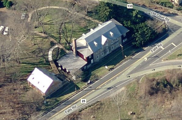
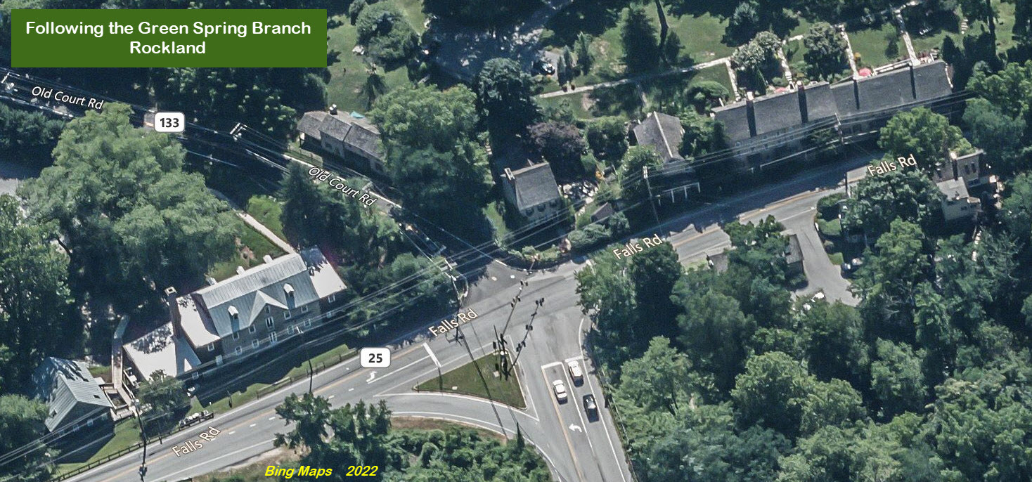
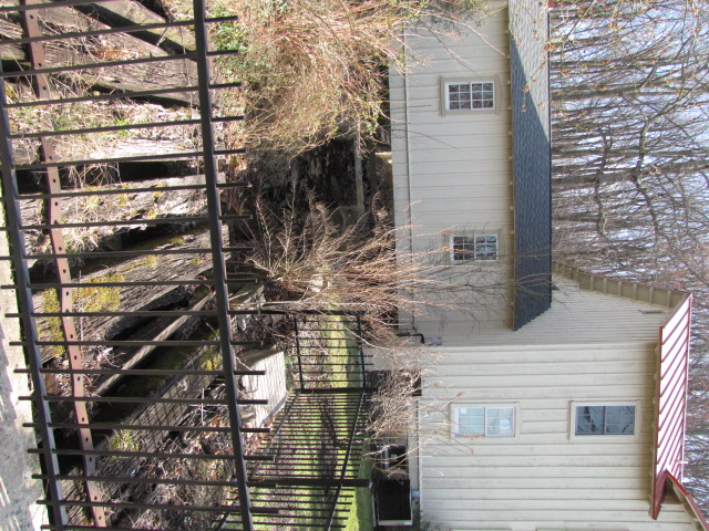
Rockland (Brooklandville)
Rockland (later changed to Brooklandville) was a hub of
activity during the 1800's and early 1900's, with grist mill, blacksmith shop,
and numerous rowhomes, with many of the old buildings surviving today. One
of the mills still has an original (but non-functioning) water wheel in place
(on the SW corner). The picture on the left shows a row of homes as I am
driving SB on Falls Road before hitting the traffic light at Old Court / Ruxton
Roads. The other two aerial shots show Rockland, and the close-up is of
the mill. Before the Jones Falls Expressway (JFX) was built, Old Court
Road used to come all the way across, now it ends on Ruxton Road at the top of
the NB exit ramp off of the JFX, and continues west at the traffic light.
A little bit of additional info is
here.
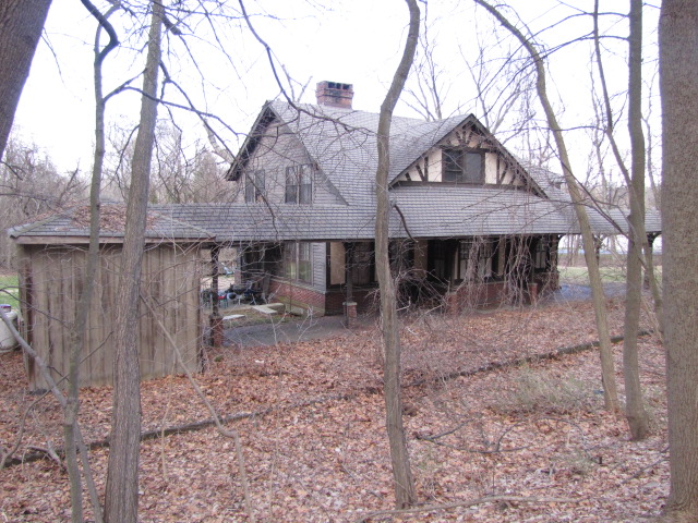
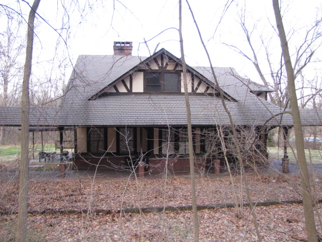
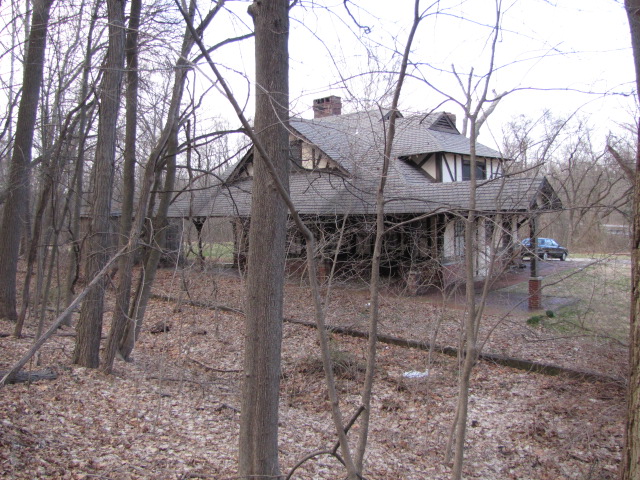
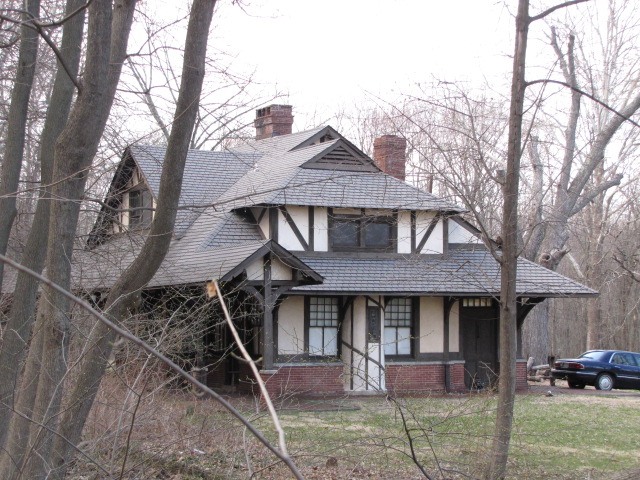
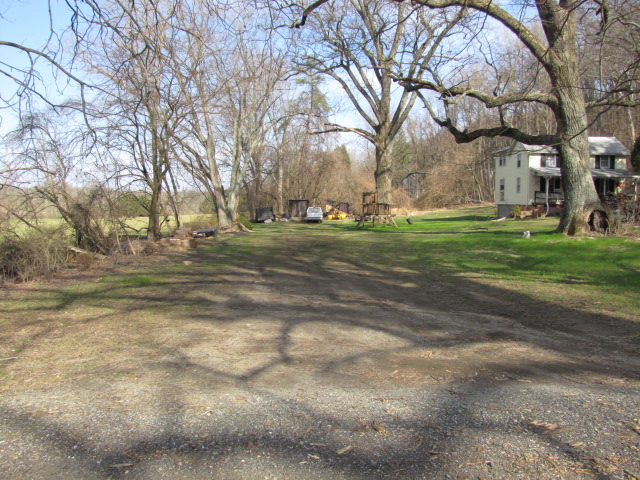
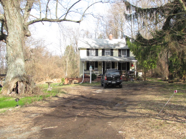
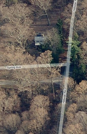
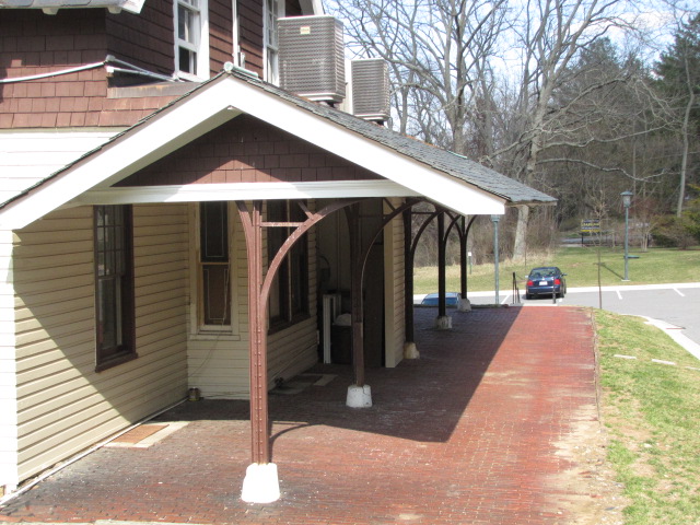
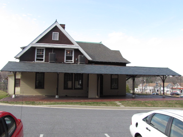
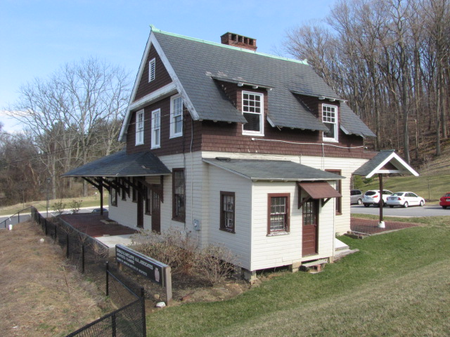
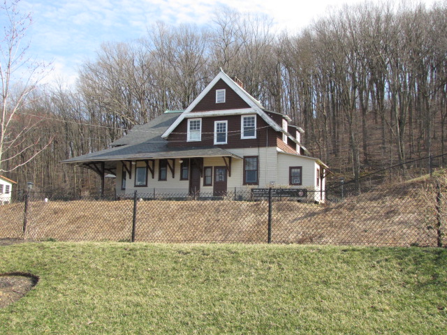
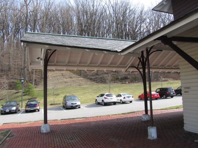
Brooklandville Station
GPS Coordinates: 39.41195, -76.66822
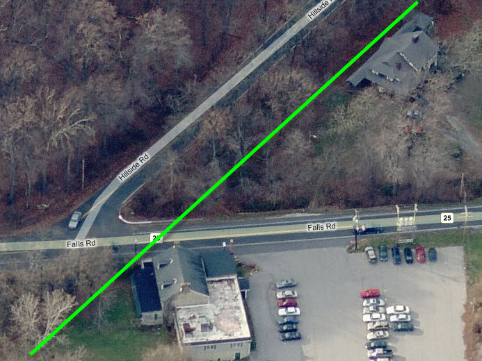
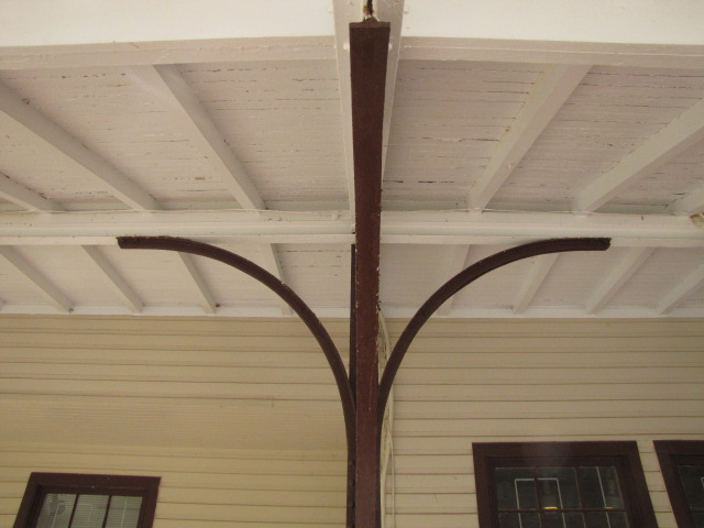
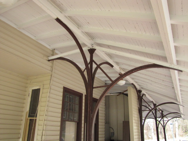
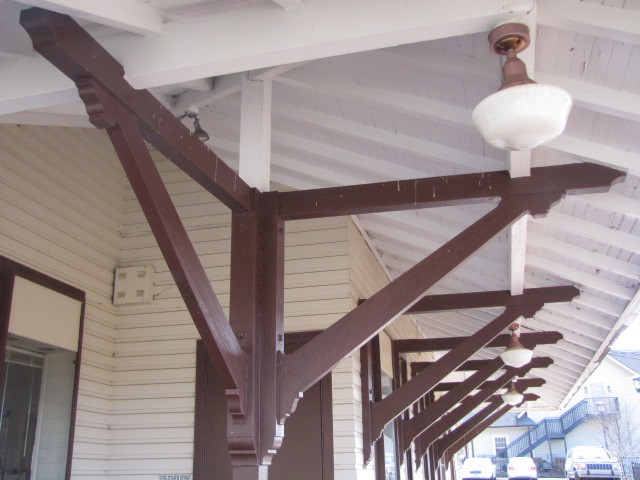
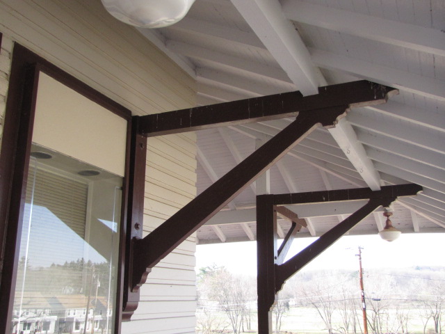
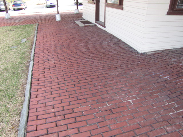
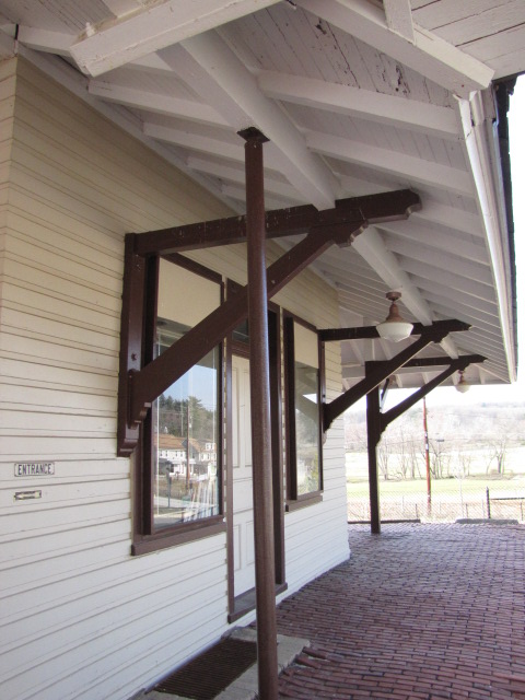
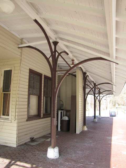
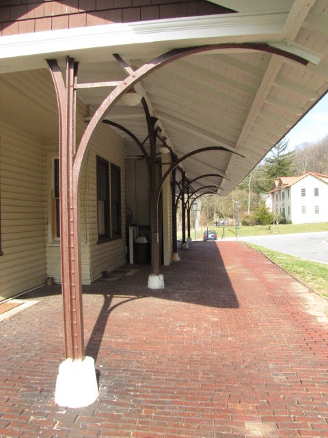
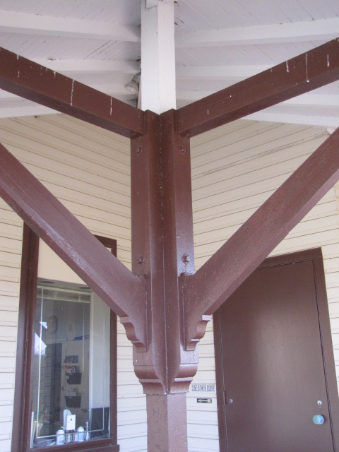
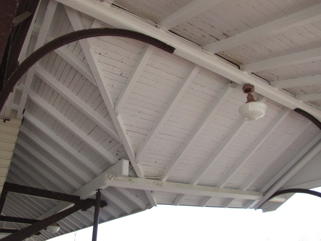
One of two surviving stations on the Green Spring Branch, it is at the corner of Falls and Hillside Roads.
Aerial shot with north on your right.
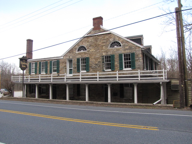
The Valley Inn, across Falls Road from the Brooklandville Station. It used
to be a popular spot when the railroad came thru here.
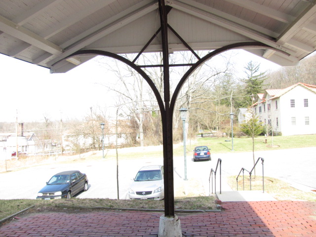
Looking east from the corner of Falls and Hillside, away from the station.
Looking south on Falls Road, the station is to the right.
A small culvert going under the branch's tracks at the end of the platform along Falls Road.
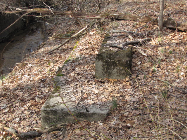
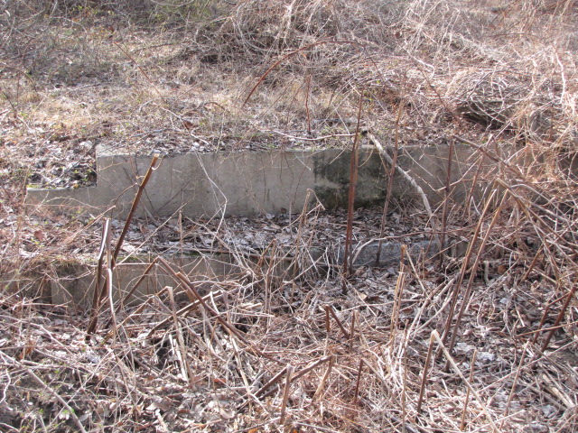
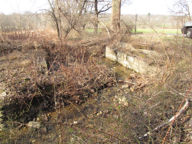
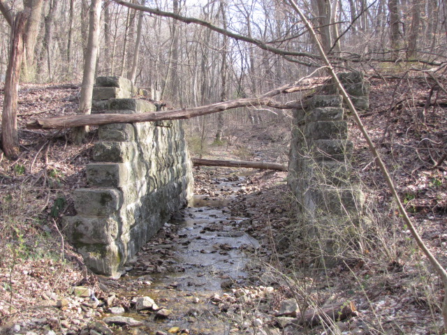
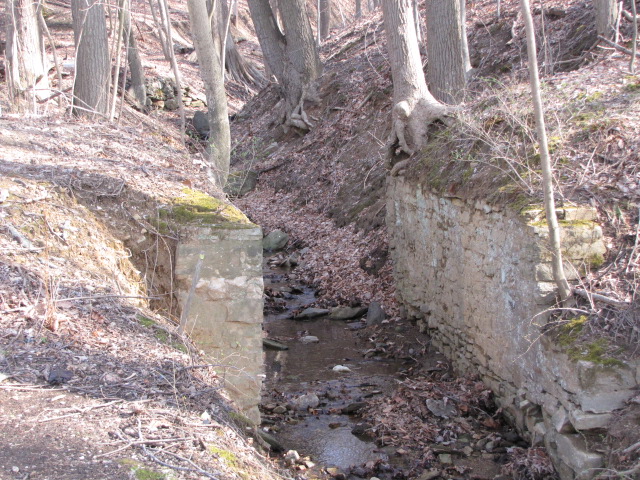
Bridge Abutments
GPS Coordinates: 39.41363, -76.68038 (approx)
This is the first set of small bridge abutments west of the
Brooklandville Station, listed as bridge #3.81.
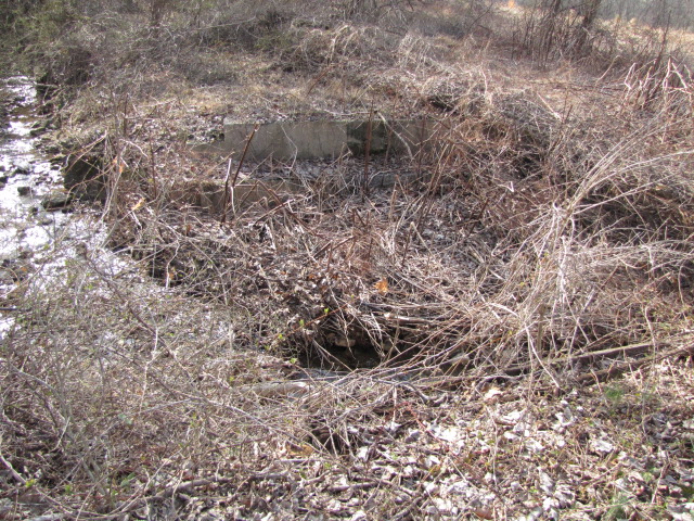
Bridge Abutments
GPS Coordinates: 39.41371, -76.68559 (approx)
Being that everything in this guide is in sequential order, this is the next set of small abutments, listed in other guides as bridge #4.21.
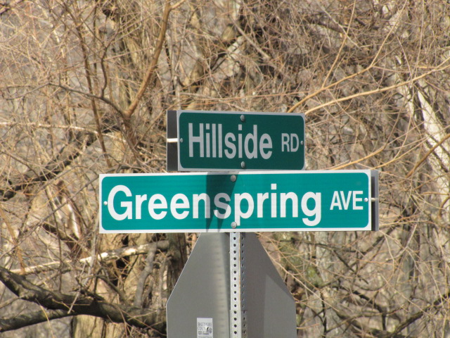
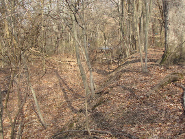
Rogers Station
GPS Coordinates: 39.41327, -76.68831
Located just to the west of Greenspring Ave. If this is the remains of the station,
it was probably just a covered shed type. And the concrete footers may have
been for signals. The left photo is looking west towards Reisterstown Rd,
and the right photo is looking east towards the Brooklandville Station.
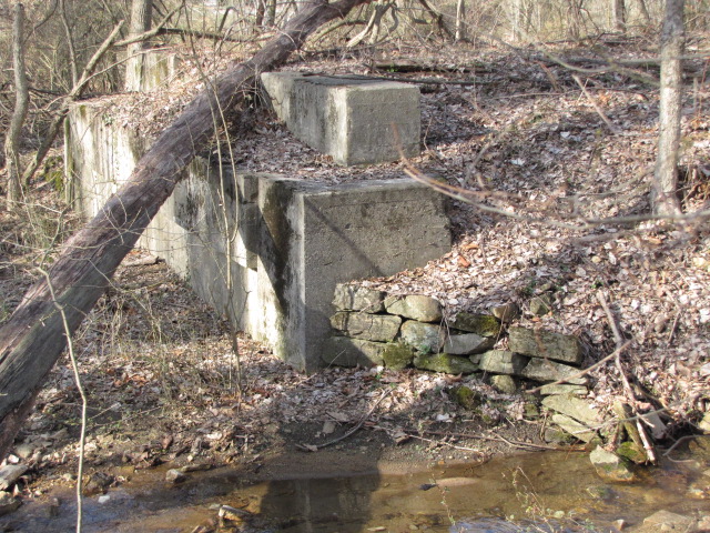
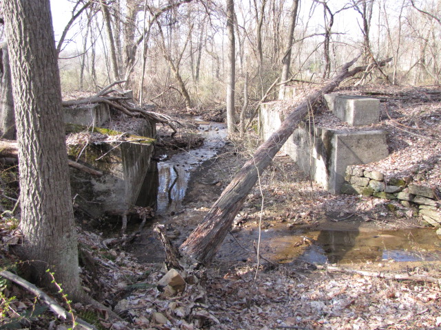
Bridge Abutments
GPS Coordinates: 39.41320, -76.68999
This set of abutments is just west of the above location.
The two photos on the right are views down the right of way,
the one on the right is looking towards the Rogers
station, and Greenspring Ave can be seen in the distance.
Bridge Abutments
GPS Coordinates: 39.41262, -76.69775
A pair of "new" looking concrete abutments at Spring Ave, and
two shots looking east, the middle photo is looking right down the middle of
where the right of way used to be.... I'm guessing the house was around when
trains went rambling by. From the air, you can't see any evidence of where
the tracks used to be.
Bridge Abutments
GPS Coordinates: 39.41180, -76.70351
A pair of nice stone bridge abutments surviving just west
of the street signs, up until maybe 2001/2002, there used to be rails
crossing the pavement in the photo on the right, which is maybe 300-400 feet
east of the abutments (in the picture we're looking west).
Bridge Abutments
GPS Coordinates: 39.40999, -76.71345
Just east of the Stevenson Station is another building that
was probably around since the turn of the last century, complete with a small
creek running under part of it, which is what this small bridge jumped over.
There is also a short piece of rail sticking up out of the ground, held in
firmly by the tree roots.
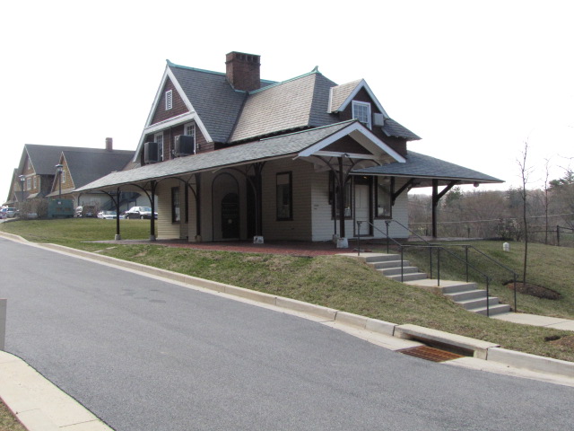
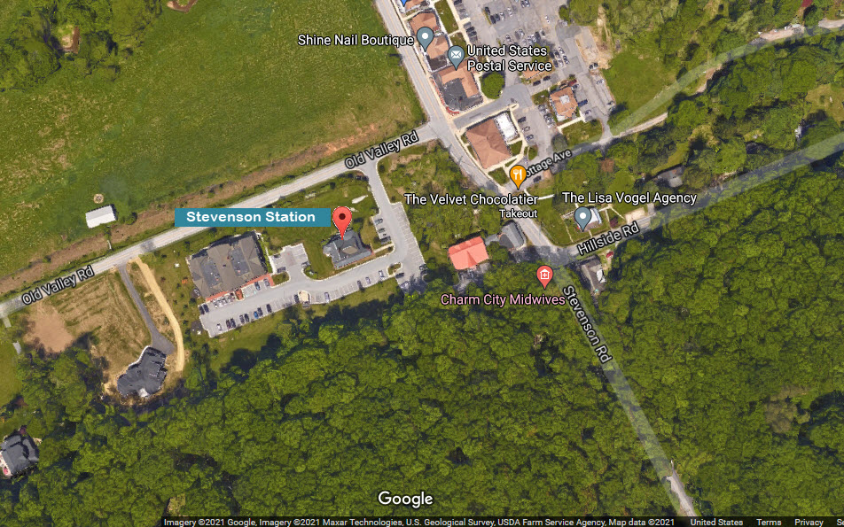
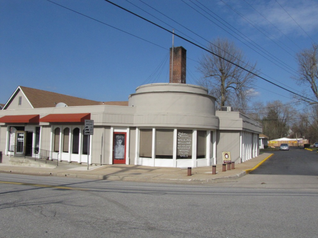
Stevenson Station
GPS Coordinates: 39.41010, -76.71405
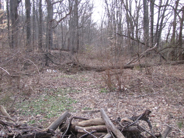
Stevenson West
The right-of-way, going westward from Stevenson Station.
Following the right-of-way as we did from Falls Road to Stevenson is not possible west of here.
Also from here west, there is virtually NOTHING to ever suggest there used to be
a railroad running thru peoples back yards, nothing.
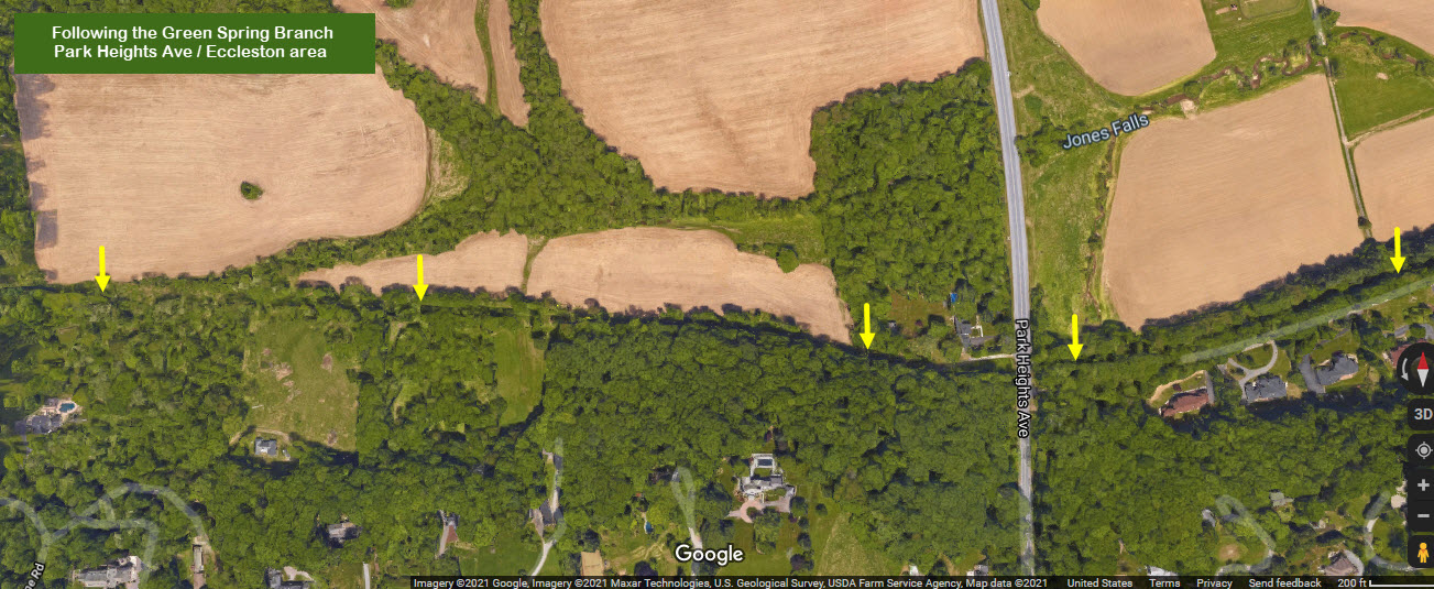
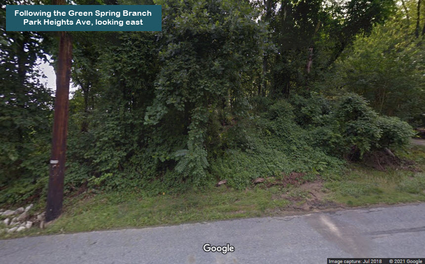
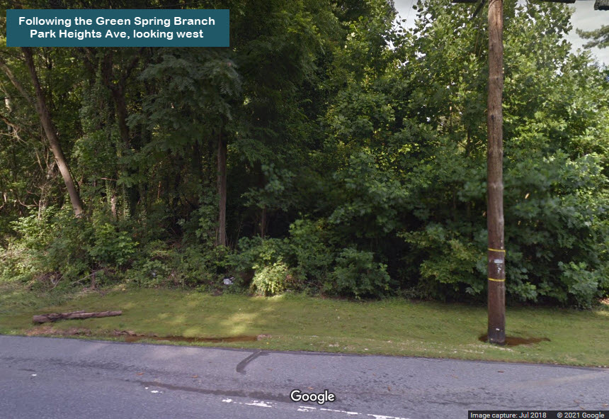
Eccleston / Parks Heights Ave
GPS Coordinates: 39.40553, -76.72913
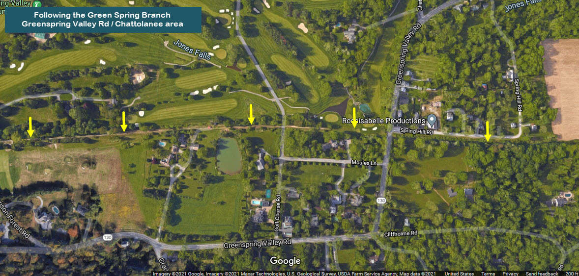
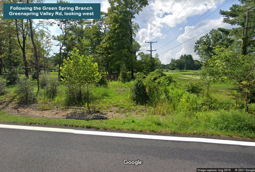
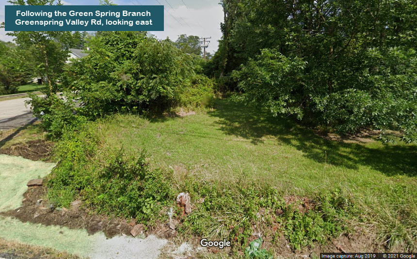
Chattolanee / Greenspring Valley Rd
GPS Coordinates: 39.40632, -76.74359
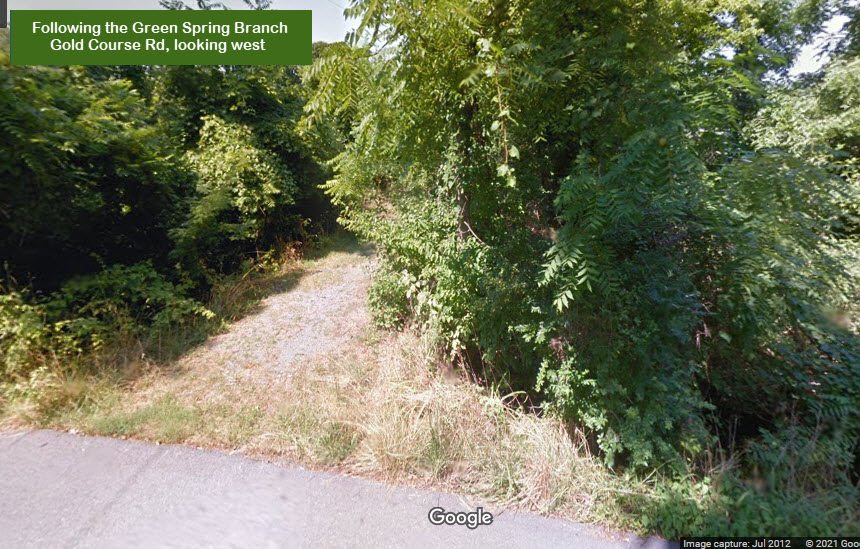
Chattolanee / Golf Course Rd
GPS Coordinates: 39.40648, -76.74614
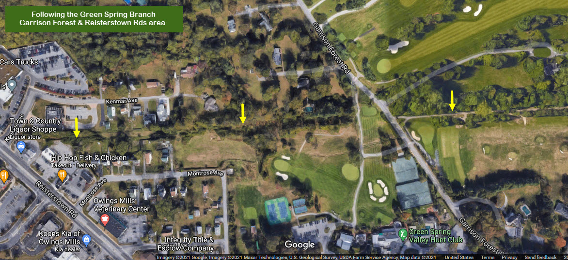
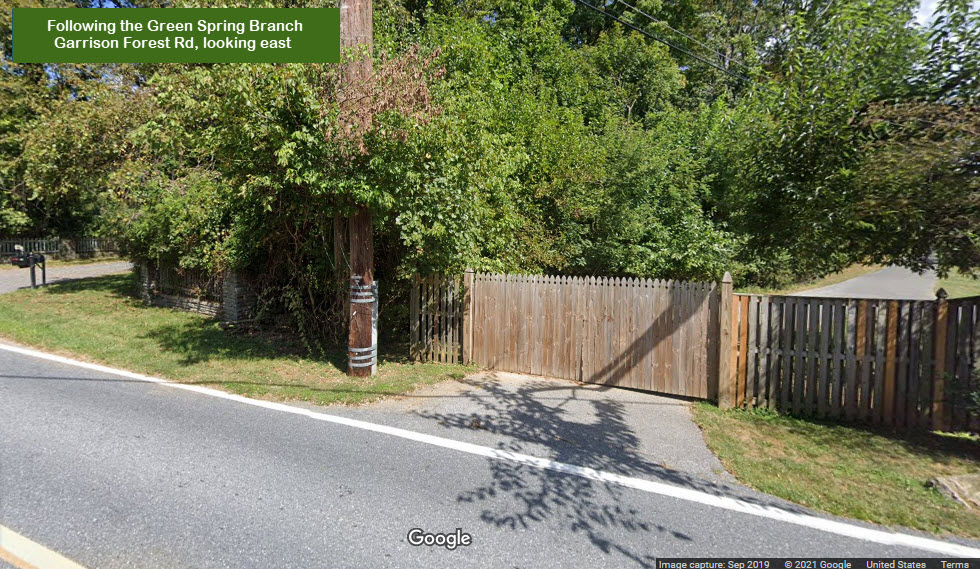
Garrison / Garrison Forest Rd
GPS Coordinates: 39.40620, -76.75386
looking east from Garrison Forest Rd
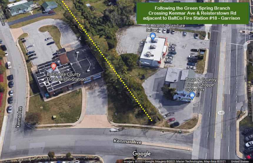
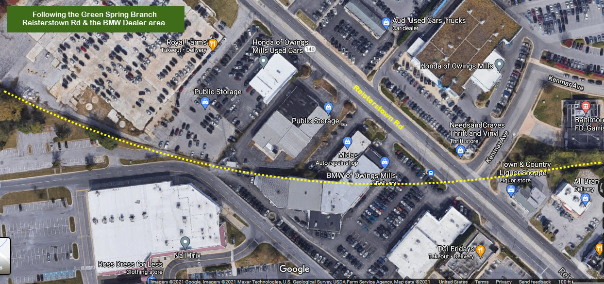
Kenmar Ave / Reisterstown Rd
GPS Coordinates: 39.40592, -76.76029
Continuing westward, we are almost at the end.
The former right-of-way runs right alongside Baltimore County Fire Station #18, Garrison.
Tween Reisterstown Rd and "Turnpike"
I've often said that if you look at property lines, and how some buildings are
built, you can find evidence of where train tracks used to roam.....
Even in 1969 when I started driving, and came over this way, it had been 30
years since the Pennsy stopped interchanging with the WM, and there was no
evidence even THEN, that there was ever a grade crossing at Reisterstown Road......
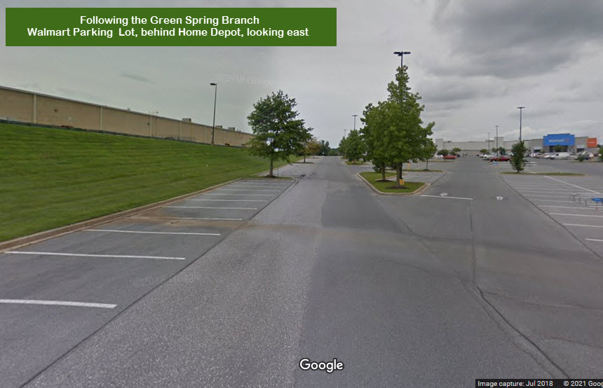
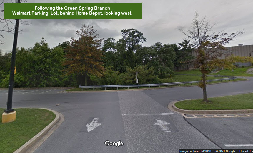
As many times as I have been to the Walmart in Garrison, I never really paid
much mind to the fact that this is where the Green Spring Branch used to run!
Here we are behind the Home Depot, only a couple hundred feet from where the junction used to be.
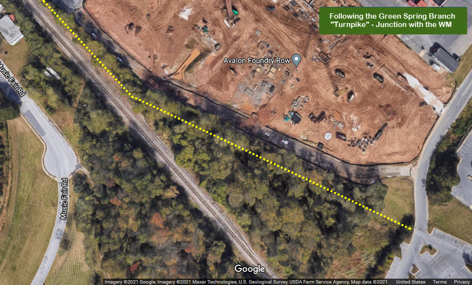
Turnpike
GPS Coordinates: 39.40902, -76.77168
This is the western end of the Green Spring Branch, where it met up with the Western Maryland Rwy.
Near as I can tell, this is where the Green Spring Branch junctioned into the Western Maryland.
Disclaimers:
New format 10/26/23: Please check out my disclaimer page for my standard
dribble and contact info here
RAILFAN GUIDES HOME RAILROAD SIGNALS HOME New 03/22/11, DEC31/2015, NOV02/2018, MAR28/2020, JUL05/2021, SEP17/18/2022, JUL03/2024,
JUN06/2025
Last Updated:
06/06/2025


 circa ~1950


 Looking west from Brooklandville Fire Station - this is on private property.
 Looking east from the fire station, towards the JFX, I83.
 Looking west from the rail trail, the R-O-W was to the right of Falls Road.
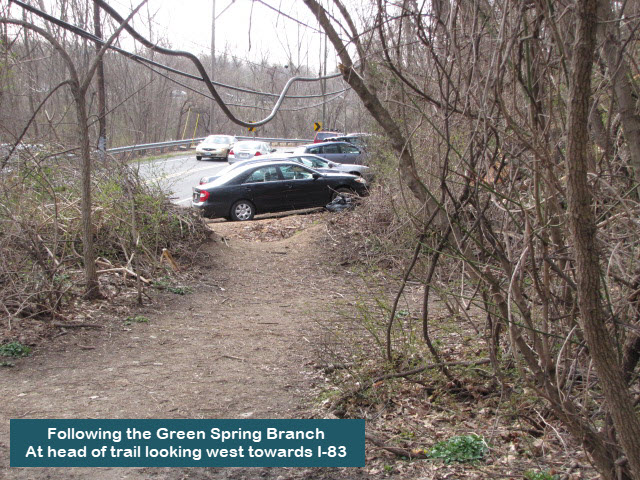 Looking west from the head of the rail trail, this and the next shot are from the same spot.
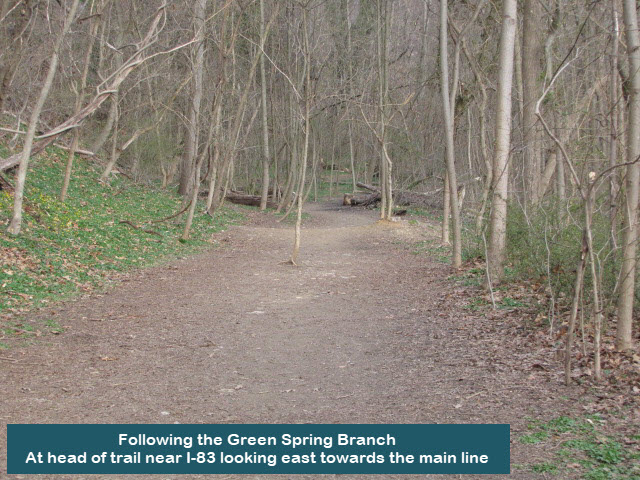 Looking east (towards the main line) down the rail trail where trains once ran.
 You can just make out the dark cinder surface of the path through the bare trees from Falls Road.
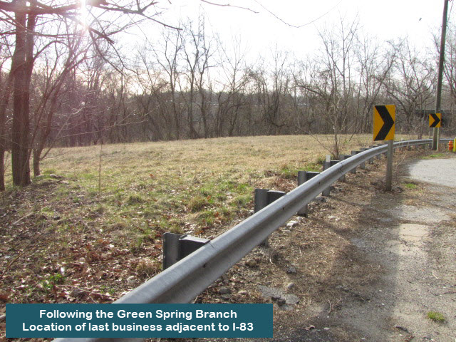


 Aerial shot with north on your right.
 The Valley Inn, across Falls Road from the Brooklandville Station. It used
to be a popular spot when the railroad came thru here.
The Valley Inn, across Falls Road from the Brooklandville Station. It used
to be a popular spot when the railroad came thru here.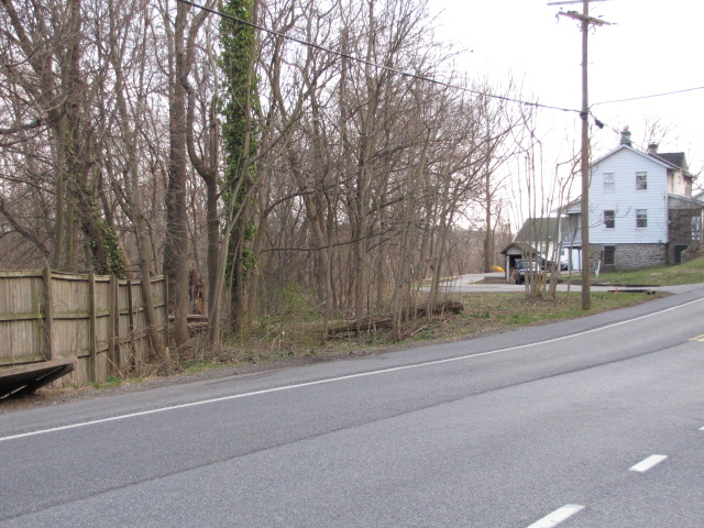 Looking east from the corner of Falls and Hillside, away from the station.
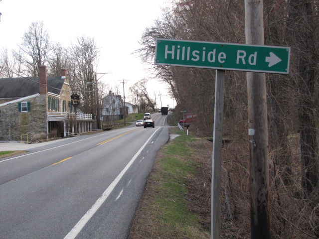 Looking south on Falls Road, the station is to the right.
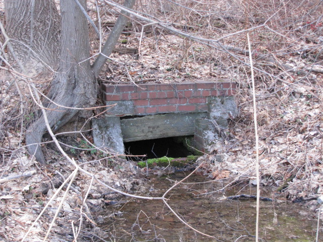 A small culvert going under the branch's tracks at the end of the platform along Falls Road.
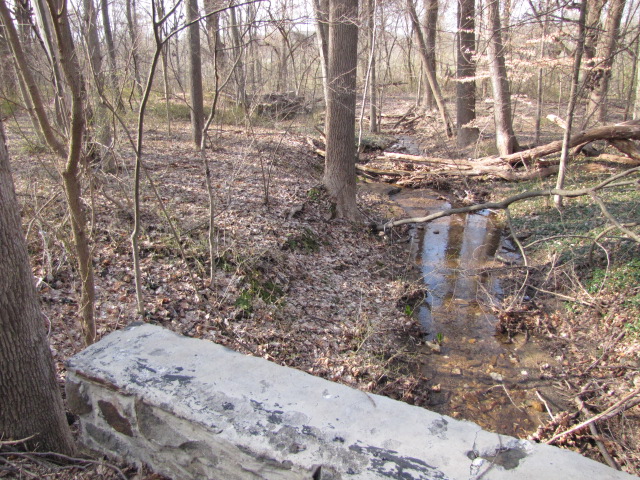


 looking east from Garrison Forest Rd