In General
Getting Here
Map
Pictures
RAILROAD SIGNALS HOME
Location / Name:
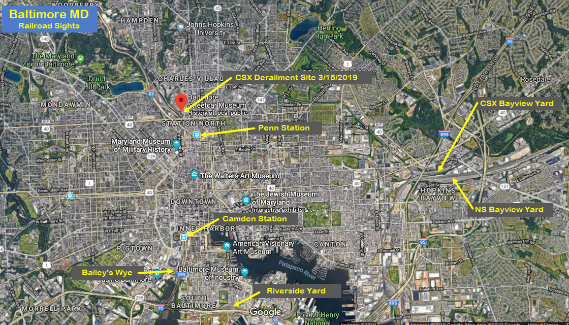
Baltimore City MD
What's Here:
CSX's Mainline from Baltimore to Philadelphia PA
the Baltimore Streetcar Museum
the Jones Falls
North Avenue
And to a lesser extent, Light Rail, and the North East Corridor
Data:
GPS Coordinates: 39.312495, -76.621490
Phone A/C: 410
ZIP: 21211
Access by train/transit:
Light Rail North Avenue Station
Amtrak & MARC Penn Station
A number of bus lines on North Ave.
The Scoop:
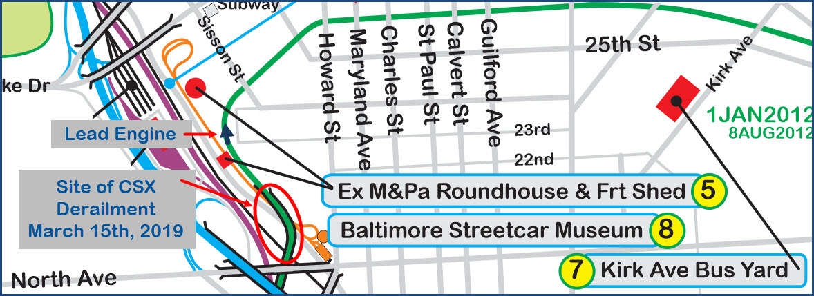
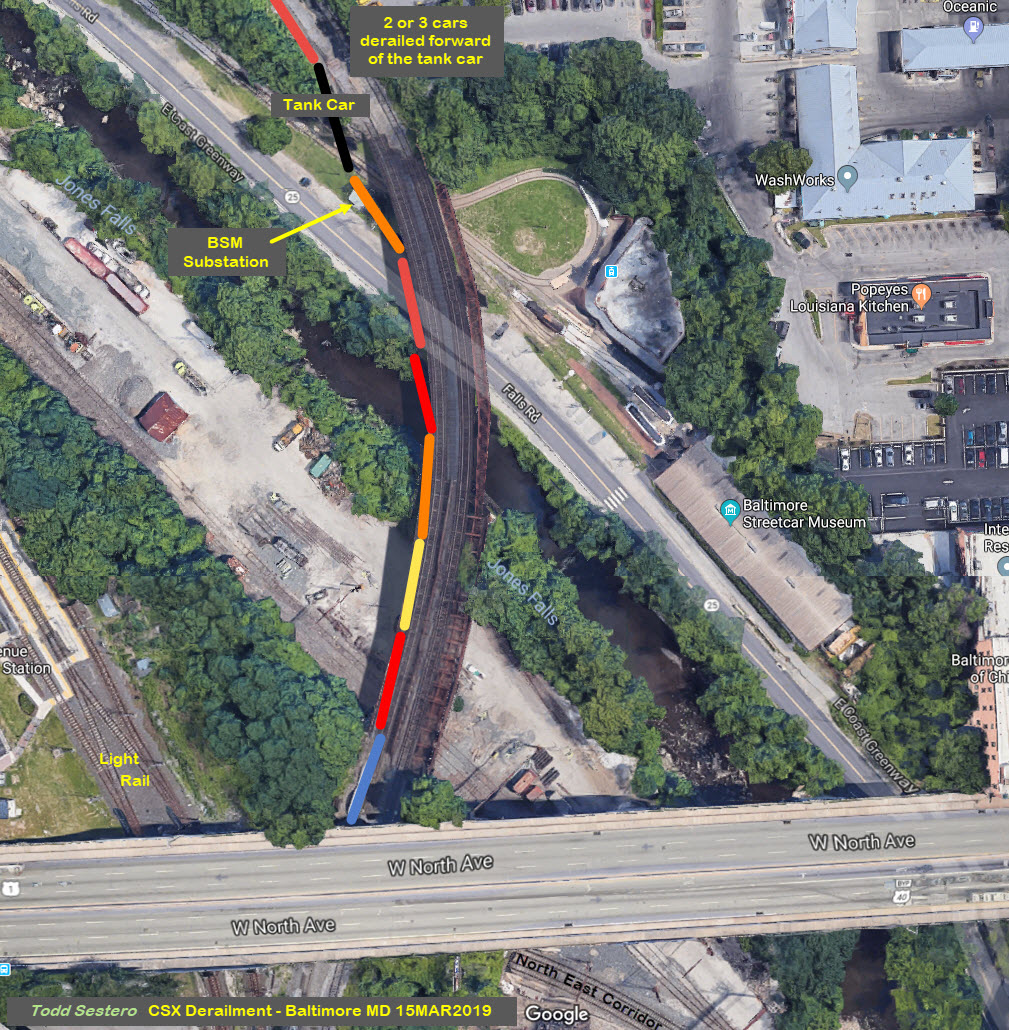
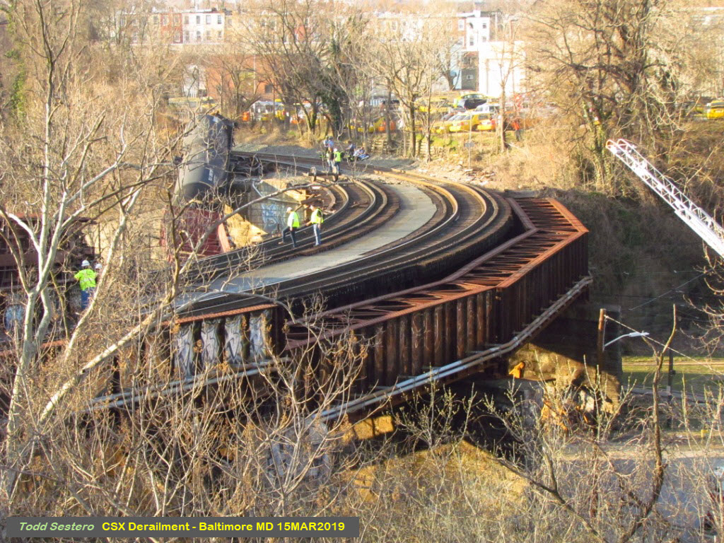
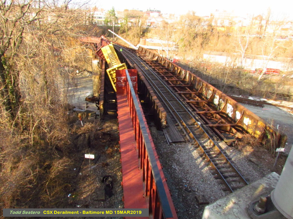
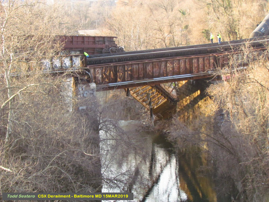
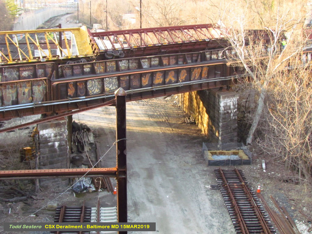
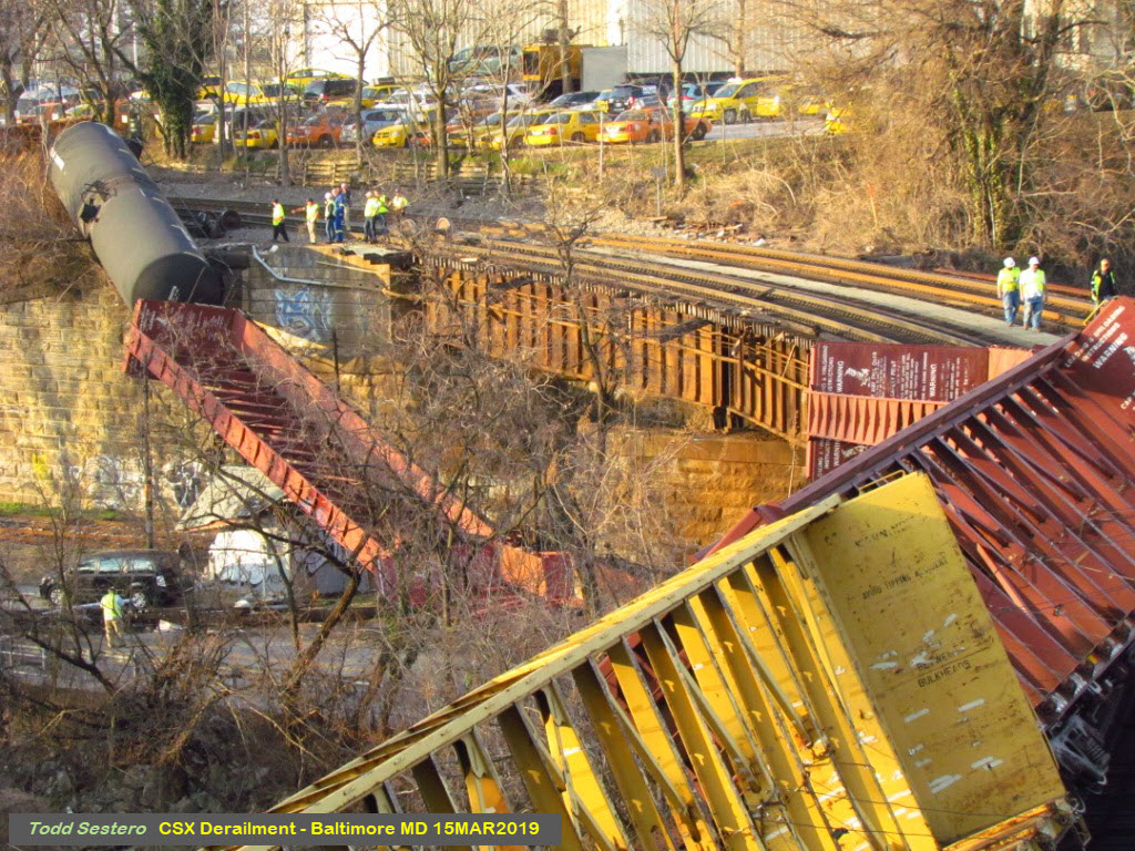
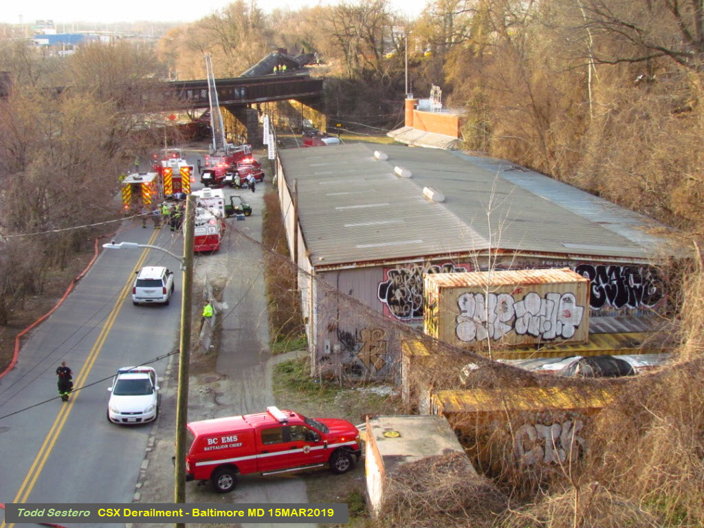
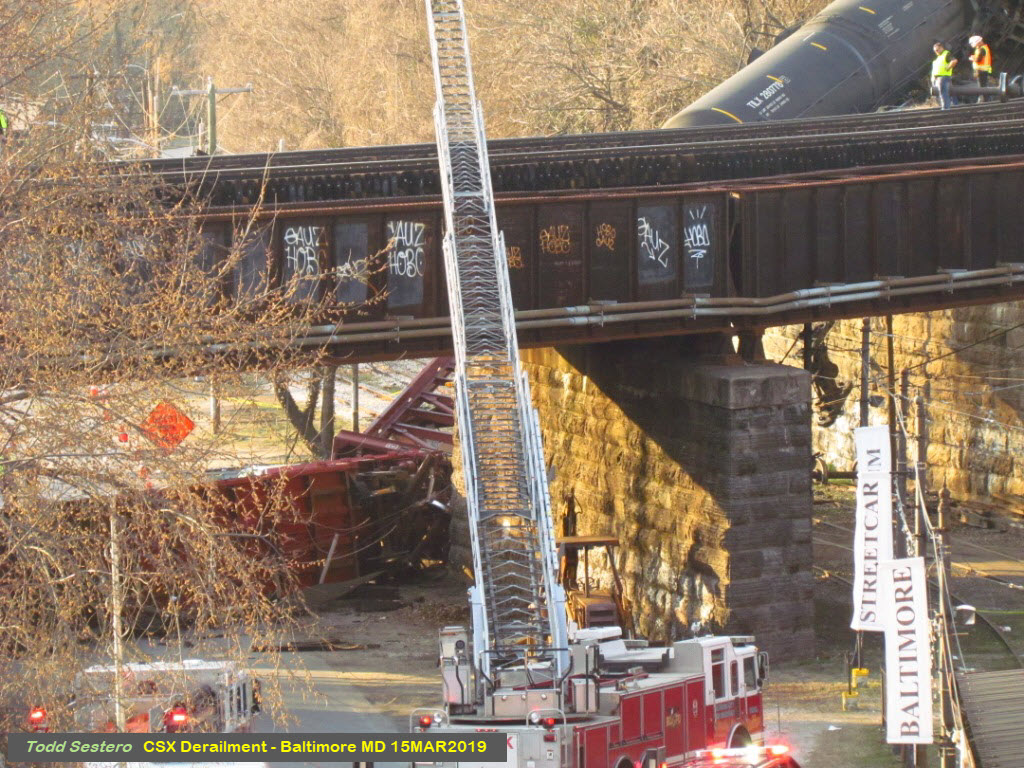
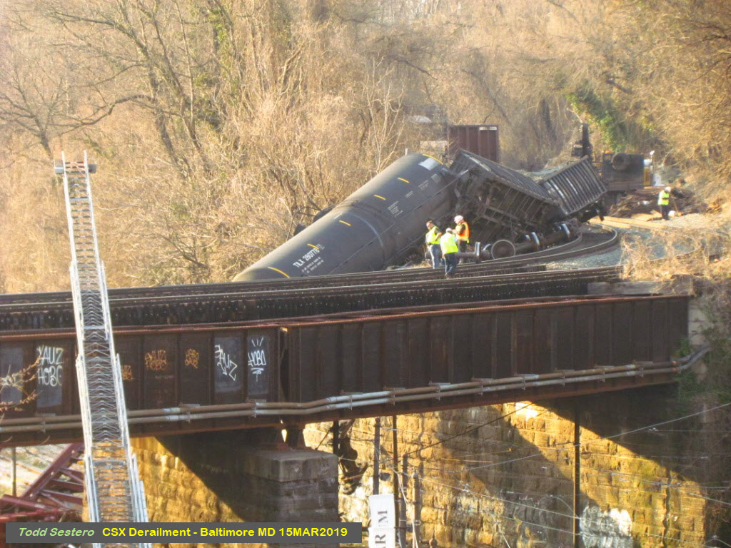
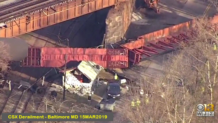
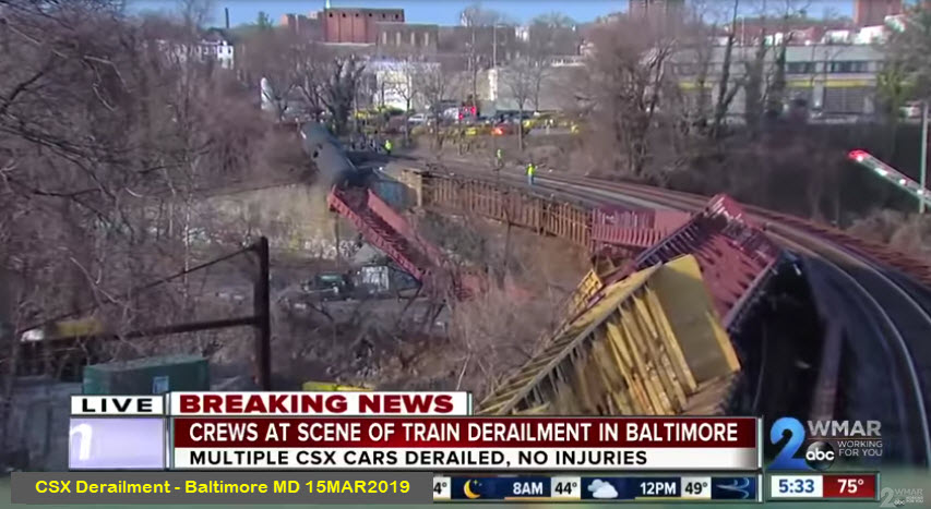
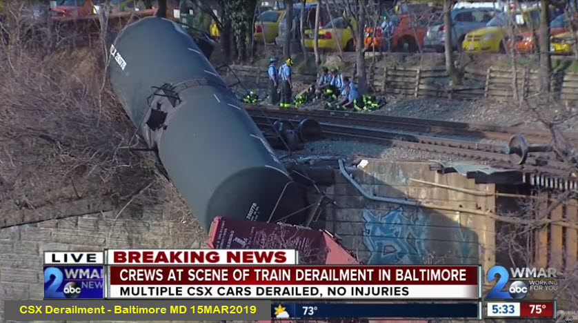
At approximately 1pm on Friday, March 15th, 2019, an east bound CSX freight (headed towards Philadelphia), was crossing the Jones Falls, Falls Road, and the Baltimore Streetcar Museum.
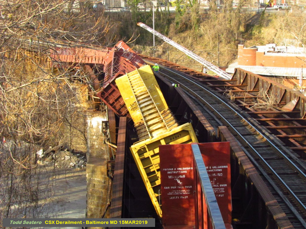
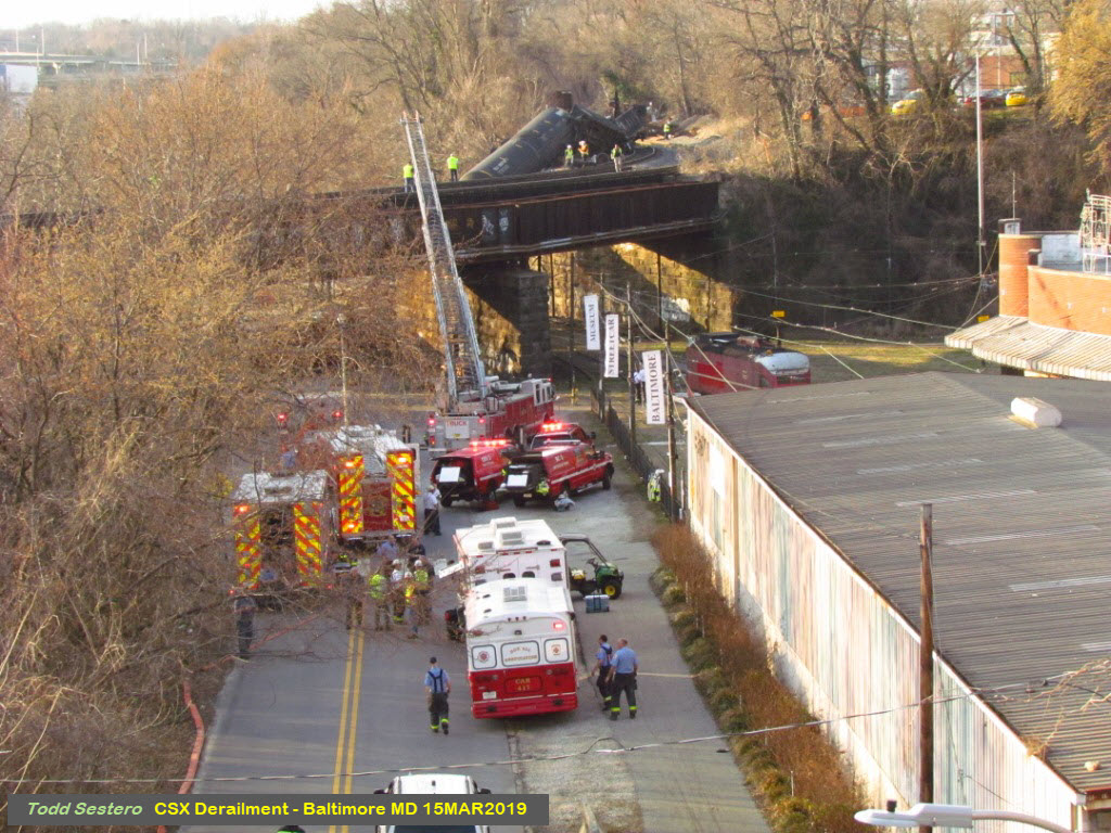
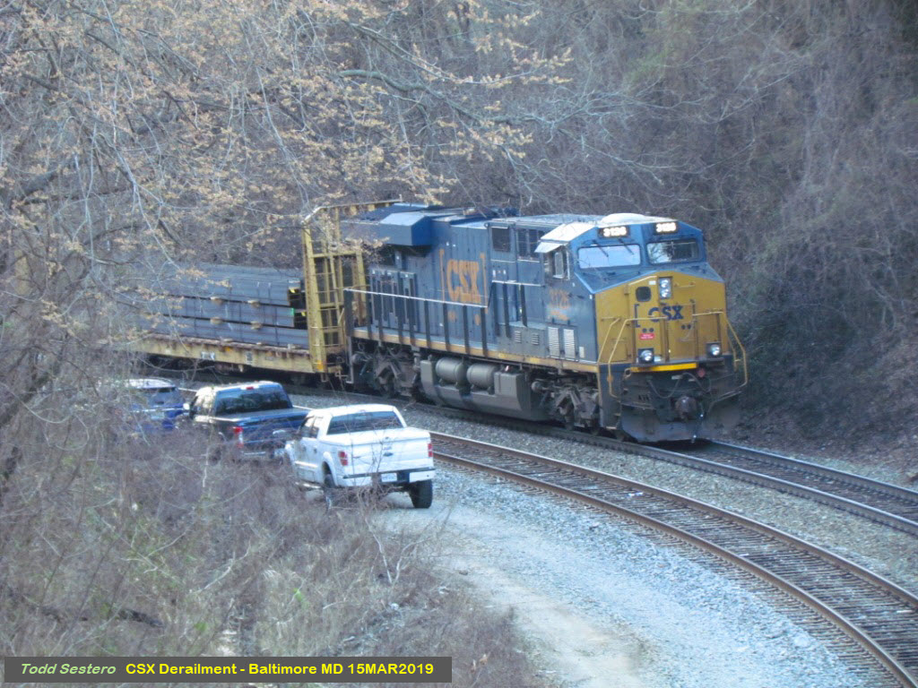
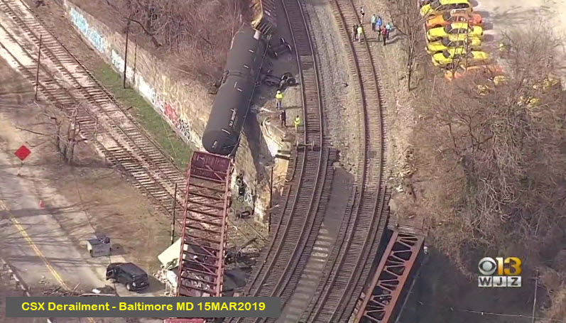
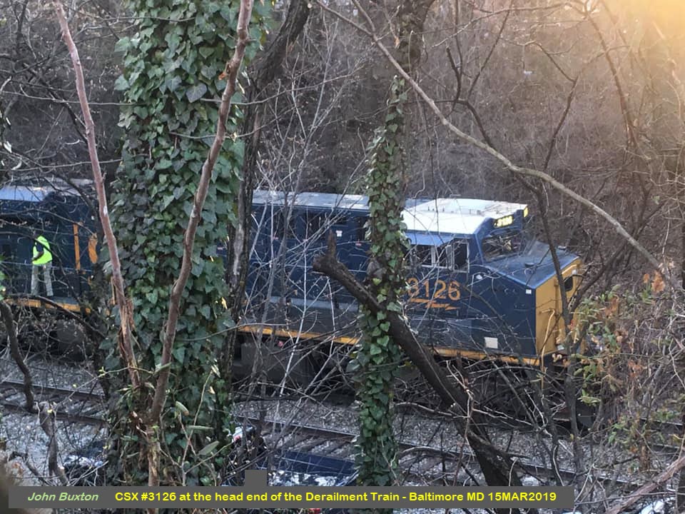
There was a number of loaded freight cars at the head end of the train, followed by at least a half a dozen empties, most of which are the kind you see carrying bulk lumber, they are called centerbeam flatcars. The empty cars were the ones to derail on the tightly curved section of the bridge spanning the Jones Falls and Falls Road. The Jones Falls is a creek flowing from Baltimore County south into and thru Baltimore emptying in the Baltimore Harbor about another mile and a half south of here.
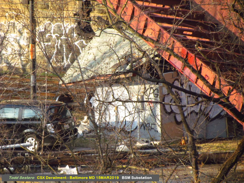
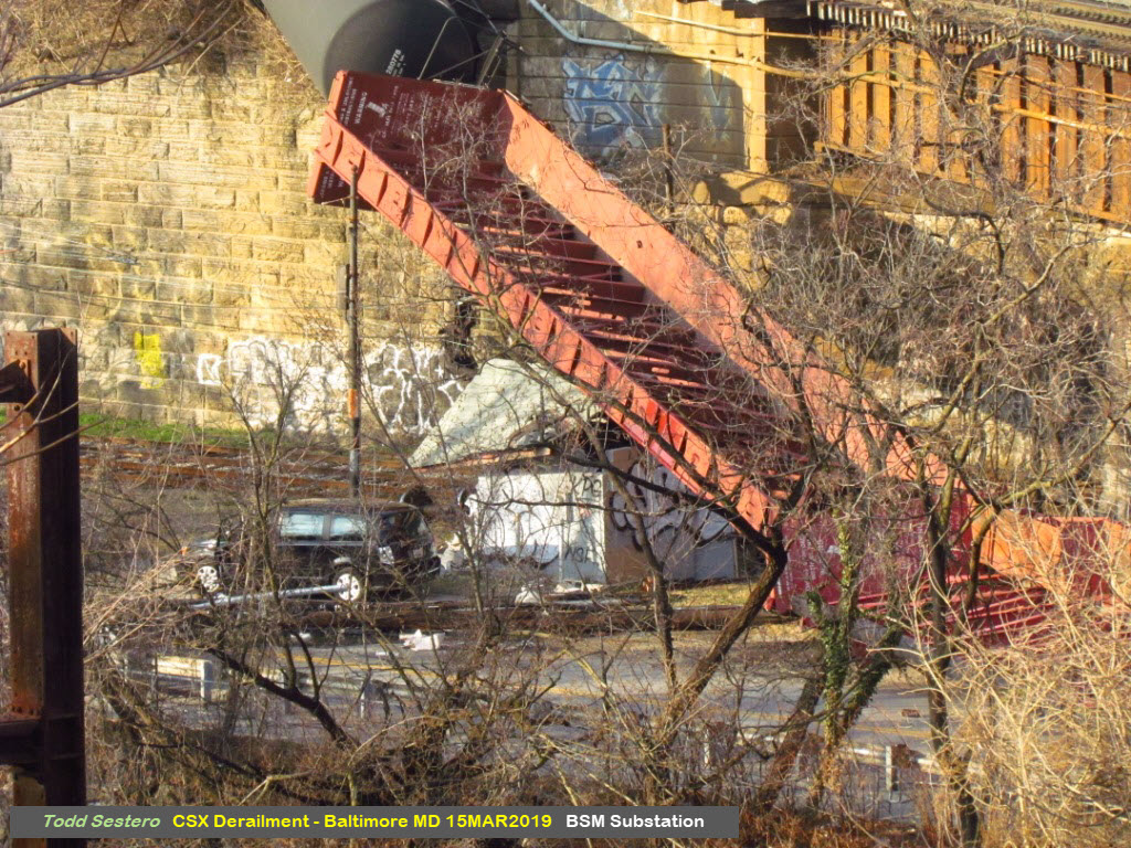
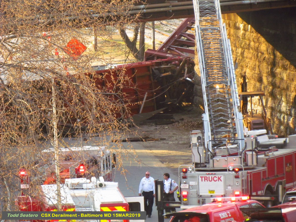
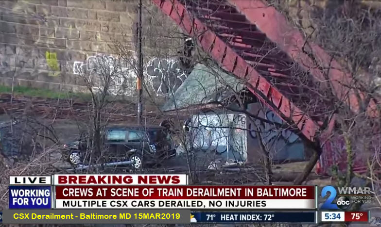
One of the cars that fell off the bridge fell onto the substation for the Baltimore Streetcar Museum. This provides power for the trolleys at the museum. I've been a member of the museum since 1967, and we always joked about their never having been a derailment. As it is, when a freight is going over the bridge, the streetcars always hold short of the overpass, just in case something falls off a car above. I guess we are going to have to stop even further away from the bridge in light of today's event! I suspect running cars for most of the summer will be out of question. Does anyone know where the power car from Charlotte is these days???
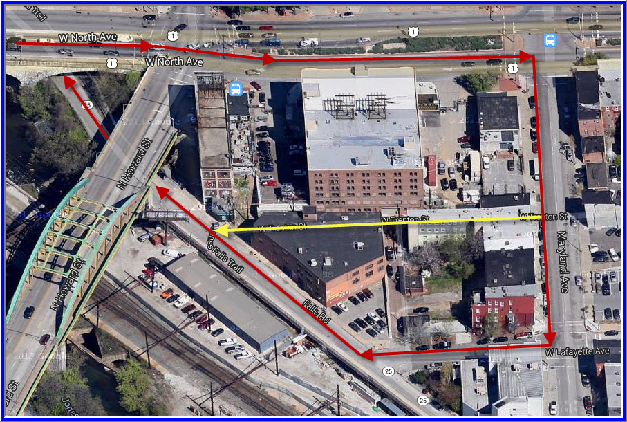
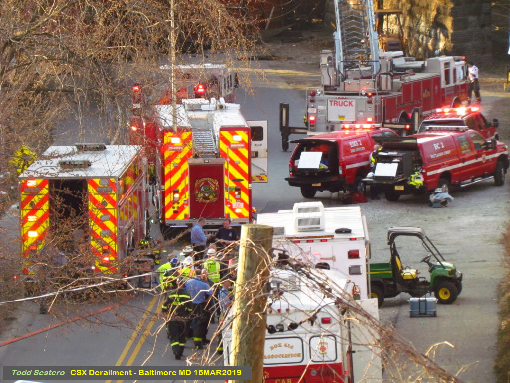
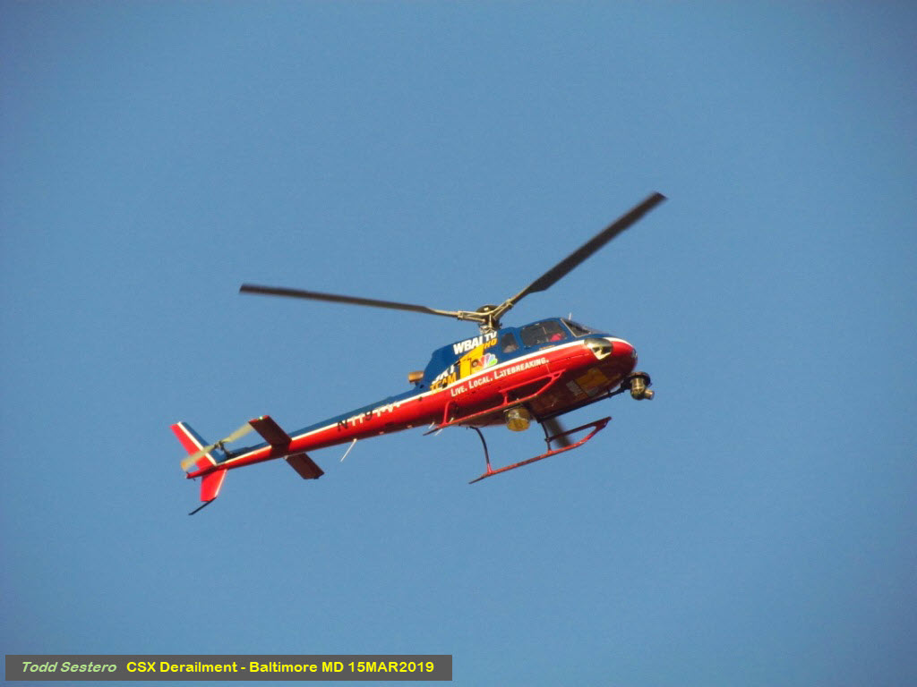
The North Avenue bridge that goes over the Light Rail, the Jones Falls, Falls Road, and CSX, provided an excellent vantage point to view the majority of the accident scene and the emergency crews. Present on the bridge were camera crews from Channels 2, 13, and 45, with Channel 11 a little further south at another location.
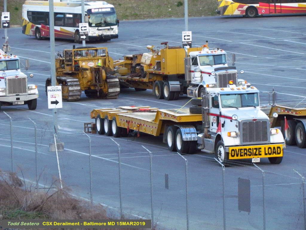
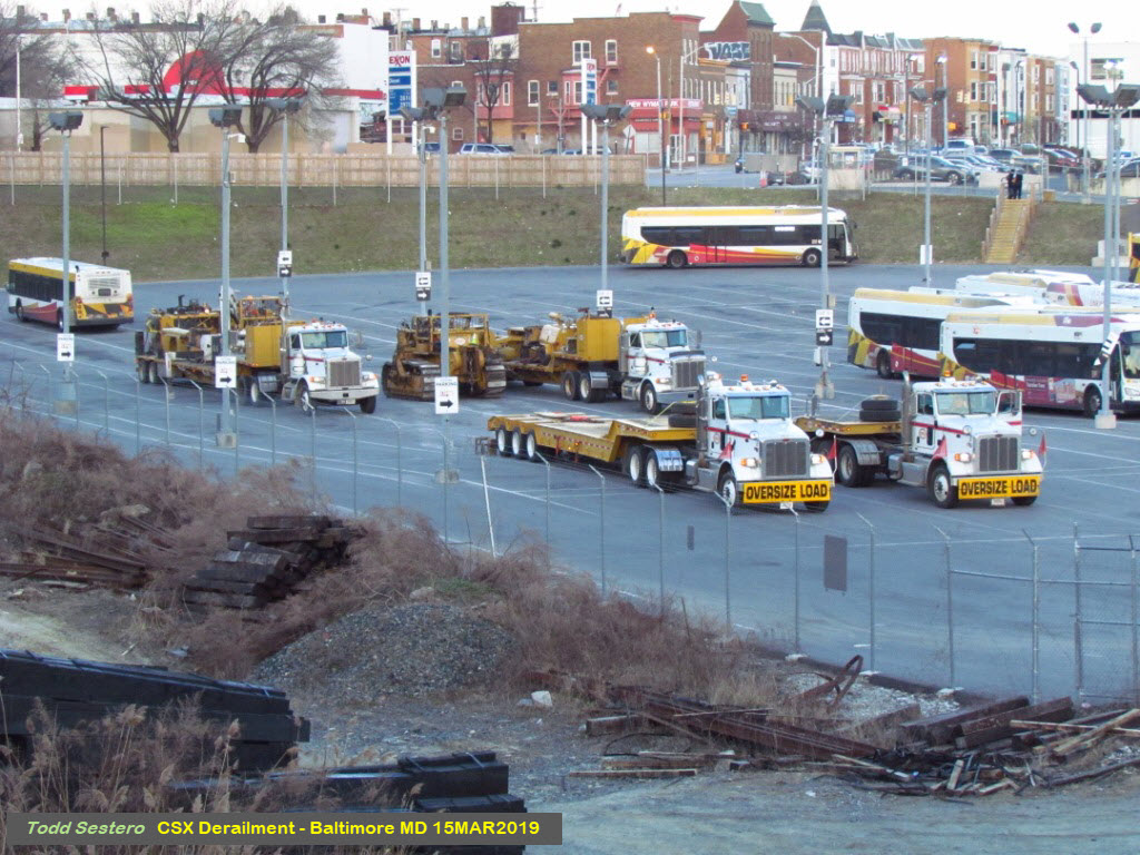
A few blocks away, it appears that CSX already had some construction equipment ready to assist in the clean-up efforts.
Corrections: The only correction to the news broadcast of Channel 13 would be to their mention that passenger trains were/are not affected. This is because the CSX Line is freight only. The passenger service is on another line altogether, a separate right-of-way below the CSX, and is Amtrak's North East Corridor. CSX, or more correctly, MARC, doesn't have passenger service until you get down to Camden Station, and that should not be affected unless the freight train is on the track that MARC uses to come out of the station on. Channel 2 also incorrectly stated that the derailment was the result of a head on collision.
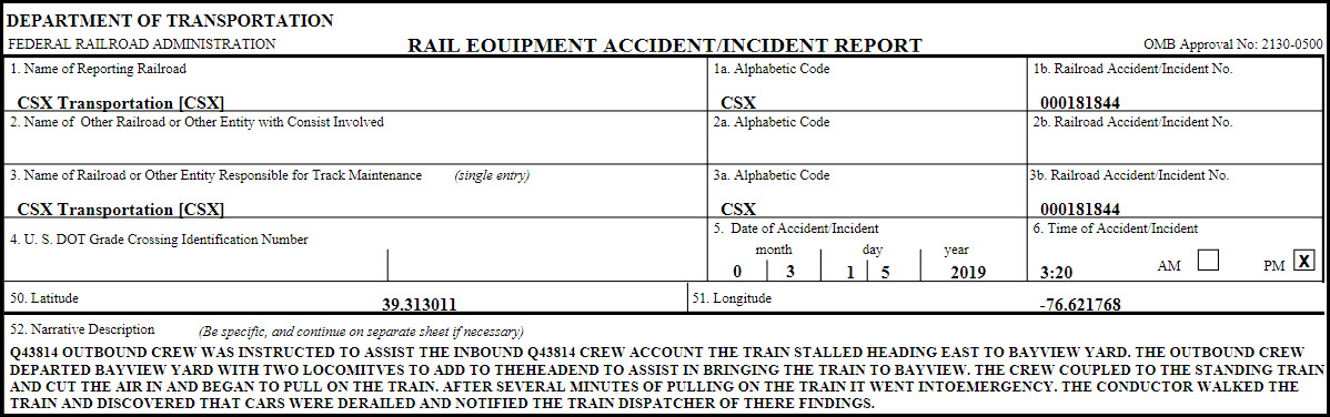
Yanked from FRA accident report #000181844, is this explanation of what happened:
Acknowledgements:
WJZ-TV, Channel 13
John Buxton
Rob Catlin
the FRA
Websites and other additional information sources of interest for the area:
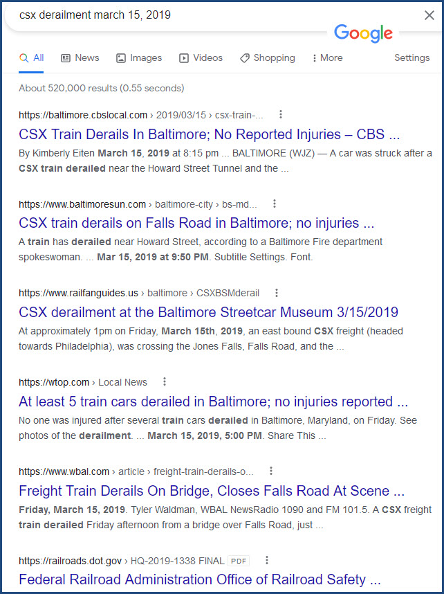
https://baltimore.cbslocal.com/2019/03/15/train-derailment-in-baltimore/
https://www.wbaltv.com/article/baltimore-train-derailment/26839449
https://safetydata.fra.dot.gov/officeofsafety/publicsite/query/AccidentByStateRailroad.aspx
https://www.baltimoremagazine.com/section/community/baltimore-streetcar-museum-csx-train-derailment/
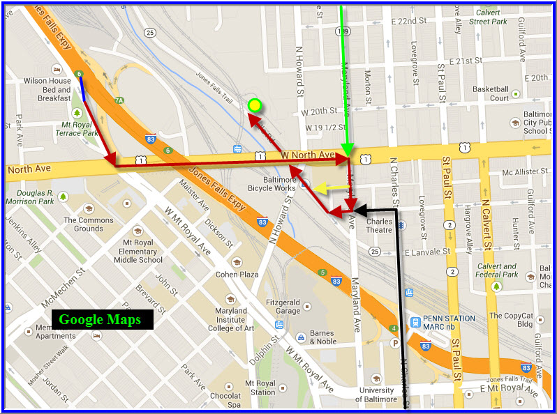
If you're "coming down" I-83, the JFX - Jones Falls Expressway from the north of Baltimore, such as the Towson area, or I-83 coming down from York or Harrisburg PA, take exit 6, North Avenue. At the end of the ramp, take a left onto North Ave, and go a few blocks till you can take a right onto Maryland Ave. You can take another right at either Trenton St (the yellow arrow) or Lafayette Ave (staying with the red). Trenton isn't always a good choice, for it is more of an alley than a street, and it might be clogged up. Either one ends at Falls Road, and you should take a right. Falls Road goes under both Howard St and North Ave.
If you're coming up from downtown (black line), Charles Street is probably the best bet. When you get to Lafeyette, hang a left, and join the red route.
From the west, you could come in via the Beltway, I-95, I-395, Conway St, and then Charles St, or, you could come in via Cooks Lane (off the end of I-70), Edmonston Ave, West Franklin, West Mulberry St, and when you hit Charles St, hang a left.
From the east side of Baltimore, streets like Pulaski Hwy/Orleans St, Baltimore St, or Madison St will get you to Charles St.
Blue cars remained on the track
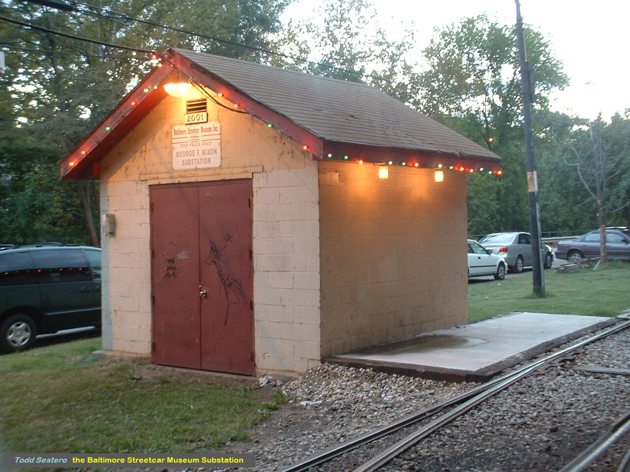
the Baltimore Streetcar Museum Substation Before the CSX Derailment

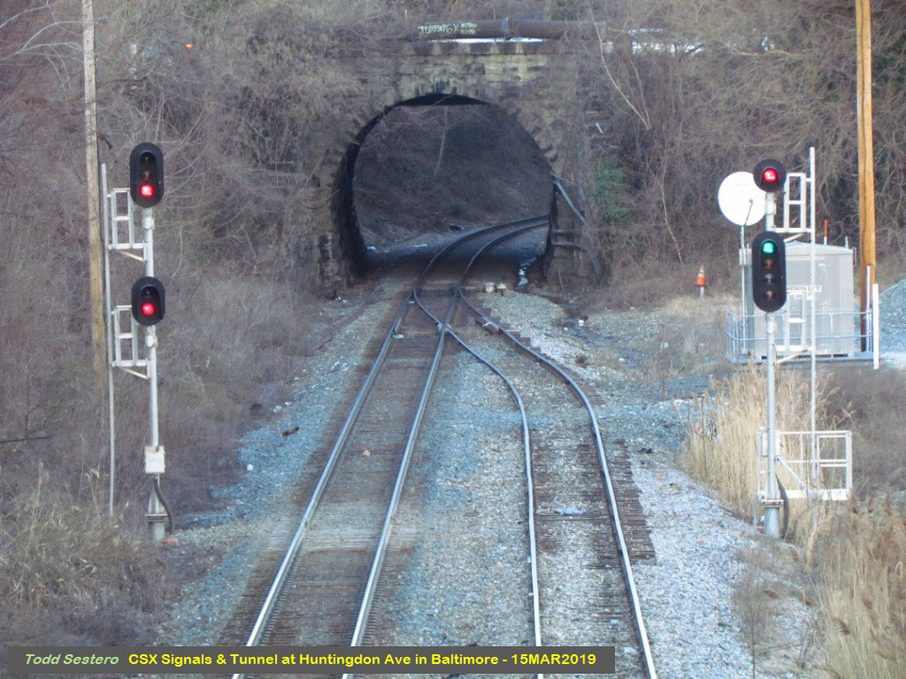
A Medium Clear for a train that will never make it.....
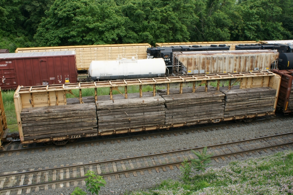
A typical Centerbeam Flatcar
Better view of the Substation from Skychopper 13
You can usually find several members of the BSM working down there on Saturdays, but not today, everything is blocked off - Rob Catlin photo

Two years later.....
Disclaimers:
I love trains, and I love signals. I am not an expert. My webpages reflect what I find on the topic of the page. This is something I have fun with while trying to help others.
Please Note: Since the main focus of my two websites is railroad signals, the railfan guides are oriented towards the signal fan being able to locate them. For those of you into the modeling aspect of our hobby, my indexa page has a list of almost everything railroad oriented I can think of to provide you with at least a few pictures to help you detail your pike.
If this is a railfan page, every effort has been made to make sure that the information contained on this map and in this railfan guide is correct. Once in a while, an error may creep in :-)
My philosophy: Pictures and maps are worth a thousand words, especially for railfanning. Text descriptions only get you so far, especially if you get lost or disoriented. Take along good maps.... a GPS is OK to get somewhere, but maps are still better if you get lost! I belong to AAA, which allows you to get local maps for free when you visit the local branches. ADC puts out a nice series of county maps for the Washington DC area, but their state maps do not have the railroads on them. If you can find em, I like the National Geographic map book of the U.S..... good, clear, and concise graphics, and they do a really good job of showing you where tourist type attractions are, although they too lack the railroads. Other notes about specific areas will show up on that page if known.
Aerial shots were taken from either Google or Bing Maps as noted. Screen captures are made with Snagit, a Techsmith product... a great tool if you have never used it!
By the way, floobydust is a term I picked up 30-40 years ago from a National Semiconductor data book, and means miscellaneous and/or other stuff.
Pictures and additional information is always needed if anyone feels inclined to take 'em, send 'em, and share 'em, or if you have something to add or correct.... credit is always given! Please be NICE!!! Contact info is here
Beware: If used as a source, ANYTHING from Wikipedia must be treated as being possibly being inaccurate, wrong, or not true.
RAILFAN GUIDES HOME
RAILROAD SIGNALS HOME
NEW MAR16/2019, MAR17/2019, MAY16/2021
Last Modified
16-May-2021