
In General
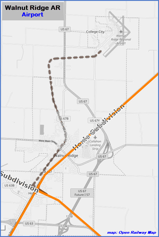
Getting Here
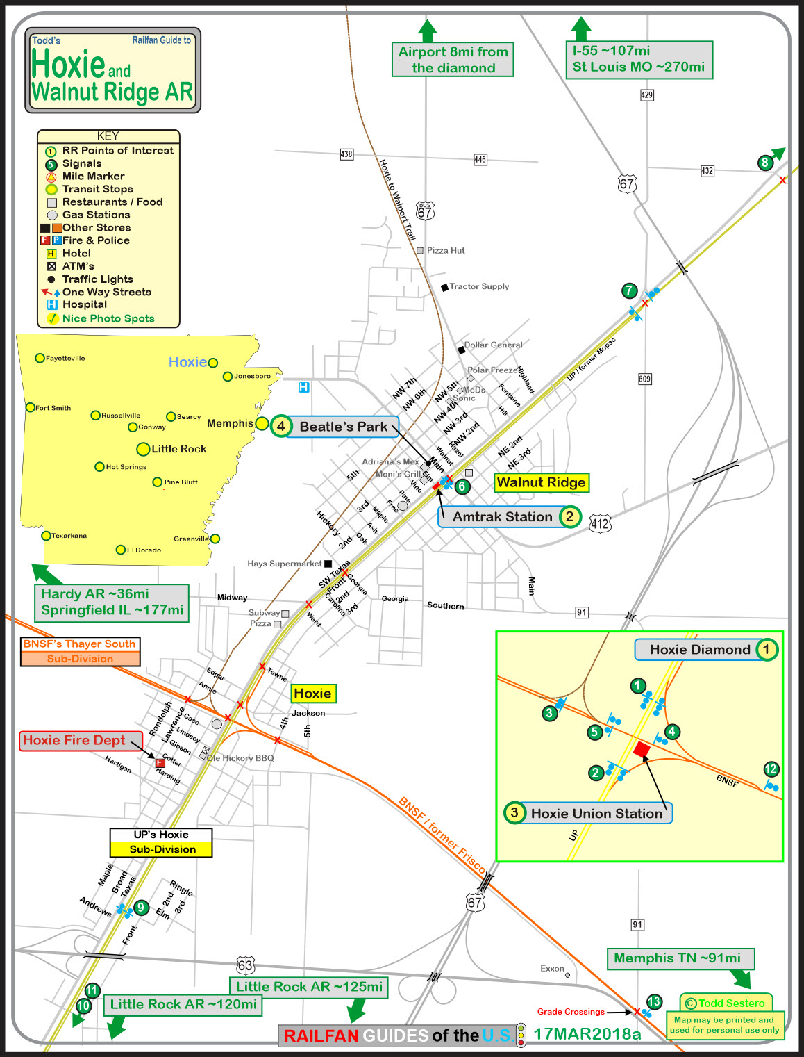
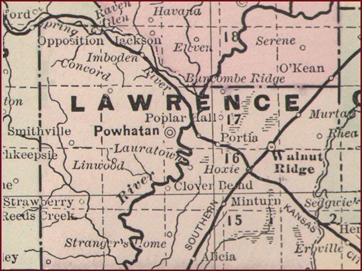
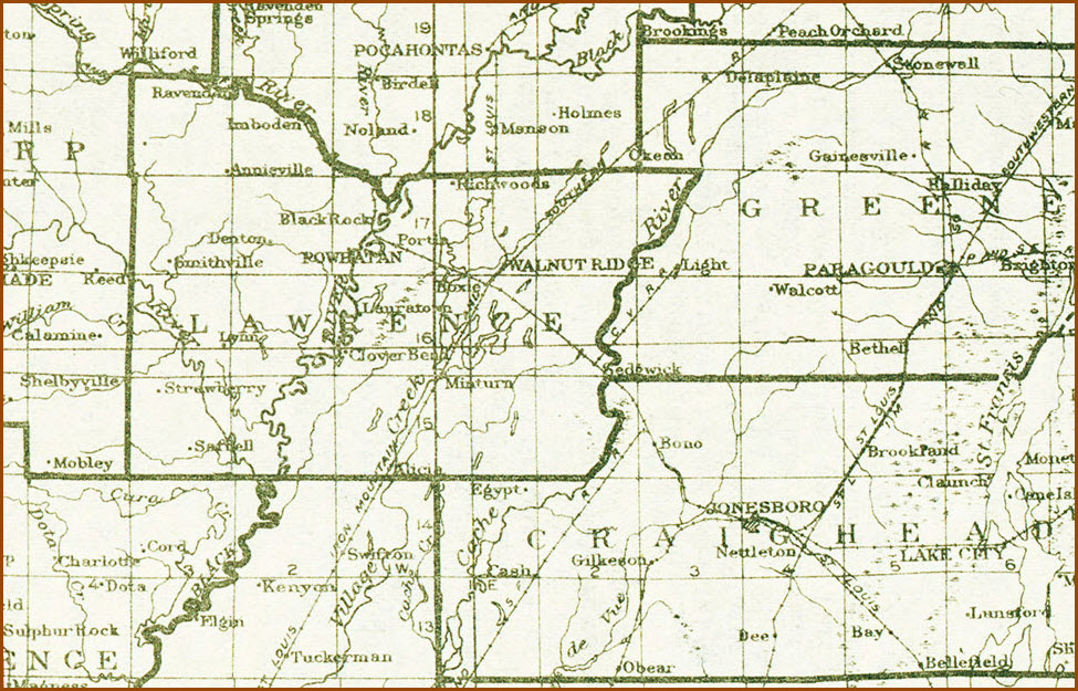
Map
Sights
Pictures
Signals
Floobydust
USGS Maps
RAILROAD SIGNALS HOME
Location / Name:
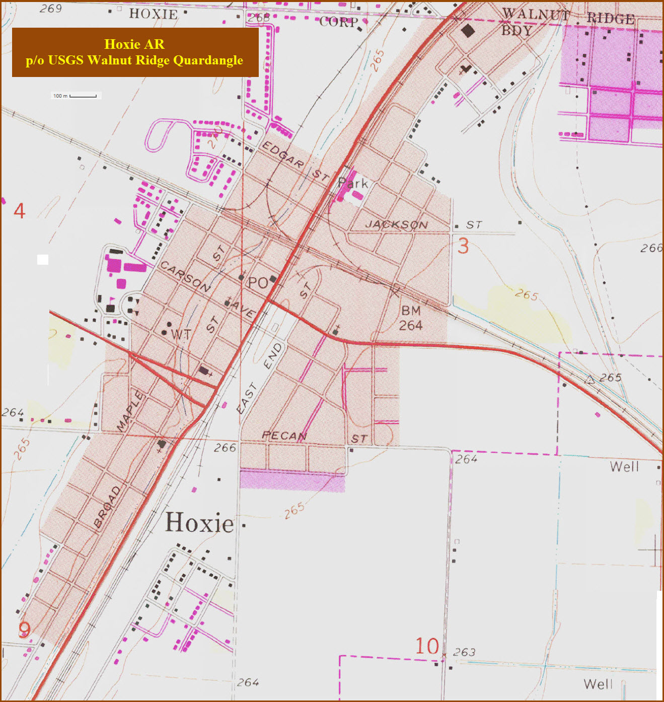
Hoxie AR, Lawrence County
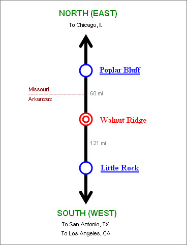
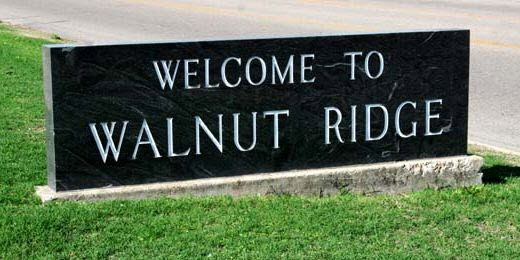
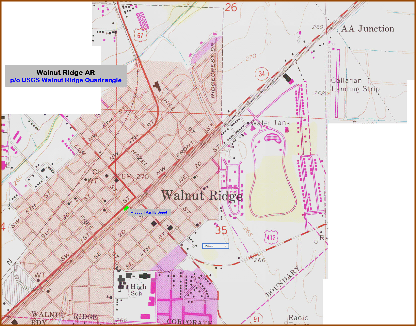
Walnut Ridge AR, Lawrence County
What's Here:
♦Hoxie:
Diamond, well signaled
Listed in Trains Magazine as a hotspot
♦Walnut Ridge:
Amtrak Station
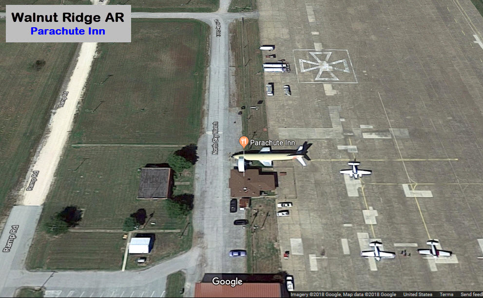
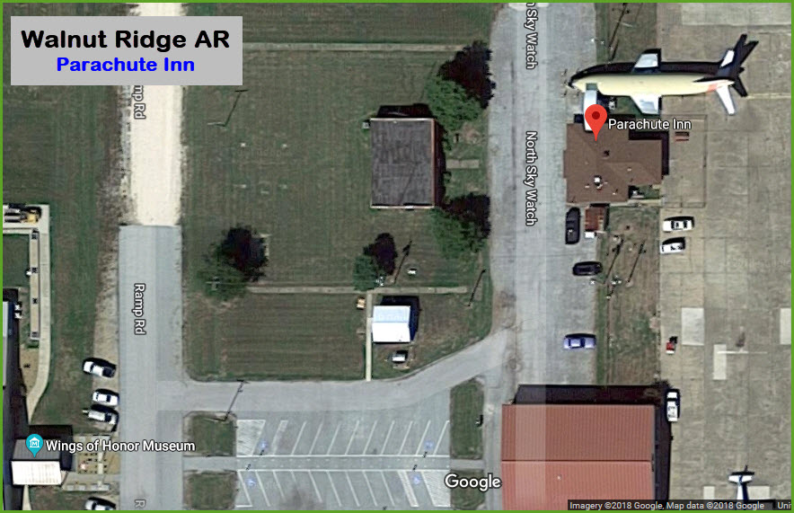
Restaurant in an Airplane
Guitar Walk, next to the Amtrak Station
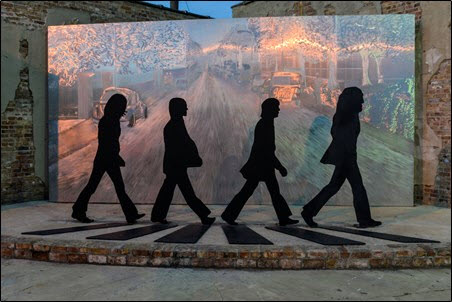
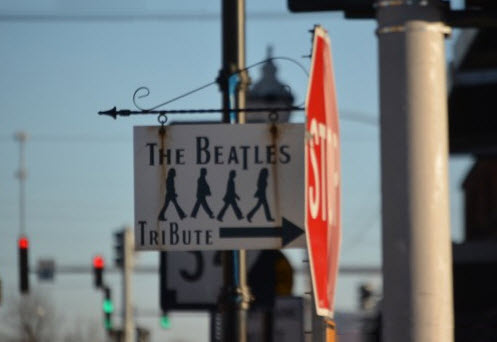
the Beatles Park
Data:
GPS Coordinates: as needed
Phone A/C: 870
ZIP: 72433 Hoxie, 72476 Walnut Ridge
Access by train/transit:
Amtrak Texas Eagle, about 1 mile north of the Hoxie diamond in Walnut Ridge
The Scoop:
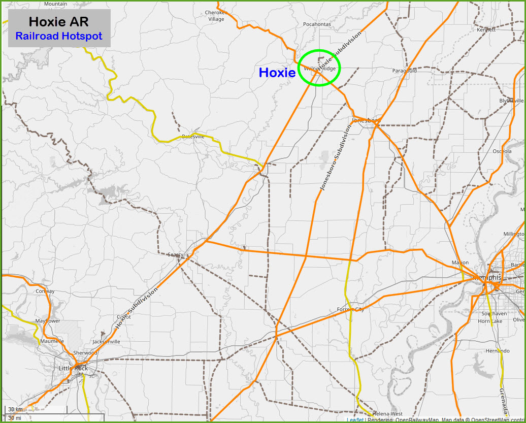
Hoxie Arkansas: most of us, like myself, have probably never heard of the town before Trains Magazine featured it as a HOTSPOT way back in 2001. According to them, there are around 30-40 trains a day plundering over the UP/BNSF diamond here. Also according to Trains, almost all UP traffic is NB. Early morning and late afternoon seem best for the action. The UP here used to be the Missouri Pacific, and the BNSF passing thru was the Frisco.
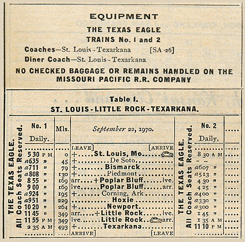
Two of those trains are Amtrak's Texas Eagle traveling between Chicago and Los Angles, via Dallas and El Paso TX, and Tucson AZ. Unfortunately, they are very early "night" trains, with scheduled arrival times of 01:36 for the SB train #21/421, and 01:41 for NB train #22/422.
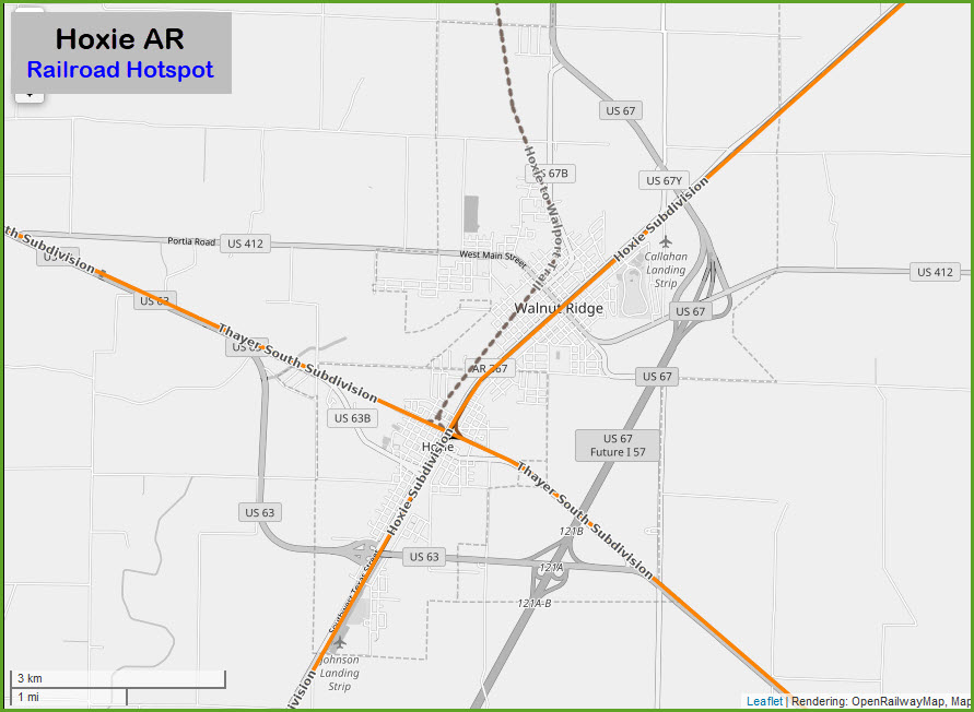
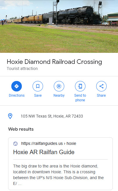
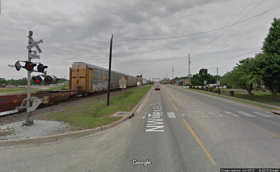
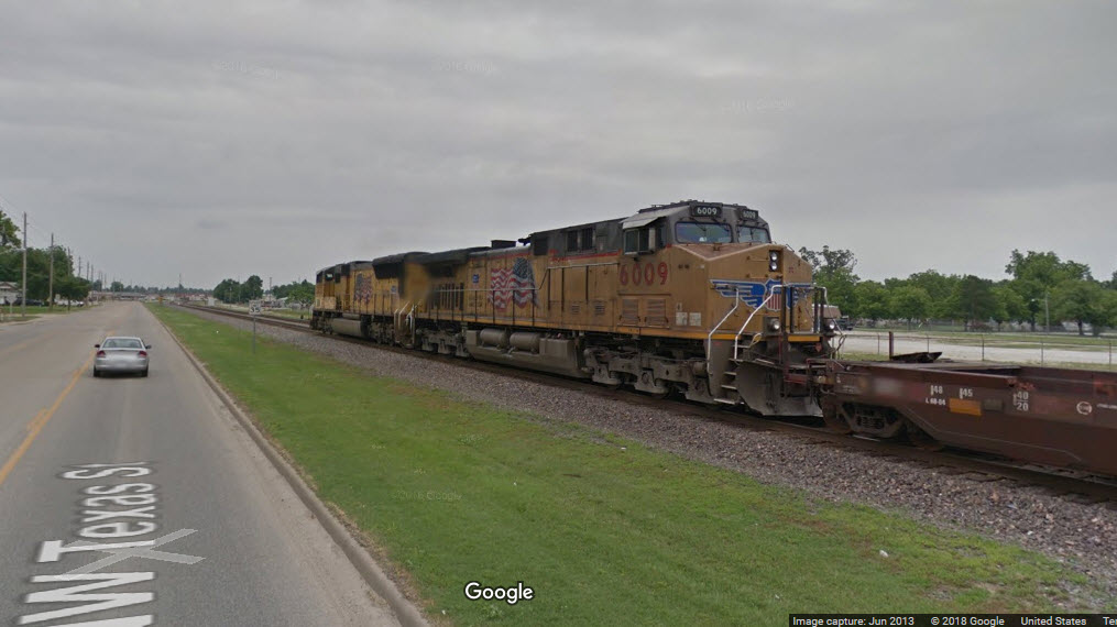
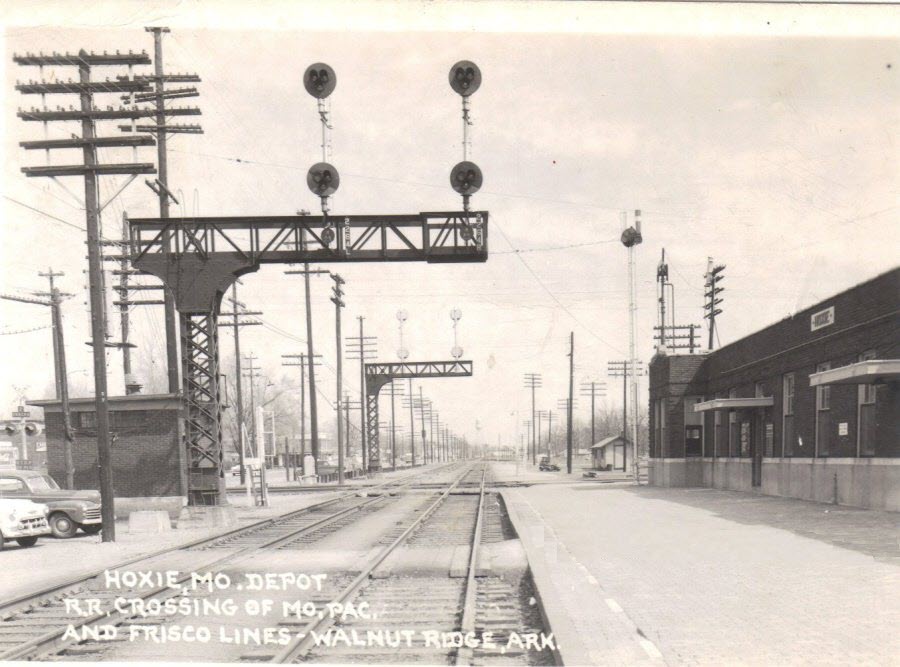
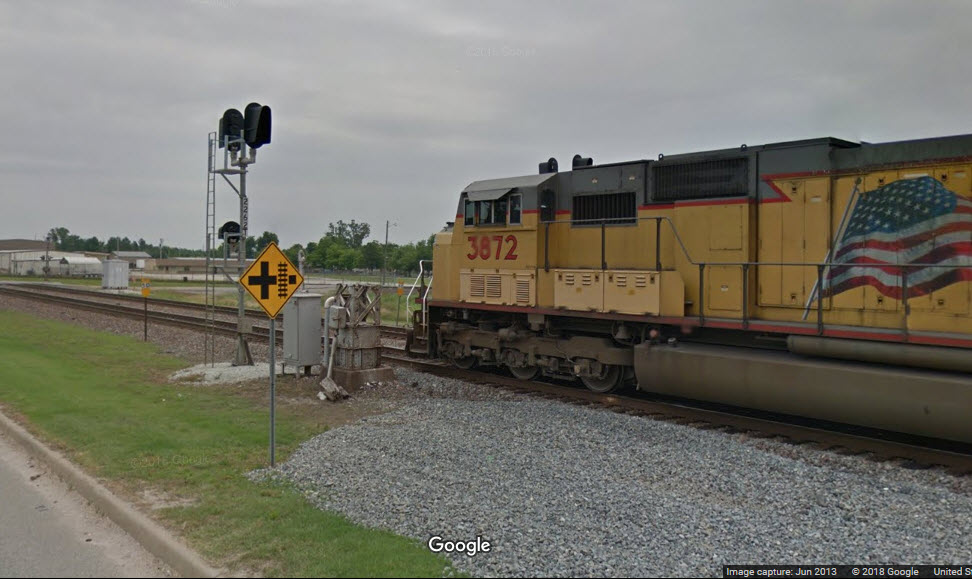
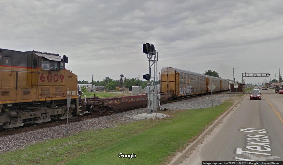
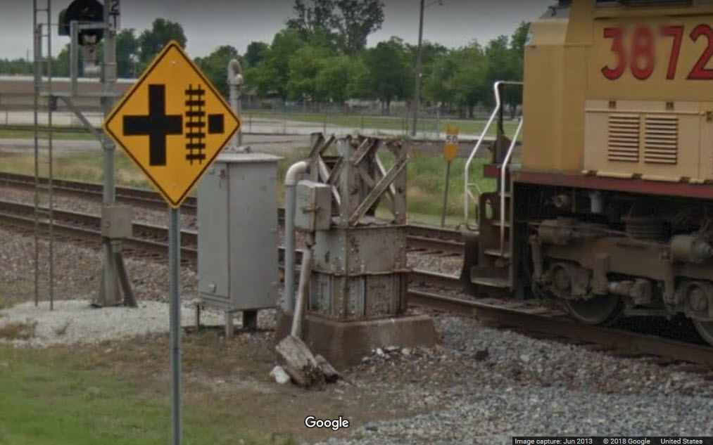
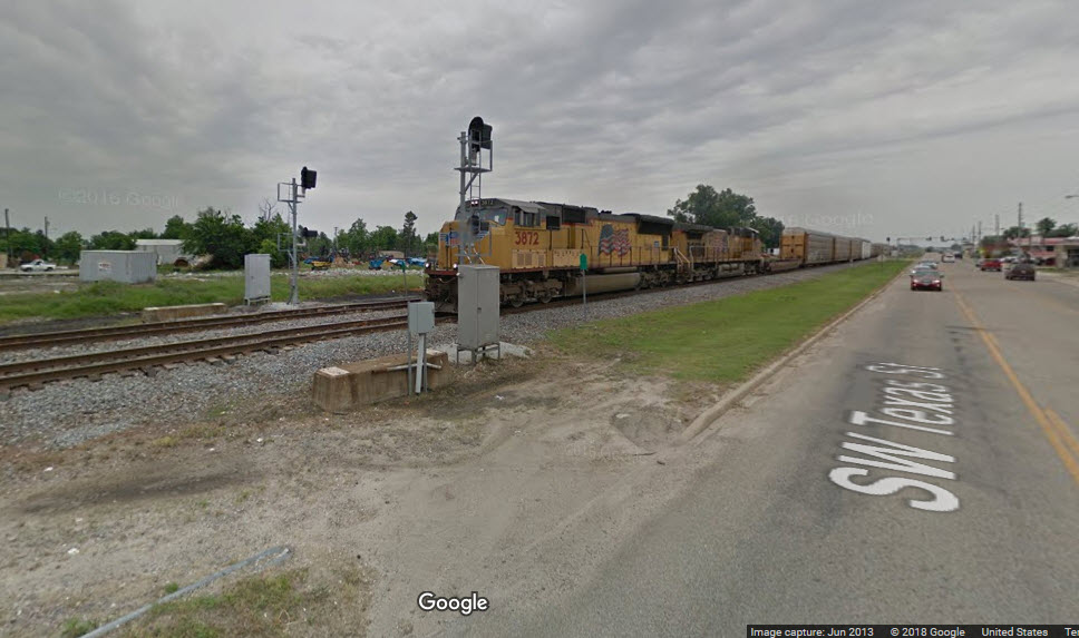
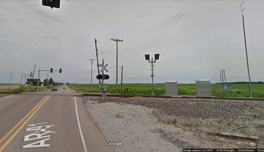
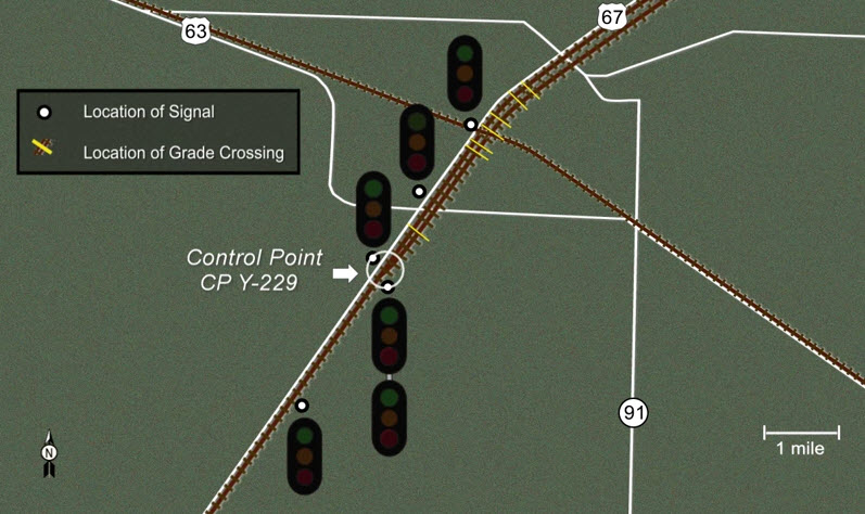
The big draw to the area is the Hoxie diamond, located in downtown Hoxie. This is a crossing between the UP's N/S Hoxie Sub-Division, and the E/W BNSF Thayer South Sub-Division. The crossing is at MP 226 on the UP, and MP 398 on the BNSF.
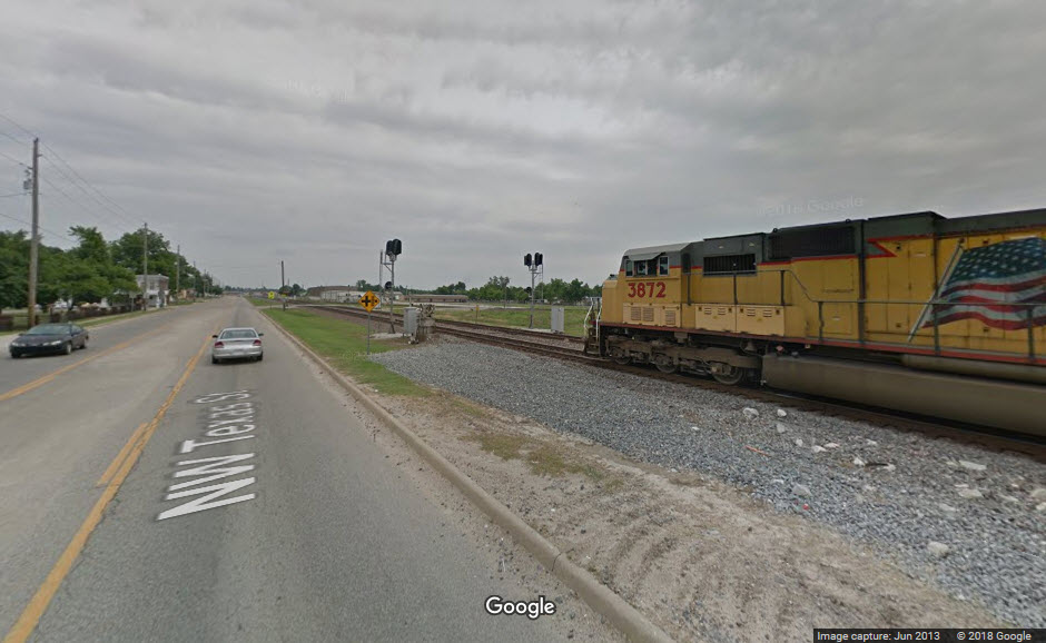
The diamond itself is well signaled, and it appears that the signals were replaced in 2013, since Google's Streetview shows some new signals in place, and others are waiting to go up (as of the time Google's cameras came thru in 2013).
Stretching about 4.9 miles is a siding on the Hoxie Sub passing thru Hoxie and Walnut Ridge, with about three of those miles being north of the diamond.
Nearby hotbox detectors are at MP's 392.0, 401.0, 216.0, and 233.0.
If you're up to following the action out of town, we're very lucky the the roads follow the tracks, or the tracks follow the roads, not sure which came first, but they do a good job of paralleling the track for good shots with signals in them.
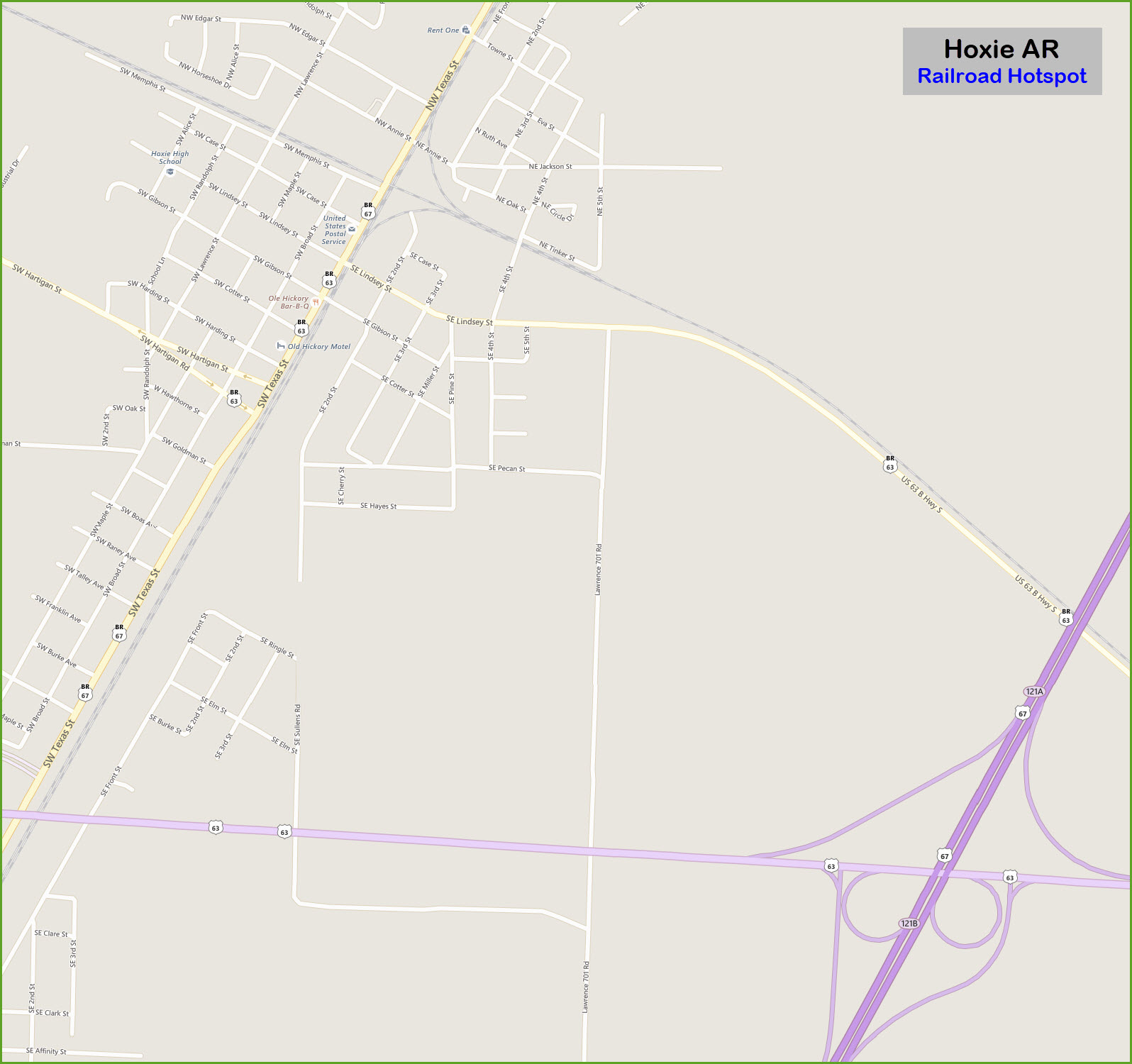
367, SW Texas St follows the Hoxie Sub-Division south, and 34 follows it north-east out of Walnut Ridge. Corning is the next major town north of Hoxie (~34mi), and Tuckerman is the next "major" town south, about 26 miles away, passing thru Minturn, Alicia & Swifton, and is at the south end of a passing siding.
Heading east and south-east out of Hoxie if US 63 Business, SE Lindsey St, which follows the Thayer South Sub-Division. In 2.08 miles from Texas St, it joins back up with US 63, and continues south-east to Bono AR (~14.5 miles) where 63 follows it fairly well, and then on to Jonesboro (~22 miles).
US 63/412 follows the Thayer South Sub west out of Hoxie on it's way to Imboden, but roads only follow the rails for about 7.4 miles before trains head north, just short of Black Rock. From downtown, take W Hartigan St, which is US 63 Business. W Memphis St parallels the Thayer sub on the west side but only for about 1000 ft or so.
On the Thayer South Sub, there is a 1.78 mile long siding on the west side of town, starting a couple hundred feet west of the diamond.
Note: I have not been to Hoxie, as such, all information comes from either Denver Todd, the internet, listed sources, or Trains Magazine.
Acknowledgements:
Denver Todd
MJ Scanlon of Olive Branch MS
Betty Davidson
Jon Walker
Stoney Warbritton
Chris Litherland
Wikipedia
Open Railway Map
Google Maps
Trains Magazine
IMDB
EBay
Websites and other additional information sources of interest for the area:
http://gregariousrailfan.com/Hoxie.html
https://www.youtube.com/watch?v=wHoAjjRHPHE source of freight with the Ferromex engine in the lead
http://ataleoftwotowns.com/1956-hoxie-depot/
http://elevation.maplogs.com/poi/kentucky_st_walnut_ridge_ar_usa.217211.html pictures of MJ Scanlon
https://www.flickr.com/people/mjscanlonphotography/ pictures of MJ Scanlon
http://www.railpictures.net/showphotos.php?userid=749 pictures of MJ Scanlon
https://www.youtube.com/watch?v=--uS_Susx3k
https://www.topozone.com/arkansas/lawrence-ar/city/walnut-ridge/
https://en.wikipedia.org/wiki/Hoxie,_Arkansas
http://www.encyclopediaofarkansas.net/encyclopedia/entry-detail.aspx?entryID=916
http://www.topix.com/album/detail/hoxie-ar/FC3QC7I7GSED3OGK
http://cityofwalnutridge.com/
https://www.trainorders.com/discussion/read.php?1,1344570
https://www.youtube.com/watch?v=EqqSIPxi0MA SB UP freight at the diamond
From Little Rock, take US 167, then US 67 north east to Hoxie.
From Memphis, take I-55 north to I-555 & US 63, and head north-west about 92 miles.
US 412 will bring you in from the west, but it will obviously not be as fast as an interstate, the sme thing for US 63 coming in the from the north-west.
US 412 will also bring you in from the east and I-55 if your coming down from St Louis.
GPS Coordinates: 36.052186, -90.973490
105 NW Texas St, Hoxie AR 72433
https://www.google.com/maps/place/Hoxie+Diamond+Railroad+Crossing/@36.0524449,-90.9727507,239m/data=!3m1!1e3!4m13!1m7!3m6!1s0x87d6a37f33b0c9cb:0x65d6dc3419d30574!2sHoxie,+AR!3b1!8m2!3d36.0504008!4d-90.9750672!3m4!1s0x87d6a3f4755ff7cd:0x3af5fa31ca519af8!8m2!3d36.0521826!4d-90.973491
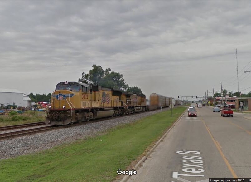
The diamond once hosted trains of the Missouri Pacific and Frisco Railroads. Now it sees Union Pacific and BNSF trains, as well as Amtrak's Texas Eagle.
We once again luck out as the Google cameras catch a NB Union Pacific freight getting ready to pound the iron at the diamond!
GPS Coordinates: 36.067503, -90.956755
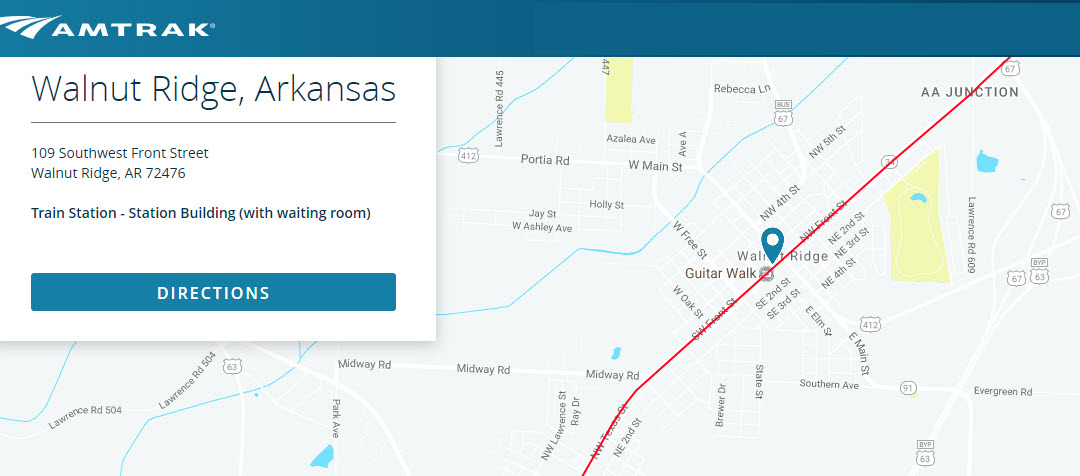
109 SW Front St, Walnut Ridge, AR 72476
Station code: WNR
(800) 872-7245
Additional Info:
https://www.amtrak.com/stations/wnr.html
https://www.wanderu.com/en/stations/us-ar/walnut-ridge/amtrak-walnut-ridge-stop-ar/
https://en.wikipedia.org/wiki/Walnut_Ridge_station
http://www.greatamericanstations.com/stations/walnut-ridge-ar-wnr/
http://texaseagle.com/station/WNR.php
http://www.trainweb.org/usarail/walnutridge.htm
The station was built by the Missouri Pacific RR in 1908.
From Wikipedia: The Missouri-Pacific Railroad ended service on its crack Texas Eagle on April 30, 1971, one day before Amtrak took over passenger services. In March 1974, Amtrak's Inter-American was extended from Fort Worth to St. Louis, restoring passenger service to the Missouri-Pacific Railroad's main line. On September 15, 1974, stops were added at the former Missouri-Pacific stations in Walnut Ridge and Newport. The Inter-American was replaced by the Eagle in 1981, which in turn was renamed as the Texas Eagle in 1988. The depot was restored in 1995 with funding made available through the Arkansas Highway and Transportation Department and the Walnut Ridge Area Chamber of Commerce.
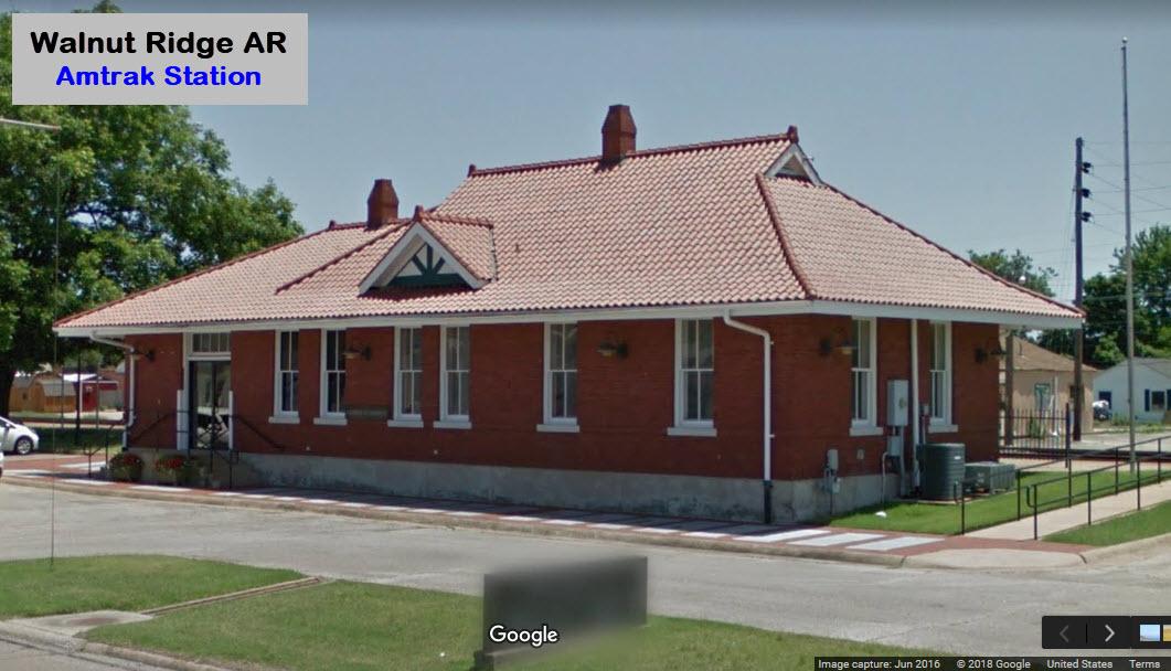
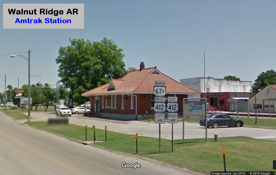

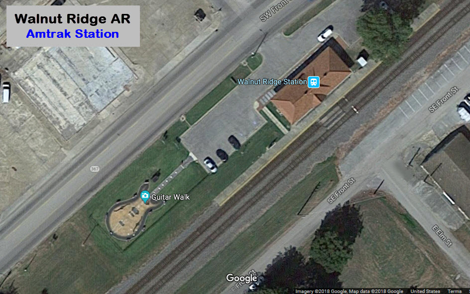
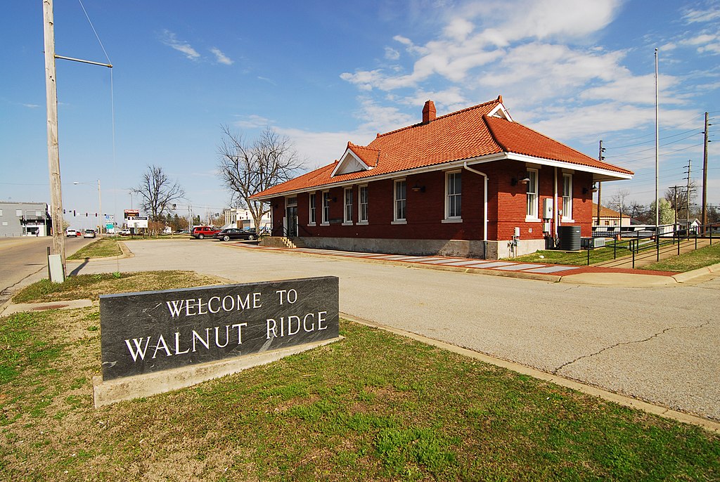 photo: Chris Litherland, from Wikipedia
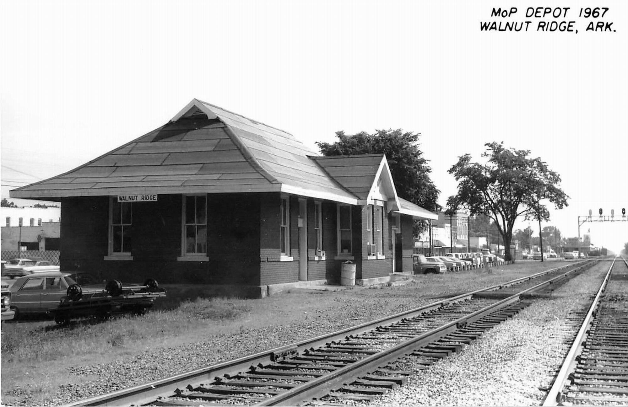
 Next stations from Walnut Ridge
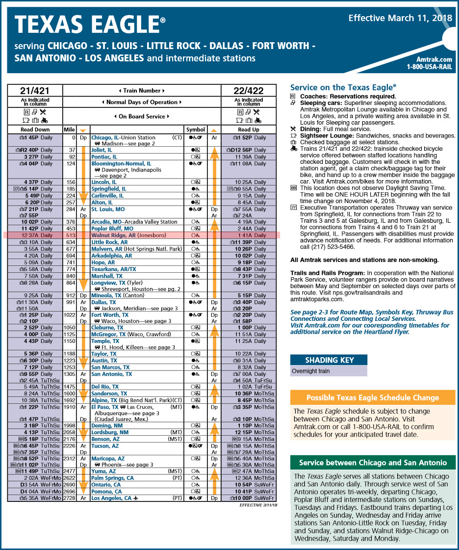
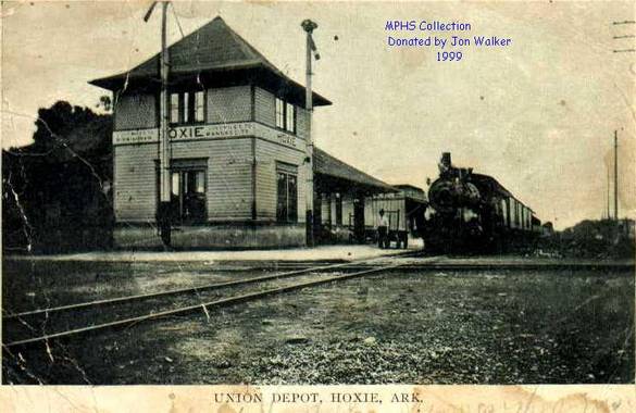
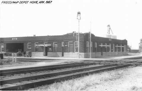
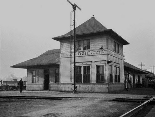
Above: In 1924, the old wooden Union Depot at Hoxie, Arkansas burned to the ground. Plans for a new depot were already in the works by the Missouri Pacific, so a larger brick depot was immediately built at the same railroad crossing to service both the Missouri Pacific and Frisco railroads.
Above: After passenger service was discontinued in the 1960s, the depot was demolished in the early 1970s. The picture is mislabeled as MO....
 downloaded to Pinterest by Betty Davidson
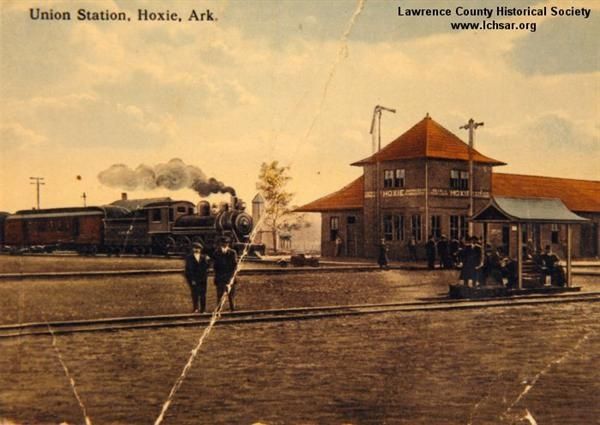
GPS Coordinates: 36.068922, -90.957356
SW 2nd St, Walnut Ridge, AR 72476
No Phone, open 24 hrs
http://www.beatlesattheridge.com/festival-info/history/
Back in 1964, when the Beatle's were here in America on tour, and they came to Dallas on September 18th, 1964. They decided they wanted to go to a Dude Ranch, Pigman Ranch near Alton MO. Well, the closest airport to the ranch that could handle the Beatle's airplane (even tho it was a small two-engine type) was the Walnut Ridge airport. They thought that they could get in and out without anyone seeing them, but that was not the case. Three teens heard the airplane land and went to check out the "different" sounding airplane (just as I would have), and discovered it was the Beatles. Calls were made, so it didn't take long for the word to spread (even back then), so by the time they were scheduled to leave on Sunday night, a large crowd of several hundred people had assembled.

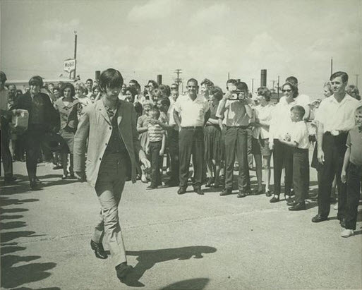 John and Ringo walking to the plane
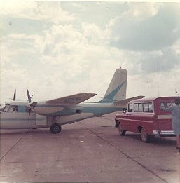 The plane and the car John and Ringo traveled in
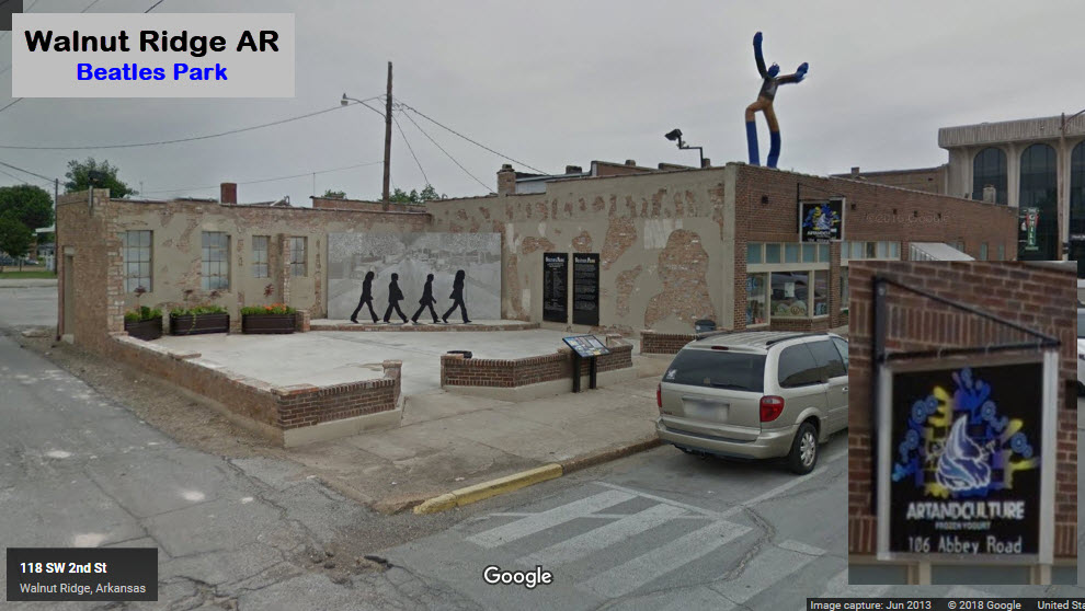
GPS Coordinates: 36.125085, -90.926390
Off my map, at the Walnut Ridge Airport
(870) 886-5918
10 North Sky Watch, Walnut Ridge, AR 72476
http://parachuteinn.business.site/
https://www.facebook.com/parachute123/
https://www.arkansas.com/attractions/detail/parachute-inn/91570
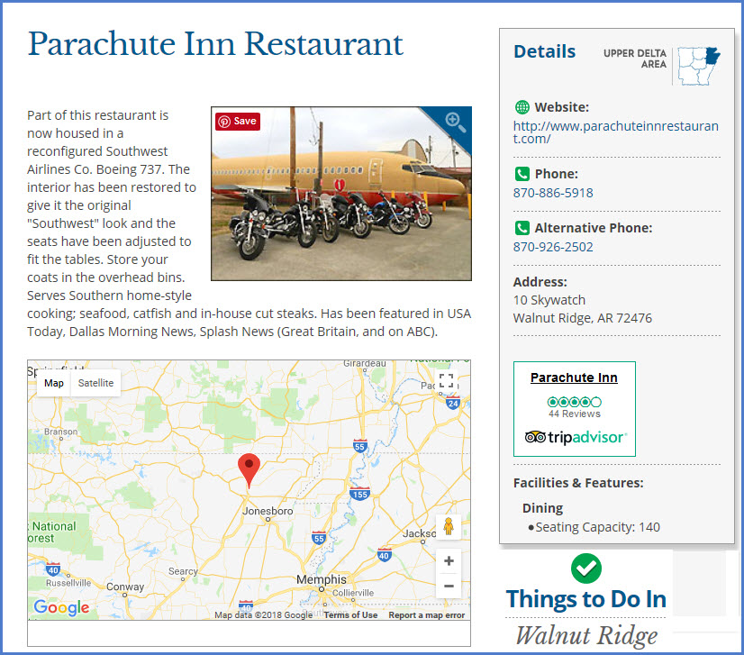
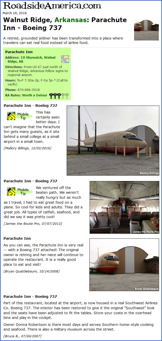
The Parachute Inn, at the Walnut Ridge airport, offers good style American fare, and has a cockpit for the kids, small and large, to play in....
It is a retired and re-purposed Southwest Airlines 737 is used for this cool idea for a restaurant!
Call ahead in the winter, they may not have the heat on and be closed.....
Signals
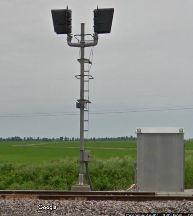
Since we're not in the overbuilt "east", we have pretty good, if not really good access to all of the signals, with very little in the way.
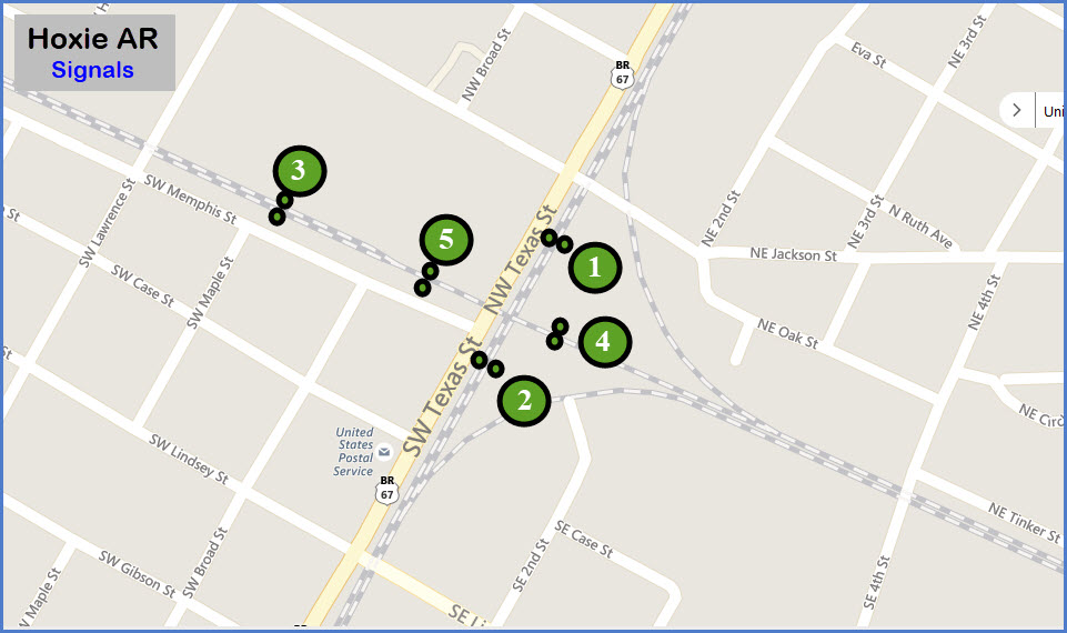
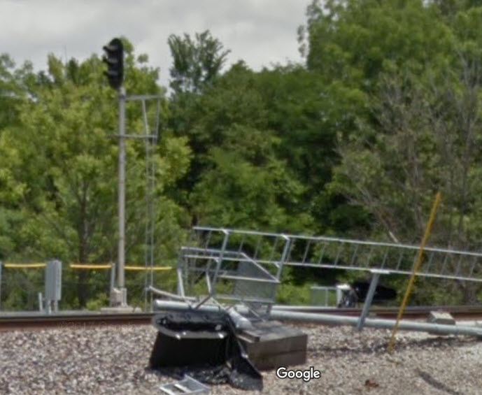
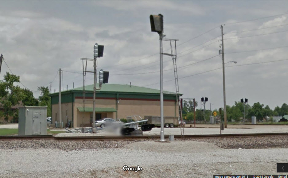
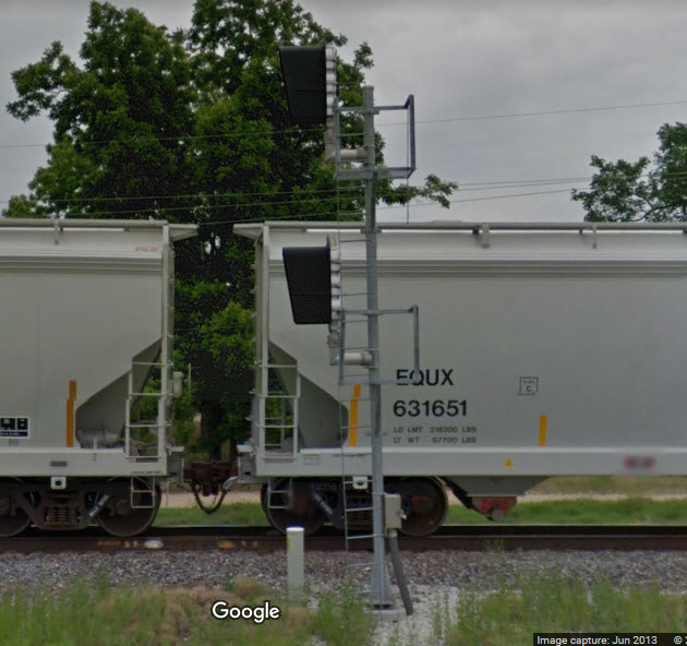
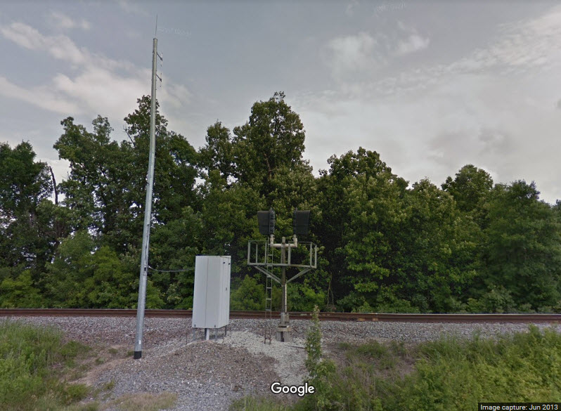
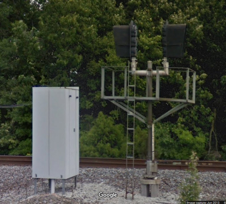
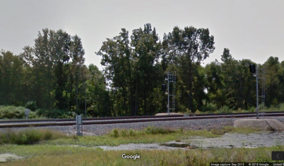
This set of signals has already been replaced. It is interesting that the railroad decided to leave part of the old signal bridge in place.
New colorlight signals are in place. Here too, we can see the bases for the previous signal bridge.
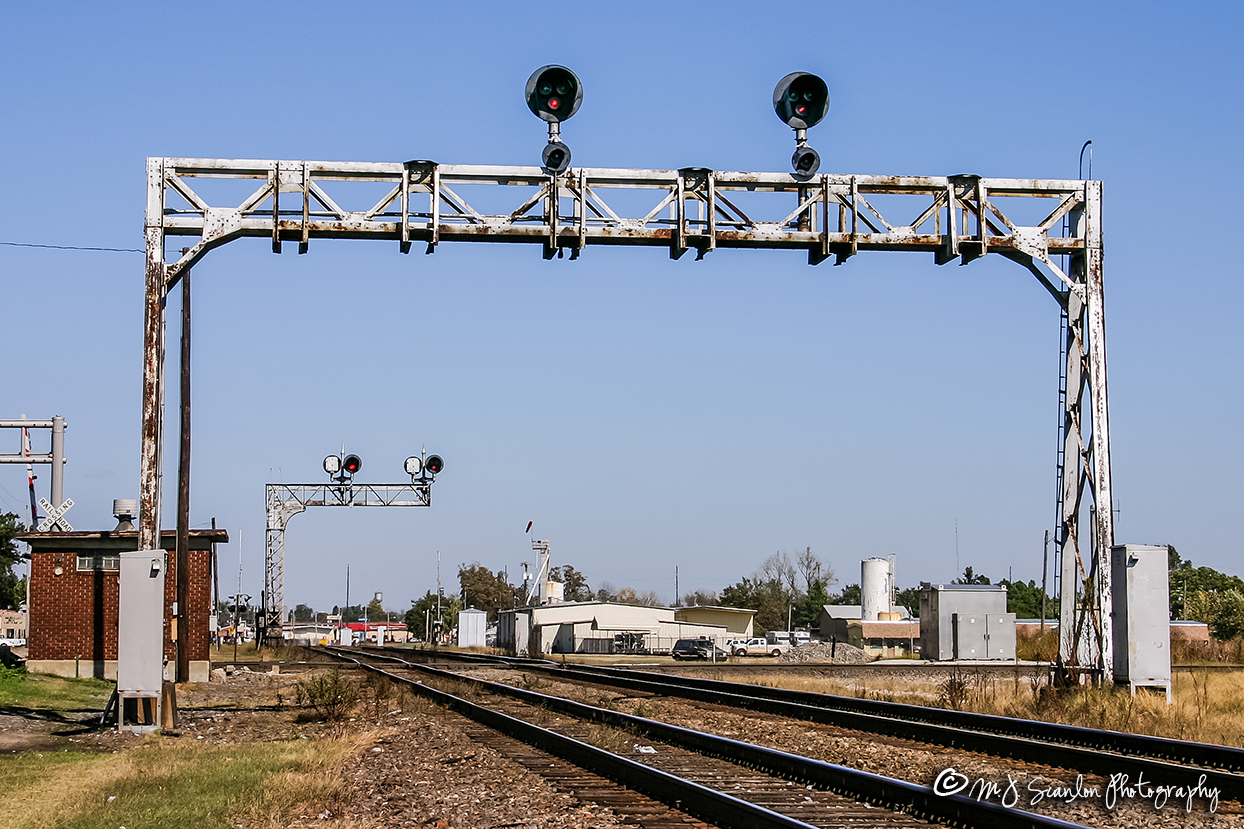 MJ Scanlon, before the new signals
The old colorlight signals still in place, with their replacements laying nearby on the ground.
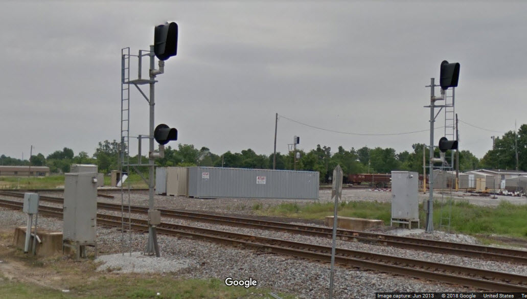
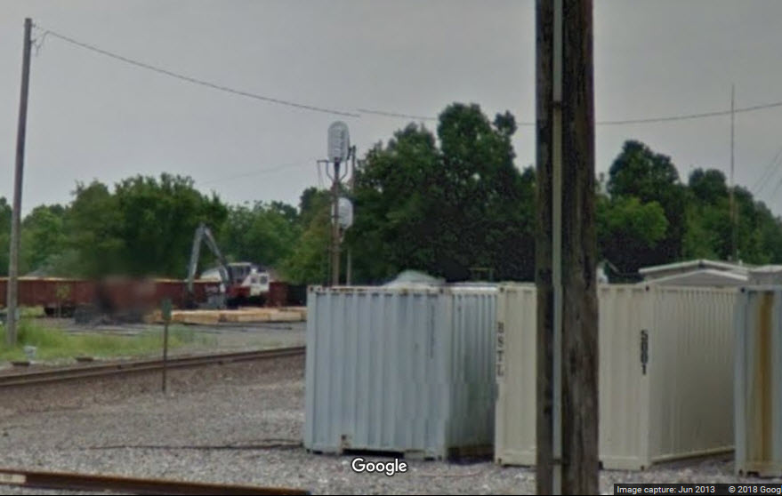
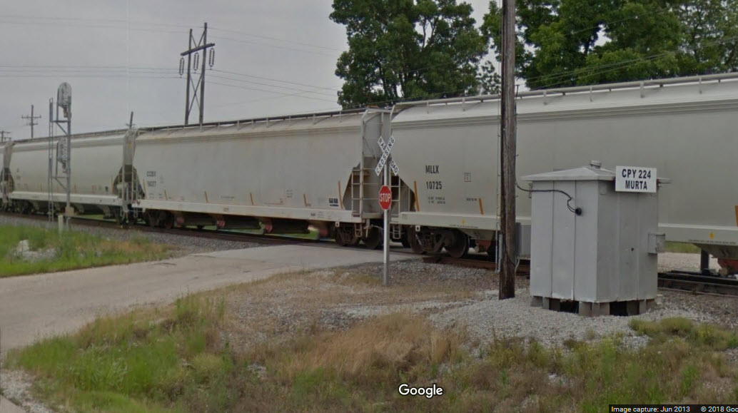
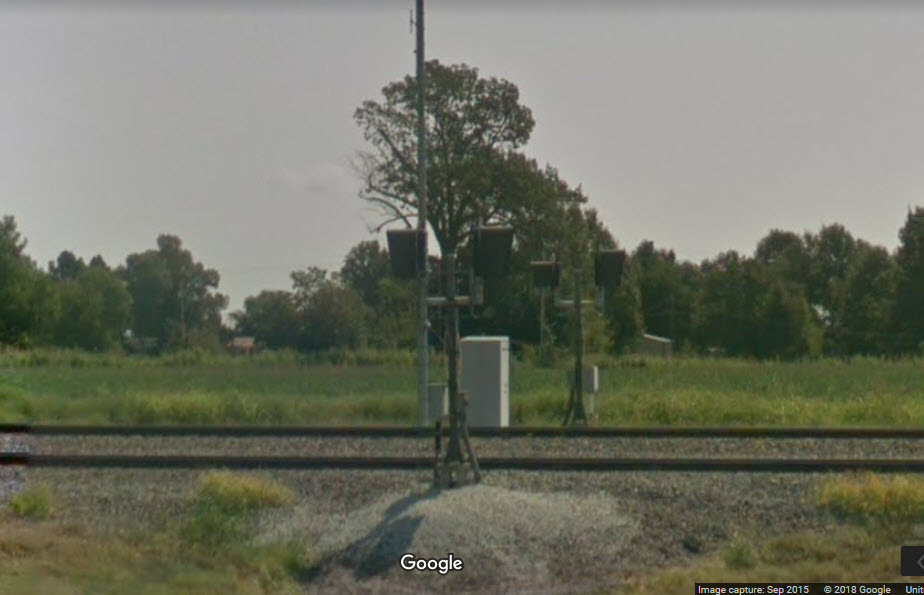
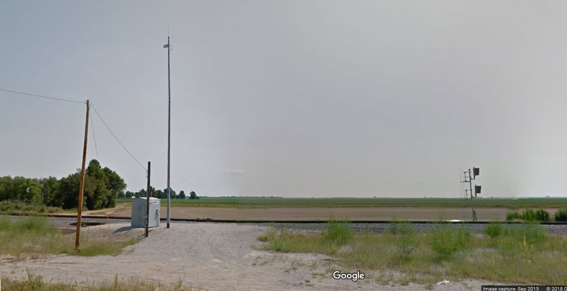
These are approach signals to the signals protecting the diamond.
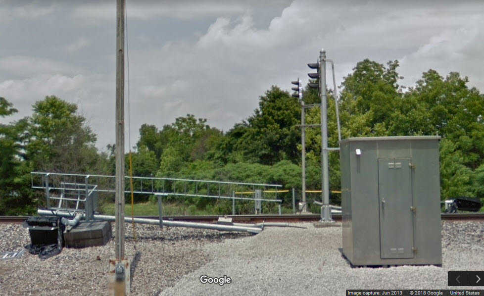
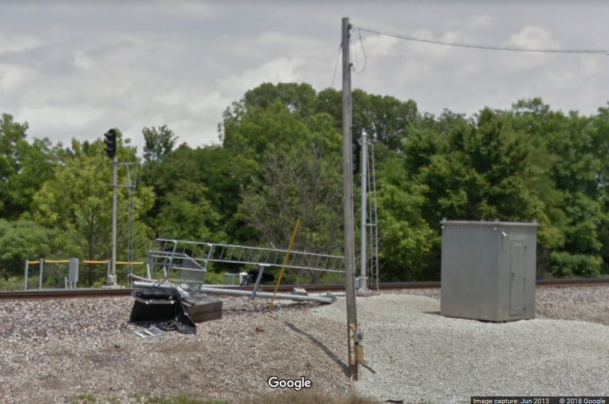
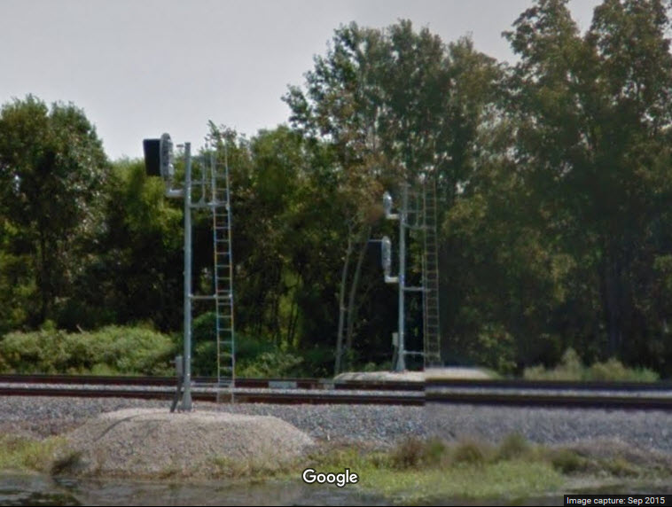
Being that I am relying on Google Streetview for my pictures, the freight train blocked my view of these signals. Anyone have better shots?
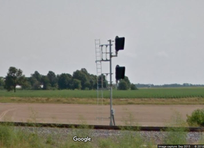
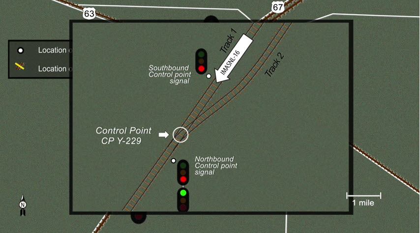
The EB signal protects the diamond, the WB signal is for trains leaving the interlocking and has a choice between two tracks ahead.
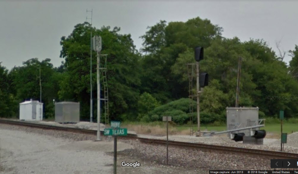
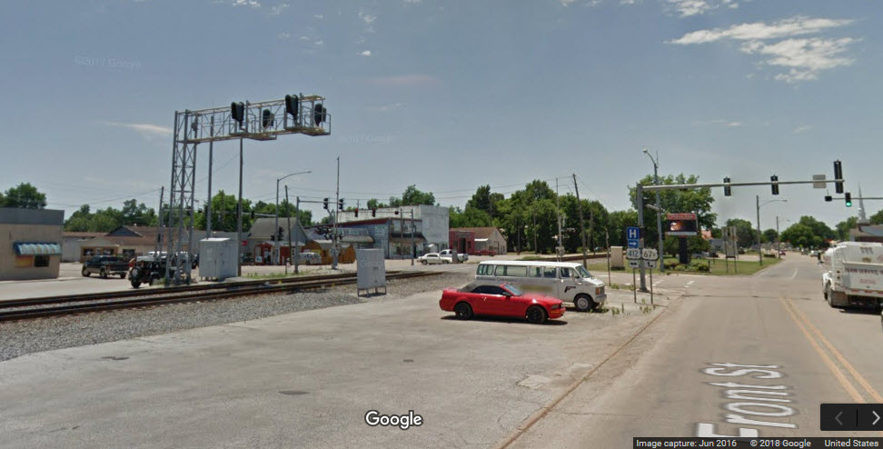
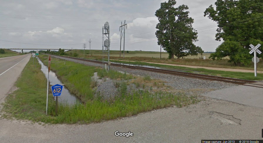
These signals are 1.5 miles from the diamond in Walnut Ridge, and the intersection of Front and Main Streets, AR34, US 412, and US 67 business.
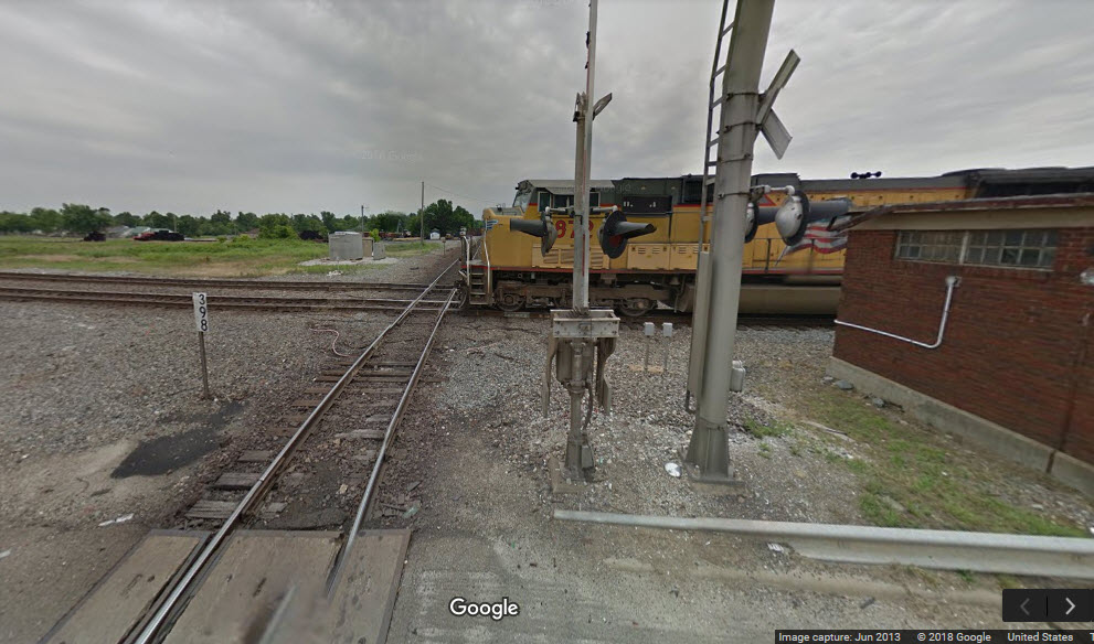
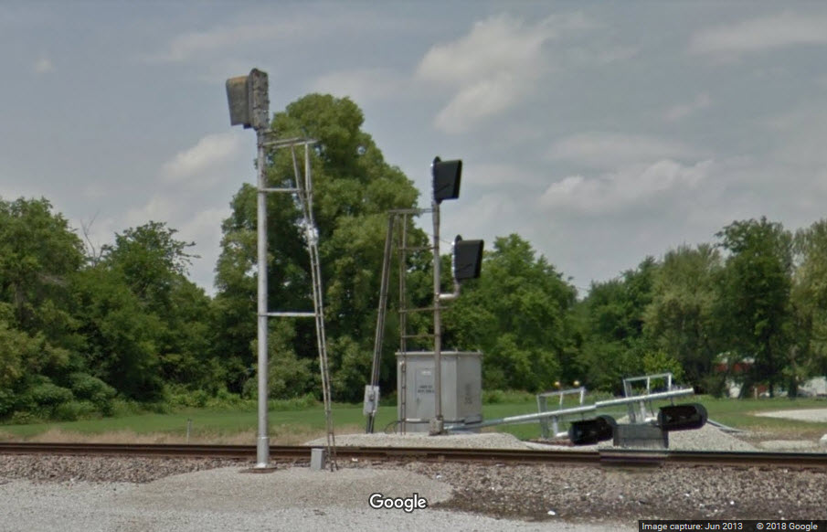
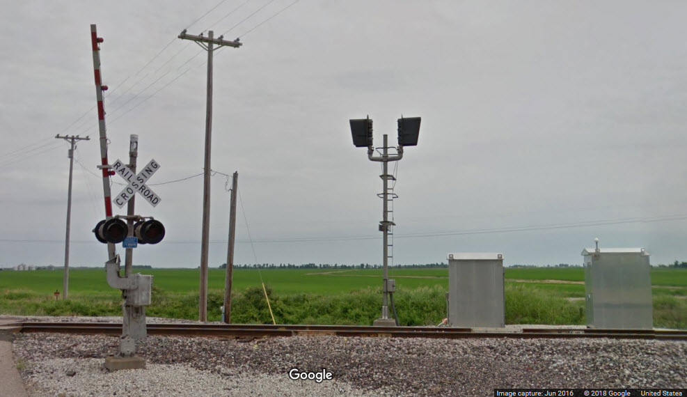
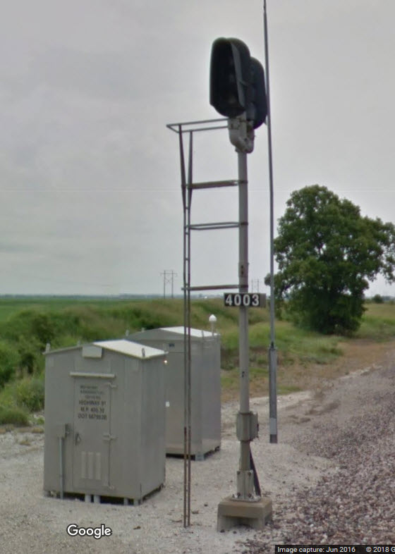
At the intersection of 34 & Lawrence County Rd 612, this set of signals sits about 3 miles north of the diamond in Hoxie. It is CPY 224, Murta.
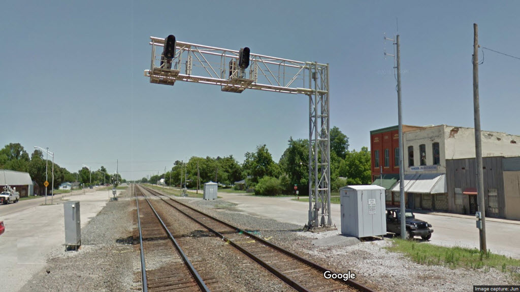
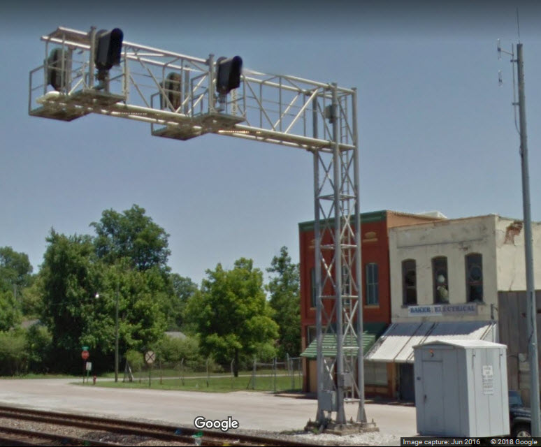
South of here we have two tracks going thu Walnut Ridge and Hoxie.

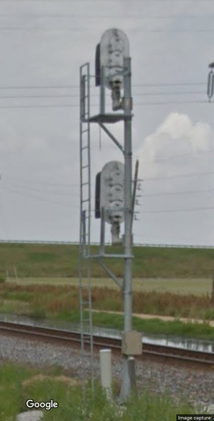
This set of signals sits ~5-1/4 miles north of the diamond in Hoxie, and is typical of the intermediate signals on this line.
Notice on the far signal, the SB signal can only display two aspects.
These two signals control movements into single track territory heading south.
Can't quite make out the CP and what JCT this is on the side of the equipment cabinet. North of here, we have two tracks, south of here, one.
Pictures needed
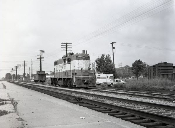 Frisco in Hoxie
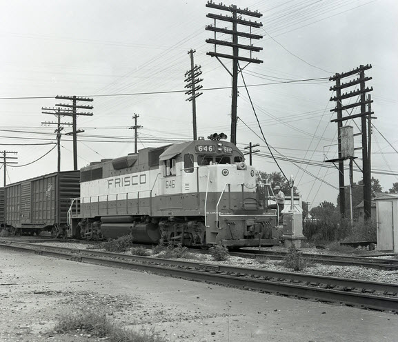 Frisco in Hoxie
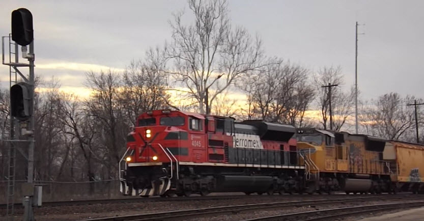 video by Stoney Warbritton, Mar 15, 2015
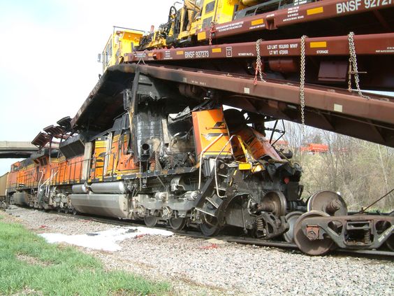
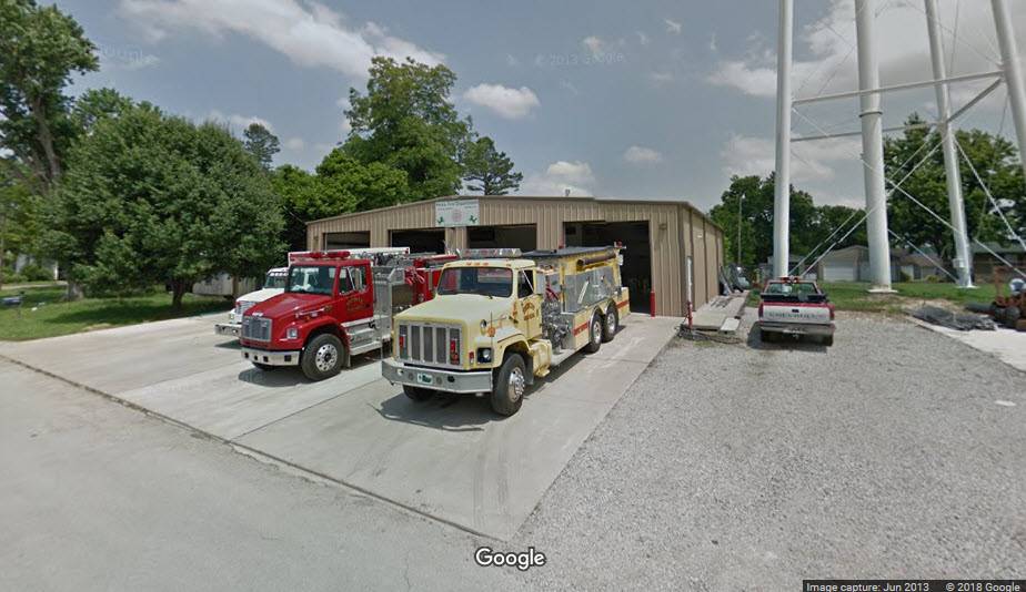
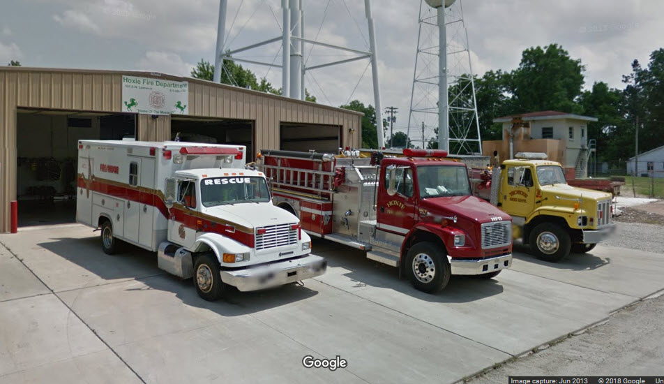
Hoxie Fire Department
A rare treat for the Google camera to catch all of the equipment sitting outside!https://www.facebook.com/hoxiefiredepartment/?rf=205507799489583
https://www.yellowpages.com/hoxie-ar/mip/hoxie-fire-department-459317328
https://www.firedepartment.net/directory/arkansas/lawrence-county/hoxie/hoxie-fire-department


Walnut Ridge - Guitar Walk, next to the Amtrak Station
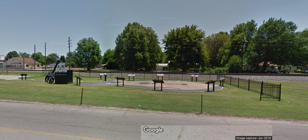 Guitar Walk
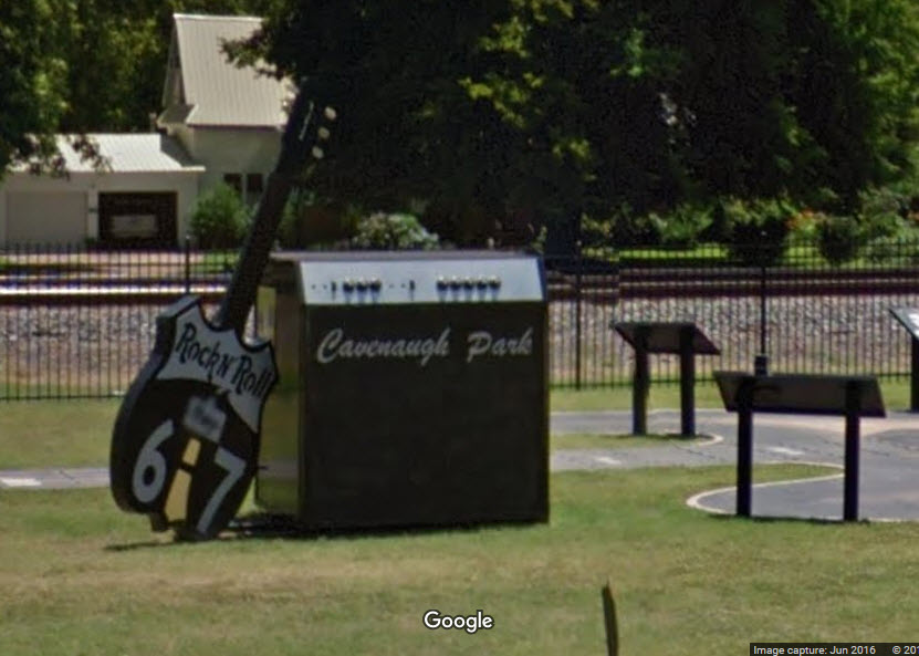 Guitar Walk
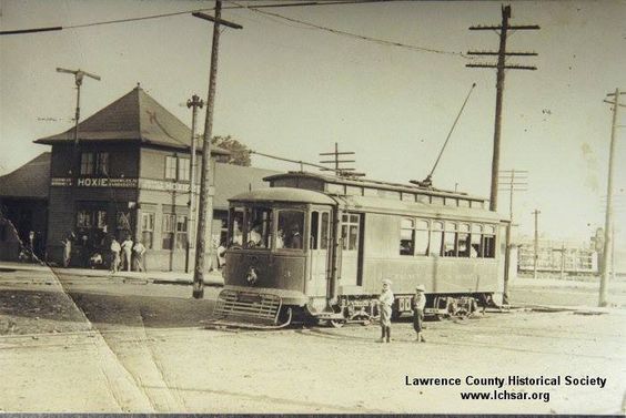
Streetcars in Walnut Ridge
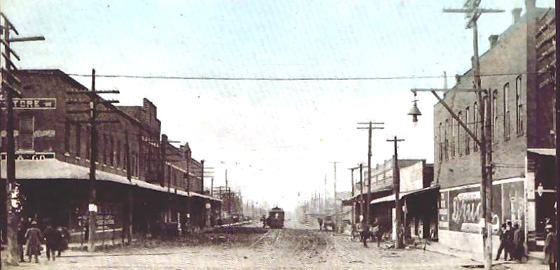 1909
1909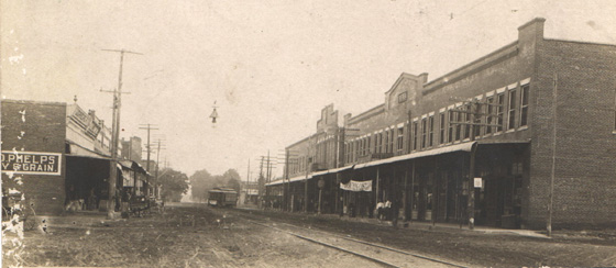 1910
1910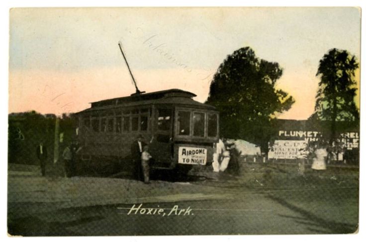
Other Walnut Ridge Stuff

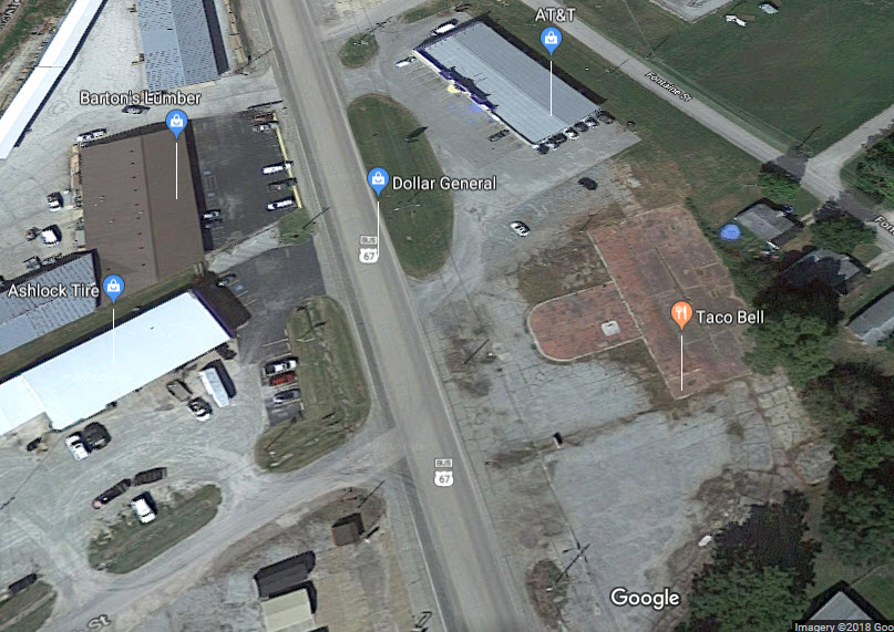
Car 54, do you know what happened to the Taco Bell???
Hoxie Misc
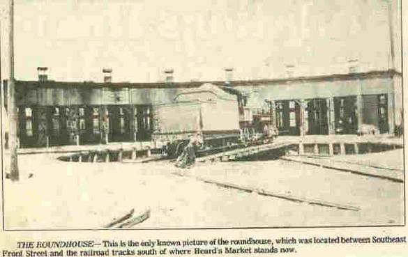
 A streetcar at the depot, Betty Davidson
The Hoxie Roundhouse
GPS Coordinates: 36.04406, -90.97703
https://www.google.com/maps/place/Hoxie,+AR/@36.0447276,-90.9768003,478m/data=!3m1!1e3!4m5!3m4!1s0x87d6a37f33b0c9cb:0x65d6dc3419d30574!8m2!3d36.0504008!4d-90.9750672
The Hoxie roundhouse was built in 1901-1902, and demolished in 1928. Apparently, not many pictures of it exist.
According to Jon Water, who visited the former roundhouse site in 2016 (or at least that is when he posted the info): Hoxie was definitely a happening place in the early 1900s due to 3 railroads intersecting there. The Cairo and Fulton being the first in 1873 (shortly after becoming the Iron Mountain), then the Kansas City, Springfield & Memphis crossing the Iron Mountain in 1883 (later becoming the Frisco). The 3rd railroad, coming in 1896, was the Hoxie, Pocahontas and Northern Railway, later becoming a part of the Frisco as well, and reaching to St Louis. The first 2 lines are still in Hoxie (UP and BNSF). The 3rd is a paved walking-bike trail reaching from Hoxie through Walnut Ridge to College City.
As part of this huge economic boom in Hoxie, the Iron Mountain railroad built a roundhouse there in 1901, a huge semicircular structure used for servicing locomotives. A turntable directed the trains into each stall of the roundhouse. Unfortunately, by 1928, it was gone.
Lots more info at: http://ataleoftwotowns.com/hoxie-roundhouse-ruins/
 pix from Topix dot com
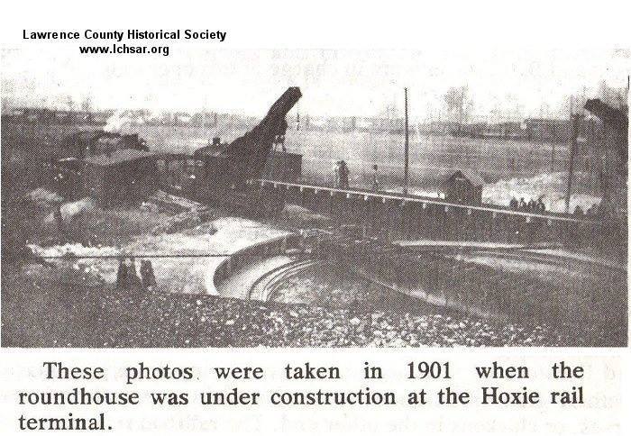
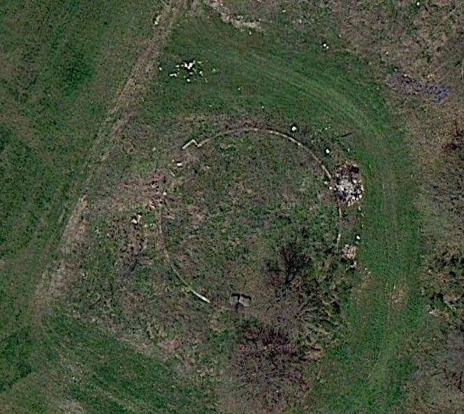 An earlier satellite view, showing the remains
It appears that the concrete base for the roundhouse has finally been removed, and may have been where the faint remains can be seen inside the green circle.
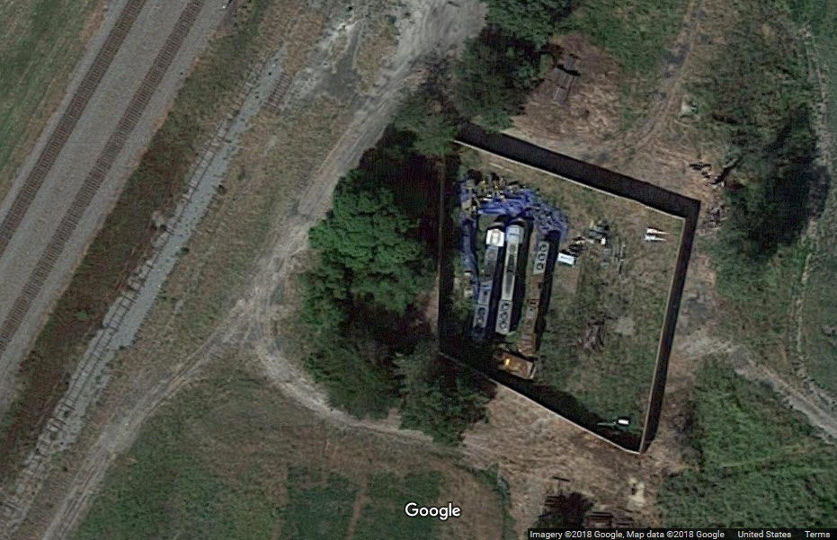
Next to it are the remains of the three engines from the 2014 accident.
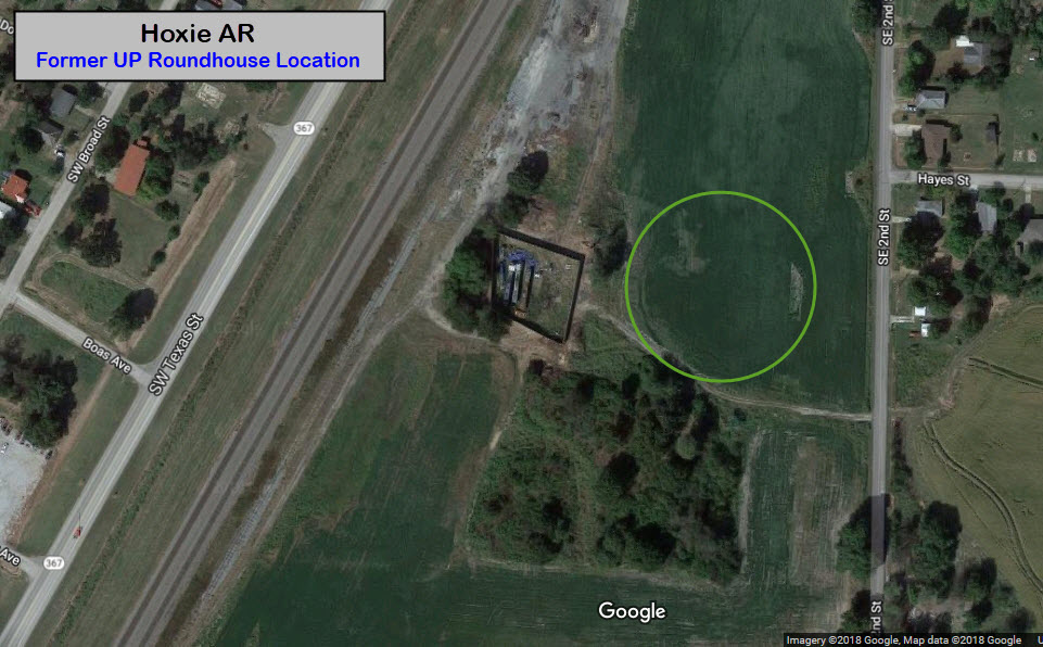 2018 satellite view
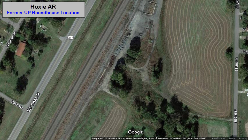 2022 view, all gone!
All Things Hoxie
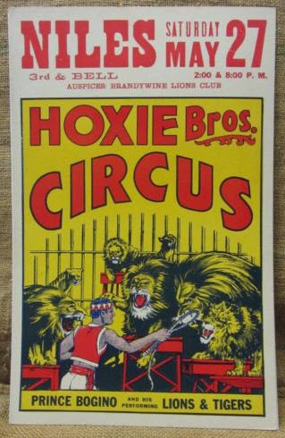
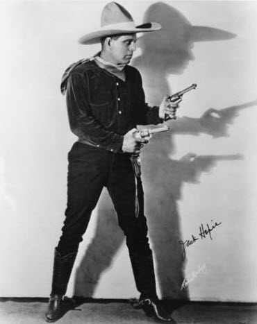
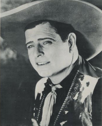
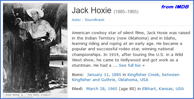
I have found references to two other things named HOXIE, one is the Hoxie Brothers Circus, and the other was a Silent Film actor by the name of Jack Hoxie.

UP accident 17AUG2014
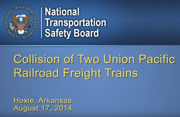
You can still find the engines from the 2014 wreck in Hoxie, surrounded by a massive wall to keep people out.... anyone need some parts???
Courtesy of the University of Texas Library, click here for their index page.
As of 1926, it looks like the USGS had not come thru and surveyed the land around Hoxie.
Disclaimers:
I love trains, and I love signals. I am not an expert. My webpages reflect what I find on the topic of the page. This is something I have fun with while trying to help others.
Please Note: Since the main focus of my two websites is railroad signals, the railfan guides are oriented towards the signal fan being able to locate them. For those of you into the modeling aspect of our hobby, my indexa page has a list of almost everything railroad oriented I can think of to provide you with at least a few pictures to help you detail your pike.
If this is a railfan page, every effort has been made to make sure that the information contained on this map and in this railfan guide is correct. Once in a while, an error may creep in :-)
My philosophy: Pictures and maps are worth a thousand words, especially for railfanning. Text descriptions only get you so far, especially if you get lost or disoriented. Take along good maps.... a GPS is OK to get somewhere, but maps are still better if you get lost! I belong to AAA, which allows you to get local maps for free when you visit the local branches. ADC puts out a nice series of county maps for the Washington DC area, but their state maps do not have the railroads on them. If you can find em, I like the National Geographic map book of the U.S..... good, clear, and concise graphics, and they do a really good job of showing you where tourist type attractions are, although they too lack the railroads. Other notes about specific areas will show up on that page if known.
Aerial shots were taken from either Google Maps or Bing Maps as noted. Screen captures are made with Snagit, a Techsmith product... a great tool if you have never used it!
By the way, floobydust is a term I picked up 30-40 years ago from a National Semiconductor data book, and means miscellaneous and/or other stuff.
Pictures and additional information is always needed if anyone feels inclined to take 'em, send 'em, and share 'em, or if you have something to add or correct.... credit is always given! Please be NICE!!! Contact info is here
Beware: If used as a source, ANYTHING from Wikipedia must be treated as being possibly being inaccurate, wrong, or not true.
RAILFAN GUIDES HOME
RAILROAD SIGNALS HOME
NEW MAR15/2018, MAR21/2018, NOV01/2022
Last Modified 01-Nov-2022